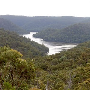
Wondabyne to Woy Woy station via Pindar Caves


8 hrs 30 mins

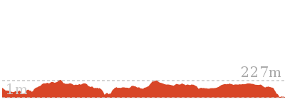
949 m
Experienced only
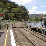


Wondabyne
(0km) Wondabyne Station → Eastern end of the Pindar Cave Track

1.5 km
32 mins
172m
-18m
Hard track
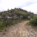
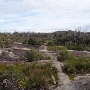
Continue straight: From the clearing[14], this walk follows the wide management trail uphill past the ‘Brisbane Water National Park’ sign[15]. The trail leads up quite steeply[16] for about 250m, where the trail bends right then leads gently uphill[17] for about 600m. Here the trail leads up a short but quite steep hill[18], to then bend left and, about 150m later, come to an intersection with the Pindar Cave track (that leads over a rock platform[19], on your left), marked with a GNW arrow post[20] (on your right).
(1.47km) Int. Rifle Range Service Track and Pindar Cave Track → Mt Pindar Lookout
3.5 km
1 hr 12 mins
129m
-129m
Hard track
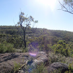
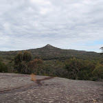
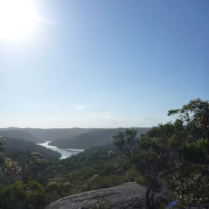
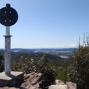
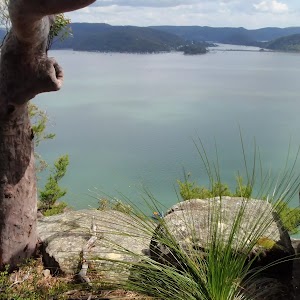
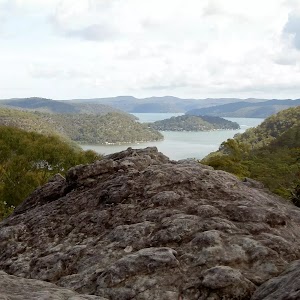
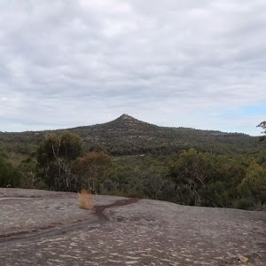
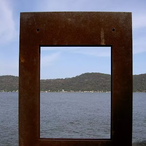
Mt Pindar lookout
(4.97km) Mt Pindar Lookout → Pool
480 m
9 mins
2m
-25m
Experienced only
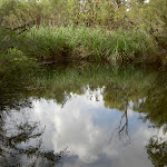
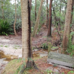
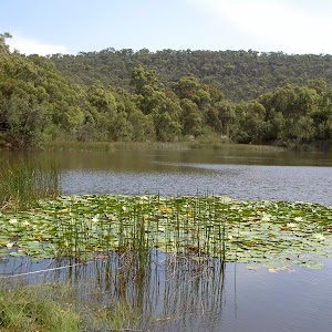
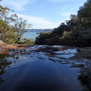
Pindar Pool
(5.45km) Pool → Pindar Cave
320 m
6 mins
12m
-6m
Experienced only
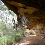
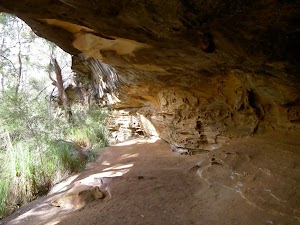
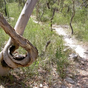
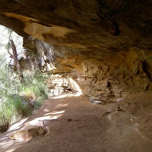
Pindar Cave
(5.77km) Pindar Cave → Waterfall
570 m
12 mins
10m
-57m
Very experienced only
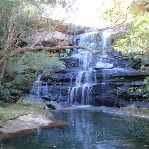
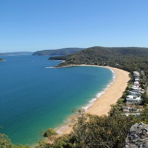
Pindar Waterfall
(5.77km) Pindar Cave → Int. Rifle Range Service Track and Pindar Cave Track
4.3 km
1 hr 27 mins
160m
-143m
Experienced only
Turn right: From the pool, the walk follows the bush track east, out of the clearing. The track passes through an area of thick vegetation as is slowly climbs up the spur, before the vegetation gives way to a rocky area. The track winds further up the hill and along the ridge edge to the lookout.
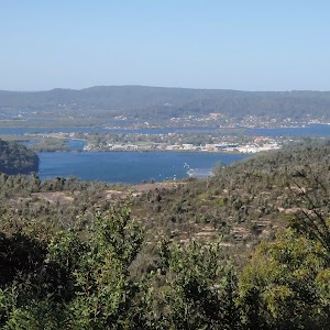
Turn left: From the lookout, the walk heads south-east along the rocky surface, to the dense tree line and follows the sandy track. This track soon bends to the north, going up the spur and across the plateau of Mt Pindar. From here the track undulates for some time and then widens to a management trail. The walk follows the management trail for a short distance, passing a large rocky outcrop to come to a ‘T’ intersection with a wide management trail.
(10.06km) Eastern end of the Pindar Cave Track → Int of GNW and Wondabyne Station tracks
630 m
11 mins
19m
-5m
Moderate track
(10.69km) Int of GNW and Wondabyne Station Trail → Kariong Brook crossing
2 km
47 mins
64m
-211m
Hard track
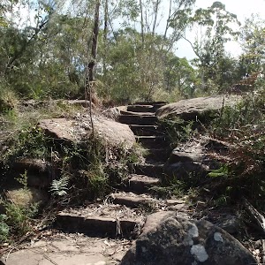
Continue straight: From the western side of Myron Brook, this walk crosses the creek on the sandstone rock platform[31] to follow the track up a few stone steps and up the short steep hill[32]. The track then flattens out as it leads around the side of the hill for about 200m to pass alongside a long rock wall[33] (on your left). Now leading downhill, the track continues for another 100m then heads down a short steep section[34] into the dense moist gully, coming to a faint intersection in front of Kariong Brook Falls[35] (on your left) (just before crossing the creek, which is often underground).
Kariong Brook Falls

(12.66km) Kariong Brook crossing → Int of the Great North Walk and Patonga service trail
690 m
24 mins
122m
-21m
Hard track
(13.35km) Int of the Great North Walk and Patonga service trail → Int of GNW and Thommos Loop track
1.5 km
28 mins
54m
-34m
Moderate track
(14.83km) Int of GNW and Thommos Loop trail → Int of GNW and Mullet Creek Trail (east)
830 m
18 mins
15m
-50m
Moderate track
(15.66km) Int of GNW and Mullet Creek Trail (east) → Int of GNW and Mt Wondabyne Peak tracks
1.2 km
25 mins
123m
-15m
Hard track
Turn left: From the intersection, this walk follows the ‘Mt Wondabyne’ sign[65] south up the trail. The trail soon begins to narrow[66] and after almost 200m, the track steps up to cross a rock platform[67], following a few GNW arrow posts to find a GNW ‘Walker Register’ tube[68]. After writing a comment, the walk continues uphill[69] along the track for about 700m, as the track become progressively flatter[70], passing beside the Mt Wondabyne Peak (up to your left). Then about 50m after leaving the trees and entering a section of low heath, this track then comes to a three-way intersection[71] (the Mt Wondabyne peak track, on the left[72]), marked with a GNW arrow post.
(16.82km) Int of Great North Walk and Mt Wondabyne Peak tracks → Mt Wondabyne Peak
210 m
5 mins
20m
-1m
Hard track
Mt Wondabyne

(16.82km) Int of Great North Walk and Mt Wondabyne Peak tracks → Mt Wondabyne Campsite
90 m
2 mins
0m
-6m
Moderate track
Mt Wondabyne Campsite
(16.91km) Mt Wondabyne Campsite → Int of Tunnel Track and Mt Wondabyne trail
760 m
16 mins
0m
-49m
Moderate track
(17.67km) Int of Tunnel Track and Mt Wondabyne trail → Int of Rocky Ponds Trail and Tunnel Track
470 m
9 mins
8m
-15m
Easy track
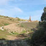
(18.13km) Int of Rocky Ponds Trail and Tunnel Track → Woy Woy Landfill
1.9 km
37 mins
25m
-120m
Moderate track
Turn left: From the intersection, this walk follows the GNW arrow post directly away from the face of the ‘Tunnel Trail’ sign[96][97] along the narrow track. After about 20m, this short track leads to an intersection with the signposted ‘Dillons Trail’[98].
Turn left: With the Patonga-bound bush track on the right, this walk follows the management trail east, down the long, gentle hill. The trail gradually steepens as it winds down to the Woy Woy Landfill site. The walk then follows the landfill fence past a building and steps through a gap in the fence. The walk then heads along the gravel driveway to the landfill road.
(20.08km) Woy Woy Landfill → Woy Woy Landfill site front gates
1 km
23 mins
38m
-84m
Easy track
(21.09km) Woy Woy Landfill site front gates → Woy Woy train station
2.9 km
45 mins
6m
-21m
Easy track
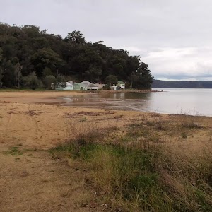
Continue straight: From the intersection, this walk follows Railway Street through the residential area, past the shopping centre to the Woy Woy train station.
Maps for the Wondabyne to Woy Woy station via Pindar Caves walk
You can download the PDF for this walk to print a map.These maps below cover the walk and the wider area around the walk, they are worth carrying for safety reasons.
| Gunderman | 1:25 000 Map Series | 91313S GUNDERMAN | NSW-91313S |
| Gosford | 1:25 000 Map Series | 91312S GOSFORD | NSW-91312S |
| Broken Bay | 1:25 000 Map Series | 91301N BROKEN BAY | NSW-91301N |
| Gosford | 1:100 000 Map Series | 9131 GOSFORD | 9131 |
| Sydney | 1:100 000 Map Series | 9130 SYDNEY | 9130 |
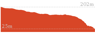
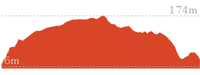
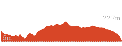
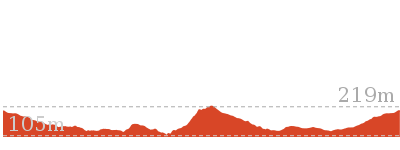
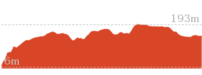
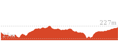
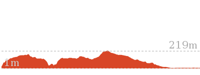
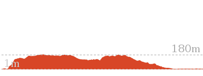
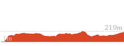
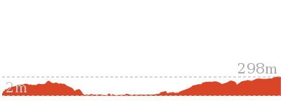
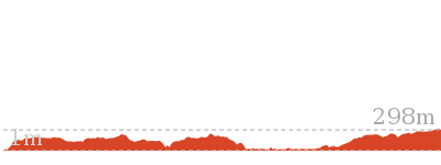
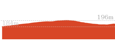
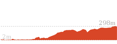
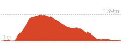
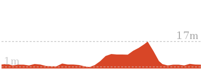
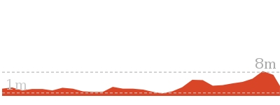
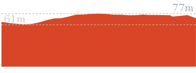
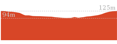
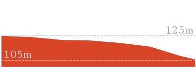
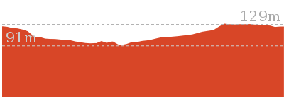
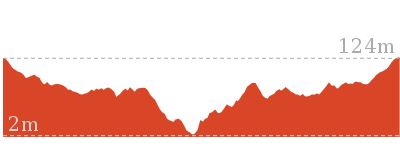
Cross sectional view of the Wondabyne to Woy Woy station via Pindar Caves bushwalking track
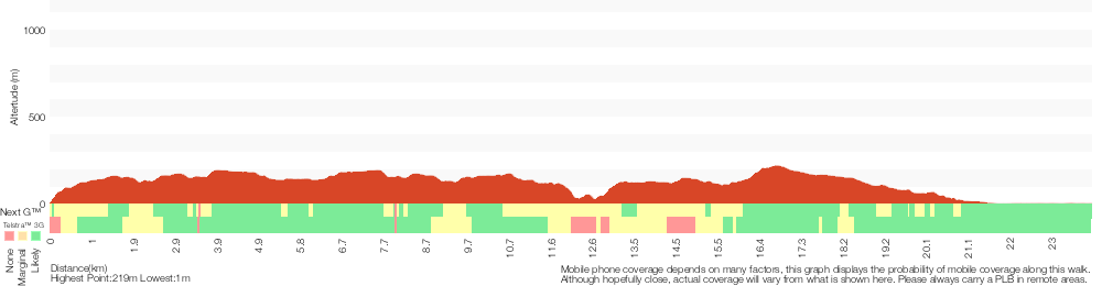
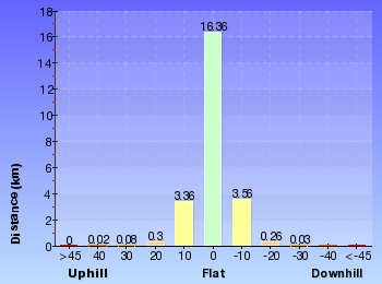
Analysis and summary of the altitude variation on the Wondabyne to Woy Woy station via Pindar Caves
Overview of this walks grade – based on the AS 2156.1 – 2001
Under this standard, a walk is graded based on the most difficult section of the walk.
| Length | 24 km | ||
| Time | 8 hrs 30 mins | ||
| . | |||
| Grade 5/6 Experienced only |
AS 2156.1 | Gradient | Very steep (4/6) |
| Quality of track | Rough unclear track (5/6) | ||
| Signs | No directional signs (5/6) | ||
| Experience Required | Moderate level of bushwalking experience recommended (4/6) | ||
| Weather | Storms may impact on navigation and safety (3/6) | ||
| Infrastructure | Limited facilities (such as cliffs not fenced, significant creeks not bridged) (4/6) |
Some more details of this walks Grading
Here is a bit more details explaining grading looking at sections of the walk
Gradient
12km of this walk is very steep and another 6km has gentle hills with occasional steps. Whilst another 6km has short steep hills and the remaining 25m is flat with no steps.
Quality of track
11km of this walk follows a rough track, where fallen trees and other obstacles are likely and another 7km follows a clear and well formed track or trail. Whilst another 3.9km follows a smooth and hardened path and a 1.6km section follows a rough unclear track. The remaining 1.4km follows a formed track, with some branches and other obstacles.
Signs
8km of this walk has minimal directional signs and another 8km has directional signs at most intersection. Whilst another 6km is clearly signposted and the remaining 1.6km Has no directional signs.
Experience Required
12km of this walk requires some bushwalking experience and another 10km requires no previous bushwalking experience. The remaining (1.6km) requires a leader a with moderate level of bushwalking experience.
weather
Around 23km of this walk is not usually affected by severe weather events (that would unexpectedly impact safety and navigation), whilst the remaining 690m is affected by storms that may impact your navigation and safety.
Infrastructure
13km of this walk is close to useful facilities (such as fenced cliffs and seats) and another 9km has limited facilities (such as cliffs not fenced, significant creeks not bridged). The remaining (2.6km) has limited facilities (such as not all cliffs fenced).
Similar walks
5.8 km Return
2 hrs 30 mins
Hard track
8.1 km Return
3 hrs 30 mins
Hard track
9.5 km One way
4 hrs
Hard track
10.1 km One way
4 hrs 15 mins
Hard track

10.8 km Circuit
4 hrs 30 mins
Hard track
11.5 km Return
6 hrs
Experienced only
12.3 km One way
5 hrs 30 mins
Hard track
15.4 km One way
6 hrs
Hard track
15.5 km One way
5 hrs 45 mins
Hard track
16.1 km One way
6 hrs 30 mins
Experienced only

17 km One way
6 hrs 30 mins
Hard track
18.1 km One way
7 hrs 30 mins
Experienced only
19.5 km One way
7 hrs 30 mins
Hard track

20.7 km One way
8 hrs 30 mins
Hard track

24.8 km One way
10 hrs
Hard track

24.8 km One way
2 Days
Hard track
26.2 km One way
10 hrs
Hard track
26.2 km One way
2 Days
Hard track

28.1 km One way
2 Days
Experienced only

33.4 km One way
2 Days
Hard track

41.5 km One way
3 Days
Hard track
Other Nearby walks
800 m Return
20 mins
Very easy
16.1 km One way
6 hrs
Hard track
4.3 km One way
1 hr 45 mins
Moderate track
4.3 km Return
2 hrs
Moderate track

931 m Circuit
30 mins
Moderate track
1.4 km Return
30 mins
Very easy
1.4 km Return
30 mins
Easy track
18.1 km Return
8 hrs
Hard track

803 m Circuit
20 mins
Moderate track
378 m Return
10 mins
Easy track
1.4 km Circuit
45 mins
Moderate track
4.2 km Circuit
2 hrs
Moderate track
Plan your trip to and from the walk here
The Wondabyne to Woy Woy station via Pindar Caves walk starts at the Wondabyne Station (gps: -33.492083, 151.25696)Your transport options to Wondabyne Station are by;
Important Note: There is no car transport option to the start of this walk.
The Wondabyne to Woy Woy station via Pindar Caves ends at the Woy Woy train station (gps: -33.485814, 151.32361)
Your transport options to Woy Woy train station are by;
(get details)


Short URL = http://wild.tl/wtwwsvpc
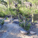
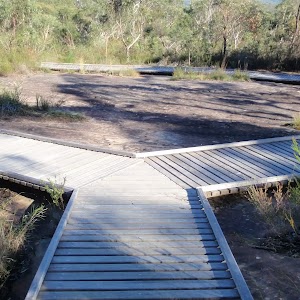
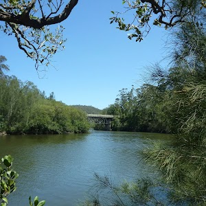
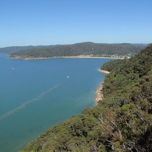
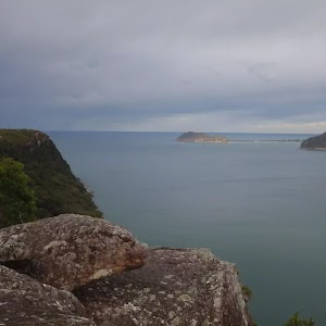
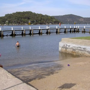
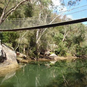
Gallery images
There are other downloads I am still working on.
You will probably need to login to access these — still all free.
* KML (google earth file)
* GPX (GPS file)
Special Maps/ brochures
* A3 topo maps
* PDF with Lands Topo map base
* PDF with arial image (and map overlay)
I wanted to get the main site live first, this extra stuff will come in time.
Happy walking
Matt 🙂
Comments