Dead Horse Gap to Cascades Lookout return


1 hr 45 mins

135 m
Moderate track


Covered in snow part of the year

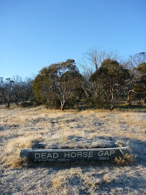
Dead Horse Gap
(0km) Cascades Trail track head → Int of Thredbo River and Dead Horse Gap tracks

160 m
3 mins
6m
-3m
Moderate track
(0.16km) Int Thredbo River and Dead Horse Gap tracks → Cascades lookout
1.9 km
39 mins
22m
-104m
Moderate track
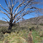
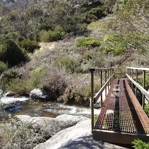
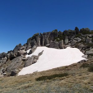
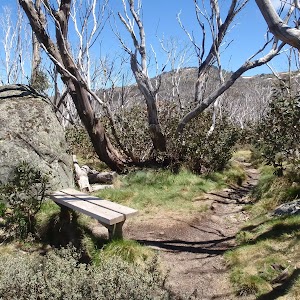
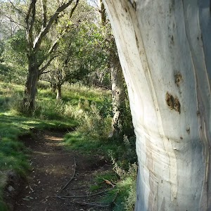
Continue straight: From the small clearing[12], this walk crosses Thredbo River using the long metal bridge[13]. This walk then turns left and heads through the grassy flat (initially over a metal grate[14]) enjoying the scattering of snow gums[15]. Before too long the track comes closer to the river again the leads down a log lined set of stairs[16] to cross the Thredbo River again on another metal bridge[17].
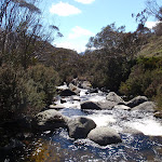
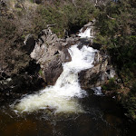
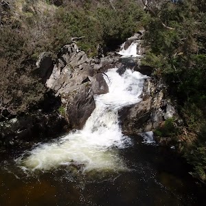
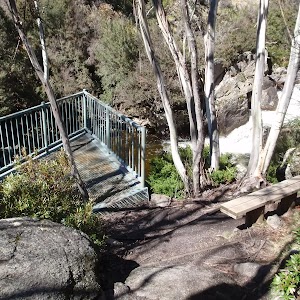
Continue straight: From the bridge, this walk crosses to the north side of the river and follows the bush track downstream, winding down the hill and through the snowgum forest. The walk continues along a metal walkway followed by a wooden boardwalk, then heads down a long hill to the intersection at the Thredbo River Cascades lookout platform.
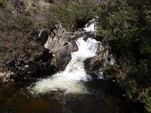
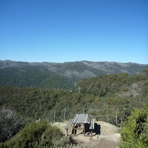
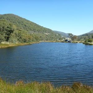
Cascades Lookout
Maps for the Dead Horse Gap to Cascades Lookout return walk
You can download the PDF for this walk to print a map.These maps below cover the walk and the wider area around the walk, they are worth carrying for safety reasons.
| Chimneys Ridge | 1:25 000 Map Series | 85241N CHIMNEYS RIDGE | NSW-85241N |
| Jacobs River | 1:100 000 Map Series | 8524 JACOBS RIVER | 8524 |
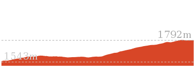
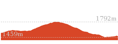
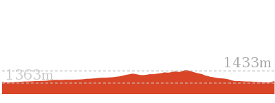
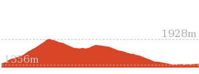
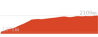
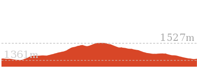
Cross sectional view of the Dead Horse Gap to Cascades Lookout return bushwalking track
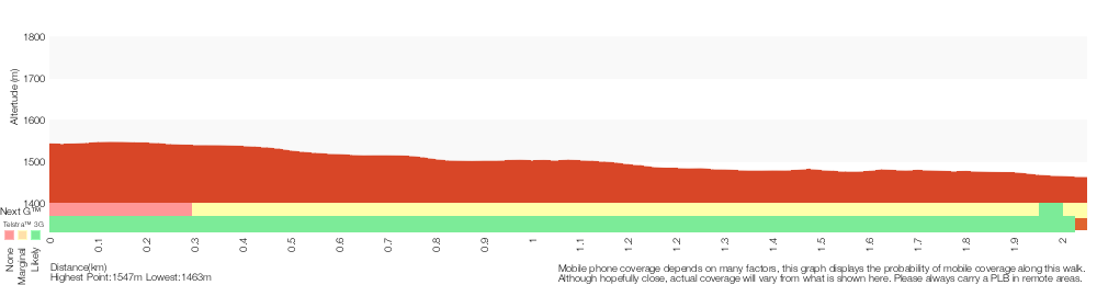
Analysis and summary of the altitude variation on the Dead Horse Gap to Cascades Lookout return
Overview of this walks grade – based on the AS 2156.1 – 2001
Under this standard, a walk is graded based on the most difficult section of the walk.
| Length | 4.1 km | ||
| Time | 1 hr 45 mins | ||
| . | |||
| Grade 3/6 Moderate track |
AS 2156.1 | Gradient | Short steep hills (3/6) |
| Quality of track | Formed track, with some branches and other obstacles (3/6) | ||
| Signs | Directional signs along the way (3/6) | ||
| Experience Required | Some bushwalking experience recommended (3/6) | ||
| Weather | Storms may impact on navigation and safety (3/6) | ||
| Infrastructure | Generally useful facilities (such as fenced cliffs and seats) (1/6) |
Some more details of this walks Grading
Here is a bit more details explaining grading looking at sections of the walk
Gradient
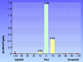
Around 1.6km of this walk has gentle hills with occasional steps, whilst the remaining 470m has short steep hills.
Quality of track
Around 1.9km of this walk follows a formed track, with some branches and other obstacles, whilst the remaining 160m follows a clear and well formed track or trail.
Signs
Around 1.6km of this walk is clearly signposted, whilst the remaining 470m has directional signs at most intersection.
Experience Required
Around 1.7km of this walk requires some bushwalking experience, whilst the remaining 340m requires no previous bushwalking experience.
weather
Around 1.6km of this walk is affected by storms that may impact your navigation and safety, whilst the remaining 470m is not usually affected by severe weather events (that would unexpectedly impact safety and navigation).
Infrastructure
This whole walk, 2km is close to useful facilities (such as fenced cliffs and seats).
Similar walks
4.8 km One way
1 hr 45 mins
Moderate track

5.3 km One way
3 hrs
Hard track

9.8 km Circuit
4 hrs 30 mins
Hard track

10.1 km Circuit
5 hrs
Hard track

Other Nearby walks
9.7 km Return
4 hrs
Hard track
19.6 km Return
7 hrs 30 mins
Hard track
4.7 km Return
2 hrs
Moderate track

3.3 km Circuit
1 hr 15 mins
Moderate track
3.7 km Circuit
2 hrs 30 mins
Hard track
5.8 km Circuit
3 hrs
Hard track
3.8 km Return
2 hrs 30 mins
Hard track

7.5 km Return
3 hrs 45 mins
Hard track
12.4 km Return
6 hrs
Hard track
3.1 km Circuit
1 hr 30 mins
Hard track
3.3 km Circuit
1 hr 15 mins
Moderate track

2.2 km Return
1 Hr
Hard track
Plan your trip to and from the walk here
The Dead Horse Gap to Cascades Lookout return walk starts and ends at the Cascades Trail track head (gps: -36.522924, 148.26452)Your main transport option to Cascades Trail track head is by;
(get details)


Short URL = http://wild.tl/dhgtclr
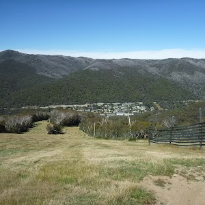
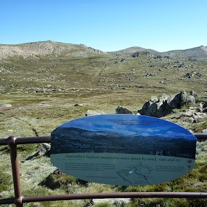
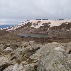
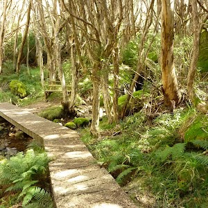
Gallery images
There are other downloads I am still working on.
You will probably need to login to access these — still all free.
* KML (google earth file)
* GPX (GPS file)
Special Maps/ brochures
* A3 topo maps
* PDF with Lands Topo map base
* PDF with arial image (and map overlay)
I wanted to get the main site live first, this extra stuff will come in time.
Happy walking
Matt 🙂
Comments