Garie Beach to Eagle Rock


3 hrs

344 m
Hard track

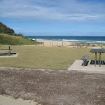


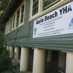
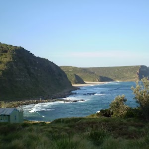
Garie Beach Kiosk
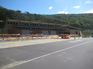
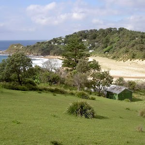
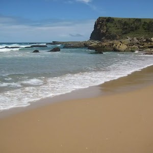
Garie Beach
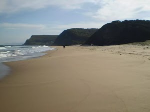
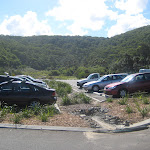
(0km) Garie Beach Car Park → North-East End of Garie Beach

690 m
13 mins
11m
-16m
Moderate track
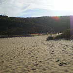
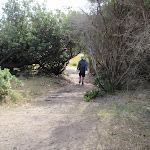
Veer right: Keeping the ocean to the right, this walk follows the beach to the northern end, to the base of a bush track which heads up the hill.
(0.69km) North-East End of Garie Beach → Garie Beach Lookout
510 m
13 mins
105m
-6m
Hard track
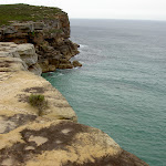
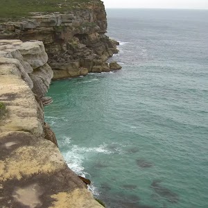
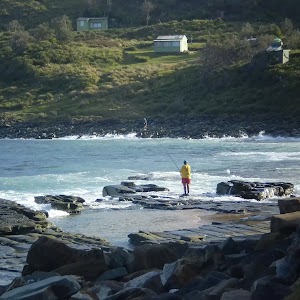
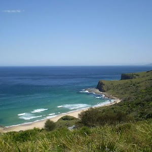
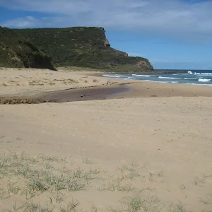
Garie Beach Lookout
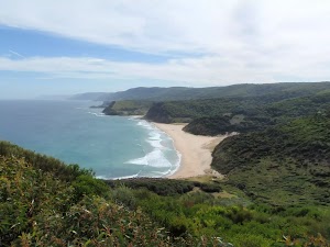
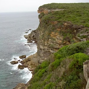
(1.2km) Garie Beach Lookout → Eagles Rock Lookout
2.7 km
57 mins
68m
-138m
Moderate track
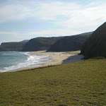
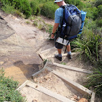
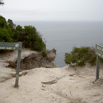
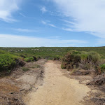
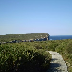
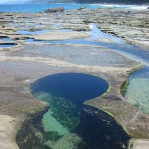
Continue straight: From the intersection, this walk heads along the narrow trail through the scrub, keeping the ocean on the right of the track. In various sections, metal walkways have been built to stabilise the environment in the area. The walk continues like this, occasionally breaking out onto the rockshelf of the cliffs, until reaching a signposted intersection, marked ‘Wattamolla 2.9km’.
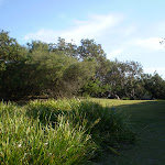
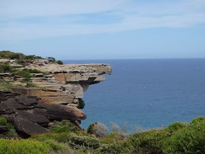
Continue straight: Keeping the ocean to the right the track follows the bushtrack through the scrub and along the coast for a short while before coming to the information signpost with views of Eagle Rock.
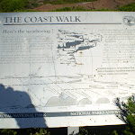
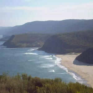
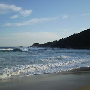
Eagle Rock Lookout
Maps for the Garie Beach to Eagle Rock walk
You can download the PDF for this walk to print a map.These maps below cover the walk and the wider area around the walk, they are worth carrying for safety reasons.
| Otford | 1:25 000 Map Series | 91294S OTFORD | NSW-91294S |
| Port Hacking | 1:100 000 Map Series | 9129 PORT HACKING | 9129 |
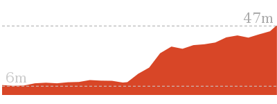
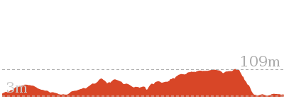
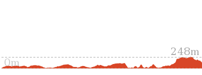
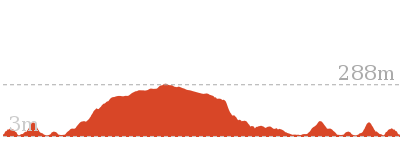
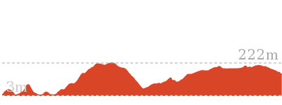
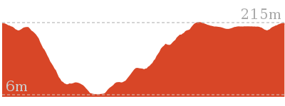
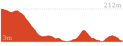
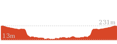
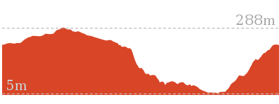
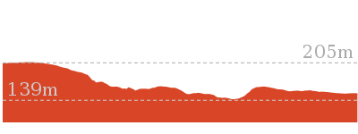
Cross sectional view of the Garie Beach to Eagle Rock bushwalking track
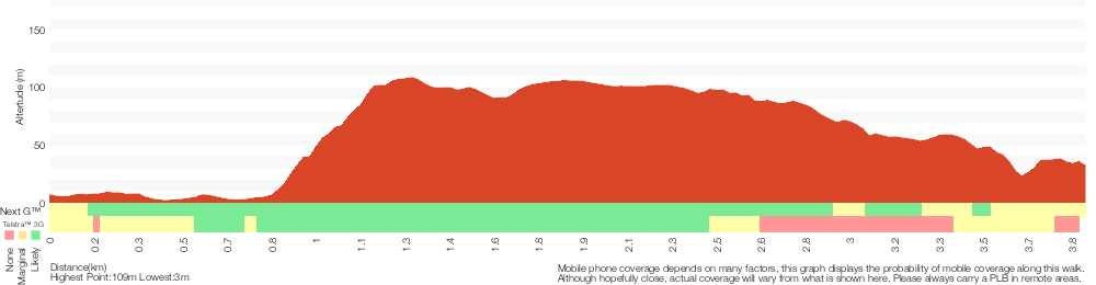
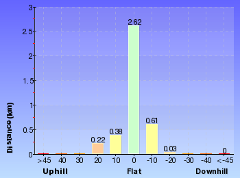
Analysis and summary of the altitude variation on the Garie Beach to Eagle Rock
Overview of this walks grade – based on the AS 2156.1 – 2001
Under this standard, a walk is graded based on the most difficult section of the walk.
| Length | 7.7 km | ||
| Time | 3 hrs | ||
| . | |||
| Grade 4/6 Hard track |
AS 2156.1 | Gradient | Very steep (4/6) |
| Quality of track | Formed track, with some branches and other obstacles (3/6) | ||
| Signs | Directional signs along the way (3/6) | ||
| Experience Required | Some bushwalking experience recommended (3/6) | ||
| Weather | Weather generally has little impact on safety (1/6) | ||
| Infrastructure | Limited facilities, not all cliffs are fenced (3/6) |
Some more details of this walks Grading
Here is a bit more details explaining grading looking at sections of the walk
Gradient
2.2km of this walk has short steep hills and another 750m has gentle hills with occasional steps. Whilst another 510m is very steep and the remaining 380m is flat with no steps.
Quality of track
Around 2.5km of this walk follows a clear and well formed track or trail, whilst the remaining 1.4km follows a formed track, with some branches and other obstacles.
Signs
Around 3.2km of this walk is clearly signposted, whilst the remaining 650m has directional signs at most intersection.
Experience Required
Around 3.2km of this walk requires no previous bushwalking experience, whilst the remaining 650m requires some bushwalking experience.
weather
This whole walk, 3.9km is not usually affected by severe weather events (that would unexpectedly impact safety and navigation).
Infrastructure
Around 3.2km of this walk has limited facilities (such as not all cliffs fenced), whilst the remaining 690m is close to useful facilities (such as fenced cliffs and seats).
Similar walks
1.3 km Return
45 mins
Moderate track
4.4 km One way
1 hr 45 mins
Hard track

7.6 km One way
3 hrs 30 mins
Hard track
9.2 km Circuit
3 hrs 30 mins
Hard track

13.3 km One way
5 hrs
Hard track

27.4 km One way
2 Days
Hard track

27.4 km One way
2 Days
Hard track
Other Nearby walks
13.5 km Circuit
7 hrs
Hard track
11 km One way
4 hrs 30 mins
Hard track
3.2 km Return
2 hrs
Moderate track
5 km Circuit
2 hrs 15 mins
Hard track
3.3 km One way
1 hr 45 mins
Hard track
4.7 km One way
1 hr 45 mins
Moderate track

11.8 km Return
4 hrs 30 mins
Hard track

12.5 km Circuit
4 hrs 30 mins
Moderate track
8.2 km Circuit
3 hrs 30 mins
Hard track
6 km Return
2 hrs 30 mins
Hard track

3.9 km One way
2 hrs
Moderate track

4.1 km One way
1 hr 30 mins
Moderate track
Plan your trip to and from the walk here
The Garie Beach to Eagle Rock walk starts and ends at the Garie Beach Car Park (gps: -34.170224, 151.06645)Your main transport option to Garie Beach Car Park is by;
(get details)


Short URL = http://wild.tl/gbter
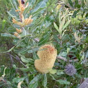
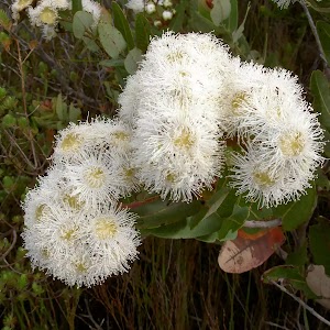
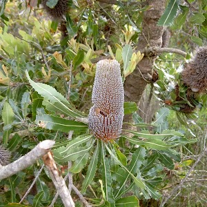
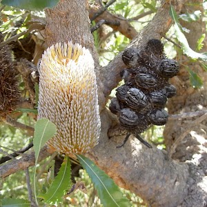
Gallery images
There are other downloads I am still working on.
You will probably need to login to access these — still all free.
* KML (google earth file)
* GPX (GPS file)
Special Maps/ brochures
* A3 topo maps
* PDF with Lands Topo map base
* PDF with arial image (and map overlay)
I wanted to get the main site live first, this extra stuff will come in time.
Happy walking
Matt 🙂
Comments