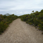
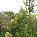
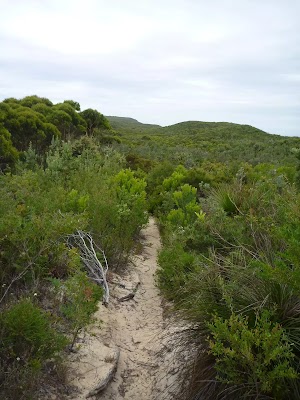
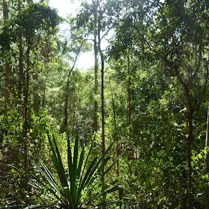
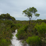
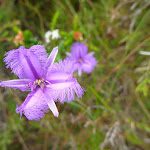
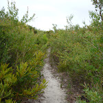
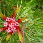
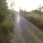
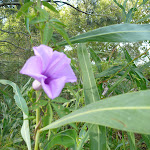
This short walk from the Awabakal car park out to the Awabakal Viewpoint offers a relaxing walk through native forest, with a quiet and secluded viewpoint at the end. The native heath throughout this walk is particularly attractive when in flower (July to October). Why not take a blanket and enjoy a picnic at the viewpoint? This short walk takes you to a lovely viewpoint through native forest and is recommended.
Awabakal Viewpoint Walk
And Walk
Awabakal Viewpoint Walk


30 mins
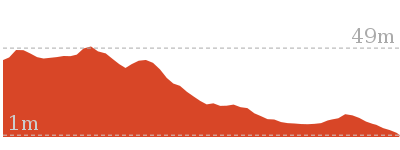
948 m Return

10 m
Hard track


Awabakal Nature Reserve
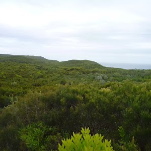
Awabakal Nature Reserve covers 227 hectares of coastal heath between Dudley and Redhead. The Awabakal Reserve contains a wide range of habitats including one of the largest remaining coastal heath communities, and also perched lagoons, creek catchments, dry and wet sclerophyll forest[1] and remnants of rainforest. This park was created in January 1978. The coastal viewpoints from the reserve are also great for whale watching, bird watching and wildflower[2] photography.
More info.
More info.
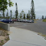
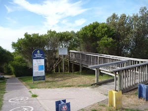
Awabakal Car Park
(0km) Awabakal Car Park (end of Ocean St, Dudley) → Int of Awabakal Walk & Viewpoint Track

320 m
5 mins
3m
-3m
Hard track
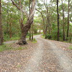
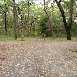
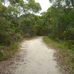
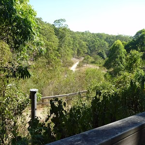
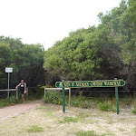
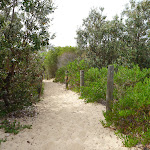
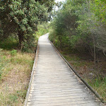
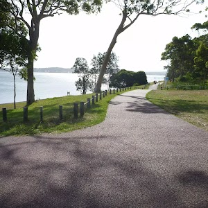
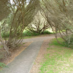
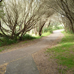
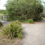
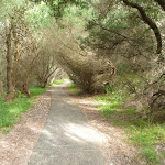
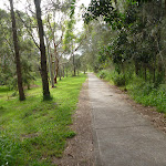
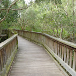
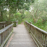
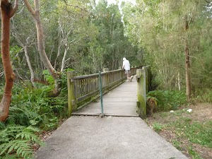
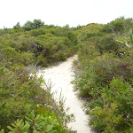
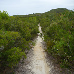
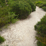
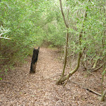
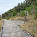
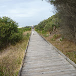
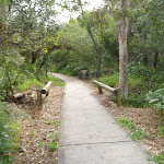
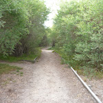
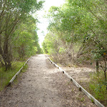
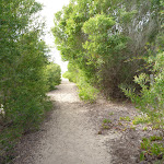
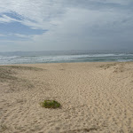
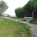
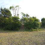
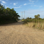
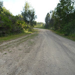
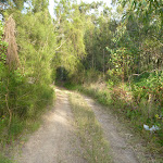
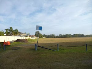
From the Awabakal car park[7][8] (end of Ocean St, Dudley), this walk passes around the locked metal gate[9] and follows the track gently downhill. The walk continues through native forest[10] for about 110m until coming to a three-way intersection[11], with a large stand-alone tree[12] and picnic table[13].
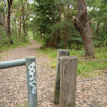
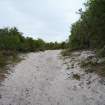
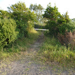
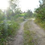
Turn right: From the intersection[14], this walk follows the track gently uphill[15], while leaving the stand-alone tree[16] directly behind you and keeping the ocean on your left. This walk continues, undulating through coastal vegetation for about 160m, until coming to a level three-way intersection[17] with a smaller track[18] on the right.
Turn right: From the intersection[14], this walk follows the track gently uphill[15], while leaving the stand-alone tree[16] directly behind you and keeping the ocean on your left. This walk continues, undulating through coastal vegetation for about 160m, until coming to a level three-way intersection[17] with a smaller track[18] on the right.
(0.32km) Int of Awabakal Walk & Lookout Track → Awabakal Viewpoint
160 m
3 mins
2m
-2m
Hard track
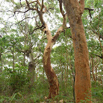
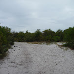
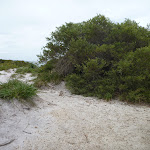
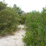
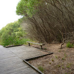
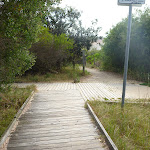
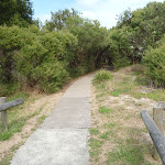
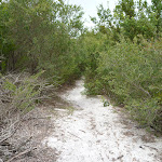
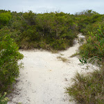
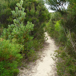
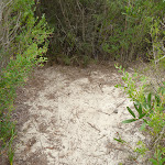
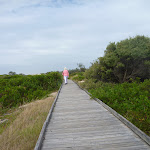
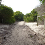
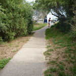
Veer left: From the intersection[19], this walk follows the wider track[20] gently uphill, while initially passing the narrower, overgrown track[21][22] on the right. This walk continues through attractive natural vegetation[23] for about 150m, to find the end of the wide track[24] and a number of small tracks[25] ahead. Then this walk follows the left-hand track for about 30m, until coming to the Awabakal Viewpoint[26].
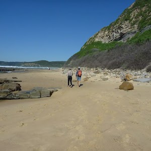
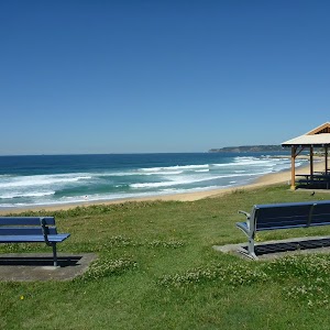
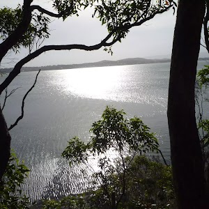
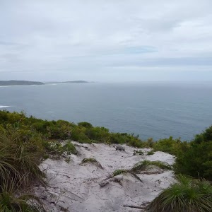
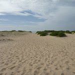
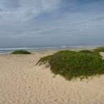
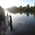
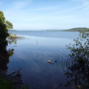
Awabakal Viewpoint

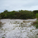
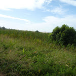
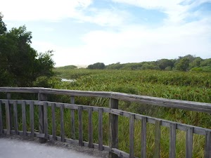
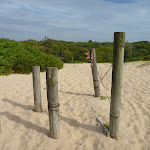
The Awabakal Viewpoint[27] offers excellent views[28] out over the ocean from its elevated viewpoint. This viewpoint[29] is unfenced and care should therefore be taken. The views are paricular good to the north towards Newcastle. Please stay on the tracks already created to reduce the erosion of the cliff top.
Maps for the Awabakal Viewpoint Walk walk
You can download the PDF for this walk to print a map.
These maps below cover the walk and the wider area around the walk, they are worth carrying for safety reasons.
| Wallsend | 1:25 000 Map Series | 92323S WALLSEND | NSW-92323S |
| Newcastle | 1:100 000 Map Series | 9232 NEWCASTLE | 9232 |
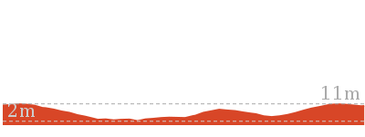
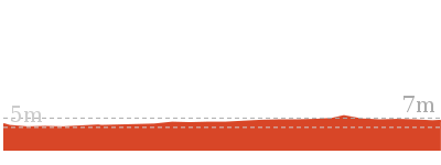
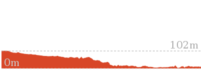
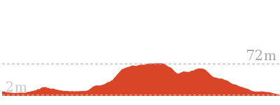
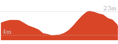
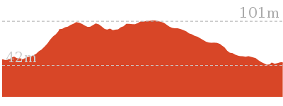
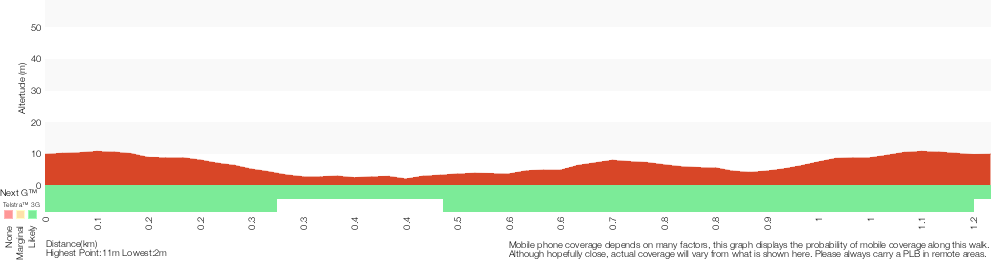
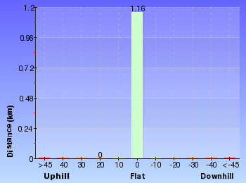
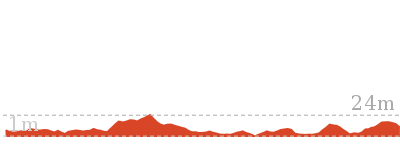
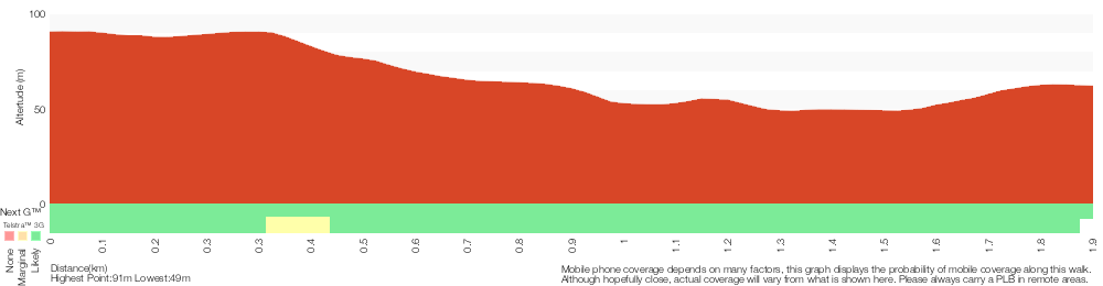
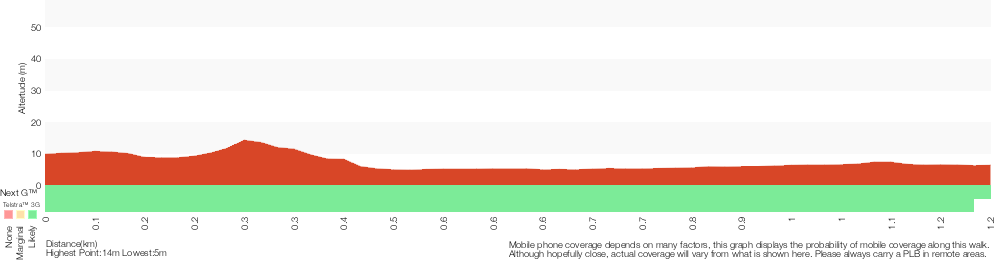
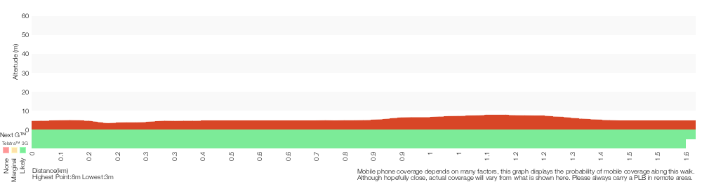
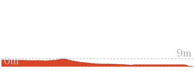
Cross sectional view of the Awabakal Viewpoint Walk bushwalking track

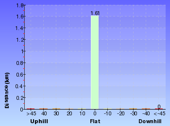
Analysis and summary of the altitude variation on the Awabakal Viewpoint Walk

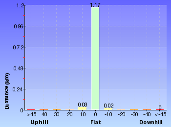
Overview of this walks grade – based on the AS 2156.1 – 2001
Under this standard, a walk is graded based on the most difficult section of the walk.
| Length | 948 m | ||
| Time | 30 mins | ||
| . | |||
| Grade 4/6 Hard track |
AS 2156.1 | Gradient | Gentle hills with occasional steps (2/6) |
| Quality of track | Formed track, with some branches and other obstacles (3/6) | ||
| Signs | Minimal directional signs (4/6) | ||
| Experience Required | Some bushwalking experience recommended (3/6) | ||
| Weather | Weather generally has little impact on safety (1/6) | ||
| Infrastructure | Limited facilities, not all cliffs are fenced (3/6) |
Some more details of this walks Grading
Here is a bit more details explaining grading looking at sections of the walk
Gradient
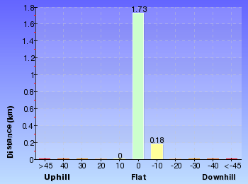
This whole walk, 470m has gentle hills with occasional steps.
Quality of track
This whole walk, 470m follows a formed track, with some branches and other obstacles.
Signs
Around 340m of this walk has minimal directional signs, whilst the remaining 140m has directional signs at most intersection.
Experience Required
This whole walk, 470m requires some bushwalking experience.
weather
This whole walk, 470m is not usually affected by severe weather events (that would unexpectedly impact safety and navigation).
Infrastructure
This whole walk, 470m has limited facilities (such as not all cliffs fenced).
Similar walks
A list of walks that share part of the track with the Awabakal Viewpoint Walk walk.
1.9 km One way
45 mins
Hard track

Other Nearby walks
A list of walks that start near the Awabakal Viewpoint Walk walk.
1.2 km Circuit
30 mins
Hard track
2.4 km Return
1 Hr
Very easy
1.3 km Return
30 mins
Very easy
3.2 km Circuit
1 Hr
Hard track

1.3 km Return
40 mins
Easy track
7.9 km One way
2 hrs 45 mins
Hard track
12.1 km One way
5 hrs 30 mins
Hard track
4.4 km One way
1 hr 30 mins
Moderate track
3.8 km Circuit
1 hr 30 mins
Hard track
666 m Circuit
30 mins
Moderate track
2.4 km Return
1 Hr
Moderate track

2.5 km Circuit
1 Hr
Moderate track
Plan your trip to and from the walk here
The Awabakal Viewpoint Walk walk starts and ends at the Awabakal Car Park (end of Ocean St, Dudley) (gps: -32.99527, 151.72749)
Your transport options to Awabakal Car Park (end of Ocean St, Dudley) are by;
![]() Bus. (get details)
Bus. (get details)
![]() Car. There is free parking available.
Car. There is free parking available.
(get details)


Short URL = http://wild.tl/avw
Gallery images
There are other downloads I am still working on.
You will probably need to login to access these — still all free.
* KML (google earth file)
* GPX (GPS file)
Special Maps/ brochures
* A3 topo maps
* PDF with Lands Topo map base
* PDF with arial image (and map overlay)
I wanted to get the main site live first, this extra stuff will come in time.
Happy walking
Matt 🙂
Northern Redhead Beach Walk
And Walk
Northern Redhead Beach Walk

30 mins
1.2 km Circuit
15 m
Hard track
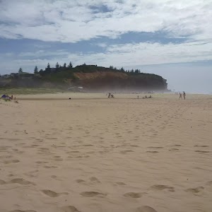
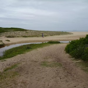
This circuit walk starts at Webb Park and briefly travels on the Owens Walkway, before walking along the beautiful Redhead Beach to the Redhead SLSC. The rock cliffs at the northern end of Redhead Beach are inspiring and attractive to walk underneath. The walk returns to Webb Park via the SLSC car park, crossing a small creek (feet will get wet) and arriving back on the Owens Walkway and Webb Park. This walk is a good way to experience the northern end of Redhead Beach.


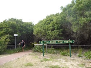
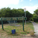
Ken & Audrey Owens Walkway
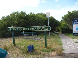
The Ken & Audrey Owens Walkway on Cain St, Redhead is a community made coastal walkway[1] through restored bushland[2]. The walkway has two halves – one direction visits the Redhead Lagoon and a timber bridge viewpoint, and the other way visits Webb Park near the Redhead shops. The walkway was made in coordination with the Redhead Landcare group. Volunteers are always needed for working bee’s on the last Sunday morning of each month. For more information, contact 49447403. The boardwalk is made of concrete and timber, and the tracks are suitable for wheelchairs and prams. There are also well positioned rest areas along the boardwalk. There is a dog walking area just off the walkway. More info.
Webb Park Car Park and Picnic Area
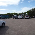
Webb Park picnic area is located on Beach Rd, Redhead, and has a small car park within it. It offers tap water[3], a toilet[4], picnic tables[5], sheltered electric barbecues[6] and a children’s playground[7]. The area is just 200m walk from Redhead surf beach[8] and also its large car park and Surf Life Saving Club. More info.
(0km) Webb Park Car Park and Picnic Area → Webb Park Four-Way Intersection
160 m
3 mins
1m
-2m
Very easy
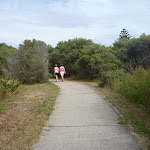
From the Webb Park car park and picnic area[9][10](off Beach St, Redhead), this walk follows the timber walkway gently uphill[11], following the ‘Ken & Audrey Owens Walkway’ sign[12] (on your right). This walk conintues along the timber boardwalk for about 130m passing a bench seat[13] part way (on the right) to come to a four-way intersection[14], with a gravel track[15] (on the left), a sandy track[16] (directly ahead) and a timber walkway[17] and ‘Keep dogs on leads’ sign[18] on the right.
(0.16km) Webb Park Four-Way Intersection → Redhead Surf Life Saving Club
470 m
8 mins
4m
-7m
Hard track
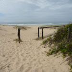
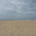
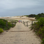
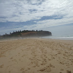
Continue straight: From the intersection[19], this walk follows the sandy track gently uphill, while initially passing the ‘Keep dogs on leads’ sign[20][21] on your right. This walk continues for about 80m, passing timber posts[22] in the sand to find views of the ocean. Then this walk continues straight ahead and gently downhill (passing more timber fences[23]) for about 100m, until coming to Redhead Beach[24][25][26] (near Webb Park).
Turn left: From Redhead Beach (near Webb Park)[27], this walk follows the beach with the ocean on your right. This walk crosses Freshwater Creek (may be covered with sand) after about 60m and continues for about 230m, until coming to the Redhead Beach Surf Life Saving Club[28].
Turn left: From Redhead Beach (near Webb Park)[27], this walk follows the beach with the ocean on your right. This walk crosses Freshwater Creek (may be covered with sand) after about 60m and continues for about 230m, until coming to the Redhead Beach Surf Life Saving Club[28].
Redhead Surf Life Saving Club

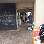
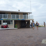
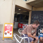
Redhead Surf Life Saving Club, on Beach Rd, Redhead, is adjacent to a large car park and the main surfing area[29] of Redhead Beach. There are changing rooms with toilets[30]. The SLSC runs a kiosk[31], open from 7am daily[32], serving hot and cold drinks, hot food, snacks and ice cream cones[33]. More info.
(0.63km) Redhead Surf Life Saving Club → Redhead Car Park (Fresh Water Creek end)
190 m
3 mins
3m
-2m
Hard track
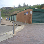
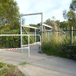
Continue straight: From the Redhead Surf Life Saving Club[34][35] (off Beach Road, Redhead) this walk follows the footpath[36], with the car park[37] on your right and vegetation[38] on your left. This walk continues for about 50m to the end of the footpath[39]. This walk then turns left into the car park and continues for about 120m, until coming to a locked metal gate[40] and ‘Dogs must be leashed’ sign[41].
(0.82km) Redhead Car Park (Fresh Water Creek end) → Owens Walkway Intersection
180 m
3 mins
5m
-1m
Hard track
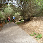
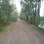
Veer left: From the south-western corner of Redhead Beach car park[42][43] (off Beach Road, Redhead) near Freshwater Creek, this walk passes around the locked metal gate[44][45] and follows the sandy track[46] (with timber steps) gently downhill, keeping the ocean on your left. This walk continues for about 40m, crossing Freshwater Creek[47] then turning right, inland. Then this walk continues gently uphill[48] and after about 70m passes through a level grassed area[49]. This walk then continues on a gravel track[50] for about 60m, until coming to the Owens Walkway four-way intersection[51], with a ‘Keep dogs on leads’ sign[52] directly ahead.
(1.01km) Webb Park Four-Way Intersection → Webb Park Car Park and Picnic Area
160 m
3 mins
2m
-1m
Very easy
Turn right: From the intersection[53], this walk follows the timber walkway gently uphill[54], while initially passing the ‘Keep dogs on leads’ sign[55] on your left and leaving the sandy track[56] directly behind. This walk soon passes a bench seat[57] (on the left) and after about 130m, comes to the Webb Park car park[58] and picnic area[59].
Maps for the Northern Redhead Beach Walk walk
You can download the PDF for this walk to print a map.
These maps below cover the walk and the wider area around the walk, they are worth carrying for safety reasons.
| Swansea | 1:25 000 Map Series | 92314N SWANSEA | NSW-92314N |
| Lake Macquarie | 1:100 000 Map Series | 9231 LAKE MACQUARIE | 9231 |
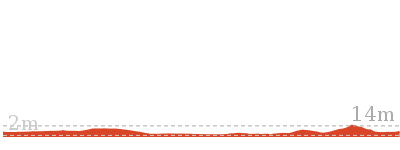
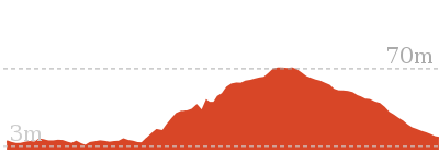
Cross sectional view of the Northern Redhead Beach Walk bushwalking track
Analysis and summary of the altitude variation on the Northern Redhead Beach Walk
Overview of this walks grade – based on the AS 2156.1 – 2001
Under this standard, a walk is graded based on the most difficult section of the walk.
| Length | 1.2 km | ||
| Time | 30 mins | ||
| . | |||
| Grade 4/6 Hard track |
AS 2156.1 | Gradient | Short steep hills (3/6) |
| Quality of track | Rough track, where fallen trees and other obstacles are likely (4/6) | ||
| Signs | Minimal directional signs (4/6) | ||
| Experience Required | Some bushwalking experience recommended (3/6) | ||
| Weather | Weather generally has little impact on safety (1/6) | ||
| Infrastructure | Limited facilities (such as cliffs not fenced, significant creeks not bridged) (4/6) |
Some more details of this walks Grading
Here is a bit more details explaining grading looking at sections of the walk
Gradient
Around 820m of this walk is flat with no steps, whilst the remaining 350m has short steep hills.
Quality of track
Around 660m of this walk follows a rough track, where fallen trees and other obstacles are likely, whilst the remaining 510m follows a smooth and hardened path.
Signs
Around 850m of this walk has minimal directional signs, whilst the remaining 320m is clearly signposted.
Experience Required
Around 660m of this walk requires some bushwalking experience, whilst the remaining 510m requires no previous bushwalking experience.
weather
This whole walk, 1.2km is not usually affected by severe weather events (that would unexpectedly impact safety and navigation).
Infrastructure
660m of this walk has limited facilities (such as cliffs not fenced, significant creeks not bridged) and another 320m is close to useful facilities (such as fenced cliffs and seats). The remaining (190m) has limited facilities (such as not all cliffs fenced).
Similar walks
A list of walks that share part of the track with the Northern Redhead Beach Walk walk.
2.4 km Return
1 Hr
Very easy
3.2 km Circuit
1 Hr
Hard track
Other Nearby walks
A list of walks that start near the Northern Redhead Beach Walk walk.
1.3 km Return
30 mins
Very easy
1.9 km One way
45 mins
Hard track
948 m Return
30 mins
Hard track

3.8 km Circuit
1 hr 30 mins
Hard track
666 m Circuit
30 mins
Moderate track
2.4 km Return
1 Hr
Moderate track
3.4 km Circuit
2 hrs 45 mins
Moderate track

3 km Return
1 hr 15 mins
Moderate track
1.3 km Return
40 mins
Easy track
7.7 km Circuit
3 hrs
Hard track
2.9 km One way
1 hr 15 mins
Hard track
2.4 km Circuit
1 Hr
Moderate track
Plan your trip to and from the walk here
The Northern Redhead Beach Walk walk starts and ends at the Webb Park Car Park and Picnic Area (gps: -33.013028, 151.71603)
Your transport options to Webb Park Car Park and Picnic Area are by;
![]() Bus. (get details)
Bus. (get details)
![]() Car. There is free parking available.
Car. There is free parking available.
(get details)
Short URL = http://wild.tl/nrbw
Gallery images
There are other downloads I am still working on.
You will probably need to login to access these — still all free.
* KML (google earth file)
* GPX (GPS file)
Special Maps/ brochures
* A3 topo maps
* PDF with Lands Topo map base
* PDF with arial image (and map overlay)
I wanted to get the main site live first, this extra stuff will come in time.
Happy walking
Matt 🙂
Cain’s Timber Bridge Viewpoint Walk
And Walk
Cain’s Timber Bridge Viewpoint Walk

30 mins
1.3 km Return
4 m
Very easy
This walk takes you beside the Owens wetland and then finishes at a lovely timber bridge over the Owens Creek. You are likely to see many birds on this walk, particularly if you do the walk in the early morning or late afternoon when the birds are most active. This walk is wheelchair accessible and even has a possible shortcut, ending at the western end of Cain St. This walk makes for a pleasant stroll at anytime of the year.


Ken & Audrey Owens Walkway
The Ken & Audrey Owens Walkway on Cain St, Redhead is a community made coastal walkway[1] through restored bushland[2]. The walkway has two halves – one direction visits the Redhead Lagoon and a timber bridge viewpoint, and the other way visits Webb Park near the Redhead shops. The walkway was made in coordination with the Redhead Landcare group. Volunteers are always needed for working bee’s on the last Sunday morning of each month. For more information, contact 49447403. The boardwalk is made of concrete and timber, and the tracks are suitable for wheelchairs and prams. There are also well positioned rest areas along the boardwalk. There is a dog walking area just off the walkway. More info.
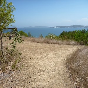
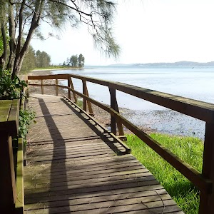
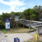
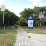
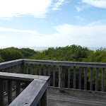
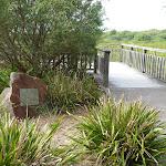
Owens Walkway Car Park & Viewpoint
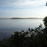
The Owens Walkway car park (off Cain St, Redhead) offers easy access to the Ken & Audrey Owens Walkway[3]. The car park has a water tap[4] and seat[5]. The viewpoint at the car park is gained via an elevated boardwalk[6] and offers views down the coast to Norah Head. From the viewpoint, surfers and whales can be seen (Northern whale migration from June to July, southern migration from Sept to Oct) . More info.
(0km) Owens Walkway Car Park (Off Cain Street) → Owens Walkway Intersection
30 m
1 mins
0m
-1m
Very easy
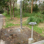
From the car park[7][8] (opposite 9 Cain St, Redhead), this walk follows the concrete footpath[9] gently downhill, while past the ‘Ken and Audrey Owens Walkway’sign[10] and elevated lookout[11] on your right. This walk continues into coastal forest[12] (passing a water tap[13] on the left) for about 30m, until coming to a T-intersection with the concrete Owens Walkway[14][15] (and some timber posts on your left).
(0.03km) Owens Walkway Intersection → Owens Wetland Lookout
130 m
2 mins
0m
0m
Very easy
Turn right: From the intersection[16], this walk follows the concrete footpath gently downhill[17][18], while keeping the ocean and wetland[19] to your left. This walk continues through coastal forest[20] for about 130m, to find an elevated timber lookout[21] and stone monument[22][23] (on your left).
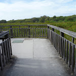
Owens Wetland Viewpoint
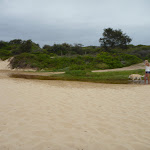
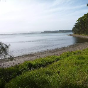
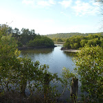
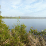
This wetlands viewpoint[24] on the Owens Walkway (in Redhead) offers good views out over water, reeds and a large wetland. In the distance are large sand dunes, with Redhead Beach behind them. This viewpoint is easily accessible via the Owens Walkway and has wheelchair access. Wildlife, particularly birds, use the wetland as a breeding site and you are likely to see birds here. There is also a stone monument[25], dedicated to the ‘Cain St Landcare Project[26]’. The viewpoint is fenced[27] and has a timber seat[28].
(0.16km) Owens Wetland Lookout → Int of Owens Walkway & Cain St Trail
340 m
5 mins
2m
0m
Very easy
Continue straight: From the lookout, this walk follows the concrete footpath whilst keeping the wetland to your left. The footpath undulates gently as it leads through the coastal forest[29] for about 300m, until coming to a T-intersection[30], marked with some concrete posts, a drinking fountain[31] and a trail[32] (on the right).
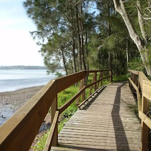
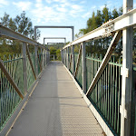
(0.51km) Int of Owens Walkway & Cain St Trail → Elevated Timber Bridge
140 m
2 mins
0m
-1m
Very easy
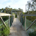
Turn left: From the intersection[36], this walk follows the concrete footpath gently downhill[37], while leaving the Cain St trail directly behind and initially keeping the drinking fountain[38] on your right. This walk continues through dense coastal forest[39] for about 140m until coming to an elevated timber foot bridge[40][41] over Owens Creek[42].
Maps for the Cain’s Timber Bridge Viewpoint Walk walk
You can download the PDF for this walk to print a map.
These maps below cover the walk and the wider area around the walk, they are worth carrying for safety reasons.
| Swansea | 1:25 000 Map Series | 92314N SWANSEA | NSW-92314N |
| Lake Macquarie | 1:100 000 Map Series | 9231 LAKE MACQUARIE | 9231 |
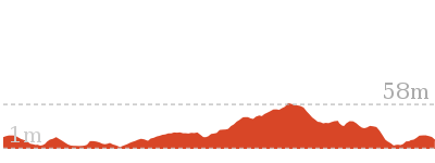
Cross sectional view of the Cain’s Timber Bridge Viewpoint Walk bushwalking track

Analysis and summary of the altitude variation on the Cain’s Timber Bridge Viewpoint Walk

Overview of this walks grade – based on the AS 2156.1 – 2001
Under this standard, a walk is graded based on the most difficult section of the walk.
| Length | 1.3 km | ||
| Time | 30 mins | ||
| . | |||
| Grade 1/6 Very easy |
AS 2156.1 | Gradient | Flat, no steps (1/6) |
| Quality of track | Smooth and hardened path (1/6) | ||
| Signs | Clearly signposted (1/6) | ||
| Experience Required | No experience required (1/6) | ||
| Weather | Weather generally has little impact on safety (1/6) | ||
| Infrastructure | Generally useful facilities (such as fenced cliffs and seats) (1/6) |
Some more details of this walks Grading
Here is a bit more details explaining grading looking at sections of the walk
Gradient
This whole walk, 640m is flat with no steps.
Quality of track
This whole walk, 640m follows a smooth and hardened path.
Signs
This whole walk, 640m is clearly signposted.
Experience Required
This whole walk, 640m requires no previous bushwalking experience.
weather
This whole walk, 640m is not usually affected by severe weather events (that would unexpectedly impact safety and navigation).
Infrastructure
This whole walk, 640m is close to useful facilities (such as fenced cliffs and seats).
Similar walks
A list of walks that share part of the track with the Cain’s Timber Bridge Viewpoint Walk walk.
2.4 km Return
1 Hr
Very easy
3.2 km Circuit
1 Hr
Hard track
Other Nearby walks
A list of walks that start near the Cain’s Timber Bridge Viewpoint Walk walk.
1.2 km Circuit
30 mins
Hard track
1.9 km One way
45 mins
Hard track
948 m Return
30 mins
Hard track
2.4 km Return
1 Hr
Moderate track
3.8 km Circuit
1 hr 30 mins
Hard track
666 m Circuit
30 mins
Moderate track
3.4 km Circuit
2 hrs 45 mins
Moderate track
3 km Return
1 hr 15 mins
Moderate track
7.7 km Circuit
3 hrs
Hard track
2.9 km One way
1 hr 15 mins
Hard track
2.4 km Circuit
1 Hr
Moderate track
7.9 km One way
2 hrs 45 mins
Hard track
Plan your trip to and from the walk here
The Cain’s Timber Bridge Viewpoint Walk walk starts and ends at the Owens Walkway Car Park (Off Cain Street) (gps: -33.015551, 151.71216)
Your transport options to Owens Walkway Car Park (Off Cain Street) are by;
![]() Bus. (get details)
Bus. (get details)
![]() Car. There is free parking available.
Car. There is free parking available.
(get details)
Short URL = http://wild.tl/ctbvw
Gallery images
There are other downloads I am still working on.
You will probably need to login to access these — still all free.
* KML (google earth file)
* GPX (GPS file)
Special Maps/ brochures
* A3 topo maps
* PDF with Lands Topo map base
* PDF with arial image (and map overlay)
I wanted to get the main site live first, this extra stuff will come in time.
Happy walking
Matt 🙂
Awabakal Coastal Walk
And Walk
Awabakal Coastal Walk

45 mins
1.9 km One way
21 m
Hard track
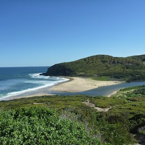
This walk traverses the Awabakal Nature Reserve. Starting from Dudley in the north, this walk travels south through coastal heath and forest, until coming to Redhead. The vegetation throughout this walk is particularly attractive during the wildflower season of July to October. The side trip out to the Awabakal Viewpoint gives great views to the north along the coastline. A car shuffle would be ideal for this one-way walk. The walking tracks are a little overgrown, but if you like native forest and heath, or simply flowers, then this is the walk for you.


Awabakal Nature Reserve
Awabakal Nature Reserve covers 227 hectares of coastal heath between Dudley and Redhead. The Awabakal Reserve contains a wide range of habitats including one of the largest remaining coastal heath communities, and also perched lagoons, creek catchments, dry and wet sclerophyll forest[1] and remnants of rainforest. This park was created in January 1978. The coastal viewpoints from the reserve are also great for whale watching, bird watching and wildflower[2] photography.
More info.
More info.
Awabakal Car Park
(0km) Awabakal Car Park (end of Ocean St, Dudley) → Int of Awabakal Walk & Viewpoint Track
320 m
5 mins
3m
-3m
Hard track
From the Awabakal car park[7][8] (end of Ocean St, Dudley), this walk passes around the locked metal gate[9] and follows the track gently downhill. The walk continues through native forest[10] for about 110m until coming to a three-way intersection[11], with a large stand-alone tree[12] and picnic table[13].
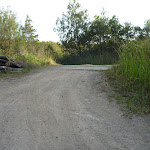
Turn right: From the intersection[14], this walk follows the track gently uphill[15], while leaving the stand-alone tree[16] directly behind you and keeping the ocean on your left. This walk continues, undulating through coastal vegetation for about 160m, until coming to a level three-way intersection[17] with a smaller track[18] on the right.
Turn right: From the intersection[14], this walk follows the track gently uphill[15], while leaving the stand-alone tree[16] directly behind you and keeping the ocean on your left. This walk continues, undulating through coastal vegetation for about 160m, until coming to a level three-way intersection[17] with a smaller track[18] on the right.
(0.32km) Int of Awabakal Walk & Lookout Track → Awabakal Viewpoint
160 m
3 mins
2m
-2m
Hard track
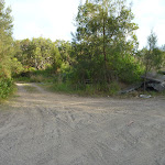
Veer left: From the intersection[19], this walk follows the wider track[20] gently uphill, while initially passing the narrower, overgrown track[21][22] on the right. This walk continues through attractive natural vegetation[23] for about 150m, to find the end of the wide track[24] and a number of small tracks[25] ahead. Then this walk follows the left-hand track for about 30m, until coming to the Awabakal Viewpoint[26]. At the end of this side trip, retrace your steps back to the main walk then Turn left.
Awabakal Viewpoint
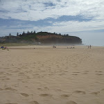
The Awabakal Viewpoint[27] offers excellent views[28] out over the ocean from its elevated viewpoint. This viewpoint[29] is unfenced and care should therefore be taken. The views are paricular good to the north towards Newcastle. Please stay on the tracks already created to reduce the erosion of the cliff top.
(0.32km) Int of Awabakal Walk & Lookout Track → Int of Awabakal Walk & Collier St, Redhead
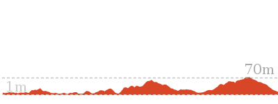
1.6 km
28 mins
18m
-47m
Hard track
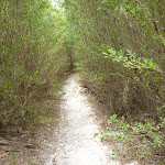
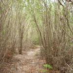
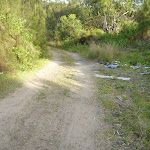
Veer right: From the intersection[30][31], this walk follows the narrow and overgrown (but well defined) track[32][33], while leaving the wide track behind and keeping the ocean to your left. This walk continues on the overgrown track[34][35][36], undulating gently through attractive native forest and heath[37][38] (with occasional views across the landscape[39][40])(ignoring side tracks[41][42]) for about 1.6km, until coming out of the bush to Collier St[43], Redhead, with a ‘No Pets Allowed’ sign[44] (on the right).
Maps for the Awabakal Coastal Walk walk
You can download the PDF for this walk to print a map.
These maps below cover the walk and the wider area around the walk, they are worth carrying for safety reasons.
| Wallsend | 1:25 000 Map Series | 92323S WALLSEND | NSW-92323S |
| Swansea | 1:25 000 Map Series | 92314N SWANSEA | NSW-92314N |
| Newcastle | 1:100 000 Map Series | 9232 NEWCASTLE | 9232 |
| Lake Macquarie | 1:100 000 Map Series | 9231 LAKE MACQUARIE | 9231 |
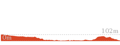
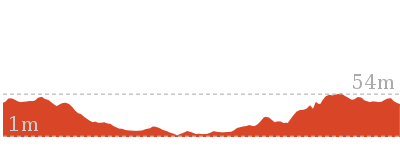
Cross sectional view of the Awabakal Coastal Walk bushwalking track
Analysis and summary of the altitude variation on the Awabakal Coastal Walk
Overview of this walks grade – based on the AS 2156.1 – 2001
Under this standard, a walk is graded based on the most difficult section of the walk.
| Length | 1.9 km | ||
| Time | 45 mins | ||
| . | |||
| Grade 4/6 Hard track |
AS 2156.1 | Gradient | Gentle hills with occasional steps (2/6) |
| Quality of track | Rough track, where fallen trees and other obstacles are likely (4/6) | ||
| Signs | Minimal directional signs (4/6) | ||
| Experience Required | Some bushwalking experience recommended (3/6) | ||
| Weather | Weather generally has little impact on safety (1/6) | ||
| Infrastructure | Limited facilities, not all cliffs are fenced (3/6) |
Some more details of this walks Grading
Here is a bit more details explaining grading looking at sections of the walk
Gradient
This whole walk, 1.9km has gentle hills with occasional steps.
Quality of track
Around 1.6km of this walk follows a rough track, where fallen trees and other obstacles are likely, whilst the remaining 320m follows a formed track, with some branches and other obstacles.
Signs
Around 1.8km of this walk has minimal directional signs, whilst the remaining 140m has directional signs at most intersection.
Experience Required
This whole walk, 1.9km requires some bushwalking experience.
weather
This whole walk, 1.9km is not usually affected by severe weather events (that would unexpectedly impact safety and navigation).
Infrastructure
This whole walk, 1.9km has limited facilities (such as not all cliffs fenced).
Similar walks
A list of walks that share part of the track with the Awabakal Coastal Walk walk.
948 m Return
30 mins
Hard track
Other Nearby walks
A list of walks that start near the Awabakal Coastal Walk walk.
1.2 km Circuit
30 mins
Hard track
2.4 km Return
1 Hr
Very easy
1.3 km Return
30 mins
Very easy
3.2 km Circuit
1 Hr
Hard track
1.3 km Return
40 mins
Easy track
7.9 km One way
2 hrs 45 mins
Hard track
12.1 km One way
5 hrs 30 mins
Hard track
4.4 km One way
1 hr 30 mins
Moderate track
3.8 km Circuit
1 hr 30 mins
Hard track
666 m Circuit
30 mins
Moderate track
2.4 km Return
1 Hr
Moderate track
2.5 km Circuit
1 Hr
Moderate track
Plan your trip to and from the walk here
The Awabakal Coastal Walk walk starts at the Awabakal Car Park (end of Ocean St, Dudley) (gps: -32.99527, 151.72749)
Your transport options to Awabakal Car Park (end of Ocean St, Dudley) are by;
![]() Bus. (get details)
Bus. (get details)
![]() Car. There is free parking available.
Car. There is free parking available.
(get details)
The Awabakal Coastal Walk ends at the Int of Awabakal Walk & Collier St, Redhead (gps: -33.010777, 151.72498)
Your transport options to Int of Awabakal Walk & Collier St, Redhead are by;
![]() Bus. (get details)
Bus. (get details)
![]() Car. There is free parking available.
Car. There is free parking available.
(get details)
Short URL = http://wild.tl/acw
Gallery images
There are other downloads I am still working on.
You will probably need to login to access these — still all free.
* KML (google earth file)
* GPX (GPS file)
Special Maps/ brochures
* A3 topo maps
* PDF with Lands Topo map base
* PDF with arial image (and map overlay)
I wanted to get the main site live first, this extra stuff will come in time.
Happy walking
Matt 🙂
The Ken and Audrey Owens Walkway
And Walk
The Ken and Audrey Owens Walkway

1 Hr
2.4 km Return
20 m
Very easy
This walk follows a series of concrete and timber footpaths through the pleasant coastal area. This walk starts and finishes at the Webb Park Picnic Area, which has good facilities and shops nearby. The Owens Walkway has been made in conjunction with the Redhead Landcare group. This walk is great for those wanting to explore the area in a wheelchair or with a pram. There are a few alternate exits along the way if you wish to make the walk shorter.


Ken & Audrey Owens Walkway
The Ken & Audrey Owens Walkway on Cain St, Redhead is a community made coastal walkway[1] through restored bushland[2]. The walkway has two halves – one direction visits the Redhead Lagoon and a timber bridge viewpoint, and the other way visits Webb Park near the Redhead shops. The walkway was made in coordination with the Redhead Landcare group. Volunteers are always needed for working bee’s on the last Sunday morning of each month. For more information, contact 49447403. The boardwalk is made of concrete and timber, and the tracks are suitable for wheelchairs and prams. There are also well positioned rest areas along the boardwalk. There is a dog walking area just off the walkway. More info.
Webb Park Car Park and Picnic Area
Webb Park picnic area is located on Beach Rd, Redhead, and has a small car park within it. It offers tap water[3], a toilet[4], picnic tables[5], sheltered electric barbecues[6] and a children’s playground[7]. The area is just 200m walk from Redhead surf beach[8] and also its large car park and Surf Life Saving Club. More info.
(0km) Webb Park Car Park and Picnic Area → Webb Park Four-Way Intersection
160 m
3 mins
1m
-2m
Very easy
From the Webb Park car park and picnic area[9][10](off Beach St, Redhead), this walk follows the timber walkway gently uphill[11], following the ‘Ken & Audrey Owens Walkway’ sign[12] (on your right). This walk conintues along the timber boardwalk for about 130m passing a bench seat[13] part way (on the right) to come to a four-way intersection[14], with a gravel track[15] (on the left), a sandy track[16] (directly ahead) and a timber walkway[17] and ‘Keep dogs on leads’ sign[18] on the right.
(0.16km) Webb Park Four-Way Intersection → Owens Walkway Intersection
450 m
8 mins
5m
-9m
Very easy
Turn right: From the intersection[19][20], this walk follows the timber walkway gently uphill[21], while keeping the ‘Keep dogs on leads’ sign[22] and ocean (in the distance) on your left. This walk continues through the low coastal vegetation[23][24] (passing two bench seats[25][26]) for about 400m to come to a concrete footpath[27]. This walk continues along the footpath for about 50m, to a three-way intersection[28], with a footpath (on the left) and a ‘Dog Exercise Area’ sign[29] (on the right).
Continue straight: From the intersection[30][31], this walk follows the concrete footpath gently uphill[32], while leaving the ‘Dog Exercise Area’ sign[33] on your right. This walk continues for about 40m, until passing between timber posts[34][35] and coming to a three-way intersection with a gently uphill footpath[36] (on your right).
Continue straight: From the intersection[30][31], this walk follows the concrete footpath gently uphill[32], while leaving the ‘Dog Exercise Area’ sign[33] on your right. This walk continues for about 40m, until passing between timber posts[34][35] and coming to a three-way intersection with a gently uphill footpath[36] (on your right).
(0.61km) Owens Walkway Intersection → Owens Walkway Car Park (Off Cain Street)
30 m
1 mins
1m
0m
Very easy
Turn right: From the intersection[37][38], this walk follows the concrete footpath gently uphill[39], leaving the ocean directly behind you. This walk continues through coastal forest (passing a water tap[40] on the right), until coming to the Owens Walkway car park[41][42], with an elevated lookout[43] on your left.
Owens Walkway Car Park & Viewpoint
The Owens Walkway car park (off Cain St, Redhead) offers easy access to the Ken & Audrey Owens Walkway[44]. The car park has a water tap[45] and seat[46]. The viewpoint at the car park is gained via an elevated boardwalk[47] and offers views down the coast to Norah Head. From the viewpoint, surfers and whales can be seen (Northern whale migration from June to July, southern migration from Sept to Oct) . More info.
(0.61km) Owens Walkway Intersection → Owens Wetland Lookout
130 m
2 mins
0m
0m
Very easy
Continue straight: From the intersection[48], this walk follows the concrete footpath gently downhill[49][50], while keeping the ocean and wetland[51] to your left. This walk continues through coastal forest[52] for about 130m, to find an elevated timber lookout[53] and stone monument[54][55] (on your left).
Owens Wetland Viewpoint
This wetlands viewpoint[56] on the Owens Walkway (in Redhead) offers good views out over water, reeds and a large wetland. In the distance are large sand dunes, with Redhead Beach behind them. This viewpoint is easily accessible via the Owens Walkway and has wheelchair access. Wildlife, particularly birds, use the wetland as a breeding site and you are likely to see birds here. There is also a stone monument[57], dedicated to the ‘Cain St Landcare Project[58]’. The viewpoint is fenced[59] and has a timber seat[60].
(0.74km) Owens Wetland Lookout → Int of Owens Walkway & Cain St Trail
340 m
5 mins
2m
0m
Very easy
Continue straight: From the lookout, this walk follows the concrete footpath whilst keeping the wetland to your left. The footpath undulates gently as it leads through the coastal forest[61] for about 300m, until coming to a T-intersection[62], marked with some concrete posts, a drinking fountain[63] and a trail[64] (on the right).
(1.08km) Int of Owens Walkway & Cain St Trail → Elevated Timber Bridge
140 m
2 mins
0m
-1m
Very easy
Turn left: From the intersection[65], this walk follows the concrete footpath gently downhill[66], while leaving the Cain St trail directly behind and initially keeping the drinking fountain[67] on your right. This walk continues through dense coastal forest[68] for about 140m until coming to an elevated timber foot bridge[69][70] over Owens Creek[71].
Maps for the The Ken and Audrey Owens Walkway walk
You can download the PDF for this walk to print a map.
These maps below cover the walk and the wider area around the walk, they are worth carrying for safety reasons.
| Swansea | 1:25 000 Map Series | 92314N SWANSEA | NSW-92314N |
| Lake Macquarie | 1:100 000 Map Series | 9231 LAKE MACQUARIE | 9231 |
Cross sectional view of the The Ken and Audrey Owens Walkway bushwalking track
Analysis and summary of the altitude variation on the The Ken and Audrey Owens Walkway
Overview of this walks grade – based on the AS 2156.1 – 2001
Under this standard, a walk is graded based on the most difficult section of the walk.
| Length | 2.4 km | ||
| Time | 1 Hr | ||
| . | |||
| Grade 1/6 Very easy |
AS 2156.1 | Gradient | Flat, no steps (1/6) |
| Quality of track | Smooth and hardened path (1/6) | ||
| Signs | Clearly signposted (1/6) | ||
| Experience Required | No experience required (1/6) | ||
| Weather | Weather generally has little impact on safety (1/6) | ||
| Infrastructure | Generally useful facilities (such as fenced cliffs and seats) (1/6) |
Some more details of this walks Grading
Here is a bit more details explaining grading looking at sections of the walk
Gradient
This whole walk, 1.2km is flat with no steps.
Quality of track
This whole walk, 1.2km follows a smooth and hardened path.
Signs
This whole walk, 1.2km is clearly signposted.
Experience Required
This whole walk, 1.2km requires no previous bushwalking experience.
weather
This whole walk, 1.2km is not usually affected by severe weather events (that would unexpectedly impact safety and navigation).
Infrastructure
This whole walk, 1.2km is close to useful facilities (such as fenced cliffs and seats).
Similar walks
A list of walks that share part of the track with the The Ken and Audrey Owens Walkway walk.
1.2 km Circuit
30 mins
Hard track
1.3 km Return
30 mins
Very easy
3.2 km Circuit
1 Hr
Hard track
Other Nearby walks
A list of walks that start near the The Ken and Audrey Owens Walkway walk.
1.9 km One way
45 mins
Hard track
948 m Return
30 mins
Hard track
3.8 km Circuit
1 hr 30 mins
Hard track
666 m Circuit
30 mins
Moderate track
2.4 km Return
1 Hr
Moderate track
3.4 km Circuit
2 hrs 45 mins
Moderate track
3 km Return
1 hr 15 mins
Moderate track
1.3 km Return
40 mins
Easy track
7.7 km Circuit
3 hrs
Hard track
2.9 km One way
1 hr 15 mins
Hard track
2.4 km Circuit
1 Hr
Moderate track
7.9 km One way
2 hrs 45 mins
Hard track
Plan your trip to and from the walk here
The The Ken and Audrey Owens Walkway walk starts and ends at the Webb Park Car Park and Picnic Area (gps: -33.013028, 151.71603)
Your transport options to Webb Park Car Park and Picnic Area are by;
![]() Bus. (get details)
Bus. (get details)
![]() Car. There is free parking available.
Car. There is free parking available.
(get details)
Short URL = http://wild.tl/wtbvw
Gallery images
There are other downloads I am still working on.
You will probably need to login to access these — still all free.
* KML (google earth file)
* GPX (GPS file)
Special Maps/ brochures
* A3 topo maps
* PDF with Lands Topo map base
* PDF with arial image (and map overlay)
I wanted to get the main site live first, this extra stuff will come in time.
Happy walking
Matt 🙂
The Redhead Owens Walkway Circuit
And Walk
The Redhead Owens Walkway Circuit

1 Hr
3.2 km Circuit
26 m
Hard track
This walk visits the Owens Wetland on the Owens Walkway, before entering Redhead Beach and walking north to the Redhead SLSC. The cliffs to the north are worth a closer look. The walk then returns via the Redhead Beach car park, crossing a creek (your feet will get wet) and following the Owens Walkway back to the start of the walk. A good walk that gives an excellent sense of the northern end of Redhead.


Ken & Audrey Owens Walkway
The Ken & Audrey Owens Walkway on Cain St, Redhead is a community made coastal walkway[1] through restored bushland[2]. The walkway has two halves – one direction visits the Redhead Lagoon and a timber bridge viewpoint, and the other way visits Webb Park near the Redhead shops. The walkway was made in coordination with the Redhead Landcare group. Volunteers are always needed for working bee’s on the last Sunday morning of each month. For more information, contact 49447403. The boardwalk is made of concrete and timber, and the tracks are suitable for wheelchairs and prams. There are also well positioned rest areas along the boardwalk. There is a dog walking area just off the walkway. More info.
Owens Walkway Car Park & Viewpoint
The Owens Walkway car park (off Cain St, Redhead) offers easy access to the Ken & Audrey Owens Walkway[3]. The car park has a water tap[4] and seat[5]. The viewpoint at the car park is gained via an elevated boardwalk[6] and offers views down the coast to Norah Head. From the viewpoint, surfers and whales can be seen (Northern whale migration from June to July, southern migration from Sept to Oct) . More info.
(0km) Owens Walkway Car Park (Off Cain Street) → Owens Walkway Intersection
30 m
1 mins
0m
-1m
Very easy
From the car park[7][8] (opposite 9 Cain St, Redhead), this walk follows the concrete footpath[9] gently downhill, while past the ‘Ken and Audrey Owens Walkway’sign[10] and elevated lookout[11] on your right. This walk continues into coastal forest[12] (passing a water tap[13] on the left) for about 30m, until coming to a T-intersection with the concrete Owens Walkway[14][15] (and some timber posts on your left).
(0.03km) Owens Walkway Intersection → Owens Wetland Lookout
130 m
2 mins
0m
0m
Very easy
Turn right: From the intersection[16], this walk follows the concrete footpath gently downhill[17][18], while keeping the ocean and wetland[19] to your left. This walk continues through coastal forest[20] for about 130m, to find an elevated timber lookout[21] and stone monument[22][23] (on your left).
Owens Wetland Viewpoint
This wetlands viewpoint[24] on the Owens Walkway (in Redhead) offers good views out over water, reeds and a large wetland. In the distance are large sand dunes, with Redhead Beach behind them. This viewpoint is easily accessible via the Owens Walkway and has wheelchair access. Wildlife, particularly birds, use the wetland as a breeding site and you are likely to see birds here. There is also a stone monument[25], dedicated to the ‘Cain St Landcare Project[26]’. The viewpoint is fenced[27] and has a timber seat[28].
(0.16km) Owens Wetland Lookout → Int of Owens Walkway & Cain St Trail
340 m
5 mins
2m
0m
Very easy
Continue straight: From the lookout, this walk follows the concrete footpath whilst keeping the wetland to your left. The footpath undulates gently as it leads through the coastal forest[29] for about 300m, until coming to a T-intersection[30], marked with some concrete posts, a drinking fountain[31] and a trail[32] (on the right).
(0.51km) Int of Owens Walkway & Cain St Trail → Elevated Timber Bridge
140 m
2 mins
0m
-1m
Very easy
Turn left: From the intersection[33], this walk follows the concrete footpath gently downhill[34], while leaving the Cain St trail directly behind and initially keeping the drinking fountain[35] on your right. This walk continues through dense coastal forest[36] for about 140m until coming to an elevated timber foot bridge[37][38] over Owens Creek[39].
(0.64km) Elevated timber bridge → Redhead Beach (Owens Walk end)
560 m
9 mins
3m
-7m
Hard track
Continue straight: From here, this walk crosses the elevated timber bridge[44][45], and follows the sandy track[46] south. This walk continues, undulating gently through coastal forest[47] (ignoring side tracks[48]) for about 400m, to pass timber posts[49] with views[50] of the ocean. Then this walk continues towards the ocean for about 100m, until arriving on Redhead Beach[51][52]. Please preserve the dunes – don’t walk on the vegetation.
(1.21km) Redhead Beach (Owens Walk end) → Redhead Surf Life Saving Club
1.2 km
18 mins
7m
-4m
Hard track
Turn left: From Redhead Beach (Owens Walkway end)[53][54][55], this walk follows the beach, with the ocean on your right. This walk continues for about 850m until coming to a section of beach with a faint track[56] with timber posts[57] visible inland, about 60m before crossing Freshwater Creek[58].
Continue straight: From Redhead Beach (near Webb Park)[59], this walk follows the beach with the ocean on your right. This walk crosses Freshwater Creek (may be covered with sand) after about 60m and continues for about 230m, until coming to the Redhead Beach Surf Life Saving Club[60].
Continue straight: From Redhead Beach (near Webb Park)[59], this walk follows the beach with the ocean on your right. This walk crosses Freshwater Creek (may be covered with sand) after about 60m and continues for about 230m, until coming to the Redhead Beach Surf Life Saving Club[60].
Redhead Surf Life Saving Club
Redhead Surf Life Saving Club, on Beach Rd, Redhead, is adjacent to a large car park and the main surfing area[61] of Redhead Beach. There are changing rooms with toilets[62]. The SLSC runs a kiosk[63], open from 7am daily[64], serving hot and cold drinks, hot food, snacks and ice cream cones[65]. More info.
(2.36km) Redhead Surf Life Saving Club → Redhead Car Park (Fresh Water Creek end)
190 m
3 mins
3m
-2m
Hard track
Continue straight: From the Redhead Surf Life Saving Club[66][67] (off Beach Road, Redhead) this walk follows the footpath[68], with the car park[69] on your right and vegetation[70] on your left. This walk continues for about 50m to the end of the footpath[71]. This walk then turns left into the car park and continues for about 120m, until coming to a locked metal gate[72] and ‘Dogs must be leashed’ sign[73].
(2.55km) Redhead Car Park (Fresh Water Creek end) → Owens Walkway Intersection
180 m
3 mins
5m
-1m
Hard track
Veer left: From the south-western corner of Redhead Beach car park[74][75] (off Beach Road, Redhead) near Freshwater Creek, this walk passes around the locked metal gate[76][77] and follows the sandy track[78] (with timber steps) gently downhill, keeping the ocean on your left. This walk continues for about 40m, crossing Freshwater Creek[79] then turning right, inland. Then this walk continues gently uphill[80] and after about 70m passes through a level grassed area[81]. This walk then continues on a gravel track[82] for about 60m, until coming to the Owens Walkway four-way intersection[83], with a ‘Keep dogs on leads’ sign[84] directly ahead.
(2.73km) Webb Park Four-Way Intersection → Int of Owens Walkway & Dog exercise footpath
390 m
7 mins
5m
-9m
Very easy
Continue straight: From the intersection[85][86], this walk follows the timber walkway gently uphill[87], while keeping the ‘Keep dogs on leads’ sign[88] and ocean (in the distance) on your left. This walk continues through the low coastal vegetation[89][90] (passing two bench seats[91][92]) for about 400m to come to a concrete footpath[93]. This walk continues along the footpath for about 50m, to a three-way intersection[94], with a footpath (on the left) and a ‘Dog Exercise Area’ sign[95] (on the right).
(3.13km) Int of Owens Walkway & Dog exercise footpath → Owens Walkway Car Park (Off Cain Street)
90 m
2 mins
1m
0m
Very easy
Continue straight: From the intersection[96][97], this walk follows the concrete footpath gently uphill[98], while leaving the ‘Dog Exercise Area’ sign[99] on your right. This walk continues for about 40m, until passing between timber posts[100][101] and coming to a three-way intersection with a gently uphill footpath[102] (on your right).
Turn right: From the intersection[103][104], this walk follows the concrete footpath gently uphill[105], leaving the ocean directly behind you. This walk continues through coastal forest (passing a water tap[106] on the right), until coming to the Owens Walkway car park[107][108], with an elevated lookout[109] on your left.
Turn right: From the intersection[103][104], this walk follows the concrete footpath gently uphill[105], leaving the ocean directly behind you. This walk continues through coastal forest (passing a water tap[106] on the right), until coming to the Owens Walkway car park[107][108], with an elevated lookout[109] on your left.
Maps for the The Redhead Owens Walkway Circuit walk
You can download the PDF for this walk to print a map.
These maps below cover the walk and the wider area around the walk, they are worth carrying for safety reasons.
| Swansea | 1:25 000 Map Series | 92314N SWANSEA | NSW-92314N |
| Lake Macquarie | 1:100 000 Map Series | 9231 LAKE MACQUARIE | 9231 |
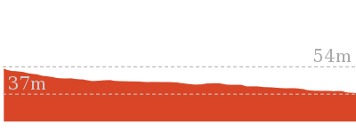
Cross sectional view of the The Redhead Owens Walkway Circuit bushwalking track

Analysis and summary of the altitude variation on the The Redhead Owens Walkway Circuit

Overview of this walks grade – based on the AS 2156.1 – 2001
Under this standard, a walk is graded based on the most difficult section of the walk.
| Length | 3.2 km | ||
| Time | 1 Hr | ||
| . | |||
| Grade 4/6 Hard track |
AS 2156.1 | Gradient | Short steep hills (3/6) |
| Quality of track | Rough track, where fallen trees and other obstacles are likely (4/6) | ||
| Signs | Minimal directional signs (4/6) | ||
| Experience Required | Moderate level of bushwalking experience recommended (4/6) | ||
| Weather | Storms may impact on navigation and safety (3/6) | ||
| Infrastructure | Limited facilities (such as cliffs not fenced, significant creeks not bridged) (4/6) |
Some more details of this walks Grading
Here is a bit more details explaining grading looking at sections of the walk
Gradient
Around 2.5km of this walk is flat with no steps, whilst the remaining 750m has short steep hills.
Quality of track
Around 1.9km of this walk follows a rough track, where fallen trees and other obstacles are likely, whilst the remaining 1.3km follows a smooth and hardened path.
Signs
Around 2.1km of this walk has minimal directional signs, whilst the remaining 1.1km is clearly signposted.
Experience Required
1.3km of this walk requires no previous bushwalking experience and another 1.1km requires some bushwalking experience. The remaining (850m) requires a leader a with moderate level of bushwalking experience.
weather
Around 1.8km of this walk is not usually affected by severe weather events (that would unexpectedly impact safety and navigation), whilst the remaining 1.4km is affected by storms that may impact your navigation and safety.
Infrastructure
1.3km of this walk has limited facilities (such as cliffs not fenced, significant creeks not bridged) and another 1.1km is close to useful facilities (such as fenced cliffs and seats). The remaining (750m) has limited facilities (such as not all cliffs fenced).
Similar walks
A list of walks that share part of the track with the The Redhead Owens Walkway Circuit walk.
1.2 km Circuit
30 mins
Hard track
1.3 km Return
30 mins
Very easy
2.4 km Return
1 Hr
Very easy
Other Nearby walks
A list of walks that start near the The Redhead Owens Walkway Circuit walk.
1.9 km One way
45 mins
Hard track
948 m Return
30 mins
Hard track
2.4 km Return
1 Hr
Moderate track
3.8 km Circuit
1 hr 30 mins
Hard track
666 m Circuit
30 mins
Moderate track
3.4 km Circuit
2 hrs 45 mins
Moderate track
3 km Return
1 hr 15 mins
Moderate track
7.7 km Circuit
3 hrs
Hard track
2.9 km One way
1 hr 15 mins
Hard track
2.4 km Circuit
1 Hr
Moderate track
7.9 km One way
2 hrs 45 mins
Hard track
12.1 km One way
5 hrs 30 mins
Hard track
Plan your trip to and from the walk here
The The Redhead Owens Walkway Circuit walk starts and ends at the Owens Walkway Car Park (Off Cain Street) (gps: -33.015551, 151.71216)
Your transport options to Owens Walkway Car Park (Off Cain Street) are by;
![]() Bus. (get details)
Bus. (get details)
![]() Car. There is free parking available.
Car. There is free parking available.
(get details)
Short URL = http://wild.tl/2o
Gallery images
There are other downloads I am still working on.
You will probably need to login to access these — still all free.
* KML (google earth file)
* GPX (GPS file)
Special Maps/ brochures
* A3 topo maps
* PDF with Lands Topo map base
* PDF with arial image (and map overlay)
I wanted to get the main site live first, this extra stuff will come in time.
Happy walking
Matt 🙂
Belmont Lagoon Spit Walk
And Walk
Belmont Lagoon Spit Walk

1 Hr
3.2 km Return
10 m
Moderate track
The Belmont Lagoon Spit walk in Belmont is a quiet relaxing walk surrounded by water. This walk is best completed in the early morning or late afternoon, when the bird life is most active. You may see Black Swans, Spoon Bills and if you are lucky, the migratory Bar Tailed Godwit. This walk is close to Redhead Beach and could happily be combined with a dip or a beach stroll. The Belmont Lagoon is a sanctuary for wildlife in the area.


Belmont Lagoon
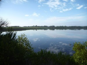
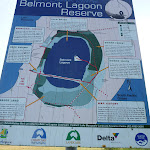
Belmont Lagoon is situated between the Pacific Ocean and Lake Macquarie in the community of Belmont. This reserve is a sanctuary for five distinct biotic areas – Swamp Forest, Swamp Heath, Reed Swamp, Sedge Land and Open Water. All these different areas interact and are important in allowing natural areas to be ecological sustainable. There is more information[1] on these biotic areas at the Belmont Lagoon car park (off Beach St, Belmont). Human history of the lagoon began with the Awabakal people who occupied the area for perhaps the last 6000 years. The ancient Awabakal legend of The Teardrop of the Moon tells how Belmont Lagoon was formed. During World War II, the Department of Defence dredged Cold Tea Creek to provide an anti-tank barrier and defence line. As part of these modifications, the lagoon was divided into two parts, and it now has a permanent connection to the saline waters of Lake Macquarie, thereby altering its salinity and circulation pattern. For more information, contact Lake Macquarie Visitor Information Centre on (02) 4921 0740.
More info.
More info.
Belmont Lagoon Car Park
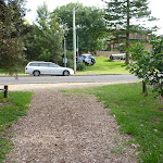
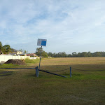
The Belmont Lagoon car park (access from corner Beach St and Ocean Park Rd, Belmont) is an open grassed car park[2], with an information sign[3] detailing existing and proposed walking tracks at the lagoon. There is a water tap[4] available about 100m north of the car park (adjacent to the cricket oval). Please respect the private houses[5] that abutt onto the car park.
More info.
More info.
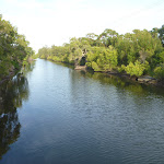
(0km) Belmont Lagoon (Beach St Car Park) → Int of Cold Tea Walkway & Ocean Park Trail
960 m
15 mins
4m
-2m
Moderate track
From the Belmont Lagoon car park[6] (off Ocean Park Road, Belmont), this walk passes around the locked metal gate[7] and crosses the cricket oval[8], passing the ‘Belmont Lagoon Reserve Map’ sign[9] and keeping the houses to your left. This walk continues for about 200m across the oval and then across a footbridge[10][11] over Cold Tea Creek[12], to come to a three-way intersection[13][14] with a track (on the Cold Tea Walkway[15][16]).
Turn right: From the intersection[17][18], this walk follows the trail, initially keeping the footbridge and creek on your right[19] and Belmont Lagoon on your left. This walk continues for about 700m, until coming to a four-way intersection[20] with a large trail, and a faint trail[21] directly ahead.
Turn right: From the intersection[17][18], this walk follows the trail, initially keeping the footbridge and creek on your right[19] and Belmont Lagoon on your left. This walk continues for about 700m, until coming to a four-way intersection[20] with a large trail, and a faint trail[21] directly ahead.
(0.96km) Int of Cold Tea Walkway & Ocean Park Trail → Belmont Lagoon Car Park
1.2 km
19 mins
2m
-3m
Moderate track
Turn right: From the intersection[22][23], this walk follows the trail south, while keeping the overhead power lines[24] on your right and the ocean on your left. This walk continues along the trail, gently undulating through regrowth bush[25] and wetlands[26] for about 500m, until passing through a large metal gate[27]and coming to a three-way intersection[28] with the sealed Ocean Park Road.
Veer right: From the intersection[29], this walk follows Ocean Park Road gently uphill, while initially keeping the large metal gate[30] and Ocean Park Trail on your right. This walk continues for about 500m to pass Green Street[31] on your left. Then this walk continues for about 120m, passing William Street and some houses[32] on your left, until coming to a three-way intersection with a trail and ‘Belmont Lagoon Reserve’ sign[33][34] on the right (as Ocean Park Road[35] turns left).
Veer right: From the intersection[36][37], this walk follows the trail, while keeping the ‘Belmont Lagoon Reserve’ sign[38][39] on the right and the houses on the left. This walk continues for about 150m, until coming to a car park[40] with a low metal locked gate[41], and a ‘Belmont Lagoon Reserve Map’ sign[42] on the right (with cricket oval[43] beyond).
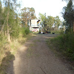
(0.96km) Int of Cold Tea Walkway & Ocean Park Trail → Belmont Lagoon Spit
650 m
10 mins
1m
-3m
Moderate track
Turn left: From the intersection[44], this walk follows the trail, keeping the overhead power lines[45] on your left and the ocean to your right. This walk continues for about 280m until coming to a three-way intersection[46] with a trail[47] on the left and large pile of concrete rubble directly ahead.
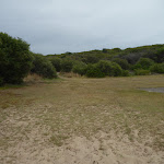
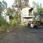
Continue straight: From the intersection[48], this walk follows the trail gently downhill[49], while keeping the large pile of concrete rubble[50] initially on your right. This walk continues, undulating gently[51] with the lagoon[52] on both sides for about 400m, until coming to the end of the spit[53] and two derelict buildings[54].
Continue straight: From the intersection[48], this walk follows the trail gently downhill[49], while keeping the large pile of concrete rubble[50] initially on your right. This walk continues, undulating gently[51] with the lagoon[52] on both sides for about 400m, until coming to the end of the spit[53] and two derelict buildings[54].
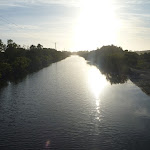
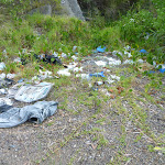
Belmont Lagoon Spit
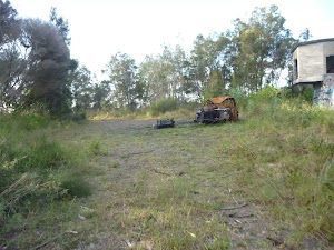
The Belmont Lagood spit is surrounded by water and bird life. This is a fabulous place to enjoy in the early morning or evening, when bird life is most active. Birds you are likely to see include the Black Swan, Royal Spoonbill, Superb Blue Wren, Variegated Wren, Blackfaced Cuckoo Shrike, Eastern Whip Bird, Welcome Swallow and the international migatory waders, such as the Bar-Tailed Godwit. At the end of the spit, there are two derelict buildings[55] and a burnt-out car[56]. The spit is a good place to see the main biotic areas, including reed swamp, swamp heath, swamp forest, sedge land and open water. More info.
Maps for the Belmont Lagoon Spit Walk walk
You can download the PDF for this walk to print a map.
These maps below cover the walk and the wider area around the walk, they are worth carrying for safety reasons.
| Swansea | 1:25 000 Map Series | 92314N SWANSEA | NSW-92314N |
| Lake Macquarie | 1:100 000 Map Series | 9231 LAKE MACQUARIE | 9231 |
Cross sectional view of the Belmont Lagoon Spit Walk bushwalking track
Analysis and summary of the altitude variation on the Belmont Lagoon Spit Walk
Overview of this walks grade – based on the AS 2156.1 – 2001
Under this standard, a walk is graded based on the most difficult section of the walk.
| Length | 3.2 km | ||
| Time | 1 Hr | ||
| . | |||
| Grade 3/6 Moderate track |
AS 2156.1 | Gradient | Gentle hills with occasional steps (2/6) |
| Quality of track | Clear and well formed track or trail (2/6) | ||
| Signs | Directional signs along the way (3/6) | ||
| Experience Required | No experience required (1/6) | ||
| Weather | Weather generally has little impact on safety (1/6) | ||
| Infrastructure | Generally useful facilities (such as fenced cliffs and seats) (1/6) |
Some more details of this walks Grading
Here is a bit more details explaining grading looking at sections of the walk
Gradient
Around 880m of this walk has gentle hills with occasional steps, whilst the remaining 730m is flat with no steps.
Quality of track
This whole walk, 1.6km follows a clear and well formed track or trail.
Signs
This whole walk, 1.6km has directional signs at most intersection.
Experience Required
This whole walk, 1.6km requires no previous bushwalking experience.
weather
This whole walk, 1.6km is not usually affected by severe weather events (that would unexpectedly impact safety and navigation).
Infrastructure
This whole walk, 1.6km is close to useful facilities (such as fenced cliffs and seats).
Similar walks
A list of walks that share part of the track with the Belmont Lagoon Spit Walk walk.
Other Nearby walks
A list of walks that start near the Belmont Lagoon Spit Walk walk.
7.7 km Circuit
3 hrs
Hard track
2.9 km One way
1 hr 15 mins
Hard track
2.4 km Circuit
1 Hr
Moderate track
3.4 km Circuit
2 hrs 45 mins
Moderate track
3 km Return
1 hr 15 mins
Moderate track
2.4 km Return
1 Hr
Moderate track
3.8 km Circuit
1 hr 30 mins
Hard track
666 m Circuit
30 mins
Moderate track
1.3 km Return
30 mins
Very easy
3.2 km Circuit
1 Hr
Hard track
3.2 km Return
1 Hr
Moderate track
1.2 km Circuit
30 mins
Hard track
Plan your trip to and from the walk here
The Belmont Lagoon Spit Walk walk starts and ends at the Belmont Lagoon (Beach St Car Park) (gps: -33.048223, 151.65833)
Your transport options to Belmont Lagoon (Beach St Car Park) are by;
![]() Bus. (get details)
Bus. (get details)
![]() Car. There is free parking available.
Car. There is free parking available.
(get details)
Short URL = http://wild.tl/blsw
Gallery images
There are other downloads I am still working on.
You will probably need to login to access these — still all free.
* KML (google earth file)
* GPX (GPS file)
Special Maps/ brochures
* A3 topo maps
* PDF with Lands Topo map base
* PDF with arial image (and map overlay)
I wanted to get the main site live first, this extra stuff will come in time.
Happy walking
Matt 🙂
Comments