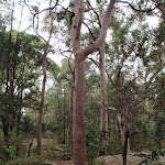
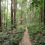
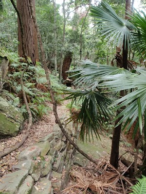
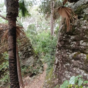
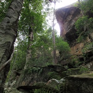
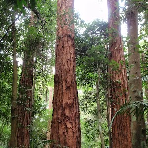
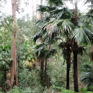
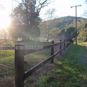
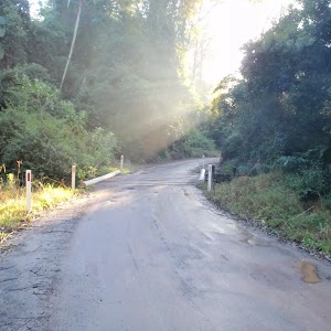
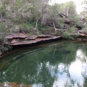
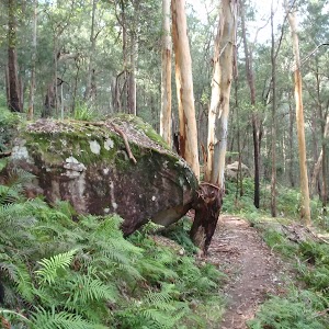
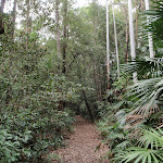
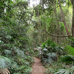
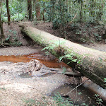
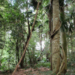
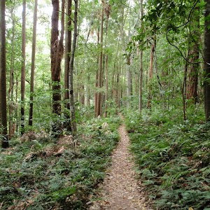
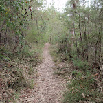
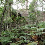
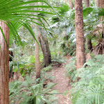
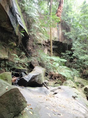
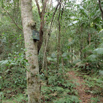
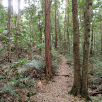
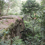
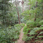
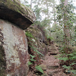
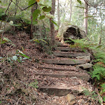
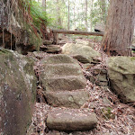
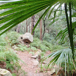
An excellent walk, spending much of its time in the shaded, rainforest-filled valleys of the Strickland State Forest. From the dry eucalypt forest around the Banksia picnic area, the walk soon descends into moist forest, filled with ferns and cabbage tree palms. You could make this a return walk by retracing your steps, or make it a circuit walk by returning to the Banksia picnic area via the road.
Stoney Creek Trail
And Walk
Stoney Creek Trail


1 Hr
2.2 km One way

58 m
Moderate track


Strickland State Forest
The Strickland State Forest, managed by State Forests of NSW, is located on the NSW Central Coast, close to the F3. The Strickland State Forest has a wide range of vegetation, including patches of rainforest along the sheltered creeks. The walking tracks take in some beautiful scenery, including a mixture of native forest and the remnants of an old arboretum. ‘Strickland is no longer actively harvested and is managed for education and recreation purposes’. The ‘Friends of Strickland’ undertake projects including the construction of walking tracks. Note: Access into Strickland is during the daytime only with the entrance gate being unlocked between 7am and 5pm (Apr – Oct) and between 7am and 7pm (Nov – Mar) [3] More info.
(0km) Banksia car park → Banksia picnic area

50 m
1 mins
0m
-2m
Moderate track
From the car park (near the end of Strickland Rd in the Strickland State Forest), this walk passes around the gate and goes across the picnic area to the track intersection at the opposite end. There is a track signpost (‘Strickland Falls Loop Trail’) a little to the left.
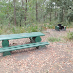
Banksia Picnic Area
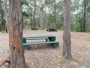
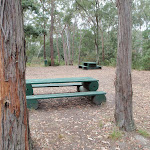
This picnic area is in the Strickland State Forest, on the NSW Central Coast. The facilities include picnic tables, pit toilets, BBQ fire places, garbage bins and tank water. A few bush walking tracks start from the picnic area.
(0.05km) Banksia picnic area → Int of Cabbage Tree and Stoney Creek trails
1.1 km
25 mins
31m
-106m
Moderate track
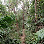
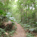
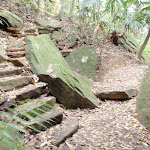
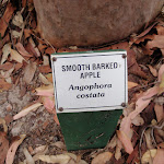
Veer left: From the intersection, the walk follows the ‘Cabbage Tree Walk Trail’ arrow along the bush track, leaving the ‘Gosford Lookout’ sign behind, to the right. The walk initially passes through relatively dry forest, with signs naming some of the trees, before descending through moist forest, filled with cabbage palms. After a while the track reaches the intersection signposted ‘Stoney Creek Trail’.
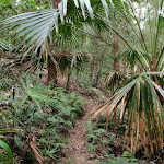
Cabbage-Tree Palm
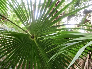
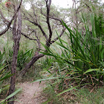
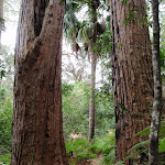
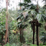
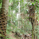
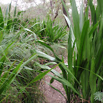
The Cabbage-Tree Palm (Livistona australis) is a tall, slender palm growing up to about 25 m in height and 0.35 m diameter. It is found in moist open forest, often in swampy sites and on margins of rainforests or near the sea. It is widely spread along the New South Wales coast and extends north into Queensland and southwards to eastern Victoria, growing further south than any other native Australian palm. More info.
(1.17km) Int of Cabbage Tree and Stoney Creek trails → Int of Stoney Creek and Bellbird trails
920 m
20 mins
23m
-73m
Moderate track
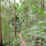
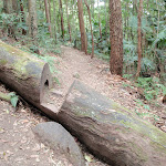
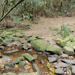
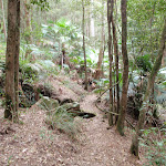
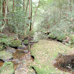
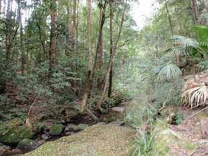
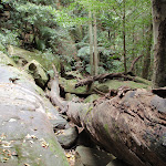
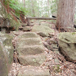
Veer left: From the intersection, the walk follows the ‘Stoney Creek Trail’ arrow along the bush track, going down the hill. The track descends gently through forest filled with ferns and cabbage palms, before passing a ‘Rainforests and Preservation’ information sign, and arriving at an intersection with a management trail, beside Stoney [6] Creek.
(2.09km) Int of Stoney Creek and Bellbird trails → Strickland Lower car park
80 m
2 mins
4m
0m
Moderate track
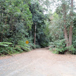
Veer left: From the intersection, the walk follows the management trail up the hill, away from the creek crossing. The walk passes an information board, with a map of the walking trails, and soon reaches the car park.
Maps for the Stoney Creek Trail walk
You can download the PDF for this walk to print a map.
These maps below cover the walk and the wider area around the walk, they are worth carrying for safety reasons.
| Gosford | 1:25 000 Map Series | 91312S GOSFORD | NSW-91312S |
| Wyong | 1:25 000 Map Series | 91312N WYONG | NSW-91312N |
| Gosford | 1:100 000 Map Series | 9131 GOSFORD | 9131 |
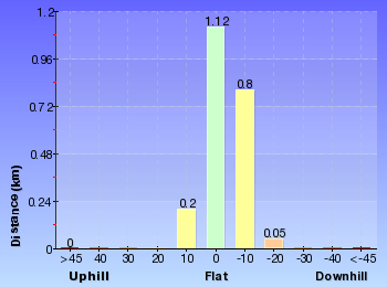
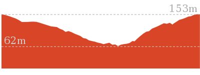
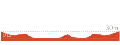
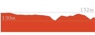
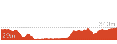
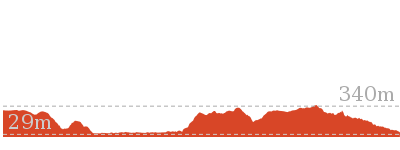
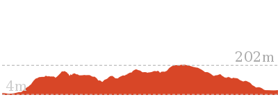
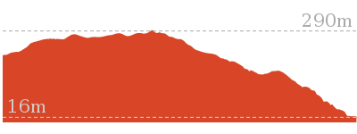
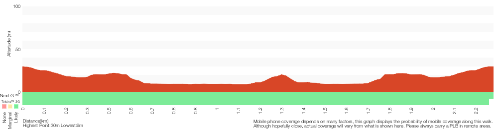
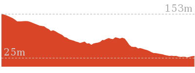
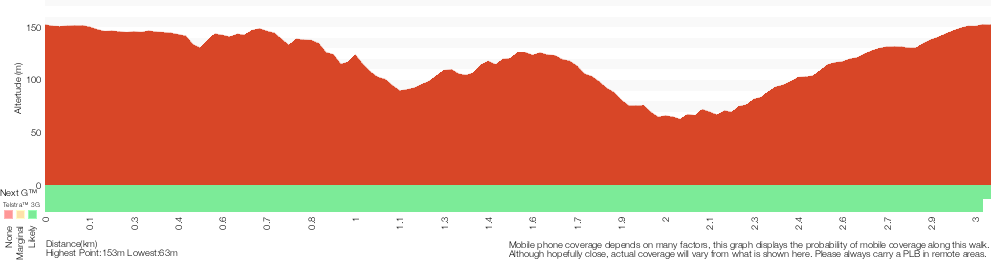
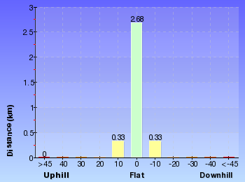
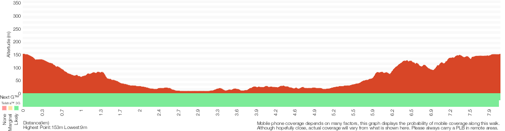
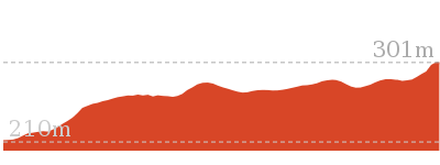
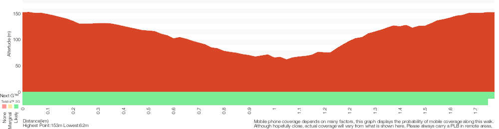
Cross sectional view of the Stoney Creek Trail bushwalking track
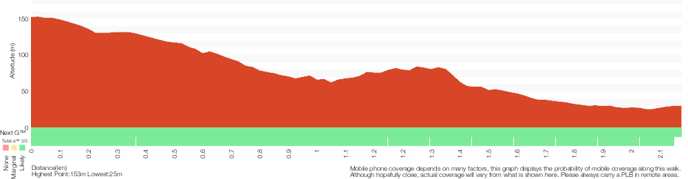
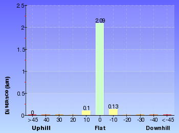
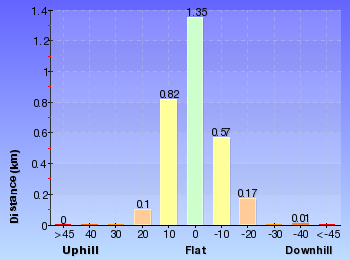
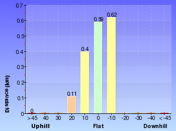
Analysis and summary of the altitude variation on the Stoney Creek Trail
Overview of this walks grade – based on the AS 2156.1 – 2001
Under this standard, a walk is graded based on the most difficult section of the walk.
| Length | 2.2 km | ||
| Time | 1 Hr | ||
| . | |||
| Grade 3/6 Moderate track |
AS 2156.1 | Gradient | Gentle hills with occasional steps (2/6) |
| Quality of track | Formed track, with some branches and other obstacles (3/6) | ||
| Signs | Directional signs along the way (3/6) | ||
| Experience Required | No experience required (1/6) | ||
| Weather | Weather generally has little impact on safety (1/6) | ||
| Infrastructure | Limited facilities, not all cliffs are fenced (3/6) |
Some more details of this walks Grading
Here is a bit more details explaining grading looking at sections of the walk
Gradient
Around 2.1km of this walk has gentle hills with occasional steps, whilst the remaining 50m is flat with no steps.
Quality of track
Around 1.1km of this walk follows a formed track, with some branches and other obstacles, whilst the remaining 1.1km follows a clear and well formed track or trail.
Signs
Around 2.1km of this walk has directional signs at most intersection, whilst the remaining 80m is clearly signposted.
Experience Required
This whole walk, 2.2km requires no previous bushwalking experience.
weather
This whole walk, 2.2km is not usually affected by severe weather events (that would unexpectedly impact safety and navigation).
Infrastructure
Around 2.1km of this walk has limited facilities (such as not all cliffs fenced), whilst the remaining 50m is close to useful facilities (such as fenced cliffs and seats).
Similar walks
A list of walks that share part of the track with the Stoney Creek Trail walk.
1.7 km Circuit
1 Hr
Moderate track
1.8 km Circuit
1 Hr
Moderate track

2.3 km Circuit
1 Hr
Moderate track
3 km Circuit
1 hr 30 mins
Moderate track

3.3 km Circuit
1 hr 15 mins
Moderate track
8.1 km Circuit
3 hrs 30 mins
Moderate track

Other Nearby walks
A list of walks that start near the Stoney Creek Trail walk.
1.7 km Return
45 mins
Moderate track

6 km One way
2 hrs 30 mins
Hard track
21.1 km One way
8 hrs
Hard track
47.4 km One way
3 Days
Hard track
26.7 km One way
2 Days
Hard track
426 m Return
20 mins
Moderate track

11.3 km One way
4 hrs 30 mins
Hard track
643 m Circuit
30 mins
Moderate track

900 m Return
30 mins
Hard track

8.3 km Return
3 hrs 15 mins
Moderate track

10.8 km Circuit
4 hrs 15 mins
Hard track

10.1 km Return
4 hrs 15 mins
Hard track
Plan your trip to and from the walk here
The Stoney Creek Trail walk starts at the Banksia car park (gps: -33.37331, 151.32253)
Your main transport option to Banksia car park is by;
![]() Car. There is free parking available.
Car. There is free parking available.
(get details)
The Stoney Creek Trail ends at the Strickland Lower car park (gps: -33.379942, 151.32508)
Your main transport option to Strickland Lower car park is by;
![]() Car. There is free parking available.
Car. There is free parking available.
(get details)


Short URL = http://wild.tl/sct
Gallery images
There are other downloads I am still working on.
You will probably need to login to access these — still all free.
* KML (google earth file)
* GPX (GPS file)
Special Maps/ brochures
* A3 topo maps
* PDF with Lands Topo map base
* PDF with arial image (and map overlay)
I wanted to get the main site live first, this extra stuff will come in time.
Happy walking
Matt 🙂
Arboretum Loop Trail
And Walk
Arboretum Loop Trail

1 Hr
2.3 km Circuit
45 m
Moderate track
A very nice walk through a mixture of native (regrowth) forest and one of Australia’s oldest arboretums. The arboretum has both native and exotic trees, with the plantings dating from 1887-1924. This walk takes you along some of the rainforest-clad creeks of Strickland State Forest, before crossing a small suspension bridge and looping through the arboretum with its stands of huge Hoop Pines, Bunya Pines and others.


Strickland State Forest
The Strickland State Forest, managed by State Forests of NSW, is located on the NSW Central Coast, close to the F3. The Strickland State Forest has a wide range of vegetation, including patches of rainforest along the sheltered creeks. The walking tracks take in some beautiful scenery, including a mixture of native forest and the remnants of an old arboretum. ‘Strickland is no longer actively harvested and is managed for education and recreation purposes’. The ‘Friends of Strickland’ undertake projects including the construction of walking tracks. Note: Access into Strickland is during the daytime only with the entrance gate being unlocked between 7am and 5pm (Apr – Oct) and between 7am and 7pm (Nov – Mar) [3] More info.
(0km) Strickland Lower car park → Int of Stoney Creek and Bellbird trails
80 m
2 mins
0m
-4m
Moderate track
From the car park, the walk follows the ‘Walking Trails’ arrow along the management trail. The walk passes an information board, with a map of the walking trails, and continues a short distance to an intersection just before the creek crossing.
(0.08km) Int of Stoney Creek and Bellbird trails → Arboretum junction
450 m
8 mins
6m
-10m
Moderate track
Veer left: From the intersection, the walk crosses the creek and follows the ‘Arboretum Loop Trail’ arrow along the old management trail. The trail meanders through shaded forest, filled with cabbage palms, for some time before reaching a signposted intersection with a bush track.
(0.53km) Arboretum junction → Suspension bridge intersection
130 m
2 mins
0m
-11m
Moderate track
Continue straight: From the intersection, the walk follows the ‘Arboretum Trail’ arrow down the timber steps and along the overgrown management trail. After a short distance, the walk crosses a suspension bridge over Narara Creek, bends to the left and almost immediately reaches an unmarked intersection with a narrow bush track, to the right.
(0.66km) Suspension bridge intersection → North int of Arboretum Loop and Bellbird trail
100 m
2 mins
0m
0m
Moderate track
Continue straight: From the intersection, the walk follows the old management trail away from the suspension bridge. The walk soon arrives at the intersection signposted ‘Arboretum Loop Trail’.
Strickland State Forest Arboretum
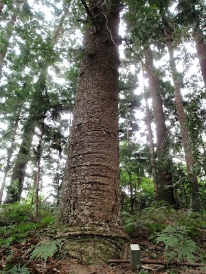
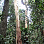
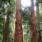
This arboretum is apparently one of the oldest in Australia, with plantings dating from 1887-1924[5]. Numerous signs have been placed along the walking tracks to identify some of the species of trees. There are very tall, and impressive, examples of Hoop Pine, Bunya Pine, Tallow Wood and Red Cedar. More info.
(0.76km) North int of Arboretum Loop and Bellbird trail → Bunya pine grove
430 m
7 mins
3m
-2m
Moderate track
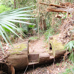
Veer left: From the intersection, this walk follows the ‘Arboretum Loop Trail’ arrow along the bush track, away from the old management trail. The walk passes through moist forest, filled with cabbage palms, with the creek visible to the left. The walk crosses over a number of fallen tree trunks with steps cut into them. There are small signs in places identifying some of the trees. After a while the walk passes a track marker arrow, where a large fallen tree trunk spans the creek, to the left. The walk then passes a ‘Forest Arboretum’ information board and continues, passing a metal box on a post (marked ‘Water Research’), and following several track arrows to reach an intersection with a management trail (with a gate visible to the left). There is a grove of tall ‘Bunya Pine’ trees beside this intersection.
(1.19km) Bunya pine grove → Strickland Lower car park
1.1 km
22 mins
36m
-19m
Moderate track
Veer right: From the intersection, the walk follows the old management trail away from the nearby gate, going gently up the hill. After a short distance the walk arrives at an intersection with a bush track, signposted ‘Bellbird Trail’.
Continue straight: From the intersection, the walk follows the ‘Arboretum Trail’ arrow along the old management trail, going gently down the hill. After a short distance, the walk arrives at the intersection, signposted ‘Arboretum Loop Trail’.
Veer left: From the intersection, the walk follows the old management trail, leaving the signposted ‘Arboretum Loop Trail’ behind on the right. After a short distance, the walk reaches an intersection with a narrow bush track, to the left, just before the suspension bridge.
Continue straight: From the intersection, the walk crosses the suspension bridge over Narara Creek and follows the overgrown management trail for a short distance to a signposted intersection.
Continue straight: From the intersection, the walk follows the ‘Return To Carpark’ arrow along the old management trail, going up the hill. The trail meanders through shaded forest, filled with cabbage palms, for some time before crossing Stoney Creek to an intersection signposted ‘Stoney Creek Walk Trail’.
Veer right: From the intersection, the walk follows the management trail up the hill, away from the creek crossing. The walk passes an information board, with a map of the walking trails, and soon reaches the car park.
Maps for the Arboretum Loop Trail walk
You can download the PDF for this walk to print a map.
These maps below cover the walk and the wider area around the walk, they are worth carrying for safety reasons.
| Gosford | 1:25 000 Map Series | 91312S GOSFORD | NSW-91312S |
| Wyong | 1:25 000 Map Series | 91312N WYONG | NSW-91312N |
| Gosford | 1:100 000 Map Series | 9131 GOSFORD | 9131 |
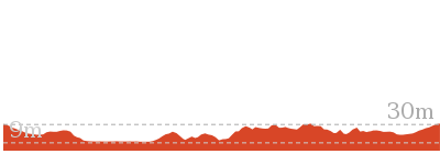
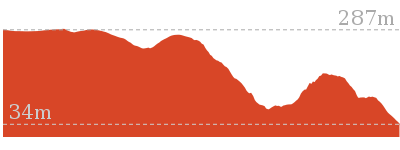
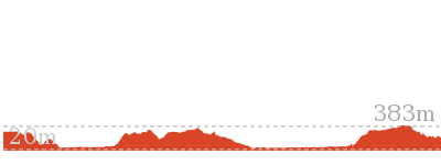
Cross sectional view of the Arboretum Loop Trail bushwalking track
Analysis and summary of the altitude variation on the Arboretum Loop Trail
Overview of this walks grade – based on the AS 2156.1 – 2001
Under this standard, a walk is graded based on the most difficult section of the walk.
| Length | 2.3 km | ||
| Time | 1 Hr | ||
| . | |||
| Grade 3/6 Moderate track |
AS 2156.1 | Gradient | Gentle hills with occasional steps (2/6) |
| Quality of track | Formed track, with some branches and other obstacles (3/6) | ||
| Signs | Directional signs along the way (3/6) | ||
| Experience Required | Some bushwalking experience recommended (3/6) | ||
| Weather | Storms may impact on navigation and safety (3/6) | ||
| Infrastructure | Limited facilities, not all cliffs are fenced (3/6) |
Some more details of this walks Grading
Here is a bit more details explaining grading looking at sections of the walk
Gradient
Around 1.7km of this walk has gentle hills with occasional steps, whilst the remaining 580m is flat with no steps.
Quality of track
Around 1.6km of this walk follows a formed track, with some branches and other obstacles, whilst the remaining 740m follows a clear and well formed track or trail.
Signs
Around 2.2km of this walk has directional signs at most intersection, whilst the remaining 160m is clearly signposted.
Experience Required
Around 1.4km of this walk requires no previous bushwalking experience, whilst the remaining 900m requires some bushwalking experience.
weather
Around 1.4km of this walk is not usually affected by severe weather events (that would unexpectedly impact safety and navigation), whilst the remaining 900m is affected by storms that may impact your navigation and safety.
Infrastructure
Around 2.1km of this walk has limited facilities (such as not all cliffs fenced), whilst the remaining 260m is close to useful facilities (such as fenced cliffs and seats).
Similar walks
A list of walks that share part of the track with the Arboretum Loop Trail walk.
2.2 km One way
1 Hr
Moderate track
3.3 km Circuit
1 hr 15 mins
Moderate track
8.1 km Circuit
3 hrs 30 mins
Moderate track
Other Nearby walks
A list of walks that start near the Arboretum Loop Trail walk.
1.7 km Circuit
1 Hr
Moderate track
1.8 km Circuit
1 Hr
Moderate track
1.7 km Return
45 mins
Moderate track
3 km Circuit
1 hr 30 mins
Moderate track
6 km One way
2 hrs 30 mins
Hard track
21.1 km One way
8 hrs
Hard track
47.4 km One way
3 Days
Hard track
26.7 km One way
2 Days
Hard track
426 m Return
20 mins
Moderate track
11.3 km One way
4 hrs 30 mins
Hard track
643 m Circuit
30 mins
Moderate track
900 m Return
30 mins
Hard track
Plan your trip to and from the walk here
The Arboretum Loop Trail walk starts and ends at the Strickland Lower car park (gps: -33.379942, 151.32508)
Your main transport option to Strickland Lower car park is by;
![]() Car. There is free parking available.
Car. There is free parking available.
(get details)
Short URL = http://wild.tl/alt
Gallery images
There are other downloads I am still working on.
You will probably need to login to access these — still all free.
* KML (google earth file)
* GPX (GPS file)
Special Maps/ brochures
* A3 topo maps
* PDF with Lands Topo map base
* PDF with arial image (and map overlay)
I wanted to get the main site live first, this extra stuff will come in time.
Happy walking
Matt 🙂
Strickland Falls and Cabbage Tree loop

1 hr 30 mins
3 km Circuit
221 m
Moderate track
This excellent loop walk combines the Strickland Falls and Cabbage Tree loop walks. The walk starts in the dry eucalypt forest around the Banksia Picnic Area and soon descends into lush green rainforest remnants, filled with ferns and cabbage tree palms. The walk includes some great scenery along the base of the cliff line and around the falls, although the falls themselves are often just a trickle. A great way to see some of the beautiful scenery of the Strickland State Forest.


Strickland State Forest
The Strickland State Forest, managed by State Forests of NSW, is located on the NSW Central Coast, close to the F3. The Strickland State Forest has a wide range of vegetation, including patches of rainforest along the sheltered creeks. The walking tracks take in some beautiful scenery, including a mixture of native forest and the remnants of an old arboretum. ‘Strickland is no longer actively harvested and is managed for education and recreation purposes’. The ‘Friends of Strickland’ undertake projects including the construction of walking tracks. Note: Access into Strickland is during the daytime only with the entrance gate being unlocked between 7am and 5pm (Apr – Oct) and between 7am and 7pm (Nov – Mar) [3] More info.
(0km) Banksia car park → Int of Strickland Falls trail and Strickland Rd
90 m
2 mins
1m
-2m
Moderate track
From the car park, the walk follows the road away from the picnic area and soon reaches an intersection with a bush track, signposted ‘Strickland Falls’, ’40 Minute Easy Walk’.
(0.09km) Int of Strickland Falls trail and Strickland Rd → Strickland Falls
740 m
18 mins
35m
-49m
Moderate track
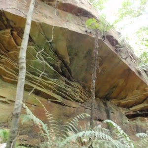
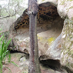
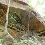
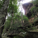
Turn left: From the intersection, this walk follows a bush track away from the road, passing the ‘Strickland Falls’ signpost, to the left. The track initially passes through quite dry forest. After a while, the walk passes some nice rock overhangs and descends through increasingly moist forest and boulders, to reach the signposted ‘Strickland Falls’.
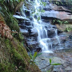
Strickland Falls
Strickland Falls are a short walk from the Banksia Picnic Area in the Strickland State Forest, Central Coast, NSW. The falls are often just a trickle, but will be more impressive after good rain. The scenery around the falls is still beautiful with moist rainforest scenery to enjoy.
(0.83km) Strickland Falls → Int of Cabbage Tree and Stoney Creek trails
1 km
33 mins
77m
-139m
Moderate track
Turn sharp left: From the waterfall, the walk follows the arrow (carved into the rock) along the bush track, going gently down the hill (not up the steps). The track meanders through some beautiful scenery with ferns, cabbage palms and boulders. After a while, the walk crosses a gully below some imposing cliffs and continues further before reaching the intersection signposted ‘Cabbage Tree Trail’.
Veer right: From the intersection, the walk follows the ‘Cabbage Tree Trail’ arrow along the bush track, keeping the valley to the right. This section of the walk passes some interesting boulders and continues through forest filled with cabbage palms and ferns, before reaching an intersection, signposted ‘Stoney Creek Trail’.
Veer right: From the intersection, the walk follows the ‘Cabbage Tree Trail’ arrow along the bush track, keeping the valley to the right. This section of the walk passes some interesting boulders and continues through forest filled with cabbage palms and ferns, before reaching an intersection, signposted ‘Stoney Creek Trail’.
Cabbage-Tree Palm
The Cabbage-Tree Palm (Livistona australis) is a tall, slender palm growing up to about 25 m in height and 0.35 m diameter. It is found in moist open forest, often in swampy sites and on margins of rainforests or near the sea. It is widely spread along the New South Wales coast and extends north into Queensland and southwards to eastern Victoria, growing further south than any other native Australian palm. More info.
(1.87km) Int of Cabbage Tree and Stoney Creek trails → Banksia picnic area
1.1 km
25 mins
106m
-31m
Moderate track
Veer left: From the intersection, this walk follows the level bush track, away from the signpost, keeping the valley to the right. As the track climbs, the vegetation becomes mush drier. The walk passes through some nice boulders and eventually passes a ‘Cabbage Tree Walk Trail’ sign, to the left, just before reaching the intersection at the end of the Banksia picnic area.
Banksia Picnic Area
This picnic area is in the Strickland State Forest, on the NSW Central Coast. The facilities include picnic tables, pit toilets, BBQ fire places, garbage bins and tank water. A few bush walking tracks start from the picnic area.
(2.99km) Banksia picnic area → Banksia car park
50 m
1 mins
2m
0m
Moderate track
Veer right: From the intersection, this walk goes across the picnic area, and passes around the gate, into the car park (near the end of Strickland Rd in the Strickland State Forest).
Maps for the Strickland Falls and Cabbage Tree loop walk
You can download the PDF for this walk to print a map.
These maps below cover the walk and the wider area around the walk, they are worth carrying for safety reasons.
| Gosford | 1:25 000 Map Series | 91312S GOSFORD | NSW-91312S |
| Wyong | 1:25 000 Map Series | 91312N WYONG | NSW-91312N |
| Gosford | 1:100 000 Map Series | 9131 GOSFORD | 9131 |
Cross sectional view of the Strickland Falls and Cabbage Tree loop bushwalking track
Analysis and summary of the altitude variation on the Strickland Falls and Cabbage Tree loop
Overview of this walks grade – based on the AS 2156.1 – 2001
Under this standard, a walk is graded based on the most difficult section of the walk.
| Length | 3 km | ||
| Time | 1 hr 30 mins | ||
| . | |||
| Grade 3/6 Moderate track |
AS 2156.1 | Gradient | Short steep hills (3/6) |
| Quality of track | Formed track, with some branches and other obstacles (3/6) | ||
| Signs | Directional signs along the way (3/6) | ||
| Experience Required | Some bushwalking experience recommended (3/6) | ||
| Weather | Storms may impact on navigation and safety (3/6) | ||
| Infrastructure | Limited facilities, not all cliffs are fenced (3/6) |
Some more details of this walks Grading
Here is a bit more details explaining grading looking at sections of the walk
Gradient
2.6km of this walk has gentle hills with occasional steps and another 340m has short steep hills. The remaining (140m) is flat with no steps.
Quality of track
Around 2.9km of this walk follows a formed track, with some branches and other obstacles, whilst the remaining 140m follows a clear and well formed track or trail.
Signs
This whole walk, 3km has directional signs at most intersection.
Experience Required
Around 1.8km of this walk requires some bushwalking experience, whilst the remaining 1.3km requires no previous bushwalking experience.
weather
Around 2.3km of this walk is not usually affected by severe weather events (that would unexpectedly impact safety and navigation), whilst the remaining 740m is affected by storms that may impact your navigation and safety.
Infrastructure
Around 2.9km of this walk has limited facilities (such as not all cliffs fenced), whilst the remaining 140m is close to useful facilities (such as fenced cliffs and seats).
Similar walks
A list of walks that share part of the track with the Strickland Falls and Cabbage Tree loop walk.
1.7 km Return
45 mins
Moderate track
1.7 km Circuit
1 Hr
Moderate track
1.8 km Circuit
1 Hr
Moderate track
2.2 km One way
1 Hr
Moderate track
8.1 km Circuit
3 hrs 30 mins
Moderate track
Other Nearby walks
A list of walks that start near the Strickland Falls and Cabbage Tree loop walk.
2.3 km Circuit
1 Hr
Moderate track
3.3 km Circuit
1 hr 15 mins
Moderate track
6 km One way
2 hrs 30 mins
Hard track
21.1 km One way
8 hrs
Hard track
47.4 km One way
3 Days
Hard track
26.7 km One way
2 Days
Hard track
426 m Return
20 mins
Moderate track
11.3 km One way
4 hrs 30 mins
Hard track
643 m Circuit
30 mins
Moderate track
900 m Return
30 mins
Hard track
8.3 km Return
3 hrs 15 mins
Moderate track
10.8 km Circuit
4 hrs 15 mins
Hard track
Plan your trip to and from the walk here
The Strickland Falls and Cabbage Tree loop walk starts and ends at the Banksia car park (gps: -33.373305, 151.32252)
Your main transport option to Banksia car park is by;
![]() Car. There is free parking available.
Car. There is free parking available.
(get details)
Short URL = http://wild.tl/sfactl
Gallery images
There are other downloads I am still working on.
You will probably need to login to access these — still all free.
* KML (google earth file)
* GPX (GPS file)
Special Maps/ brochures
* A3 topo maps
* PDF with Lands Topo map base
* PDF with arial image (and map overlay)
I wanted to get the main site live first, this extra stuff will come in time.
Happy walking
Matt 🙂
Bellbird Trail
And Walk
Bellbird Trail

1 hr 15 mins
3.3 km Circuit
89 m
Moderate track
A great walk, passing through plenty of the Strickland rainforest, and among the tall tress of the arboretum. You are likely to have the sound of Bellbirds adding to the atmosphere along parts of this walk. There are a number of picturesque creek crossings along the way, one with a small suspension bridge. The Banksia picnic area is a very short deviation off the road if you want to make use of the facilities.


Strickland State Forest
The Strickland State Forest, managed by State Forests of NSW, is located on the NSW Central Coast, close to the F3. The Strickland State Forest has a wide range of vegetation, including patches of rainforest along the sheltered creeks. The walking tracks take in some beautiful scenery, including a mixture of native forest and the remnants of an old arboretum. ‘Strickland is no longer actively harvested and is managed for education and recreation purposes’. The ‘Friends of Strickland’ undertake projects including the construction of walking tracks. Note: Access into Strickland is during the daytime only with the entrance gate being unlocked between 7am and 5pm (Apr – Oct) and between 7am and 7pm (Nov – Mar) [3] More info.
Banksia Picnic Area
This picnic area is in the Strickland State Forest, on the NSW Central Coast. The facilities include picnic tables, pit toilets, BBQ fire places, garbage bins and tank water. A few bush walking tracks start from the picnic area.
(0km) Strickland Lower car park → Int of Stoney Creek and Bellbird trails
80 m
2 mins
0m
-4m
Moderate track
From the car park, the walk follows the ‘Walking Trails’ arrow along the management trail. The walk passes an information board, with a map of the walking trails, and continues a short distance to an intersection just before the creek crossing.
(0.08km) Int of Stoney Creek and Bellbird trails → Arboretum junction
450 m
8 mins
6m
-10m
Moderate track
Veer left: From the intersection, the walk crosses the creek and follows the ‘Arboretum Loop Trail’ arrow along the old management trail. The trail meanders through shaded forest, filled with cabbage palms, for some time before reaching a signposted intersection with a bush track.
(0.53km) Arboretum junction → Suspension bridge intersection
130 m
2 mins
0m
-11m
Moderate track
Continue straight: From the intersection, the walk follows the ‘Arboretum Trail’ arrow down the timber steps and along the overgrown management trail. After a short distance, the walk crosses a suspension bridge over Narara Creek, bends to the left and almost immediately reaches an unmarked intersection with a narrow bush track, to the right.
(0.66km) Suspension bridge intersection → North int of Arboretum Loop and Bellbird trail
100 m
2 mins
0m
0m
Moderate track
Continue straight: From the intersection, the walk follows the old management trail away from the suspension bridge. The walk soon arrives at the intersection signposted ‘Arboretum Loop Trail’.
Strickland State Forest Arboretum
This arboretum is apparently one of the oldest in Australia, with plantings dating from 1887-1924[5]. Numerous signs have been placed along the walking tracks to identify some of the species of trees. There are very tall, and impressive, examples of Hoop Pine, Bunya Pine, Tallow Wood and Red Cedar. More info.
(0.76km) North int of Arboretum Loop and Bellbird trail → Bunya pine grove
430 m
7 mins
3m
-2m
Moderate track
Veer left: From the intersection, this walk follows the ‘Arboretum Loop Trail’ arrow along the bush track, away from the old management trail. The walk passes through moist forest, filled with cabbage palms, with the creek visible to the left. The walk crosses over a number of fallen tree trunks with steps cut into them. There are small signs in places identifying some of the trees. After a while the walk passes a track marker arrow, where a large fallen tree trunk spans the creek, to the left. The walk then passes a ‘Forest Arboretum’ information board and continues, passing a metal box on a post (marked ‘Water Research’), and following several track arrows to reach an intersection with a management trail (with a gate visible to the left). There is a grove of tall ‘Bunya Pine’ trees beside this intersection.
(1.19km) Bunya pine grove → South int of Arboretum Loop and Bellbird trail
220 m
5 mins
9m
-9m
Moderate track
Veer right: From the intersection, the walk follows the old management trail away from the nearby gate, going gently up the hill. After a short distance the walk arrives at an intersection with a bush track, signposted ‘Bellbird Trail’.
(1.41km) South int of Arboretum Loop and Bellbird trail → Bellbird Narara crossing
780 m
16 mins
35m
-21m
Moderate track
Turn left: From the intersection, the walk follows the ‘Bellbird Trail’ arrow along the bush track, going up the hill. There are some track markers on short brown posts in this area, although they are often obscured in the undergrowth. The narrow, and sometimes faint, bush track goes through vine filled forest for a short distance to a ‘T’ intersection marked with a number of arrows.
Turn left: From the intersection, the walk follows the bush track, in the opposite direction to the arrow on the tree, following the short brown arrow post. The walk follows the narrow bush track for some time through beautiful forest, filled with cabbage palms, ferns and vines. Narara Creek is often visible just to the right. After a while, the walk arrives at some concreted steps just before crossing Narara Creek.
Turn left: From the intersection, the walk follows the bush track, in the opposite direction to the arrow on the tree, following the short brown arrow post. The walk follows the narrow bush track for some time through beautiful forest, filled with cabbage palms, ferns and vines. Narara Creek is often visible just to the right. After a while, the walk arrives at some concreted steps just before crossing Narara Creek.
Bellbirds
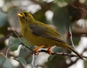
The Bellbird (more properly known as the Bell Miner) is a member of the Honeyeater family. These birds live and breed in large colonies, aggressively defending their territory. More often heard than seen, their call is described as a “Sweet, musical, bell-like ‘tink'”. They are ‘mostly olive-green, with a short, down-curved, bright yellow bill, a red-orange bare eye patch and orange-yellow feet and legs’. More info.
Bellbird Trail Narara crossing
This picturesque crossing of Narara Creek is on the ‘Bellbird Trail’ in the Strickland State Forest. It is a great spot to break for a rest, or lunch, on your walk. There are no facilities, however, there are some steps and rocks to sit on while you soak up the scenery.
(2.18km) Bellbird Narara crossing → Strickland Lower car park
1.2 km
23 mins
36m
-32m
Moderate track
Continue straight: From the concreted steps, the walk crosses Narara Creek and follows the bush track, which immediately bends to the right, following the creek downstream. The walk passes signs naming some of the trees and meanders through the beautiful forest for some time before reaching an intersection signposted ‘Return To Carpark’.
Turn left: From the intersection, the walk follows the ‘Return To Carpark’ arrow along the old management trail, going up the hill. The trail meanders through shaded forest, filled with cabbage palms, for some time before crossing Stoney Creek to an intersection signposted ‘Stoney Creek Walk Trail’.
Veer right: From the intersection, the walk follows the management trail up the hill, away from the creek crossing. The walk passes an information board, with a map of the walking trails, and soon reaches the car park.
Maps for the Bellbird Trail walk
You can download the PDF for this walk to print a map.
These maps below cover the walk and the wider area around the walk, they are worth carrying for safety reasons.
| Gosford | 1:25 000 Map Series | 91312S GOSFORD | NSW-91312S |
| Wyong | 1:25 000 Map Series | 91312N WYONG | NSW-91312N |
| Gosford | 1:100 000 Map Series | 9131 GOSFORD | 9131 |
Cross sectional view of the Bellbird Trail bushwalking track

Analysis and summary of the altitude variation on the Bellbird Trail
Overview of this walks grade – based on the AS 2156.1 – 2001
Under this standard, a walk is graded based on the most difficult section of the walk.
| Length | 3.3 km | ||
| Time | 1 hr 15 mins | ||
| . | |||
| Grade 3/6 Moderate track |
AS 2156.1 | Gradient | Gentle hills with occasional steps (2/6) |
| Quality of track | Formed track, with some branches and other obstacles (3/6) | ||
| Signs | Directional signs along the way (3/6) | ||
| Experience Required | Some bushwalking experience recommended (3/6) | ||
| Weather | Storms may impact on navigation and safety (3/6) | ||
| Infrastructure | Limited facilities, not all cliffs are fenced (3/6) |
Some more details of this walks Grading
Here is a bit more details explaining grading looking at sections of the walk
Gradient
Around 3km of this walk has gentle hills with occasional steps, whilst the remaining 320m is flat with no steps.
Quality of track
Around 2.9km of this walk follows a formed track, with some branches and other obstacles, whilst the remaining 490m follows a clear and well formed track or trail.
Signs
Around 3.2km of this walk has directional signs at most intersection, whilst the remaining 160m is clearly signposted.
Experience Required
Around 2km of this walk requires some bushwalking experience, whilst the remaining 1.3km requires no previous bushwalking experience.
weather
Around 1.8km of this walk is not usually affected by severe weather events (that would unexpectedly impact safety and navigation), whilst the remaining 1.5km is affected by storms that may impact your navigation and safety.
Infrastructure
Around 3.2km of this walk has limited facilities (such as not all cliffs fenced), whilst the remaining 130m is close to useful facilities (such as fenced cliffs and seats).
Similar walks
A list of walks that share part of the track with the Bellbird Trail walk.
2.2 km One way
1 Hr
Moderate track
2.3 km Circuit
1 Hr
Moderate track
8.1 km Circuit
3 hrs 30 mins
Moderate track
Other Nearby walks
A list of walks that start near the Bellbird Trail walk.
1.7 km Circuit
1 Hr
Moderate track
1.8 km Circuit
1 Hr
Moderate track
1.7 km Return
45 mins
Moderate track
3 km Circuit
1 hr 30 mins
Moderate track
6 km One way
2 hrs 30 mins
Hard track
21.1 km One way
8 hrs
Hard track
47.4 km One way
3 Days
Hard track
26.7 km One way
2 Days
Hard track
426 m Return
20 mins
Moderate track
11.3 km One way
4 hrs 30 mins
Hard track
643 m Circuit
30 mins
Moderate track
900 m Return
30 mins
Hard track
Plan your trip to and from the walk here
The Bellbird Trail walk starts and ends at the Strickland Lower car park (gps: -33.379942, 151.32508)
Your main transport option to Strickland Lower car park is by;
![]() Car. There is free parking available.
Car. There is free parking available.
(get details)
Short URL = http://wild.tl/28
Gallery images
There are other downloads I am still working on.
You will probably need to login to access these — still all free.
* KML (google earth file)
* GPX (GPS file)
Special Maps/ brochures
* A3 topo maps
* PDF with Lands Topo map base
* PDF with arial image (and map overlay)
I wanted to get the main site live first, this extra stuff will come in time.
Happy walking
Matt 🙂
Strickland Tour
And Walk
Strickland Tour

3 hrs 30 mins
8.1 km Circuit
402 m
Moderate track
A grand tour of the Strickland State Forest. This great walk covers most of the established walking tracks in Strickland and enjoys much of the excellent scenery available in the area. Plenty of time is spent in the lush green, rainforest-filled valleys, and there is some really nice boulder and cliff scenery along the way. A loop through the old arboretum adds further interest to the walk.


Strickland State Forest
The Strickland State Forest, managed by State Forests of NSW, is located on the NSW Central Coast, close to the F3. The Strickland State Forest has a wide range of vegetation, including patches of rainforest along the sheltered creeks. The walking tracks take in some beautiful scenery, including a mixture of native forest and the remnants of an old arboretum. ‘Strickland is no longer actively harvested and is managed for education and recreation purposes’. The ‘Friends of Strickland’ undertake projects including the construction of walking tracks. Note: Access into Strickland is during the daytime only with the entrance gate being unlocked between 7am and 5pm (Apr – Oct) and between 7am and 7pm (Nov – Mar) [3] More info.
(0km) Banksia car park → Banksia picnic area
50 m
1 mins
0m
-2m
Moderate track
From the car park (near the end of Strickland Rd in the Strickland State Forest), this walk passes around the gate and goes across the picnic area to the track intersection at the opposite end. There is a track signpost (‘Strickland Falls Loop Trail’) a little to the left.
Banksia Picnic Area
This picnic area is in the Strickland State Forest, on the NSW Central Coast. The facilities include picnic tables, pit toilets, BBQ fire places, garbage bins and tank water. A few bush walking tracks start from the picnic area.
(0.05km) Banksia picnic area → Int of Cabbage Tree and Stoney Creek trails
1.1 km
25 mins
31m
-106m
Moderate track
Veer left: From the intersection, the walk follows the ‘Cabbage Tree Walk Trail’ arrow along the bush track, leaving the ‘Gosford Lookout’ sign behind, to the right. The walk initially passes through relatively dry forest, with signs naming some of the trees, before descending through moist forest, filled with cabbage palms. After a while the track reaches the intersection signposted ‘Stoney Creek Trail’.
Cabbage-Tree Palm
The Cabbage-Tree Palm (Livistona australis) is a tall, slender palm growing up to about 25 m in height and 0.35 m diameter. It is found in moist open forest, often in swampy sites and on margins of rainforests or near the sea. It is widely spread along the New South Wales coast and extends north into Queensland and southwards to eastern Victoria, growing further south than any other native Australian palm. More info.
(1.17km) Int of Cabbage Tree and Stoney Creek trails → Int of Stoney Creek and Bellbird trails
920 m
20 mins
23m
-73m
Moderate track
Veer left: From the intersection, the walk follows the ‘Stoney Creek Trail’ arrow along the bush track, going down the hill. The track descends gently through forest filled with ferns and cabbage palms, before passing a ‘Rainforests and Preservation’ information sign, and arriving at an intersection with a management trail, beside Stoney [6] Creek.
(2.09km) Int of Stoney Creek and Bellbird trails → Arboretum junction
450 m
8 mins
6m
-10m
Moderate track
Turn right: From the intersection, the walk crosses the creek and follows the ‘Arboretum Loop Trail’ arrow along the old management trail. The trail meanders through shaded forest, filled with cabbage palms, for some time before reaching a signposted intersection with a bush track.
(2.54km) Arboretum junction → North int of Arboretum Loop and Bellbird trail
230 m
4 mins
0m
-11m
Moderate track
Continue straight: From the intersection, the walk follows the ‘Arboretum Trail’ arrow down the timber steps and along the overgrown management trail. After a short distance, the walk crosses a suspension bridge over Narara Creek, bends to the left and almost immediately reaches an unmarked intersection with a narrow bush track, to the right.
Continue straight: From the intersection, the walk follows the old management trail away from the suspension bridge. The walk soon arrives at the intersection signposted ‘Arboretum Loop Trail’.
Continue straight: From the intersection, the walk follows the old management trail away from the suspension bridge. The walk soon arrives at the intersection signposted ‘Arboretum Loop Trail’.
Strickland State Forest Arboretum
This arboretum is apparently one of the oldest in Australia, with plantings dating from 1887-1924[9]. Numerous signs have been placed along the walking tracks to identify some of the species of trees. There are very tall, and impressive, examples of Hoop Pine, Bunya Pine, Tallow Wood and Red Cedar. More info.
(2.77km) North int of Arboretum Loop and Bellbird trail → Bunya pine grove
430 m
7 mins
3m
-2m
Moderate track
Veer left: From the intersection, this walk follows the ‘Arboretum Loop Trail’ arrow along the bush track, away from the old management trail. The walk passes through moist forest, filled with cabbage palms, with the creek visible to the left. The walk crosses over a number of fallen tree trunks with steps cut into them. There are small signs in places identifying some of the trees. After a while the walk passes a track marker arrow, where a large fallen tree trunk spans the creek, to the left. The walk then passes a ‘Forest Arboretum’ information board and continues, passing a metal box on a post (marked ‘Water Research’), and following several track arrows to reach an intersection with a management trail (with a gate visible to the left). There is a grove of tall ‘Bunya Pine’ trees beside this intersection.
(3.2km) Bunya pine grove → Bellbird Narara crossing
1 km
21 mins
44m
-30m
Moderate track
Veer right: From the intersection, the walk follows the old management trail away from the nearby gate, going gently up the hill. After a short distance the walk arrives at an intersection with a bush track, signposted ‘Bellbird Trail’.
Turn left: From the intersection, the walk follows the ‘Bellbird Trail’ arrow along the bush track, going up the hill. There are some track markers on short brown posts in this area, although they are often obscured in the undergrowth. The narrow, and sometimes faint, bush track goes through vine filled forest for a short distance to a ‘T’ intersection marked with a number of arrows.
Turn left: From the intersection, the walk follows the bush track, in the opposite direction to the arrow on the tree, following the short brown arrow post. The walk follows the narrow bush track for some time through beautiful forest, filled with cabbage palms, ferns and vines. Narara Creek is often visible just to the right. After a while, the walk arrives at some concreted steps just before crossing Narara Creek.
Bellbirds
The Bellbird (more properly known as the Bell Miner) is a member of the Honeyeater family. These birds live and breed in large colonies, aggressively defending their territory. More often heard than seen, their call is described as a “Sweet, musical, bell-like ‘tink'”. They are ‘mostly olive-green, with a short, down-curved, bright yellow bill, a red-orange bare eye patch and orange-yellow feet and legs’. More info.
Bellbird Trail Narara crossing
This picturesque crossing of Narara Creek is on the ‘Bellbird Trail’ in the Strickland State Forest. It is a great spot to break for a rest, or lunch, on your walk. There are no facilities, however, there are some steps and rocks to sit on while you soak up the scenery.
(4.19km) Bellbird Narara crossing → Int of Cabbage Tree and Strickland Falls trails
2.3 km
52 mins
162m
-62m
Moderate track
Continue straight: From the concreted steps, the walk crosses Narara Creek and follows the bush track, which immediately bends to the right, following the creek downstream. The walk passes signs naming some of the trees and meanders through the beautiful forest for some time before reaching an intersection signposted ‘Return To Carpark’.
Turn left: From the intersection, the walk follows the ‘Return To Carpark’ arrow along the old management trail, going up the hill. The trail meanders through shaded forest, filled with cabbage palms, for some time before crossing Stoney Creek to an intersection signposted ‘Stoney Creek Walk Trail’.
Turn left: From the intersection, the walk follows the ‘Stoney Creek Walk Trail’ arrow along the bush track, keeping the creek to the left. The walk passes a ‘Rainforests and Preservation’ information sign, then gently climbs through forest filled with ferns and cabbage palms for some time before reaching the intersection, signposted ‘Stoney Creek Trail’.
Turn left: From the intersection, the walk follows the ‘Cabbage Tree Trail’ arrow along the bush track, going up the hill. This section of the walk passes through forest filled with cabbage palms and ferns. The walk also passes some interesting boulders, before reaching an intersection, signposted ‘Strickland Falls Trail’.
(6.53km) Int of Cabbage Tree and Strickland Falls trails → Strickland Falls
700 m
22 mins
82m
-70m
Moderate track
Veer left: From the intersection, this walk follows the ‘Strickland Falls Trail’ arrow along the bush track, keeping the valley to the left. The track meanders through some beautiful scenery with ferns, cabbage palms and boulders. A cliff line is often visible through the trees to the right. After a while, the walk crosses a gully below some imposing cliffs and continues further before reaching the signposted ‘Strickland Falls’.
Strickland Falls
Strickland Falls are a short walk from the Banksia Picnic Area in the Strickland State Forest, Central Coast, NSW. The falls are often just a trickle, but will be more impressive after good rain. The scenery around the falls is still beautiful with moist rainforest scenery to enjoy.
(7.23km) Strickland Falls → Int of Strickland Falls trail and Strickland Rd
740 m
18 mins
49m
-35m
Moderate track
Turn sharp right: From the intersection, this walk follows the ‘Banksia Picnic Area’ arrow along the bush track, going up the steps. The walk climbs up through a series of boulders, with some nice overhangs along the way. The vegetation becomes much drier as the walk climbs out of the valley. After a while the track comes to an intersection with the road, signposted ‘Strickland Falls’.
(7.97km) Int of Strickland Falls trail and Strickland Rd → Banksia car park
90 m
2 mins
2m
-1m
Moderate track
Turn right: From the intersection, the walk follows the road to the gate in the car park , just before the picnic area.
Maps for the Strickland Tour walk
You can download the PDF for this walk to print a map.
These maps below cover the walk and the wider area around the walk, they are worth carrying for safety reasons.
| Gosford | 1:25 000 Map Series | 91312S GOSFORD | NSW-91312S |
| Wyong | 1:25 000 Map Series | 91312N WYONG | NSW-91312N |
| Gosford | 1:100 000 Map Series | 9131 GOSFORD | 9131 |
Cross sectional view of the Strickland Tour bushwalking track
Analysis and summary of the altitude variation on the Strickland Tour

Overview of this walks grade – based on the AS 2156.1 – 2001
Under this standard, a walk is graded based on the most difficult section of the walk.
| Length | 8.1 km | ||
| Time | 3 hrs 30 mins | ||
| . | |||
| Grade 3/6 Moderate track |
AS 2156.1 | Gradient | Short steep hills (3/6) |
| Quality of track | Formed track, with some branches and other obstacles (3/6) | ||
| Signs | Directional signs along the way (3/6) | ||
| Experience Required | Some bushwalking experience recommended (3/6) | ||
| Weather | Storms may impact on navigation and safety (3/6) | ||
| Infrastructure | Limited facilities, not all cliffs are fenced (3/6) |
Some more details of this walks Grading
Here is a bit more details explaining grading looking at sections of the walk
Gradient
7km of this walk has gentle hills with occasional steps and another 460m is flat with no steps. The remaining (340m) has short steep hills.
Quality of track
Around 6km of this walk follows a formed track, with some branches and other obstacles, whilst the remaining 2.3km follows a clear and well formed track or trail.
Signs
This whole walk, 8km has directional signs at most intersection.
Experience Required
Around 4.2km of this walk requires no previous bushwalking experience, whilst the remaining 3.8km requires some bushwalking experience.
weather
Around 6km of this walk is not usually affected by severe weather events (that would unexpectedly impact safety and navigation), whilst the remaining 2.3km is affected by storms that may impact your navigation and safety.
Infrastructure
Around 8km of this walk has limited facilities (such as not all cliffs fenced), whilst the remaining 270m is close to useful facilities (such as fenced cliffs and seats).
Similar walks
A list of walks that share part of the track with the Strickland Tour walk.
1.7 km Return
45 mins
Moderate track
1.7 km Circuit
1 Hr
Moderate track
1.8 km Circuit
1 Hr
Moderate track
2.2 km One way
1 Hr
Moderate track
2.3 km Circuit
1 Hr
Moderate track
3 km Circuit
1 hr 30 mins
Moderate track
3.3 km Circuit
1 hr 15 mins
Moderate track
Other Nearby walks
A list of walks that start near the Strickland Tour walk.
6 km One way
2 hrs 30 mins
Hard track
21.1 km One way
8 hrs
Hard track
47.4 km One way
3 Days
Hard track
26.7 km One way
2 Days
Hard track
426 m Return
20 mins
Moderate track
11.3 km One way
4 hrs 30 mins
Hard track
643 m Circuit
30 mins
Moderate track
900 m Return
30 mins
Hard track
8.3 km Return
3 hrs 15 mins
Moderate track
10.8 km Circuit
4 hrs 15 mins
Hard track
10.1 km Return
4 hrs 15 mins
Hard track
4.4 km Return
2 hrs
Hard track
Plan your trip to and from the walk here
The Strickland Tour walk starts and ends at the Banksia car park (gps: -33.37331, 151.32253)
Your main transport option to Banksia car park is by;
![]() Car. There is free parking available.
Car. There is free parking available.
(get details)
Short URL = http://wild.tl/29
Gallery images
There are other downloads I am still working on.
You will probably need to login to access these — still all free.
* KML (google earth file)
* GPX (GPS file)
Special Maps/ brochures
* A3 topo maps
* PDF with Lands Topo map base
* PDF with arial image (and map overlay)
I wanted to get the main site live first, this extra stuff will come in time.
Happy walking
Matt 🙂
Strickland Falls
And Walk
Strickland Falls

45 mins
1.7 km Return
87 m
Moderate track
This walk from the Banksia picnic area, to the Strickland Falls, includes a fantastic variety of forest scenery. The falls themselves are often just a trickle, although the scenery in the area makes the walk well worthwhile. The cliff lines and boulders around the falls are interesting and there are pockets of rainforest in the shaded valleys, dominated by cabbage palm trees.

Strickland State Forest
The Strickland State Forest, managed by State Forests of NSW, is located on the NSW Central Coast, close to the F3. The Strickland State Forest has a wide range of vegetation, including patches of rainforest along the sheltered creeks. The walking tracks take in some beautiful scenery, including a mixture of native forest and the remnants of an old arboretum. ‘Strickland is no longer actively harvested and is managed for education and recreation purposes’. The ‘Friends of Strickland’ undertake projects including the construction of walking tracks. Note: Access into Strickland is during the daytime only with the entrance gate being unlocked between 7am and 5pm (Apr – Oct) and between 7am and 7pm (Nov – Mar) [3] More info.
Banksia Picnic Area
This picnic area is in the Strickland State Forest, on the NSW Central Coast. The facilities include picnic tables, pit toilets, BBQ fire places, garbage bins and tank water. A few bush walking tracks start from the picnic area.
(0km) Banksia car park → Int of Strickland Falls trail and Strickland Rd
90 m
2 mins
1m
-2m
Moderate track
From the car park, the walk follows the road away from the picnic area and soon reaches an intersection with a bush track, signposted ‘Strickland Falls’, ’40 Minute Easy Walk’.
(0.09km) Int of Strickland Falls trail and Strickland Rd → Strickland Falls
740 m
18 mins
35m
-49m
Moderate track
Turn left: From the intersection, this walk follows a bush track away from the road, passing the ‘Strickland Falls’ signpost, to the left. The track initially passes through quite dry forest. After a while, the walk passes some nice rock overhangs and descends through increasingly moist forest and boulders, to reach the signposted ‘Strickland Falls’.
Strickland Falls
Strickland Falls are a short walk from the Banksia Picnic Area in the Strickland State Forest, Central Coast, NSW. The falls are often just a trickle, but will be more impressive after good rain. The scenery around the falls is still beautiful with moist rainforest scenery to enjoy.
Maps for the Strickland Falls walk
You can download the PDF for this walk to print a map.
These maps below cover the walk and the wider area around the walk, they are worth carrying for safety reasons.
| Wyong | 1:25 000 Map Series | 91312N WYONG | NSW-91312N |
| Gosford | 1:100 000 Map Series | 9131 GOSFORD | 9131 |
Cross sectional view of the Strickland Falls bushwalking track

Analysis and summary of the altitude variation on the Strickland Falls

Overview of this walks grade – based on the AS 2156.1 – 2001
Under this standard, a walk is graded based on the most difficult section of the walk.
| Length | 1.7 km | ||
| Time | 45 mins | ||
| . | |||
| Grade 3/6 Moderate track |
AS 2156.1 | Gradient | Gentle hills with occasional steps (2/6) |
| Quality of track | Formed track, with some branches and other obstacles (3/6) | ||
| Signs | Directional signs along the way (3/6) | ||
| Experience Required | Some bushwalking experience recommended (3/6) | ||
| Weather | Storms may impact on navigation and safety (3/6) | ||
| Infrastructure | Limited facilities, not all cliffs are fenced (3/6) |
Some more details of this walks Grading
Here is a bit more details explaining grading looking at sections of the walk
Gradient
Around 740m of this walk has gentle hills with occasional steps, whilst the remaining 95m is flat with no steps.
Quality of track
Around 740m of this walk follows a formed track, with some branches and other obstacles, whilst the remaining 95m follows a clear and well formed track or trail.
Signs
This whole walk, 830m has directional signs at most intersection.
Experience Required
Around 740m of this walk requires some bushwalking experience, whilst the remaining 95m requires no previous bushwalking experience.
weather
Around 740m of this walk is affected by storms that may impact your navigation and safety, whilst the remaining 95m is not usually affected by severe weather events (that would unexpectedly impact safety and navigation).
Infrastructure
Around 740m of this walk has limited facilities (such as not all cliffs fenced), whilst the remaining 95m is close to useful facilities (such as fenced cliffs and seats).
Similar walks
A list of walks that share part of the track with the Strickland Falls walk.
1.8 km Circuit
1 Hr
Moderate track
3 km Circuit
1 hr 30 mins
Moderate track
8.1 km Circuit
3 hrs 30 mins
Moderate track
Other Nearby walks
A list of walks that start near the Strickland Falls walk.
1.7 km Circuit
1 Hr
Moderate track
2.2 km One way
1 Hr
Moderate track
2.3 km Circuit
1 Hr
Moderate track
3.3 km Circuit
1 hr 15 mins
Moderate track
6 km One way
2 hrs 30 mins
Hard track
21.1 km One way
8 hrs
Hard track
47.4 km One way
3 Days
Hard track
26.7 km One way
2 Days
Hard track
426 m Return
20 mins
Moderate track
11.3 km One way
4 hrs 30 mins
Hard track
643 m Circuit
30 mins
Moderate track
900 m Return
30 mins
Hard track
Plan your trip to and from the walk here
The Strickland Falls walk starts and ends at the Banksia car park (gps: -33.373305, 151.32252)
Your main transport option to Banksia car park is by;
![]() Car. There is free parking available.
Car. There is free parking available.
(get details)
Short URL = http://wild.tl/26
Gallery images
There are other downloads I am still working on.
You will probably need to login to access these — still all free.
* KML (google earth file)
* GPX (GPS file)
Special Maps/ brochures
* A3 topo maps
* PDF with Lands Topo map base
* PDF with arial image (and map overlay)
I wanted to get the main site live first, this extra stuff will come in time.
Happy walking
Matt 🙂
Cabbage Tree Trail
And Walk
Cabbage Tree Trail

1 Hr
1.7 km Circuit
115 m
Moderate track
A beautiful walk from the Banksia picnic area. This walk starts in the dry eucalypt forest, typical of the hilltops in the area, and descends to areas of lush forest, filled with cabbage tree palms and ferns. Some interesting boulder outcrops and the great variety of vegetation just add to the scenery on this excellent walk.


Strickland State Forest
The Strickland State Forest, managed by State Forests of NSW, is located on the NSW Central Coast, close to the F3. The Strickland State Forest has a wide range of vegetation, including patches of rainforest along the sheltered creeks. The walking tracks take in some beautiful scenery, including a mixture of native forest and the remnants of an old arboretum. ‘Strickland is no longer actively harvested and is managed for education and recreation purposes’. The ‘Friends of Strickland’ undertake projects including the construction of walking tracks. Note: Access into Strickland is during the daytime only with the entrance gate being unlocked between 7am and 5pm (Apr – Oct) and between 7am and 7pm (Nov – Mar) [3] More info.
Banksia Picnic Area
This picnic area is in the Strickland State Forest, on the NSW Central Coast. The facilities include picnic tables, pit toilets, BBQ fire places, garbage bins and tank water. A few bush walking tracks start from the picnic area.
(0km) Banksia car park → Banksia picnic area
50 m
1 mins
0m
-2m
Moderate track
From the car park (near the end of Strickland Rd in the Strickland State Forest), this walk passes around the gate and goes across the picnic area to the track intersection at the opposite end. There is a track signpost (‘Strickland Falls Loop Trail’) a little to the left.
(0.05km) Banksia picnic area → Int of Cabbage Tree and Stoney Creek trails
1.1 km
25 mins
31m
-106m
Moderate track
Veer left: From the intersection, the walk follows the ‘Cabbage Tree Walk Trail’ arrow along the bush track, leaving the ‘Gosford Lookout’ sign behind, to the right. The walk initially passes through relatively dry forest, with signs naming some of the trees, before descending through moist forest, filled with cabbage palms. After a while the track reaches the intersection signposted ‘Stoney Creek Trail’.
Cabbage-Tree Palm
The Cabbage-Tree Palm (Livistona australis) is a tall, slender palm growing up to about 25 m in height and 0.35 m diameter. It is found in moist open forest, often in swampy sites and on margins of rainforests or near the sea. It is widely spread along the New South Wales coast and extends north into Queensland and southwards to eastern Victoria, growing further south than any other native Australian palm. More info.
(1.17km) Int of Cabbage Tree and Stoney Creek trails → Int of Cabbage Tree and Strickland Falls trails
340 m
11 mins
57m
-7m
Moderate track
Veer right: From the intersection, the walk follows the ‘Cabbage Tree Trail’ arrow along the bush track, going up the hill. This section of the walk passes through forest filled with cabbage palms and ferns. The walk also passes some interesting boulders, before reaching an intersection, signposted ‘Strickland Falls Trail’.
(1.5km) Int of Cabbage Tree and Strickland Falls trails → Banksia car park
220 m
5 mins
27m
0m
Moderate track
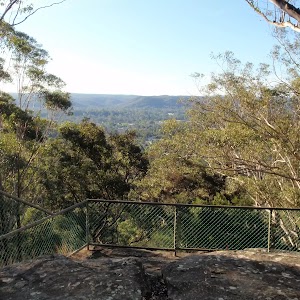
Turn right: Fromt the intersection, the walk follows the ‘walker arrow’ along the bush track, going up the hill. The vegetation on this section of the walk changes from moist forest, filled with ferns and cabbage palms, to relatively dry forest to as the track climbs. The track climbs, using steps cut into the rock in places, before passing the ‘Gosford Lookout’ rock platform, to the right. At this lookout point, the track bends to the left, passes a ‘Gosford Lookout’ signpost and immediately arrives at the intersection at the end of the Banksia picnic area.
Turn left: From the intersection, this walk goes across the picnic area, and passes around the gate, into the car park (near the end of Strickland Rd in the Strickland State Forest).
Turn left: From the intersection, this walk goes across the picnic area, and passes around the gate, into the car park (near the end of Strickland Rd in the Strickland State Forest).
Maps for the Cabbage Tree Trail walk
You can download the PDF for this walk to print a map.
These maps below cover the walk and the wider area around the walk, they are worth carrying for safety reasons.
| Gosford | 1:25 000 Map Series | 91312S GOSFORD | NSW-91312S |
| Wyong | 1:25 000 Map Series | 91312N WYONG | NSW-91312N |
| Gosford | 1:100 000 Map Series | 9131 GOSFORD | 9131 |
Cross sectional view of the Cabbage Tree Trail bushwalking track
Analysis and summary of the altitude variation on the Cabbage Tree Trail
Overview of this walks grade – based on the AS 2156.1 – 2001
Under this standard, a walk is graded based on the most difficult section of the walk.
| Length | 1.7 km | ||
| Time | 1 Hr | ||
| . | |||
| Grade 3/6 Moderate track |
AS 2156.1 | Gradient | Short steep hills (3/6) |
| Quality of track | Formed track, with some branches and other obstacles (3/6) | ||
| Signs | Directional signs along the way (3/6) | ||
| Experience Required | Some bushwalking experience recommended (3/6) | ||
| Weather | Weather generally has little impact on safety (1/6) | ||
| Infrastructure | Limited facilities, not all cliffs are fenced (3/6) |
Some more details of this walks Grading
Here is a bit more details explaining grading looking at sections of the walk
Gradient
1.1km of this walk has gentle hills with occasional steps and another 510m has short steep hills. The remaining (95m) is flat with no steps.
Quality of track
Around 1.6km of this walk follows a formed track, with some branches and other obstacles, whilst the remaining 95m follows a clear and well formed track or trail.
Signs
This whole walk, 1.7km has directional signs at most intersection.
Experience Required
Around 1.2km of this walk requires no previous bushwalking experience, whilst the remaining 510m requires some bushwalking experience.
weather
This whole walk, 1.7km is not usually affected by severe weather events (that would unexpectedly impact safety and navigation).
Infrastructure
Around 1.5km of this walk has limited facilities (such as not all cliffs fenced), whilst the remaining 270m is close to useful facilities (such as fenced cliffs and seats).
Similar walks
A list of walks that share part of the track with the Cabbage Tree Trail walk.
1.8 km Circuit
1 Hr
Moderate track
2.2 km One way
1 Hr
Moderate track
3 km Circuit
1 hr 30 mins
Moderate track
8.1 km Circuit
3 hrs 30 mins
Moderate track
Other Nearby walks
A list of walks that start near the Cabbage Tree Trail walk.
1.7 km Return
45 mins
Moderate track
2.3 km Circuit
1 Hr
Moderate track
3.3 km Circuit
1 hr 15 mins
Moderate track
6 km One way
2 hrs 30 mins
Hard track
21.1 km One way
8 hrs
Hard track
47.4 km One way
3 Days
Hard track
26.7 km One way
2 Days
Hard track
426 m Return
20 mins
Moderate track
11.3 km One way
4 hrs 30 mins
Hard track
643 m Circuit
30 mins
Moderate track
900 m Return
30 mins
Hard track
8.3 km Return
3 hrs 15 mins
Moderate track
Plan your trip to and from the walk here
The Cabbage Tree Trail walk starts and ends at the Banksia car park (gps: -33.37331, 151.32253)
Your main transport option to Banksia car park is by;
![]() Car. There is free parking available.
Car. There is free parking available.
(get details)
Short URL = http://wild.tl/27
Gallery images
There are other downloads I am still working on.
You will probably need to login to access these — still all free.
* KML (google earth file)
* GPX (GPS file)
Special Maps/ brochures
* A3 topo maps
* PDF with Lands Topo map base
* PDF with arial image (and map overlay)
I wanted to get the main site live first, this extra stuff will come in time.
Happy walking
Matt 🙂
Strickland Falls Loop Trail
And Walk
Strickland Falls Loop Trail
1 Hr
1.8 km Circuit
133 m
Moderate track
A loop walk with plenty of excellent scenery. The walk starts in the dry eucalypt forest around the Banksia Picnic Area and soon descends into lush green rainforest remnants, filled with ferns and cabbage tree palms. The walk includes some great scenery along the base of the cliff line and around the falls, although the falls themselves are often just a trickle. A great walk to experience a slice of the beautiful scenery of the Strickland State Forest.

Strickland State Forest
The Strickland State Forest, managed by State Forests of NSW, is located on the NSW Central Coast, close to the F3. The Strickland State Forest has a wide range of vegetation, including patches of rainforest along the sheltered creeks. The walking tracks take in some beautiful scenery, including a mixture of native forest and the remnants of an old arboretum. ‘Strickland is no longer actively harvested and is managed for education and recreation purposes’. The ‘Friends of Strickland’ undertake projects including the construction of walking tracks. Note: Access into Strickland is during the daytime only with the entrance gate being unlocked between 7am and 5pm (Apr – Oct) and between 7am and 7pm (Nov – Mar) [3] More info.
(0km) Banksia car park → Banksia picnic area
50 m
1 mins
0m
-2m
Moderate track
From the car park (near the end of Strickland Rd in the Strickland State Forest), this walk passes around the gate and goes across the picnic area to the track intersection at the opposite end. There is a track signpost (‘Strickland Falls Loop Trail’) a little to the left.
Banksia Picnic Area
This picnic area is in the Strickland State Forest, on the NSW Central Coast. The facilities include picnic tables, pit toilets, BBQ fire places, garbage bins and tank water. A few bush walking tracks start from the picnic area.
(0.05km) Banksia picnic area → Strickland Falls
870 m
26 mins
82m
-95m
Moderate track
Turn right: From the intersection, this walk follows the bush track past the ‘Gosford Lookout’ sign, towards the rock platform (the lookout). At the rock platform lookout, the track bends to the right and descends gently, using steps cut into the rock in places. The vegetation on this section of the walk changes from relatively dry forest at the picnic area to moist forest filled with ferns and cabbage palms as the track descends. After a short distance, the walk arrives at an intersection signposted ‘Cabbage Tree Trail’.
Veer right: From the intersection, this walk follows the ‘Strickland Falls Trail’ arrow along the bush track, keeping the valley to the left. The track meanders through some beautiful scenery with ferns, cabbage palms and boulders. A cliff line is often visible through the trees to the right. After a while, the walk crosses a gully below some imposing cliffs and continues further before reaching the signposted ‘Strickland Falls’.
Veer right: From the intersection, this walk follows the ‘Strickland Falls Trail’ arrow along the bush track, keeping the valley to the left. The track meanders through some beautiful scenery with ferns, cabbage palms and boulders. A cliff line is often visible through the trees to the right. After a while, the walk crosses a gully below some imposing cliffs and continues further before reaching the signposted ‘Strickland Falls’.
Strickland Falls
Strickland Falls are a short walk from the Banksia Picnic Area in the Strickland State Forest, Central Coast, NSW. The falls are often just a trickle, but will be more impressive after good rain. The scenery around the falls is still beautiful with moist rainforest scenery to enjoy.
(0.92km) Strickland Falls → Int of Strickland Falls trail and Strickland Rd
740 m
18 mins
49m
-35m
Moderate track
Turn sharp right: From the intersection, this walk follows the ‘Banksia Picnic Area’ arrow along the bush track, going up the steps. The walk climbs up through a series of boulders, with some nice overhangs along the way. The vegetation becomes much drier as the walk climbs out of the valley. After a while the track comes to an intersection with the road, signposted ‘Strickland Falls’.
(1.66km) Int of Strickland Falls trail and Strickland Rd → Banksia car park
90 m
2 mins
2m
-1m
Moderate track
Turn right: From the intersection, the walk follows the road to the gate in the car park , just before the picnic area.
Maps for the Strickland Falls Loop Trail walk
You can download the PDF for this walk to print a map.
These maps below cover the walk and the wider area around the walk, they are worth carrying for safety reasons.
| Wyong | 1:25 000 Map Series | 91312N WYONG | NSW-91312N |
| Gosford | 1:100 000 Map Series | 9131 GOSFORD | 9131 |
Cross sectional view of the Strickland Falls Loop Trail bushwalking track
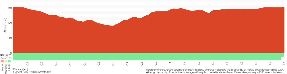
Analysis and summary of the altitude variation on the Strickland Falls Loop Trail
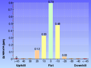
Overview of this walks grade – based on the AS 2156.1 – 2001
Under this standard, a walk is graded based on the most difficult section of the walk.
| Length | 1.8 km | ||
| Time | 1 Hr | ||
| . | |||
| Grade 3/6 Moderate track |
AS 2156.1 | Gradient | Short steep hills (3/6) |
| Quality of track | Formed track, with some branches and other obstacles (3/6) | ||
| Signs | Directional signs along the way (3/6) | ||
| Experience Required | Some bushwalking experience recommended (3/6) | ||
| Weather | Storms may impact on navigation and safety (3/6) | ||
| Infrastructure | Limited facilities, not all cliffs are fenced (3/6) |
Some more details of this walks Grading
Here is a bit more details explaining grading looking at sections of the walk
Gradient
1.4km of this walk has gentle hills with occasional steps and another 180m has short steep hills. The remaining (140m) is flat with no steps.
Quality of track
Around 1.6km of this walk follows a formed track, with some branches and other obstacles, whilst the remaining 140m follows a clear and well formed track or trail.
Signs
This whole walk, 1.8km has directional signs at most intersection.
Experience Required
Around 1.6km of this walk requires some bushwalking experience, whilst the remaining 140m requires no previous bushwalking experience.
weather
Around 1km of this walk is not usually affected by severe weather events (that would unexpectedly impact safety and navigation), whilst the remaining 740m is affected by storms that may impact your navigation and safety.
Infrastructure
Around 1.4km of this walk has limited facilities (such as not all cliffs fenced), whilst the remaining 320m is close to useful facilities (such as fenced cliffs and seats).
Similar walks
A list of walks that share part of the track with the Strickland Falls Loop Trail walk.
1.7 km Return
45 mins
Moderate track
1.7 km Circuit
1 Hr
Moderate track
2.2 km One way
1 Hr
Moderate track
3 km Circuit
1 hr 30 mins
Moderate track
8.1 km Circuit
3 hrs 30 mins
Moderate track
Other Nearby walks
A list of walks that start near the Strickland Falls Loop Trail walk.
2.3 km Circuit
1 Hr
Moderate track
3.3 km Circuit
1 hr 15 mins
Moderate track
6 km One way
2 hrs 30 mins
Hard track
21.1 km One way
8 hrs
Hard track
47.4 km One way
3 Days
Hard track
26.7 km One way
2 Days
Hard track
426 m Return
20 mins
Moderate track
11.3 km One way
4 hrs 30 mins
Hard track
643 m Circuit
30 mins
Moderate track
900 m Return
30 mins
Hard track
8.3 km Return
3 hrs 15 mins
Moderate track
10.8 km Circuit
4 hrs 15 mins
Hard track
Plan your trip to and from the walk here
The Strickland Falls Loop Trail walk starts and ends at the Banksia car park (gps: -33.37331, 151.32253)
Your main transport option to Banksia car park is by;
![]() Car. There is free parking available.
Car. There is free parking available.
(get details)
Short URL = http://wild.tl/sflt
Gallery images
There are other downloads I am still working on.
You will probably need to login to access these — still all free.
* KML (google earth file)
* GPX (GPS file)
Special Maps/ brochures
* A3 topo maps
* PDF with Lands Topo map base
* PDF with arial image (and map overlay)
I wanted to get the main site live first, this extra stuff will come in time.
Happy walking
Matt 🙂
Comments