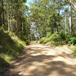
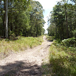
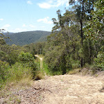
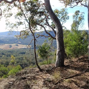
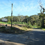
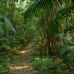
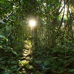
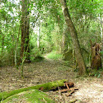
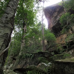
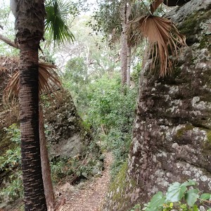
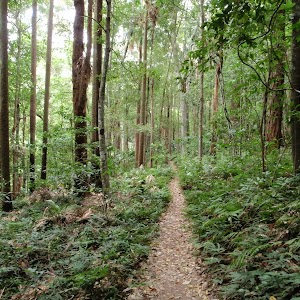
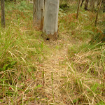
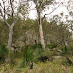
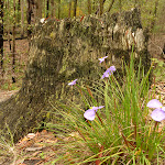
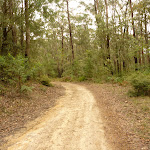
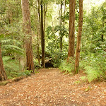
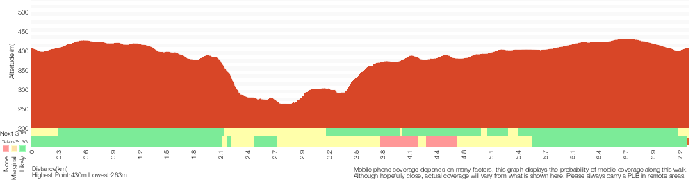
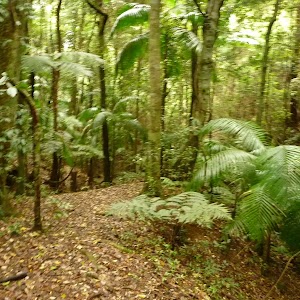
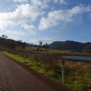
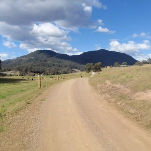
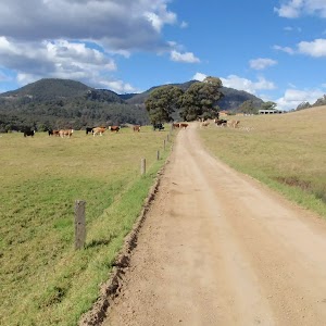
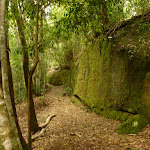
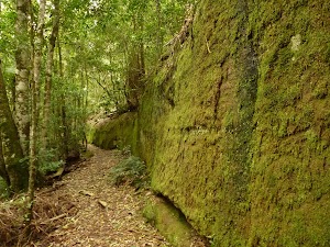
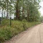
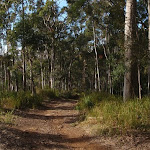
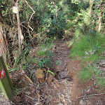
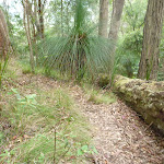
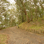
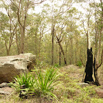
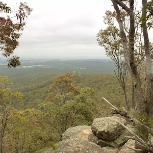
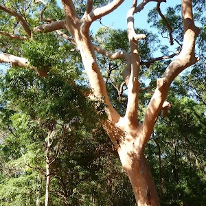
This section of the Great North Walk start from grand views at Heaton Lookout in Heaton state forest and leads to the picnic area and motel at Heaton Gap. The first section of this walk follows the dirt road to a communication tower before passing another lookout and expansive valley views. Here you start the steep decent along a rocky track and passing a lovely grove of grass trees. From here you follow a grassy trail and powerlines before the narrow track leads down and across the road at Heaton Gap.
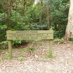
Heaton Lookout to Heaton Gap
And Walk
Heaton Lookout to Heaton Gap


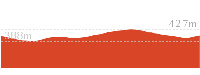
2 hrs
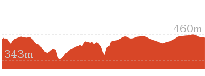
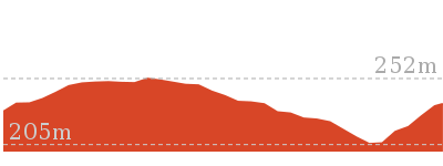
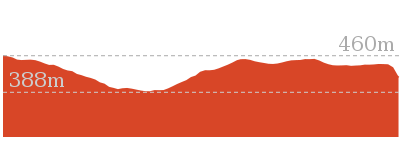
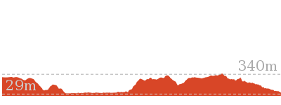
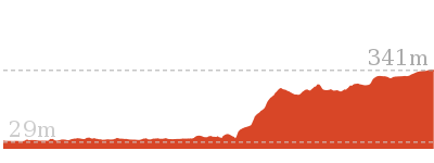
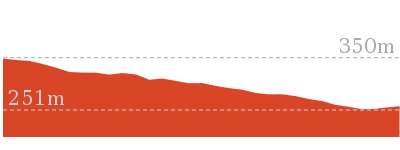
4.3 km One way

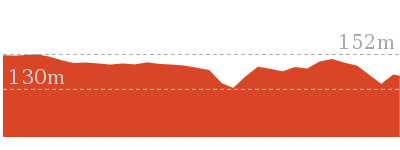
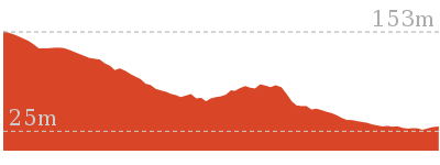
153 m
Hard track


Heaton Lookout
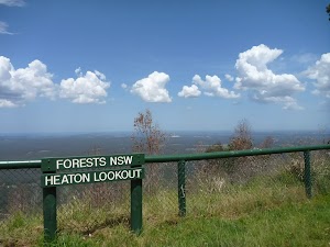
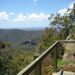
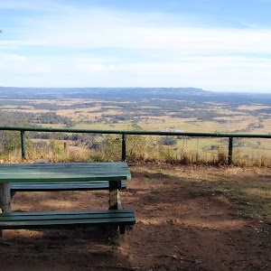
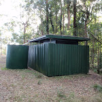
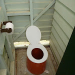
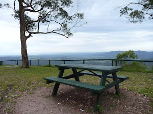
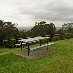
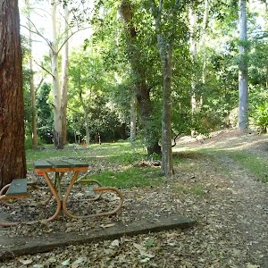
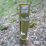
Heaton Lookout[1] is one of the larger lookouts located on Heaton Road. This fenced lookout faces south-east. There are wood fired barbecues[2], picnic tables[3] and a pit toilet[4]. Heaton Lookout is a great place to stop for a snack, and the amazing view[5] feels like a bonus. This lookout was named after Richard Heaton, a timber cutter who came to Australia as a convict. There is a water tank here, due to vandalism in the area this is not a reliable water source.
(0km) Heaton Lookout. → Heaton Communications Tower

2.4 km
54 mins
144m
-54m
Moderate track
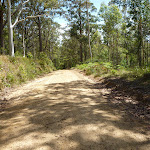
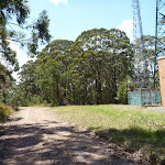
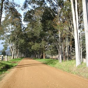
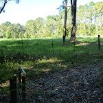
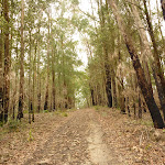
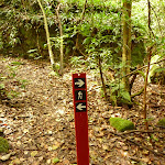
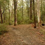
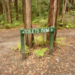
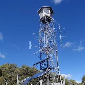
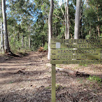
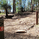
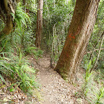
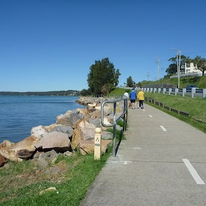
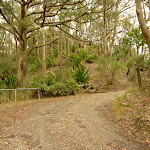
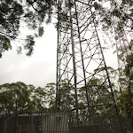
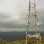
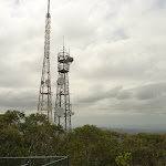
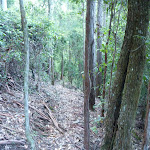
From ‘Heaton Lookout’[7], this walk follows the ‘Heaton Gap’ sign[8] gently uphill along the dirt Heaton Rd[9], past the toilet[10]. After about 250m, the road leads past the ‘Heaton Loop Trail’ side track[11], then about 250m later (staying left at the Y-intersection) the road passes another section of the same signposted track[12] as the road bends left, enjoying the views over the clearing (on your right). The road now leads gently uphill[13] for about 1.7km, ignoring a series of side tracks until coming to a clear three-way intersection[14] just past the brick building[15] and fenced communication tower[16] (on the right, and a small dam on the left).
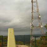
(2.43km) Heaton Communications Tower → Heaton Gap Lookout
620 m
13 mins
3m
-69m
Moderate track
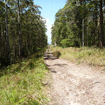
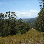
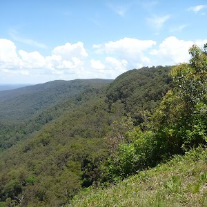
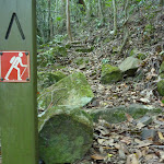
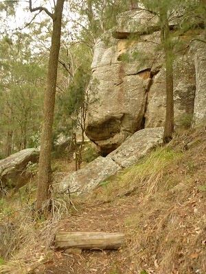
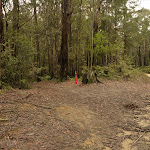
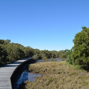
Turn right: From the intersection[17], this walk follows the GNW arrow marker[18] off the main road, heading east along the wide trail, initially keeping the fenced tower[19] on your right. The trail follows the power lines[20]. The unsignposted and unfenced clearing[21] has wide, uninterrupted views to the south.
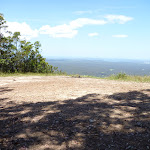
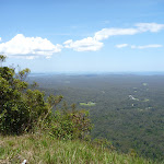
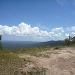
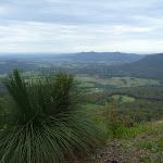
Heaton Gap Lookout

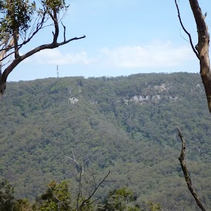
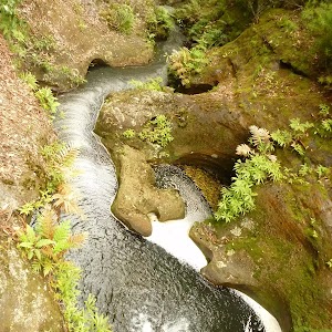
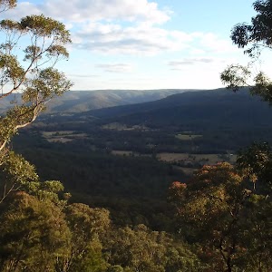
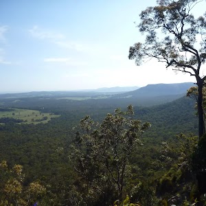
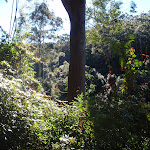
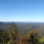
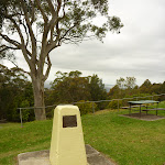
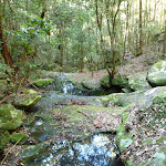
Heaton Gap lookout is a fantastic spot to stop and catch your breath in Heaton State Forest. This unfenced lookout[22] offers exhilarating views over the valleys towards Tuggerah Lake and Lake Macquarie[23]. this unsignposted view, as with many features in the area, was named after Richard Heaton, a timber cutter who came to Australia as a convict. More info.
(3.05km) Heaton Gap Lookout → Int of GNW and Freemans Drive tracks
860 m
22 mins
1m
-190m
Hard track
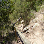
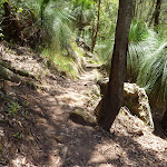
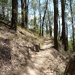
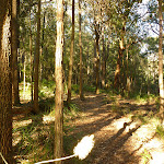
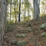
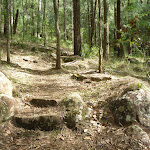
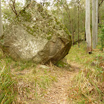
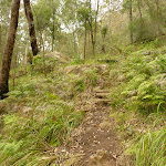
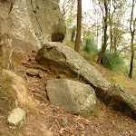
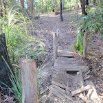
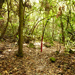
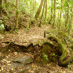
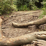
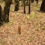
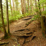
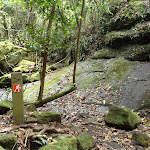
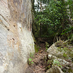
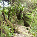
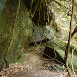
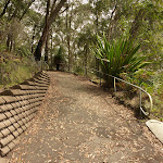
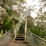
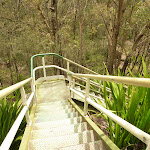
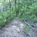
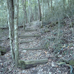
Continue straight: From Heaton Gap Lookout[25], this walk follows the track east, moderately steeply downhill, initially keeping the view from Heaton Gap Lookout[26] on your right. After about 60m, the track leads to a timber platform with more views[27], underneath the power lines. The walk continues past some handrailing for about 20m to come to the ‘Great North Walk Walker Register’ post[28]. After noting your intentions, the walk continues steeply downhill[29] with stone and timber steps[30] and sections for handrail for about 200m, past the rock boulders and grass trees where the track widens into a narrow grassy trail. Here the walk follows this trail and the power lines downhill, steeply[31] in places, for about 600m, until coming to a level unsignposted three-way intersection[32] with the Freemans Drive trail[33] (on the right).
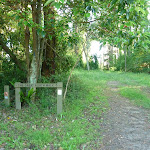
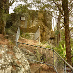
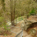
(3.91km) Int of GNW track and Freemans Drive trail → Heaton Gap Track Head
360 m
10 mins
5m
-82m
Hard track
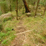
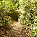
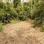
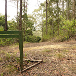
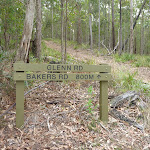
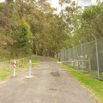
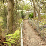
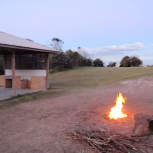
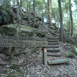
Veer left: From the intersection[34], this walk follows the GNW arrow post and power lines[35] steeply downhill[36] along the trail. The walk continues for about 180m to find a three-way intersection[37], with a GNW arrow marker on the right (where the power line trail bends left). The walk turns right, leaving the power lines and following the GNW arrow marker steeply down a narrower forested track[38]. The track winds down some timber steps, towards the sound of traffic for about 160m then down a timber staircase[39] to the edge of Freemans Drive. Here the walk crosses Freemans Drive[40] (busy road, please be careful to look and listen for traffic) and comes to the Watagan Forest Motel[41], petrol station (on the left), picnic area[42] and signposted ‘Heaton Gap Track Head’[43] (on the right).
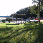
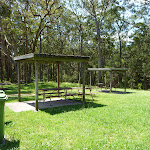
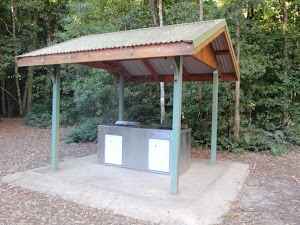
Watagan Forest Motel
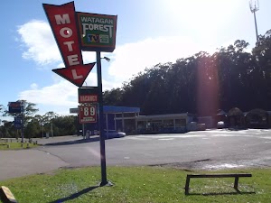
Watagan Forest Motel[44] is located on Branxton-Toronto Road. This retro-style motel is located right on the Great North Walk. The motel offers six rooms[45] for around $99 per night – each with a double bed[46] (four rooms also have twin singles), a television[47], bathroom with shower[48], air conditioning[49], and breakfast included. Room service is available. Adjoining the motel is a service station[50], which also offers dining room meals as well as a small grocery selection (bread, milk, bottled water, rice, pasta, etc), open until 8:30pm daily. A rest area is situated next to the motel, with covered picnic tables and garbage bins[51]. For further information, phone (02)4938 0149.
Maps for the Heaton Lookout to Heaton Gap walk
You can download the PDF for this walk to print a map.
These maps below cover the walk and the wider area around the walk, they are worth carrying for safety reasons.
| Quorrobolong | 1:25 000 Map Series | 91322S QUORROBOLONG | NSW-91322S |
| Cessnock | 1:50 000 Map Series | 91322 CESSNOCK | CW-91322 |
| Cessnock | 1:100 000 Map Series | 9132 CESSNOCK | 9132 |
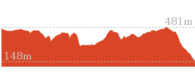
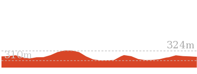
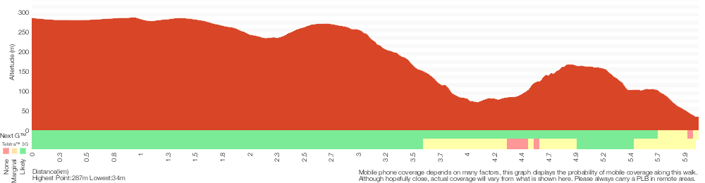
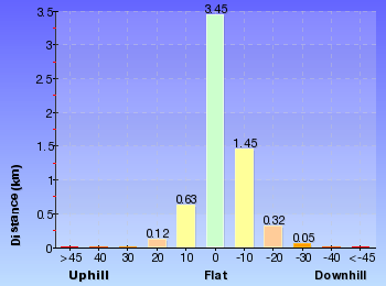
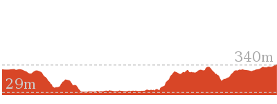
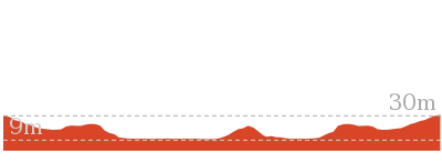
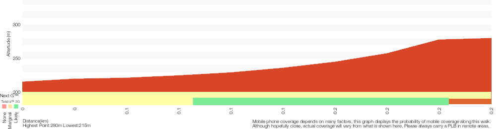
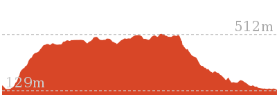
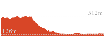
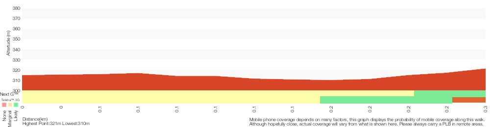
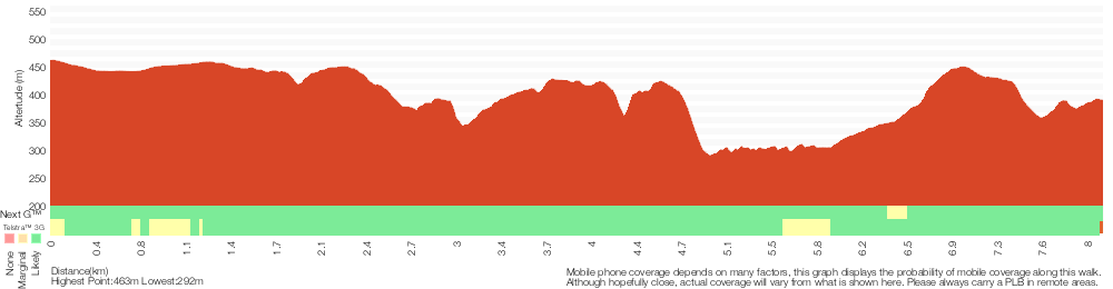
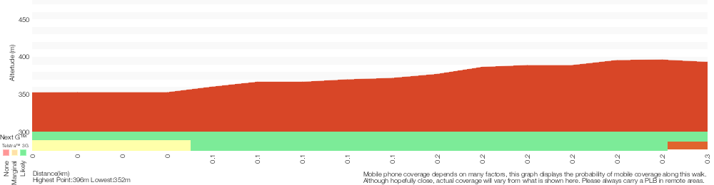
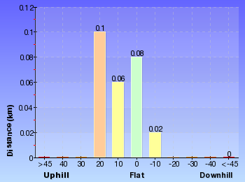
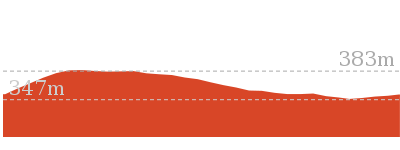
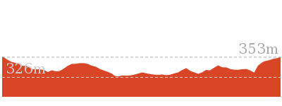
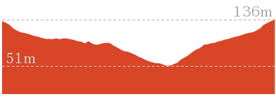
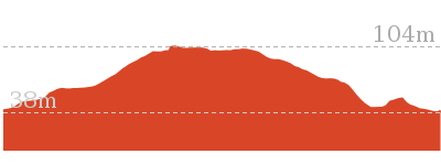
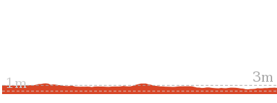
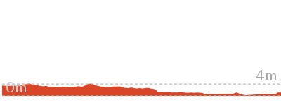
Cross sectional view of the Heaton Lookout to Heaton Gap bushwalking track
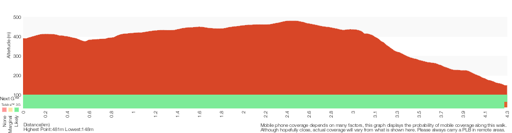
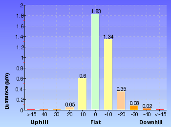
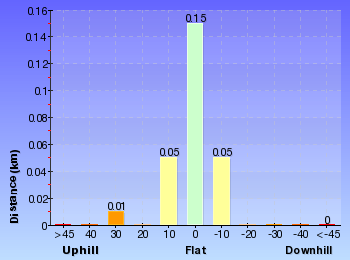
Analysis and summary of the altitude variation on the Heaton Lookout to Heaton Gap
Overview of this walks grade – based on the AS 2156.1 – 2001
Under this standard, a walk is graded based on the most difficult section of the walk.
| Length | 4.3 km | ||
| Time | 2 hrs | ||
| . | |||
| Grade 4/6 Hard track |
AS 2156.1 | Gradient | Very steep (4/6) |
| Quality of track | Rough track, where fallen trees and other obstacles are likely (4/6) | ||
| Signs | Directional signs along the way (3/6) | ||
| Experience Required | Some bushwalking experience recommended (3/6) | ||
| Weather | Weather generally has little impact on safety (1/6) | ||
| Infrastructure | Generally useful facilities (such as fenced cliffs and seats) (1/6) |
Some more details of this walks Grading
Here is a bit more details explaining grading looking at sections of the walk
Gradient
Around 3.1km of this walk has short steep hills, whilst the remaining 1.2km is very steep.
Quality of track
2.4km of this walk follows a clear and well formed track or trail and another 980m follows a formed track, with some branches and other obstacles. The remaining (860m) follows a rough track, where fallen trees and other obstacles are likely.
Signs
This whole walk, 4.3km has directional signs at most intersection.
Experience Required
This whole walk, 4.3km requires some bushwalking experience.
weather
This whole walk, 4.3km is not usually affected by severe weather events (that would unexpectedly impact safety and navigation).
Infrastructure
This whole walk, 4.3km is close to useful facilities (such as fenced cliffs and seats).
Similar walks
A list of walks that share part of the track with the Heaton Lookout to Heaton Gap walk.
12.5 km One way
6 hrs
Hard track
29.7 km One way
2 Days
Hard track

60.5 km One way
4 Days
Hard track

Other Nearby walks
A list of walks that start near the Heaton Lookout to Heaton Gap walk.
8.1 km One way
4 hrs
Hard track

14.8 km One way
6 hrs
Hard track

718 m Circuit
30 mins
Moderate track

516 m Return
15 mins
Moderate track
5.6 km Circuit
2 hrs 30 mins
Hard track
2.5 km Circuit
1 Hr
Hard track


1.5 km Return
1 Hr
Moderate track
1.7 km Return
1 Hr
Hard track
1.3 km Circuit
45 mins
Moderate track

406 m Return
30 mins
Hard track

4.4 km Return
3 hrs 30 mins
Moderate track
17.2 km One way
7 hrs
Hard track
Plan your trip to and from the walk here
The Heaton Lookout to Heaton Gap walk starts at the Heaton Lookout. (gps: -32.983668, 151.45483)
Your main transport option to Heaton Lookout. is by;
![]() Car. There is free parking available.
Car. There is free parking available.
(get details)
The Heaton Lookout to Heaton Gap ends at the Heaton Gap Track Head (gps: -32.965275, 151.47939)
Your main transport option to Heaton Gap Track Head is by;
![]() Car. There is free parking available.
Car. There is free parking available.
(get details)


Short URL = http://wild.tl/hlthg
Gallery images
There are other downloads I am still working on.
You will probably need to login to access these — still all free.
* KML (google earth file)
* GPX (GPS file)
Special Maps/ brochures
* A3 topo maps
* PDF with Lands Topo map base
* PDF with arial image (and map overlay)
I wanted to get the main site live first, this extra stuff will come in time.
Happy walking
Matt 🙂
Somersby Store to Ourimbah Valley Trackhead

2 hrs 30 mins
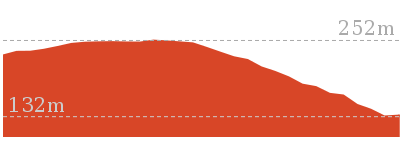
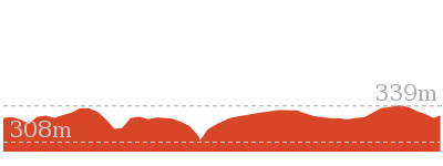
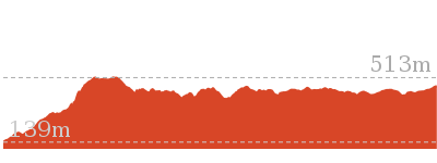
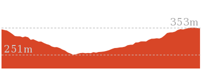
6 km One way
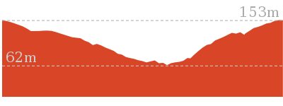
194 m
Hard track
Starting with a walk through the streets of urban Somerbsy, you soon leave the farms and head into Palm Grove Nature Reserve. First you will follow the signposted track down the open dry ridge to the dense rainforest. In this valley you can explores the moist rainforest with towering Eucalypts, Strangler Fig trees, Cabbage Palms and a tangle of vines. From here walk up the rocky track to another dry ridge, where you can follow a side trip to a flat clearing and designated campsite. From near the campsite the track winds down through another moist forest and past more Cabbage Palms before coming to the signposted Ourimbah Valley Trackhead on Ourimbah Creek Road.
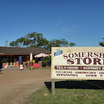


Somersby Store

Somersby Store offers a good place to have lunch or pick up the basic food supplies. The store serves hot food including burgers, chips, pies etc and cold drinks. Opening hours are 6am – 6pm Monday to Friday and 6.30am to 4pm on Saturdays (closed Sundays). There is a pay phone and a bus stop however services are limited to two buses a day. Contact details are (02)4372 1269, at 841 Wisemans Ferry Road Somersby, NSW 2250. The store owners are happy for you to phone ahead. If you are a large group you can order ahead to save the stress. I always encourage people to use local stores like this on track, but since it is a small store it is worth phoning ahead to see what they have what you want in stock.
(0km) Somersby Store → End of Kilkenny Road
2.6 km
48 mins
54m
-69m
Moderate track
From the Somersby Store[1], this walk heads north, gently downhill along the side of ‘Wisemans Ferry Rd’, past the public toilet[2]. After about 120m, this walk crosses an on-ramp[3] then heads over the bridge[4] crossing Peats Ridge Road, then past another on-ramp[5]. The walk continues along Wisemans Ferry Rd for about 700m to then turn sharp right at the three-way intersection[6], onto ‘Dog Trap Rd’[7]. Just over 100m along Dog Trap Rd, this walk turns left into ‘Kilkenny Rd’[8]. The walk follows Kilkenny Rd past the rural properties[9] for about 1.2km, where the walk continues along the now dirt road[10]. About 50m after becoming dirt, the road leads across a rock ford[11] that can be extremely slippery when wet. The walk continues up along the dirt road[12] for another 300m to come to the end of the road and a ‘Great North Walk’ sign[13], beside ‘Illawong’ (farm).
(2.63km) End of Kilkenny Road → creek crossing
1.4 km
32 mins
11m
-207m
Hard track
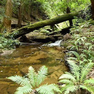
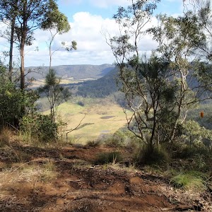
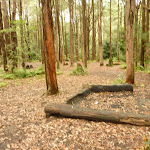
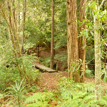
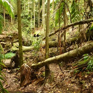
Continue straight: From the northern end of Kilkenny Road next to ‘Illawong’ (farm)[14], this walk follows the ‘The Great North Walk’ sign[15] along the management trail, between the two farms[16]. After about 300m, the trail leads to a clearing[17], where this walk turns right to follow the GNW arrow post along track beside the fence line[18] (keeping the paddock on your right) for about 70m. The walk then turns left and follows the ‘The Great North Walk’ sign[19] down the hill. The track leads steeply at first[20] and become progressively less steep as the walk heads down the ridge line, until almost flattening out[21] about 400m after leaving the farm. The track then bends left and winds steeply down the side of the ridge, down a series of rock steps[22] for about 600m, leading into a dense moist rain forest. The track passes some wonderful examples of bird’s nest ferns (Asplenium australasicum)[23] before the last little walk down to the rocky intermittent creek[24]. This walk then crosses the creek in the mossy, cool and moist valley[25].
(4.01km) creek crossing → Palm Grove Campsite intersection
1 km
28 mins
114m
-25m
Hard track
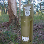
Continue straight: From beside the creek[26], this walk follows the GNW arrow post[27] uphill, using the series of rock steps[28]. The track leads uphill, passing some notably large trees[29] over about 120m to then turn right onto a leafy trail[30]. Here the walk crosses an ephemeral creek[31] then continues along the leafy trail in the shaded rainforest[32]. After about 250m, the walk turns left, following the ‘Great North Walk’ sign[33] gently up along a narrow track for about 60m to pass a large strangler fig tree[34]. Just past the fig, this track begins to climb steeply up a series of rock steps[35] and switch-backs[36] for about 100m to pass along side a rock wall[37] (on your right). Just past the rock wall, this walk ducks under a fallen tree[38] then continues steeply (into the more open forest) up more rock steps[39] and switchback for another 250m, where the track flattens out and comes to the signposted ‘Walker Register’ tube[40]. After leaving your comments, and having a bit of a read of other people’s adventures, this walk turns right and follows the GNW arrow post[41] along the top of the ridge, through a clearing[42]. Here the walk start to lead down along the top of the ridge[43] for about 150m to come to a three-way intersection[44], marked with a couple of GNW arrow posts (just before a campsite[45], ahead).
(5.05km) Palm Grove Campsite intersection → Palm Grove Campsite
50 m
1 mins
0m
-2m
Moderate track
Continue straight: From the intersection, this walk heads gently downhill along the top of the ridge towards the clearing for just shy of 50m to come to the signposted ‘Camping Area’[46]. At the end of this side trip, retrace your steps back to the main walk then Turn right.
(5.05km) Palm Grove Campsite intersection → Ourimbah Valley Trackhead
990 m
24 mins
15m
-143m
Hard track
Turn left: From the intersection, this walk follows the GNW arrow post north-west, gently down off the side of the ridge[47] (initially keeping the campsite track down to your right). The track leads down along the side of the ridge[48] for about 150m before leading much more steeply down a series of rock steps[49] for about 200m. The track mostly flatten out just before passing a tall fig growing over a large boulder[50] (on your right). Here the track winds more gently downhill for about 150m to pass a couple cabbage palms (Livistona australis)[51], then continues to wind fairly steeply down for another 400m where the track mostly flattens out again[52]. Near the end of this 400m, the track leads through a short weedy section before heading down a short embankment[53] to a T-intersection with the dirt Ourimbah Creek Rd[54], marked with a large ‘Ourimbah Valley Trackhead’ sign[55].
Maps for the Somersby Store to Ourimbah Valley Trackhead walk
You can download the PDF for this walk to print a map.
These maps below cover the walk and the wider area around the walk, they are worth carrying for safety reasons.
| Wyong | 1:25 000 Map Series | 91312N WYONG | NSW-91312N |
| Gosford | 1:100 000 Map Series | 9131 GOSFORD | 9131 |
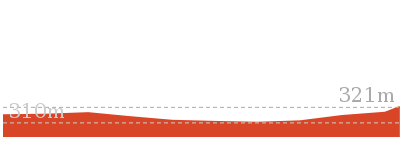
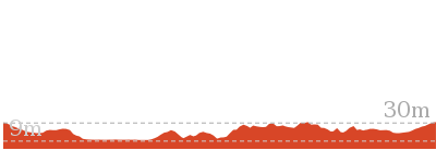
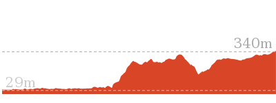
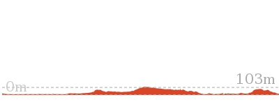
Cross sectional view of the Somersby Store to Ourimbah Valley Trackhead bushwalking track
Analysis and summary of the altitude variation on the Somersby Store to Ourimbah Valley Trackhead
Overview of this walks grade – based on the AS 2156.1 – 2001
Under this standard, a walk is graded based on the most difficult section of the walk.
| Length | 6 km | ||
| Time | 2 hrs 30 mins | ||
| . | |||
| Grade 4/6 Hard track |
AS 2156.1 | Gradient | Very steep (4/6) |
| Quality of track | Rough track, where fallen trees and other obstacles are likely (4/6) | ||
| Signs | Minimal directional signs (4/6) | ||
| Experience Required | Moderate level of bushwalking experience recommended (4/6) | ||
| Weather | Storms may impact on navigation and safety (3/6) | ||
| Infrastructure | Limited facilities (such as cliffs not fenced, significant creeks not bridged) (4/6) |
Some more details of this walks Grading
Here is a bit more details explaining grading looking at sections of the walk
Gradient
Around 3.4km of this walk is very steep, whilst the remaining 2.6km has gentle hills with occasional steps.
Quality of track
2.6km of this walk follows a smooth and hardened path and another 2.4km follows a rough track, where fallen trees and other obstacles are likely. The remaining (990m) follows a formed track, with some branches and other obstacles.
Signs
2.6km of this walk is clearly signposted and another 2.4km has minimal directional signs. The remaining (990m) has directional signs at most intersection.
Experience Required
2.6km of this walk requires no previous bushwalking experience and another 2.4km requires some bushwalking experience. The remaining (1km) requires a leader a with moderate level of bushwalking experience.
weather
Around 3.4km of this walk is not usually affected by severe weather events (that would unexpectedly impact safety and navigation), whilst the remaining 2.6km is affected by storms that may impact your navigation and safety.
Infrastructure
2.6km of this walk is close to useful facilities (such as fenced cliffs and seats) and another 2km has limited facilities (such as not all cliffs fenced). The remaining (1.4km) has limited facilities (such as cliffs not fenced, significant creeks not bridged).
Similar walks
A list of walks that share part of the track with the Somersby Store to Ourimbah Valley Trackhead walk.
21.1 km One way
8 hrs
Hard track
26.7 km One way
2 Days
Hard track
47.4 km One way
3 Days
Hard track
Other Nearby walks
A list of walks that start near the Somersby Store to Ourimbah Valley Trackhead walk.
1.7 km Return
45 mins
Moderate track
3 km Circuit
1 hr 30 mins
Moderate track

1.7 km Circuit
1 Hr
Moderate track
2.2 km One way
1 Hr
Moderate track
1.8 km Circuit
1 Hr
Moderate track

8.1 km Circuit
3 hrs 30 mins
Moderate track

2.3 km Circuit
1 Hr
Moderate track
3.3 km Circuit
1 hr 15 mins
Moderate track
11.2 km One way
4 hrs 30 mins
Hard track
15 km One way
5 hrs 30 mins
Hard track
426 m Return
20 mins
Moderate track

8.3 km Return
3 hrs 15 mins
Moderate track

Plan your trip to and from the walk here
The Somersby Store to Ourimbah Valley Trackhead walk starts at the Somersby Store (gps: -33.358078, 151.29029)
Your transport options to Somersby Store are by;
![]() Bus. A bus service runs along Wisemans Ferry Rd passing Somersby store. The service runs between Gosford and Spencer only a few times a day. Please check timetable for more info or Phone Busway on (02) 4368 2277. The bus only picks passengers up from Somersby to head to Gosford on the morning runs. (get details)
Bus. A bus service runs along Wisemans Ferry Rd passing Somersby store. The service runs between Gosford and Spencer only a few times a day. Please check timetable for more info or Phone Busway on (02) 4368 2277. The bus only picks passengers up from Somersby to head to Gosford on the morning runs. (get details)
![]() Car. There is free parking available.
Car. There is free parking available.
(get details)
The Somersby Store to Ourimbah Valley Trackhead ends at the Ourimbah Valley Trackhead (gps: -33.317429, 151.30013)
Your main transport option to Ourimbah Valley Trackhead is by;
![]() Car. There is free parking available.
Car. There is free parking available.
(get details)
Short URL = http://wild.tl/sstovt
Gallery images
There are other downloads I am still working on.
You will probably need to login to access these — still all free.
* KML (google earth file)
* GPX (GPS file)
Special Maps/ brochures
* A3 topo maps
* PDF with Lands Topo map base
* PDF with arial image (and map overlay)
I wanted to get the main site live first, this extra stuff will come in time.
Happy walking
Matt 🙂
Monkey Face Cliff Walk
And Walk
Monkey Face Cliff Walk

30 mins
406 m Return
65 m
Hard track
This short but steep walk to the base of an attractive cliff is worthwhile. The walk travels through open forest with gum trees and Xanthorhoea trees to eventually follow timber steps steeply to the base of the Monkey Face cliff. This cliff is used by rock climbers and abseiling parties, so be aware that people may be above you. Spend some time exploring the base of cliff before returning the same way.


(0km) Bangalow camping ground → Int at the base of Monkey Face Cliff
200 m
10 mins
65m
0m
Hard track
From Bangalow Camping Ground[3] (on Bangalow Rd[4]), this walk follows the track up the moderately steep hill[5] (directly opposite the camp ground[6]). The track is followed for about 100m, to find a small flat area with a large rock[7]. The track then continues steeply uphill with timber steps[8] for about 110m, until coming to an indistinct three-way intersection at the base of Monkey Face cliff[9].
Base of Monkey Face Cliff
Maps for the Monkey Face Cliff Walk walk
You can download the PDF for this walk to print a map.
These maps below cover the walk and the wider area around the walk, they are worth carrying for safety reasons.
| Morisset | 1:25 000 Map Series | 91311N MORISSET | NSW-91311N |
| Gosford | 1:100 000 Map Series | 9131 GOSFORD | 9131 |
Cross sectional view of the Monkey Face Cliff Walk bushwalking track
Analysis and summary of the altitude variation on the Monkey Face Cliff Walk
Overview of this walks grade – based on the AS 2156.1 – 2001
Under this standard, a walk is graded based on the most difficult section of the walk.
| Length | 406 m | ||
| Time | 30 mins | ||
| . | |||
| Grade 4/6 Hard track |
AS 2156.1 | Gradient | Very steep (4/6) |
| Quality of track | Formed track, with some branches and other obstacles (3/6) | ||
| Signs | Minimal directional signs (4/6) | ||
| Experience Required | Some bushwalking experience recommended (3/6) | ||
| Weather | Weather generally has little impact on safety (1/6) | ||
| Infrastructure | Limited facilities (such as cliffs not fenced, significant creeks not bridged) (4/6) |
Some more details of this walks Grading
Here is a bit more details explaining grading looking at sections of the walk
Gradient
This whole walk, 200m is very steep.
Quality of track
This whole walk, 200m follows a formed track, with some branches and other obstacles.
Signs
This whole walk, 200m has minimal directional signs.
Experience Required
This whole walk, 200m requires some bushwalking experience.
weather
This whole walk, 200m is not usually affected by severe weather events (that would unexpectedly impact safety and navigation).
Infrastructure
This whole walk, 200m has limited facilities (such as cliffs not fenced, significant creeks not bridged).
Similar walks
A list of walks that share part of the track with the Monkey Face Cliff Walk walk.
Other Nearby walks
A list of walks that start near the Monkey Face Cliff Walk walk.
1.3 km Circuit
45 mins
Moderate track
1.5 km Return
1 Hr
Moderate track
1.7 km Return
1 Hr
Hard track
718 m Circuit
30 mins
Moderate track
516 m Return
15 mins
Moderate track

4.3 km One way
2 hrs
Hard track

12.5 km One way
6 hrs
Hard track
8.1 km One way
4 hrs
Hard track
5.6 km Circuit
2 hrs 30 mins
Hard track
2.5 km Circuit
1 Hr
Hard track
14.8 km One way
6 hrs
Hard track
4.4 km Return
3 hrs 30 mins
Moderate track
Plan your trip to and from the walk here
The Monkey Face Cliff Walk walk starts and ends at the Bangalow camping ground (gps: -33.016511, 151.42556)
Your main transport option to Bangalow camping ground is by;
![]() Car. There is free parking available.
Car. There is free parking available.
(get details)
Short URL = http://wild.tl/mfcw
Gallery images
There are other downloads I am still working on.
You will probably need to login to access these — still all free.
* KML (google earth file)
* GPX (GPS file)
Special Maps/ brochures
* A3 topo maps
* PDF with Lands Topo map base
* PDF with arial image (and map overlay)
I wanted to get the main site live first, this extra stuff will come in time.
Happy walking
Matt 🙂
Abbotts Falls Walking Track
And Walk
Abbotts Falls Walking Track

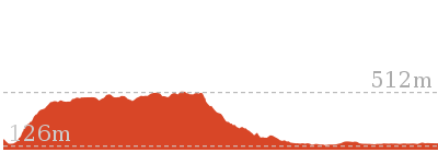
3 hrs
7.3 km Circuit
329 m
Hard track
This circuit takes you through both dry and moist forest, using a combination of walking trails and wider tracks. The side trip to the dammed pool is recommended, to see the deep Aboriginal carved grooves by the pool. This walk travels through open forest with wild flowers (in season) to descend into a moist rainforest environment near Abbotts Falls. This is great place to cool off on a hot summer’s day.


The Pines Camping Area

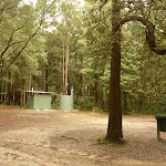
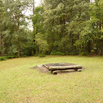
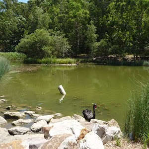
The Pines Camping Area is large and popular, and positioned under large pine trees which provide excellent shade. These trees are remnants from trial plantings of different pine species, established in the 1920s and 1930s. The campsite has pit toilets, picnic tables, fireplaces and water (treat water before use – water maybe unavailable). There is access to the creek for cooling off in the summer. More info.
(0km) Pines Camping Area → Int of Pines & Abbotts Falls Track
120 m
2 mins
0m
-9m
Moderate track
From the Pines Camping area[1], this walk follows the track[2] gently downhill (passing a ‘Walking Track’ sign[3] on your left. Then this walk follows the track for about 30m to find a rotten timber footbridge[4]. This walk crosses the footbridge and after about 10m, comes to a T-intersection with a track.
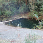
(0.12km) Int of Pines and Abbotts Falls walking trails → Dammed Pool
120 m
2 mins
0m
-8m
Moderate track
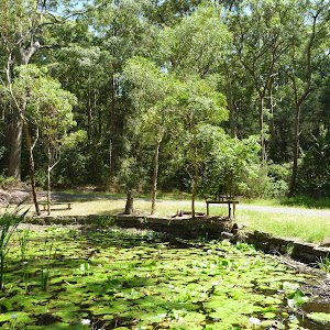
Turn left: From the intersection[5], this walk follows the track gently downhill[6], keeping the creek on your left. This walk follows the track (ignoring a creek ford[7] to the left) for about 25m, to find stone cut steps. This walk follows the track down the stone steps for about 20m to find a small waterfall[8] (on your left). The track continues gently downhill through moist forest[9] for about 80m, until coming to timber railings[10] and a dammed pool[11]. At the end of this side trip, retrace your steps back to the main walk then Continue straight.
Dammed Pool on the Pines Walking track
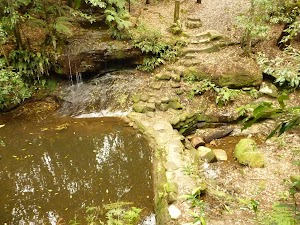
The dammed pool by Dora Creek (on the Pine walking track) is surrounded by lovely moist eucalypt forest and has an attractive dammed pool. Then is also evidence of axe-sharpening rubbing grooves on damp rock shelves from historical aboriginal use. The dammed pool is on the Pines loop walk, which can be begun from either the Pines campsite or the Pines picnic area. More info.
(0.12km) Int of Pines and Abbotts Falls Track → Pines Picnic Area Toilet Block on Palmers Rd
470 m
10 mins
31m
-1m
Moderate track
Turn right: From the intersection[12], this walk follows the track gently uphill (keeping the creek to your right). This walk follows the track for about 140m (ignoring a timber stepped track[13] down to the creek). This walk continues to follow the track gently uphill away from the creek through large pine trees[14] for about 130m, to find the Pines Picnic Area[15] (large open area with metal shelter on the right[16]). This walk then passes through the picnic area for about 200m to the toilet block[17] on Palmers Rd.
(0.59km) Pines Picnic AreaToilet Block on Palmers Rd → Int of Palmers Rd & Abbotts Falls Track
370 m
6 mins
2m
-9m
Easy track
Pines picnic area

This large picnic area is often used by groups participating in Forests NSW’s school and community programs. The area provides plenty of tree cover, as well as a number of picnic benches and tables. There is a large shelter built and reserved for the Forests NSW’s programs, but is available for use at any other time. The area is surrounded by native plants and animals.
(0.96km) Int of Palmers Road and Abbotts Falls walking trail → Int of Abbotts Falls Track & Howes Rd
190 m
4 mins
4m
-6m
Moderate track
Turn left: From the ‘Abbotts Falls Walking Trail’ sign[21] on Palmers Rd, this walk follows the track gently downhill, passing the sign (on your right). About 70m along the track, this walk finds another ‘Abbotts Falls Walking Trail’ sign[22]. This walk continues to follow the track (passing the second sign to your right) moderately steeply downhill, crossing a small creek[23] after about 45m. Then this walk continues to follow the moderately steep trail uphill for about 60m, until coming to a four-way intersection[24], with a narrow management trail[25](Howes Rd).
(1.15km) Int of Abbotts Falls walking trail and Howes Road → Int of Abbotts Falls walking trail and Abbotts Road
680 m
13 mins
4m
-48m
Moderate track
Continue straight: From the intersection[26], this walk follows the level track east, passing the track marker[27] (on your left). Then this walk continues to follow the track through re-growth bush[28] for about 600m, before descending moderately steeply[29] to cross a dilapidated timber bridge[30] over a dry creek. The track continues moderately steeply uphill[31] for about 60m, until coming to a T-intersection[32], with a management trail[33] (Abbotts Rd).
(1.84km) Int of Abbotts Falls walking trail and Abbotts Road → End of Abbotts Road
180 m
4 mins
13m
-5m
Moderate track
Turn left: From the intersection[34], this walk follows the management trail (Abbotts Rd) north and moderately steeply uphill[35], while keeping the red track marker on your left. This walk continues to follow the trail for about 90m (to find a highpoint on the trail). The trail continues moderately steeply downhill[36] for about 100m, until coming to the end of the management trail[37] (Abbotts Rd) and a track marker[38] (on the right).
(2.02km) End of Abbotts Road → Abbotts Falls Track (near Dora Creek)
400 m
13 mins
9m
-113m
Hard track
Turn right: From the end of Abbotts Rd[39], this walk follow the track steeply downhill[40] (passing a track marker[41] on the left). The walk continues to follow the track through switch backs and thick forest[42] (with views on the left[43]) for about 400m, until coming to a red metal track marker[44] (with Dora Creek[45] 20m beyond the marker).
(2.42km) Abbotts Falls Track (near Dora Creek) → Dora Creek
340 m
8 mins
15m
-32m
Moderate track
Veer left: From the red metal track marker[46] (with Dora Creek 20m beyond)[47], this walk follows the track south[48] (initially over rocks), keeping the creek on the left. Then the walk continues along the track, moderately steeply downhill[49] for about 80m, and across a mossy creek[50]. The track then continues moderately steeply uphill[51] for about 25m, to find a level section of track. The walk continues moderately steeply downhill along the track, through attractive rainforest[52] for about 200m, to find Dora Creek[53]. This walk then crosses Dora Creek and follows it downstream[54] for about 40m, until coming to a track[55] and timber track marker(on the left)[56]. (Abbotts Falls can be heard downstream from here).
Abbotts Falls
Abbotts Falls in the Olney State Forest are located in a secluded valley on Dora Creek. Thick rainforest lines Dora Creek and these falls are a great place to visit on a hot, dry day in summer. The falls can be found along the Abbotts Falls walking track. Please note that the falls are unfenced and care should be taken.
(2.76km) Dora Creek → Abbotts Falls
30 m
0m
0m
Hard track
Continue straight: From Dora Creek[57] and the timber track marker[58], this walk follows the track moderately steeply uphill[59], while keeping the creek on your right. This walk follows the track for about 60m, until coming to a small clearing[60], with an unfenced cliff and Abbotts Falls[61] partly visible on the right.
(2.79km) Abbotts Falls → Abbotts Falls service trail
610 m
19 mins
76m
-47m
Hard track
Turn left: From Abbotts Falls[62], this walk follows a track moderately steeply uphill[63] (away from Dora Creek), keeping the valley on your right. This walk follows the overgrown track[64] through attractive rainforest for about 500m (passing over fallen trees[65] on the way), until coming to Abbotts Falls management trail[66].
(3.39km) Abbotts Falls service trail → Int of Abbotts Falls service trail and German Point Road
290 m
11 mins
69m
-1m
Moderate track
(3.68km) Int of Abbotts Falls service trail and German Point Road → Int of German Point Road and Watagan Forest Road
2.7 km
51 mins
91m
-29m
Easy track
Turn left: From the intersection[71], this walk follows the management trail gently uphill, keeping the ‘German Point Rd/Return To Pines’ sign[72] on your right. This walk continues to follow the trail (with occasional level sections[73]) through regrowth forest[74] for about 2.6km (ignoring side trails[75]), until coming to Watagan Forest Rd[76] and a walking track marker[77] (on the left).
(6.35km) Int of German Point Road and Watagan Forest Road → Int of Abbotts Falls & Casuarina Tracks
100 m
2 mins
1m
-1m
Moderate track
Veer left: From the intersection[78], this walk follows the level track[79] south, passing the red metal track marker[80] (which is about 5m from Watagan Forest Rd) on your right. This walk follows the track through regrowth bush[81] for about 90m, until coming to a three-way intersection[82], with a track and red metal track marker[83] (on the right).
(6.44km) Int of Abbotts Falls & Casuarina Tracks → Int of Abbotts Falls Track & Turpentine Rd
270 m
5 mins
7m
0m
Easy track
Turn right: From the intersection[84], this walk follows the track gently uphill[85] and keeping the red metal track marker on your right. About 180m along the track, the walk comes to Casuarina campsite[86]. The walk continues through Casuarina campsite (about 80m), passing a toilet block[87] (on the right), and comes to a three-way intersection[88] with Turpentine Rd and ‘Turpentines Camping Area’ sign[89] (on the left).
Casuarina Campsite
The Casuarina Campsite is a small and secluded site, set amongst forest oaks and a variety of eucalypts[90]. The Casuarina Camping Area can accommodate caravans and trailers as well as individual campsites. There are fireplaces[91], toilets[92], picnic tables[93] and water (treat water before use – water maybe unavailable).
Old Mill picnic area

The Old Mill picnic area is set alongside Watagan Forest Road and is a great place for family sport, with a wide and flat grassed area surrounded by forest. Please note that this site is for day use only, with no camping allowed. The site has picnic tables and fireplaces.
(6.71km) Int of Abbotts Falls Track & Turpentine Rd → Turpentine Campsite
420 m
7 mins
0m
-23m
Easy track
Turn left: From the intersection, [94] this walk follows the management trail (Turpentine Rd) gently downhill, while keeping the ‘Turpentines Camping Area’ sign[95] to your right, and red metal track marker[96] to your left. This walk follows the trail through regrowth forest and campsites[97] (on the left) for about 400m, until coming to Turpentine campsite[98] and a ‘Toilet 150m’ sign[99].
Turpentine Campsite

Turpentine camping area provides many sheltered sites amongst turpentine trees[100]. It is an ideal spot for smaller groups or families[101]. The campsite is spread out along the end of Turpentine Road, providing picnic benches, tables, fireplaces and water (treat water before use – water maybe unavailable). Toilet facilities are located in the nearby Pines Camping or Casuarina Camping Areas. There is good access to a creek[102] for cooling off in the summer.
(7.13km) Turpentine Campsite → Int of Abbotts Falls trail and Pines camping area
210 m
4 mins
7m
-8m
Moderate track
Veer right: From Turpentine campsite[103] and the ‘Toilet 150m’ sign[104], this walk follows the toilet sign[105] south, gently downhill towards the creek. This walk crosses the campsite and after about 130m, descends moderately steeply[106] into a creek and footbridge[107]. Then this walk crosses the creek via the footbridge[108] and follows the track moderately steeply uphill[109] for about 60m, to find the Pines campsites[110]. This walk crosses the campsite, tending left and keeping the toilet[111] to the right, until coming to the ‘Walking Trail’ sign and track.
Maps for the Abbotts Falls Walking Track walk
You can download the PDF for this walk to print a map.
These maps below cover the walk and the wider area around the walk, they are worth carrying for safety reasons.
| Morisset | 1:25 000 Map Series | 91311N MORISSET | NSW-91311N |
| Gosford | 1:100 000 Map Series | 9131 GOSFORD | 9131 |
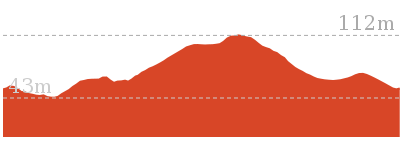
Cross sectional view of the Abbotts Falls Walking Track bushwalking track
Analysis and summary of the altitude variation on the Abbotts Falls Walking Track

Overview of this walks grade – based on the AS 2156.1 – 2001
Under this standard, a walk is graded based on the most difficult section of the walk.
| Length | 7.3 km | ||
| Time | 3 hrs | ||
| . | |||
| Grade 4/6 Hard track |
AS 2156.1 | Gradient | Very steep (4/6) |
| Quality of track | Rough track, where fallen trees and other obstacles are likely (4/6) | ||
| Signs | Directional signs along the way (3/6) | ||
| Experience Required | Moderate level of bushwalking experience recommended (4/6) | ||
| Weather | Weather generally has little impact on safety (1/6) | ||
| Infrastructure | Limited facilities (such as cliffs not fenced, significant creeks not bridged) (4/6) |
Some more details of this walks Grading
Here is a bit more details explaining grading looking at sections of the walk
Gradient
4.4km of this walk has gentle hills with occasional steps and another 2.5km has short steep hills. The remaining (400m) is very steep.
Quality of track
4.3km of this walk follows a clear and well formed track or trail and another 2km follows a formed track, with some branches and other obstacles. The remaining (1km) follows a rough track, where fallen trees and other obstacles are likely.
Signs
Around 6km of this walk is clearly signposted, whilst the remaining 1.7km has directional signs at most intersection.
Experience Required
5km of this walk requires no previous bushwalking experience and another 2.3km requires some bushwalking experience. The remaining (30m) requires a leader a with moderate level of bushwalking experience.
weather
This whole walk, 7km is not usually affected by severe weather events (that would unexpectedly impact safety and navigation).
Infrastructure
4.5km of this walk is close to useful facilities (such as fenced cliffs and seats) and another 2.8km has limited facilities (such as not all cliffs fenced). The remaining (30m) has limited facilities (such as cliffs not fenced, significant creeks not bridged).
Similar walks
A list of walks that share part of the track with the Abbotts Falls Walking Track walk.
1.7 km Circuit
45 mins
Moderate track
Other Nearby walks
A list of walks that start near the Abbotts Falls Walking Track walk.
1.9 km Circuit
2 hrs 30 mins
Hard track
1.5 km Return
1 Hr
Moderate track
17.8 km One way
7 hrs
Hard track
4.1 km One way
2 hrs
Hard track

12.6 km One way
5 hrs 30 mins
Hard track
29.7 km One way
2 Days
Hard track
17.2 km One way
7 hrs
Hard track
406 m Return
30 mins
Hard track
13.8 km One way
5 hrs
Hard track
1.3 km Circuit
45 mins
Moderate track
4.4 km Return
3 hrs 30 mins
Moderate track
13 km One way
6 hrs
Hard track

Plan your trip to and from the walk here
The Abbotts Falls Walking Track walk starts and ends at the Pines Camping Area (gps: -33.062918, 151.33661)
Your main transport option to Pines Camping Area is by;
![]() Car. There is free parking available.
Car. There is free parking available.
(get details)
Short URL = http://wild.tl/afwt
Gallery images
There are other downloads I am still working on.
You will probably need to login to access these — still all free.
* KML (google earth file)
* GPX (GPS file)
Special Maps/ brochures
* A3 topo maps
* PDF with Lands Topo map base
* PDF with arial image (and map overlay)
I wanted to get the main site live first, this extra stuff will come in time.
Happy walking
Matt 🙂
Moss Wall Walk
And Walk
Moss Wall Walk

15 mins
516 m Return
22 m
Moderate track
A gentle walk past the Boarding House dam and through moist rainforest to a long straight moss covered wall. Spend some time exploring the creek and pools beside the moss wall before retracing your steps back to the Boarding House dam picnic area and car park. A cool sheltered spot to relax, particularly on a hot summer day.


Boarding House Dam Picnic Area
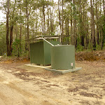
The boarding house dam picnic area in the Watagans National Park offers a relaxed spot to have a picnic amongst large gum trees[1], combined with a walk to the dam and moss wall. The picnic area is surrounded by a wide, sleepy creek that has been widened by the dam. There are a number of sheltered picnic tables, barbeques, a toilet[2], and water (treat water before use – water maybe unavailable).
The dam was built in 1952 for fire fighting and recreational use. The area was established in the 1850s as a logging camp, as part of the Barnier Timber Lease. Now it is a great picnic area,
The dam was built in 1952 for fire fighting and recreational use. The area was established in the 1850s as a logging camp, as part of the Barnier Timber Lease. Now it is a great picnic area,
(0km) Boarding House Dam Picnic Area → Int of Boarding House Dam loop
100 m
2 mins
3m
-4m
Easy track
From the boarding house dam picnic area[4], this walk follows the track gently up timber steps[5], keeping the very large tree stump[6] and dam[7] on your right. This walk follows the track (with a concrete dam[8] on the right) for about 45m, before descending gently on a track and timber steps[9] for about 30m, until coming to a three-way intersection[10], with a track (on the left) and footbridge[11] (on the right).
(0.1km) Int of Boarding House Dam loop → Moss wall Bridge
160 m
4 mins
11m
-4m
Moderate track
Continue straight: From the intersection[12], this walk follows the track up timber steps[13] initially away from the creek, but keeping the creek to your right. This walk follows the track gently downhill (turning left at a timber track marker[14]) for about 90m, to find the northern end of a long straight moss wall[15]. This walk then follows the track (at the base of the moss wall[16]) for about 100m, until coming to a three-way intersection[17], with a bridge on the right (at the southern end of the moss wall).
Maps for the Moss Wall Walk walk
You can download the PDF for this walk to print a map.
These maps below cover the walk and the wider area around the walk, they are worth carrying for safety reasons.
| Quorrobolong | 1:25 000 Map Series | 91322S QUORROBOLONG | NSW-91322S |
| Morisset | 1:25 000 Map Series | 91311N MORISSET | NSW-91311N |
| Cessnock | 1:50 000 Map Series | 91322 CESSNOCK | CW-91322 |
| Cessnock | 1:100 000 Map Series | 9132 CESSNOCK | 9132 |
| Gosford | 1:100 000 Map Series | 9131 GOSFORD | 9131 |
Cross sectional view of the Moss Wall Walk bushwalking track
Analysis and summary of the altitude variation on the Moss Wall Walk
Overview of this walks grade – based on the AS 2156.1 – 2001
Under this standard, a walk is graded based on the most difficult section of the walk.
| Length | 516 m | ||
| Time | 15 mins | ||
| . | |||
| Grade 3/6 Moderate track |
AS 2156.1 | Gradient | Gentle hills with occasional steps (2/6) |
| Quality of track | Formed track, with some branches and other obstacles (3/6) | ||
| Signs | Directional signs along the way (3/6) | ||
| Experience Required | Some bushwalking experience recommended (3/6) | ||
| Weather | Weather generally has little impact on safety (1/6) | ||
| Infrastructure | Generally useful facilities (such as fenced cliffs and seats) (1/6) |
Some more details of this walks Grading
Here is a bit more details explaining grading looking at sections of the walk
Gradient
This whole walk, 260m has gentle hills with occasional steps.
Quality of track
Around 160m of this walk follows a formed track, with some branches and other obstacles, whilst the remaining 100m follows a clear and well formed track or trail.
Signs
Around 160m of this walk has directional signs at most intersection, whilst the remaining 100m is clearly signposted.
Experience Required
Around 160m of this walk requires some bushwalking experience, whilst the remaining 100m requires no previous bushwalking experience.
weather
This whole walk, 260m is not usually affected by severe weather events (that would unexpectedly impact safety and navigation).
Infrastructure
This whole walk, 260m is close to useful facilities (such as fenced cliffs and seats).
Similar walks
A list of walks that share part of the track with the Moss Wall Walk walk.
718 m Circuit
30 mins
Moderate track
Other Nearby walks
A list of walks that start near the Moss Wall Walk walk.
12.5 km One way
6 hrs
Hard track
8.1 km One way
4 hrs
Hard track
1.5 km Return
1 Hr
Moderate track
1.7 km Return
1 Hr
Hard track
406 m Return
30 mins
Hard track
1.3 km Circuit
45 mins
Moderate track
4.3 km One way
2 hrs
Hard track
5.6 km Circuit
2 hrs 30 mins
Hard track
2.5 km Circuit
1 Hr
Hard track
4.4 km Return
3 hrs 30 mins
Moderate track
29.7 km One way
2 Days
Hard track
17.2 km One way
7 hrs
Hard track
Plan your trip to and from the walk here
The Moss Wall Walk walk starts and ends at the Boarding House Dam Picnic Area (gps: -32.9985, 151.40554)
Your main transport option to Boarding House Dam Picnic Area is by;
![]() Car. There is free parking available.
Car. There is free parking available.
(get details)
Short URL = http://wild.tl/mww
Gallery images
There are other downloads I am still working on.
You will probably need to login to access these — still all free.
* KML (google earth file)
* GPX (GPS file)
Special Maps/ brochures
* A3 topo maps
* PDF with Lands Topo map base
* PDF with arial image (and map overlay)
I wanted to get the main site live first, this extra stuff will come in time.
Happy walking
Matt 🙂
Watagan Headquarters to Heaton Lookout

4 hrs
8.1 km One way
571 m
Hard track
This scenic walk includes dramatic lookouts and time spent in moist cool forest. The walk initially travels on dirt road past Hunter and MacLean’s Lookout, before descending into the Wallis Creek catchment. Here the walk traverses underneath many cliffs before crossing Wallis Creek and arriving at Heaton Lookout. A recommended walk with car access either end.


Watagan Headquarters
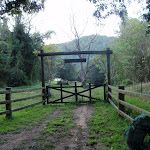
Watagan Headsquarters campsite[1] (aka Forestry HQ) is located in the Heaton State Forest, beside Bakers Rd, near Heaton Rd. This campsite has wood fired barbecues[2], picnic tables[3] and a garbage bin[4]. The large, flat, cleared area[5] allows plenty of room to pitch a tent. In 2010, a series of vandalism attacks occurred on the water tank, so there is no longer water available.
(0km) Forestry H.Q campsite → Hunter Lookout picnic area
1.6 km
27 mins
21m
-38m
Moderate track
From the intersection (Forestry H.Q. campsite)[6], this walk follows Bakers Road gently downhill[7], while keeping the GNW arrow marker on your right[8] and the large ‘Great North Walk’ sign[9] on your left. The walk continues, undulating gently for about 900m until coming to a three-way intersection with Rocky Creek Road[10] (on the right).
Continue straight: From the intersection[11], this walk follows Bakers Road north and gently uphill, while keeping Rocky Creek Road (no signpost) on your right. The walk continues, undulating gently for about 400m until coming to a three-way intersection with Glen Road[12] (on the right).
Continue straight: From the intersection[13], this walk follows Bakers Road gently uphill[14], while keeping Glen Road on your right. The walk continues, undulating gently for about 250m until coming to Hunter Lookout picnic area[15] (on the left).
Veer left: From the intersection, this walk heads off the road and up the hill following the Hunter Lookout picnic area sign, past the wooden gate and the public toilet, to the picnic area area and the lookout.
Hunter Lookout

Hunter Lookout[16] can be found on Bakers Road, along the Great North Walk. This fenced lookout has everything you will need snack-stop, including toilets[17], picnic tables, chairs and wood-fired barbecues[18]. This lookout has fantastic views[19] over much of the Hunter region[20]. In 2010, a series of vandalism attacks occurred on the water tank, so water is no longer available at Hunter Lookout.
(1.62km) Hunter Lookout picnic area → Int of GNW track & Bakers Road
670 m
15 mins
39m
-35m
Moderate track
Continue straight: From the picnic area, this walk heads north, past the metal gate to the intersection of Bakers Road.
Veer left: From the Hunter Lookout picnic area[21] (on Bakers Road), this walk follows Bakers Road north and gently downhill[22], while keeping Hunter Lookout on your left. The walk continues for about 400m until coming to a Y-intersection[23] (Bakers Road loop).
Veer right: From the intersection[24] (Bakers Road loop),this walk follows the Bakers Road loop gently downhill, while keeping the gently uphill Bakers Road loop on your left. The walk continues through forest for about 210m until coming to a three-way intersection[25] with a wide track and ‘The Great North Walk/Maclean Lookout’ sign[26] on the right.
(2.29km) Int of GNW track & Bakers Road → Maclean Lookout
100 m
2 mins
3m
-5m
Moderate track
Turn left: From the intersection[27], this walk follows Bakers Road gently uphill, while keeping the GNW arrow marker and views on your right. The walk continues for about 80m until coming to Mcleans Lookout[28] (on the right). At the end of this side trip, retrace your steps back to the main walk then Continue straight.
(2.29km) Int of GNW track & Bakers Road → Int of GNW track AND Glen Road
570 m
15 mins
21m
-83m
Hard track
Turn right: From the intersection[32], this walk follows the trail gently downhill[33], while keeping the ‘Heaton Lookout’ sign on your right. The walk continues (becoming moderately steep downhill) for about 280m until coming to a three-way intersection[34] with a track on the left.
Turn sharp right: From the intersection[35], this walk follows the track moderately steeply downhill[36], while keeping the GNW arrow marker on your left. The walk continues (descending moderately steeply into[37] and out[38] of a gully) for about 150m, until coming to a three-way intersection, Glen Road[39].
Turn sharp right: From the intersection[35], this walk follows the track moderately steeply downhill[36], while keeping the GNW arrow marker on your left. The walk continues (descending moderately steeply into[37] and out[38] of a gully) for about 150m, until coming to a three-way intersection, Glen Road[39].
(2.85km) Int of GNW track & Glen Road → Int of GNW track & a narrow road
860 m
25 mins
87m
-67m
Hard track
Turn left: From the intersection[40], this walk follows the track gently downhill[41], while keeping the ‘Glenn Rd’ sign[42] on your right. The walk continues through forest[43] for about 120m, until coming to a three-way intersection[44] with a track and GNW arrow marker (on the left).
Turn left : From the intersection[45], this walk follows the GNW arrow marker[46] moderately steeply down along the track[47]. The walk continues for about 100m, to find a forested mossy creek[48] where the track bend right and continues close to the creek[49] for about 70m to then bend left and crossing the creek. The walk now follows the track undulating gently for about 280m before finding a large rock overhang[50]. The walk then continues moderately steeply uphill[51] for about 200m until coming to a T-intersection[52] with a wide trail and GNW arrow marker[53].
Turn left : From the intersection[45], this walk follows the GNW arrow marker[46] moderately steeply down along the track[47]. The walk continues for about 100m, to find a forested mossy creek[48] where the track bend right and continues close to the creek[49] for about 70m to then bend left and crossing the creek. The walk now follows the track undulating gently for about 280m before finding a large rock overhang[50]. The walk then continues moderately steeply uphill[51] for about 200m until coming to a T-intersection[52] with a wide trail and GNW arrow marker[53].
(3.71km) Int of GNW track & a wide track → Int of GNW track and Hammonds Road
770 m
24 mins
89m
-85m
Hard track
Turn right: From the intersection[54], this walk follows ‘Watagan Forest Road’ sign[55] uphill[56] along the trail for about 200m to a three-way intersection[57], with another ‘Watagan Forest Road’ sign[58] (on your left).
Continue straight: From the intersection[59], this walk follows the wide track gently downhill, while keeping the ‘Macleans Lookout 2km’ sign[60] on your right. The walk continues for about 140m to a three-way intersection[61], with Fosters Road on your right and ‘Fosters Road’ sign[62] on your left.
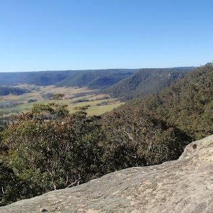
Continue straight: From the intersection[63], this walk follows the GNW arrow post down along the wide old trail[64], passing the ‘Fosters Road’ sign[65] on your left. The walk continues for about 100m, where the wide track then leads moderately steeply downhill[66] for about 150m more. The walk then crosses a gully[67] and heads up[68] over another rise for about 70m to where the track narrows then bends left at a GNW arrow post. About 180m past the post, the walk crosses a gully[69] then heads up the other side, past a termite mound[70] to an unfenced cliff with distance valley views[71]. Here the track bends right and leads up a short distance to a dirt road[72]. The walk turns left and follows the road down for just a few metres to the ‘Hammonds Road’ sign, where the ‘MacLean Lookout’ arrow[73] points back along the road.
Continue straight: From the intersection[59], this walk follows the wide track gently downhill, while keeping the ‘Macleans Lookout 2km’ sign[60] on your right. The walk continues for about 140m to a three-way intersection[61], with Fosters Road on your right and ‘Fosters Road’ sign[62] on your left.
Continue straight: From the intersection[63], this walk follows the GNW arrow post down along the wide old trail[64], passing the ‘Fosters Road’ sign[65] on your left. The walk continues for about 100m, where the wide track then leads moderately steeply downhill[66] for about 150m more. The walk then crosses a gully[67] and heads up[68] over another rise for about 70m to where the track narrows then bends left at a GNW arrow post. About 180m past the post, the walk crosses a gully[69] then heads up the other side, past a termite mound[70] to an unfenced cliff with distance valley views[71]. Here the track bends right and leads up a short distance to a dirt road[72]. The walk turns left and follows the road down for just a few metres to the ‘Hammonds Road’ sign, where the ‘MacLean Lookout’ arrow[73] points back along the road.
(4.48km) Int of GNW track and Hammonds Road → Int of GNW track and Wallis Creek
1.4 km
44 mins
113m
-214m
Hard track
Continue straight: From the intersection[74], this walk follows the ‘Heaton Lookout’ sign[75] downhill along the road a few metres, then veers left to follow the GNW arrow down the old trail[76]. The walk leads fairly steeply down for about 180m then passes around a timber barrier[77]. Here the track narrows and continues more steeply downhill[78] through forest for about 250m to a gully and creek crossing[79] (with many fallen dead trees[80]).
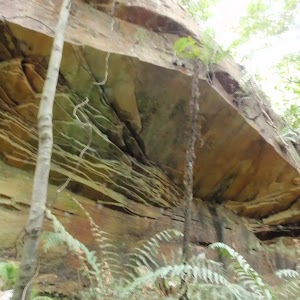
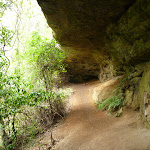
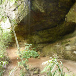
Continue straight: This walk crosses the creek[81] and follows the track, while keeping the valley on your left. The walk follows the track steeply up for a short distance, then follows along the base of a cliff[82] for about 120m to pass through a long sandstone cave[83]. The rocky track leads steeply down through the dense rainforest for 700m, following a series of GNW arrow posts to the bottom of the gully beside Wallis Creek[84].
Continue straight: This walk crosses the creek[81] and follows the track, while keeping the valley on your left. The walk follows the track steeply up for a short distance, then follows along the base of a cliff[82] for about 120m to pass through a long sandstone cave[83]. The rocky track leads steeply down through the dense rainforest for 700m, following a series of GNW arrow posts to the bottom of the gully beside Wallis Creek[84].
(5.93km) Int of GNW track and Wallis Creek → Int of GNW track and Barniers Road
1 km
30 mins
143m
0m
Hard track
Continue straight: From here, the walk crosses Wallis Creek[85], and follows the GNW arrows south gently uphill along the track. The walk continues (crossing over a tree trunk[86] with carved steps) and after about 500m, comes to a creek and a tree trunk with a directional arrow carving[87]. Then the walk follows the track[88] for about 130m (crossing the creek a number[89] of times) to find the track leaving the creek[90]. The track is followed moderately steeply uphill[91] through forest for about 400m, until coming to a level four-way intersection[92] with a ‘Barniers Road/Mt Faulk Road’ sign on your right.
(6.95km) Int of GNW track and Barniers Road → Int of GNW track and Heaton Lookout
1.2 km
29 mins
58m
-115m
Hard track
Continue straight: From the intersection[93], this walk follows the GNW arrow east, directly away from the face of the ‘Barniers Road’ sign[94]. The walk continues along the old trail for about 450m to find an intersection[95] with a track (on the right). Here the walk turns right, following the ‘The Great North Walk’ sign[96] moderately steeply down the narrow track[97] for about 220m and then crosses a creek[98]. The walk continues moderately steeply uphill[99] around another gully and after about 500m, comes to a T-intersection[100] with Heaton trail and Heaton Lookout[101] directly ahead.
Heaton Lookout
Heaton Lookout[102] is one of the larger lookouts located on Heaton Road. This fenced lookout faces south-east. There are wood fired barbecues[103], picnic tables[104] and a pit toilet[105]. Heaton Lookout is a great place to stop for a snack, and the amazing view[106] feels like a bonus. This lookout was named after Richard Heaton, a timber cutter who came to Australia as a convict. There is a water tank here, due to vandalism in the area this is not a reliable water source.
Maps for the Watagan Headquarters to Heaton Lookout walk
You can download the PDF for this walk to print a map.
These maps below cover the walk and the wider area around the walk, they are worth carrying for safety reasons.
| Quorrobolong | 1:25 000 Map Series | 91322S QUORROBOLONG | NSW-91322S |
| Cessnock | 1:50 000 Map Series | 91322 CESSNOCK | CW-91322 |
| Cessnock | 1:100 000 Map Series | 9132 CESSNOCK | 9132 |
Cross sectional view of the Watagan Headquarters to Heaton Lookout bushwalking track
Analysis and summary of the altitude variation on the Watagan Headquarters to Heaton Lookout
Overview of this walks grade – based on the AS 2156.1 – 2001
Under this standard, a walk is graded based on the most difficult section of the walk.
| Length | 8.1 km | ||
| Time | 4 hrs | ||
| . | |||
| Grade 4/6 Hard track |
AS 2156.1 | Gradient | Very steep (4/6) |
| Quality of track | Rough track, where fallen trees and other obstacles are likely (4/6) | ||
| Signs | Minimal directional signs (4/6) | ||
| Experience Required | Moderate level of bushwalking experience recommended (4/6) | ||
| Weather | Storms may impact on navigation and safety (3/6) | ||
| Infrastructure | Limited facilities (such as cliffs not fenced, significant creeks not bridged) (4/6) |
Some more details of this walks Grading
Here is a bit more details explaining grading looking at sections of the walk
Gradient
3.6km of this walk is very steep and another 2.7km has short steep hills. The remaining (1.8km) has gentle hills with occasional steps.
Quality of track
3.2km of this walk follows a rough track, where fallen trees and other obstacles are likely and another 2.8km follows a formed track, with some branches and other obstacles. The remaining (2.1km) follows a clear and well formed track or trail.
Signs
Around 4.4km of this walk has directional signs at most intersection, whilst the remaining 3.7km has minimal directional signs.
Experience Required
3km of this walk requires some bushwalking experience and another 2.6km requires a leader a with moderate level of bushwalking experience. The remaining (2.6km) requires no previous bushwalking experience.
weather
Around 6km of this walk is not usually affected by severe weather events (that would unexpectedly impact safety and navigation), whilst the remaining 1.7km is affected by storms that may impact your navigation and safety.
Infrastructure
4km of this walk has limited facilities (such as not all cliffs fenced) and another 3.9km has limited facilities (such as cliffs not fenced, significant creeks not bridged). The remaining (270m) is close to useful facilities (such as fenced cliffs and seats).
Similar walks
A list of walks that share part of the track with the Watagan Headquarters to Heaton Lookout walk.
2.5 km Circuit
1 Hr
Hard track
5.6 km Circuit
2 hrs 30 mins
Hard track
12.5 km One way
6 hrs
Hard track
29.7 km One way
2 Days
Hard track
60.5 km One way
4 Days
Hard track
Other Nearby walks
A list of walks that start near the Watagan Headquarters to Heaton Lookout walk.
718 m Circuit
30 mins
Moderate track
516 m Return
15 mins
Moderate track
4.3 km One way
2 hrs
Hard track
4.4 km Return
3 hrs 30 mins
Moderate track
14.8 km One way
6 hrs
Hard track
1.5 km Return
1 Hr
Moderate track
1.7 km Return
1 Hr
Hard track
406 m Return
30 mins
Hard track
1.3 km Circuit
45 mins
Moderate track
17.2 km One way
7 hrs
Hard track
13.8 km One way
5 hrs
Hard track
13.3 km One way
4 hrs 30 mins
Moderate track

Plan your trip to and from the walk here
The Watagan Headquarters to Heaton Lookout walk starts at the Forestry H.Q campsite (gps: -32.9756, 151.4117)
Your main transport option to Forestry H.Q campsite is by;
![]() Car. There is free parking available.
Car. There is free parking available.
(get details)
The Watagan Headquarters to Heaton Lookout ends at the Int of GNW track and Heaton Lookout (gps: -32.983668, 151.45483)
Your main transport option to Int of GNW track and Heaton Lookout is by;
![]() Car. There is free parking available.
Car. There is free parking available.
(get details)
Short URL = http://wild.tl/whthl
Gallery images
There are other downloads I am still working on.
You will probably need to login to access these — still all free.
* KML (google earth file)
* GPX (GPS file)
Special Maps/ brochures
* A3 topo maps
* PDF with Lands Topo map base
* PDF with arial image (and map overlay)
I wanted to get the main site live first, this extra stuff will come in time.
Happy walking
Matt 🙂
Mt Sugarloaf Summit
And Walk
Mt Sugarloaf Summit

30 mins
534 m Return
48 m
Moderate track
This summit walk to Mt Sugarloaf offers fabulous 360 degree views and is highly recommended. This short but steep walk follows a wide trail, which narrows to become fenced steps directly to the summit. From the summit, you can see across the surrounding plains, with the views of Newcastle, Lake Macquarie and the ocean which are quite spectacular. This walk is often enjoyed by families and children and is highly recommended.


Mount Sugarloaf Car Park

Mount Sugarloaf car park is located in West Wallsend (25km west of Newcastle) and offers fabulous views[1] of the surrounding countryside. This car park is the starting point for many walks around Mount Sugarloaf. There is a pond[2], information sign[3] and great views to the east. More info.
(0km) Mt Sugarloaf Carpark → Yellow Stone Monument
30 m
1 mins
1m
0m
Easy track
(0.03km) Yellow Stone Monument → Int of Summit & Red Track
50 m
2 mins
14m
0m
Easy track
Turn left: From the intersection[7] and yellow stone monument[8], this walk follows the road towards a locked gate[9] (with a metal ring fence to its right). The walk follows the road for about 20m then passes around the locked gate. Then the walk follows the road gently uphill[10] (with metal ring fence on the right) for about 35m, until coming to a three-way intersection[11] with a track and timber track marker[12] (on the right).
(0.08km) Int of Summit & Red Track → Int of Summit Track & Fenced Tower
120 m
4 mins
22m
0m
Moderate track
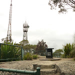
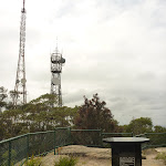
(0.19km) Int of Summit Track & Fenced Tower → Mt Sugarloaf Summit
70 m
2 mins
8m
-3m
Moderate track
Continue straight: From the fenced tower[18], this walk follows the footpath moderately steeply uphill, while keeping the fenced tower on your right. The footpath[19] (with a metal fence[20] either side) is followed up metal[21] and stone[22] steps for about 40m, until coming to Mt Sugarloaf summit[23].
Mount Sugarloaf Summit

Mount Sugarloaf Summit is located in West Wallsend (25km west of Newcastle) and offers fabulous views[24] of the surrounding countryside from a fenced lookout[25]. The summit gives 360-degree views amongst three television transmitters of the coast and mountains. There is a black stone direction table[27] to help you locate landmarks in the surrounding country. Mount Sugarloaf, also known as Great Sugar Loaf, is an extinct volcano. Unusually, on the 18th and 19th of July 1965, the mountain received 10 centimetres (4 in) of snow. It also snowed on the summit in the winter of 1975 . More info.
Maps for the Mt Sugarloaf Summit walk
You can download the PDF for this walk to print a map.
These maps below cover the walk and the wider area around the walk, they are worth carrying for safety reasons.
| Wallsend | 1:25 000 Map Series | 92323S WALLSEND | NSW-92323S |
| Newcastle | 1:100 000 Map Series | 9232 NEWCASTLE | 9232 |
Cross sectional view of the Mt Sugarloaf Summit bushwalking track
Analysis and summary of the altitude variation on the Mt Sugarloaf Summit
Overview of this walks grade – based on the AS 2156.1 – 2001
Under this standard, a walk is graded based on the most difficult section of the walk.
| Length | 534 m | ||
| Time | 30 mins | ||
| . | |||
| Grade 3/6 Moderate track |
AS 2156.1 | Gradient | Short steep hills (3/6) |
| Quality of track | Clear and well formed track or trail (2/6) | ||
| Signs | Clearly signposted (1/6) | ||
| Experience Required | No experience required (1/6) | ||
| Weather | Weather generally has little impact on safety (1/6) | ||
| Infrastructure | Generally useful facilities (such as fenced cliffs and seats) (1/6) |
Some more details of this walks Grading
Here is a bit more details explaining grading looking at sections of the walk
Gradient
Around 190m of this walk has short steep hills, whilst the remaining 80m has gentle hills with occasional steps.
Quality of track
This whole walk, 270m follows a clear and well formed track or trail.
Signs
This whole walk, 270m is clearly signposted.
Experience Required
This whole walk, 270m requires no previous bushwalking experience.
weather
This whole walk, 270m is not usually affected by severe weather events (that would unexpectedly impact safety and navigation).
Infrastructure
This whole walk, 270m is close to useful facilities (such as fenced cliffs and seats).
Similar walks
A list of walks that share part of the track with the Mt Sugarloaf Summit walk.
800 m Circuit
1 Hr
Moderate track
1.8 km Circuit
1 hr 30 mins
Moderate track
3.8 km Circuit
1 hr 45 mins
Moderate track

Other Nearby walks
A list of walks that start near the Mt Sugarloaf Summit walk.
13.3 km One way
4 hrs 30 mins
Moderate track
25.7 km One way
2 Days
Hard track
14.8 km One way
6 hrs
Hard track
1.9 km Circuit
1 Hr
Moderate track
2.7 km Circuit
1 Hr
Moderate track
6.5 km Circuit
2 hrs 30 mins
Moderate track

2.8 km Circuit
1 hr 15 mins
Moderate track
2.9 km Circuit
1 hr 15 mins
Moderate track

6 km Circuit
2 hrs 30 mins
Moderate track

731 m Circuit
30 mins
Very easy

1.2 km Return
30 mins
Very easy
945 m One way
30 mins
Easy track
Plan your trip to and from the walk here
The Mt Sugarloaf Summit walk starts and ends at the Mt Sugarloaf Carpark (gps: -32.890649, 151.53942)
Your main transport option to Mt Sugarloaf Carpark is by;
![]() Car. There is free parking available.
Car. There is free parking available.
(get details)
Short URL = http://wild.tl/mss
Gallery images
There are other downloads I am still working on.
You will probably need to login to access these — still all free.
* KML (google earth file)
* GPX (GPS file)
Special Maps/ brochures
* A3 topo maps
* PDF with Lands Topo map base
* PDF with arial image (and map overlay)
I wanted to get the main site live first, this extra stuff will come in time.
Happy walking
Matt 🙂
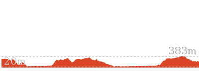
Cedar Brush to Basin Campsite
And Walk
Cedar Brush to Basin Campsite

4 hrs 30 mins
9.7 km One way
590 m
Hard track
This section of the Great North Walk makes a good walk to a comfortable campsite, with the section along the Lyrebird Trail by the Wollombi Brook being particularly recommended. From the Cedar Brush track head, the walk winds up into the Olney State Forest through bushland (crossing over two moist gullies). Once most of your height is gained, this walk follows unsealed road before dropping down into the Wollombi Brook gully. From here, the walk follows bush tracks along Lyrebird Trail and to the Basin Campsite.


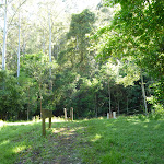


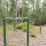
(0km) Cedar Brush Track Head → Int of GNW track & Kingtree Ridge Fire Road
2 km
58 mins
266m
-38m
Hard track
From the signposted ‘Cedar Brush Creek Trackhead’[1][2] (on Brush Creek Road[3]), this walk crosses the stile[4] and follows the track gently downhill[5], while following the ‘Newcastle’ sign[6]. The walk continues for about 220m then crosses a timber and metal bridge[7]. On the other side of the bridge, the walk heads gently uphill[8], past the ‘Please keep on track’ sign[9], then about 100m later this walk comes to ‘The Great North Walk Walkers Register’ book on a post[10] – a good place to note your intentions. Now in a denser forest, the track begins to wind moderately steeply uphill[11] (crossing over two moist gullies[12][13]) for about 1.5km until coming to a three-way intersection[14][15] with Kingtree Ridge Road.
(1.98km) Int of GNW track & Kingtree Ridge Fire Road → GNW rest area
120 m
3 mins
8m
0m
Moderate track
(2.1km) GNW rest area → Int of Kingtree Ridge & Walkers Ridge Roads
3.4 km
1 hr 4 mins
115m
-44m
Moderate track
Continue straight: From the GNW rest area[23][24], this walk follows the dirt Kingtree Ridge Road gently uphill[25], whilst initially keeping the rest area on your left. The walk follows the series of GNW arrow markers, ignoring a few side roads[26] for about 3.4km, until coming to a T-intersection[27][28][29] with the dirt Walkers Ridge Road, marked with a ‘Walkers Rest Area 3.4 km’ sign[30] pointing back along the road.
(5.47km) Int of Kingtree Ridge and Walkers Ridge Roads → Int of GNW & an unsealed road
740 m
15 mins
23m
-25m
Moderate track
Turn left: From the intersection, this walk heads along Walkers Ridge Road, following the Great North Walk arrow west over the hill, past Bobs Point Rd (on the left) and coming down the other side to the signposted intersection on the Great North Walk.
Veer right: From the intersection[31][32], this walk follows ‘The Great North Walk’ sign[33] and GNW arrow marker north east along the dirt road. The walk continues through forest (ignoring side roads[34]) as it leads over a gentle rise for about 400m, then comes to a three-way intersection[35][36] with a trail (on the left) marked with ‘The Great North Walk’ sign[37].
Veer right: From the intersection[31][32], this walk follows ‘The Great North Walk’ sign[33] and GNW arrow marker north east along the dirt road. The walk continues through forest (ignoring side roads[34]) as it leads over a gentle rise for about 400m, then comes to a three-way intersection[35][36] with a trail (on the left) marked with ‘The Great North Walk’ sign[37].
(6.22km) Int of GNW AND an unsealed road → Int of GNW AND Lyrebird trail
1.3 km
34 mins
49m
-200m
Hard track
Turn left : From the intersection[38][39], this walk follows the ‘The Great North Walk’ sign[40] south-west, gently downhill[41] along the fairly wide trail. The walk continues down for about 400m, becoming moderately steep partway [42], to come to an intersection marked with a GNW arrow marker[43] (pointing right)[44][45].
Turn right: From the intersection[46][47], this walk follows the GNW arrow post east along the narrow track, which soon bends left and crosses the trail (just below the last intersection). Here, this walk follows the GNW arrow post moderately steeply downhill[48] along the track, and down some stone steps for about 50m. The walk continues for about 700m along the side of the hill. Here the track leads steeply downhill, down a series of timber[49] and rock steps[50] for another 150m, to find a T-intersection[51][52] with the ‘Lyrebird Trail’, also marked with a ‘Basin camping area’ sign[53].
Turn right: From the intersection[46][47], this walk follows the GNW arrow post east along the narrow track, which soon bends left and crosses the trail (just below the last intersection). Here, this walk follows the GNW arrow post moderately steeply downhill[48] along the track, and down some stone steps for about 50m. The walk continues for about 700m along the side of the hill. Here the track leads steeply downhill, down a series of timber[49] and rock steps[50] for another 150m, to find a T-intersection[51][52] with the ‘Lyrebird Trail’, also marked with a ‘Basin camping area’ sign[53].
(7.5km) Int of GNW tracks AND Lyrebird Trail → Int of Rock Lilly AND Lyrebird trails
1.9 km
47 mins
125m
-139m
Moderate track
Turn sharp left: From the intersection[54], this walk follows the ‘Basin Camping Area’ sign[55] along the track, while keeping Wollombi Brook on your right. The walk continues through dense vine and mossy forest as the track gently undulates along the side of the gully. Over the first 700m, the track leads past a few sandstone caves[56][57] and crosses over several small creeks. The walk then continues for another 1.2km, where the track enters a more open forest on a saddle[58][59]. At the edge of this saddle is an intersection with the Rock Lilly trail (signposted ‘The Basin Camping Area’ sign[60] on the right) and a GNW arrow marker[61] pointing directly ahead (also leading to the Basin campsite).
(9.36km) Int of Rock Lilly and Lyrebird trails → Basin Campsite
340 m
7 mins
4m
-41m
Moderate track
Continue straight: From the intersection on the saddle[62][63], this walk follows the GNW arrow marker gently downhill[64] heading west[65] (directly away from ‘The Basin Camping Area’ sign[66]). The walk continues through tall open forest[67][68] for about 300m, until coming to the large open clearing and Basin campsite[69][70].
Basin Campsite
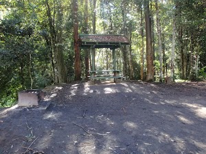
This large campsite sits by Wollombi Brook on the Great North Walk[71] and is accessible by car. The campsite provides a range of facilities such as a pit toilet[72], picnic tables and chairs[73], wood BBQs[74] and fireplaces[75]. Water is usually available from the water tank[76] or the nearby creek[77] – treat before use.
Maps for the Cedar Brush to Basin Campsite walk
You can download the PDF for this walk to print a map.
These maps below cover the walk and the wider area around the walk, they are worth carrying for safety reasons.
| Murrays Run | 1:25 000 Map Series | 91314N MURRAYS RUN | NSW-91314N |
| Dooralong | 1:25 000 Map Series | 91311S DOORALONG | NSW-91311S |
| Morisset | 1:25 000 Map Series | 91311N MORISSET | NSW-91311N |
| Gosford | 1:100 000 Map Series | 9131 GOSFORD | 9131 |
Cross sectional view of the Cedar Brush to Basin Campsite bushwalking track
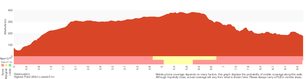
Analysis and summary of the altitude variation on the Cedar Brush to Basin Campsite
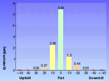
Overview of this walks grade – based on the AS 2156.1 – 2001
Under this standard, a walk is graded based on the most difficult section of the walk.
| Length | 9.7 km | ||
| Time | 4 hrs 30 mins | ||
| . | |||
| Grade 4/6 Hard track |
AS 2156.1 | Gradient | Very steep (4/6) |
| Quality of track | Formed track, with some branches and other obstacles (3/6) | ||
| Signs | Directional signs along the way (3/6) | ||
| Experience Required | Some bushwalking experience recommended (3/6) | ||
| Weather | Weather generally has little impact on safety (1/6) | ||
| Infrastructure | Limited facilities (such as cliffs not fenced, significant creeks not bridged) (4/6) |
Some more details of this walks Grading
Here is a bit more details explaining grading looking at sections of the walk
Gradient
3.7km of this walk has gentle hills with occasional steps and another 3.1km has short steep hills. The remaining (2.9km) is very steep.
Quality of track
Around 5km of this walk follows a formed track, with some branches and other obstacles, whilst the remaining 4.2km follows a clear and well formed track or trail.
Signs
Around 9km of this walk has directional signs at most intersection, whilst the remaining 370m is clearly signposted.
Experience Required
Around 4.9km of this walk requires some bushwalking experience, whilst the remaining 4.8km requires no previous bushwalking experience.
weather
This whole walk, 10km is not usually affected by severe weather events (that would unexpectedly impact safety and navigation).
Infrastructure
8km of this walk has limited facilities (such as not all cliffs fenced) and another 910m has limited facilities (such as cliffs not fenced, significant creeks not bridged). The remaining (340m) is close to useful facilities (such as fenced cliffs and seats).
Similar walks
A list of walks that share part of the track with the Cedar Brush to Basin Campsite walk.
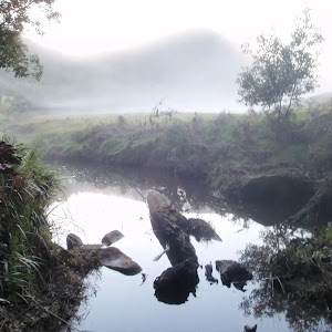
9.7 km One way
4 hrs
Hard track
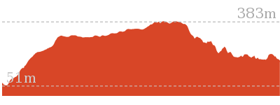
13 km One way
6 hrs
Hard track

13 km One way
6 hrs
Hard track
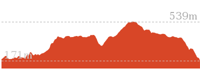
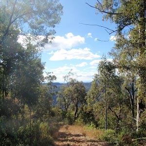
33.7 km One way
2 Days
Hard track

47.4 km One way
3 Days
Hard track
60.5 km One way
4 Days
Hard track
Other Nearby walks
A list of walks that start near the Cedar Brush to Basin Campsite walk.
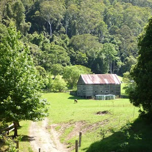
11 km One way
3 hrs 30 mins
Easy track
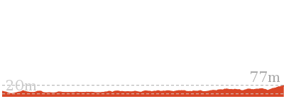
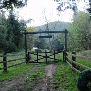
17 km One way
6 hrs 30 mins
Hard track
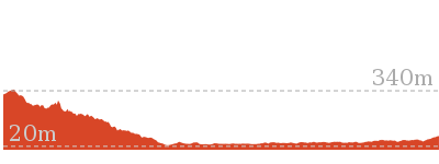
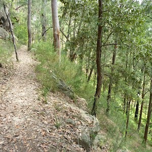
5.6 km One way
2 hrs 45 mins
Hard track
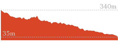
1.9 km Circuit
2 hrs 30 mins
Hard track
1.5 km Return
1 Hr
Moderate track
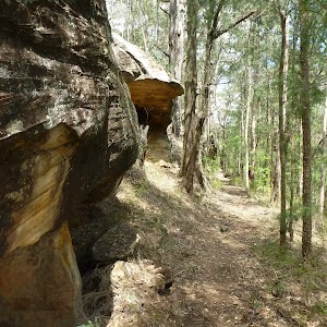
8.1 km One way
3 hrs 30 mins
Hard track
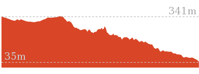
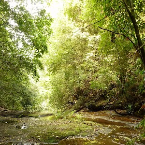
7.3 km Circuit
3 hrs
Hard track

1.7 km Circuit
45 mins
Moderate track
12.6 km One way
5 hrs 30 mins
Hard track
17.8 km One way
7 hrs
Hard track
4.1 km One way
2 hrs
Hard track
13.8 km One way
5 hrs
Hard track
Plan your trip to and from the walk here
The Cedar Brush to Basin Campsite walk starts at the Cedar Brush Track Head (gps: -33.1427, 151.25619)
Your main transport option to Cedar Brush Track Head is by;
![]() Car. There is free parking available.
Car. There is free parking available.
(get details)
The Cedar Brush to Basin Campsite ends at the Basin Campsite (gps: -33.104008, 151.23088)
Your main transport option to Basin Campsite is by;
![]() Car. There is free parking available.
Car. There is free parking available.
(get details)
Short URL = http://wild.tl/cbtbc
Gallery images
There are other downloads I am still working on.
You will probably need to login to access these — still all free.
* KML (google earth file)
* GPX (GPS file)
Special Maps/ brochures
* A3 topo maps
* PDF with Lands Topo map base
* PDF with arial image (and map overlay)
I wanted to get the main site live first, this extra stuff will come in time.
Happy walking
Matt 🙂
Boarding House Dam Circuit
And Walk
Boarding House Dam Circuit

30 mins
718 m Circuit
36 m
Moderate track
This a cool walk on a on a hot day. Take your time exploring the rock formations along the creek, before finding the moss wall. Walk alongside the moss wall to its end, and then follow a track through moist rainforest back to the dam. A pleasant relaxed walk starting and finishing from the Boarding House Dam picnic area.


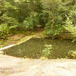
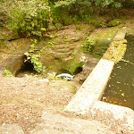
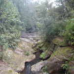

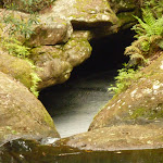


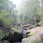

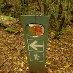

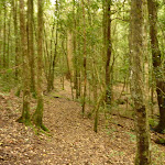

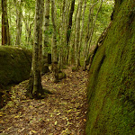


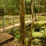

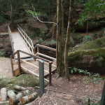
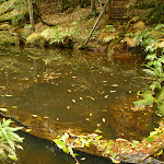
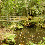


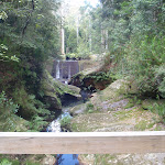

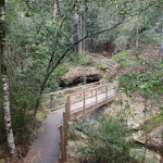
Boarding House Dam Picnic Area
The boarding house dam picnic area in the Watagans National Park offers a relaxed spot to have a picnic amongst large gum trees[1], combined with a walk to the dam and moss wall. The picnic area is surrounded by a wide, sleepy creek that has been widened by the dam. There are a number of sheltered picnic tables, barbeques, a toilet[2], and water (treat water before use – water maybe unavailable).
The dam was built in 1952 for fire fighting and recreational use. The area was established in the 1850s as a logging camp, as part of the Barnier Timber Lease. Now it is a great picnic area,
The dam was built in 1952 for fire fighting and recreational use. The area was established in the 1850s as a logging camp, as part of the Barnier Timber Lease. Now it is a great picnic area,
(0km) Boarding House Dam Picnic Area → Int of Boarding House Dam loop
100 m
2 mins
3m
-4m
Easy track
From the boarding house dam picnic area[4], this walk follows the track gently up timber steps[5], keeping the very large tree stump[6] and dam[7] on your right. This walk follows the track (with a concrete dam[8] on the right) for about 45m, before descending gently on a track and timber steps[9] for about 30m, until coming to a three-way intersection[10], with a track (on the left) and footbridge[11] (on the right).
(0.1km) Int of Boarding House Dam loop → Moss Wall Bridge
360 m
9 mins
25m
-22m
Moderate track
Turn right: From the intersection[12], this walk follows the track down steps and over the footbridge[13], crossing the creek. The walk continues through moist forest for about 50m then crosses a timber footbridge[14]. The track continues gently downhill for about 180m, to find another timber track marker[15] and footbridge[16] (on the left).
(0.46km) Moss wall Bridge → Boarding House Dam Picnic Area
260 m
6 mins
8m
-14m
Moderate track
Turn left: From the intersection[19], this walk follows the track (at the base of the moss wall[20]) north, with the moss wall on your right. After about 100m, the walk comes to the end of the moss wall. This walk continues to follow the track gently uphill (with the creek on the left and passing a timber track marker[21]) for about 90m, until descending timber steps[22] to a three-way intersection, with a bridge[23] on your left.
Continue straight: From the intersection[24], this walk follows the track gently up timber steps[25], with the creek and dam on your left. This walk follows the track (up timber steps[26] at one stage) for about 30m, to find a high point and views into the dam. This walk continues gently downhill[27] (with occasional timber steps) for about 45m, until coming to the boarding house dam picnic area[28] and car park.
Continue straight: From the intersection[24], this walk follows the track gently up timber steps[25], with the creek and dam on your left. This walk follows the track (up timber steps[26] at one stage) for about 30m, to find a high point and views into the dam. This walk continues gently downhill[27] (with occasional timber steps) for about 45m, until coming to the boarding house dam picnic area[28] and car park.
Maps for the Boarding House Dam Circuit walk
You can download the PDF for this walk to print a map.
These maps below cover the walk and the wider area around the walk, they are worth carrying for safety reasons.
| Quorrobolong | 1:25 000 Map Series | 91322S QUORROBOLONG | NSW-91322S |
| Morisset | 1:25 000 Map Series | 91311N MORISSET | NSW-91311N |
| Cessnock | 1:50 000 Map Series | 91322 CESSNOCK | CW-91322 |
| Cessnock | 1:100 000 Map Series | 9132 CESSNOCK | 9132 |
| Gosford | 1:100 000 Map Series | 9131 GOSFORD | 9131 |
Cross sectional view of the Boarding House Dam Circuit bushwalking track
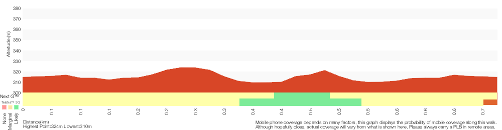
Analysis and summary of the altitude variation on the Boarding House Dam Circuit
Overview of this walks grade – based on the AS 2156.1 – 2001
Under this standard, a walk is graded based on the most difficult section of the walk.
| Length | 718 m | ||
| Time | 30 mins | ||
| . | |||
| Grade 3/6 Moderate track |
AS 2156.1 | Gradient | Gentle hills with occasional steps (2/6) |
| Quality of track | Formed track, with some branches and other obstacles (3/6) | ||
| Signs | Directional signs along the way (3/6) | ||
| Experience Required | Some bushwalking experience recommended (3/6) | ||
| Weather | Weather generally has little impact on safety (1/6) | ||
| Infrastructure | Limited facilities, not all cliffs are fenced (3/6) |
Some more details of this walks Grading
Here is a bit more details explaining grading looking at sections of the walk
Gradient
This whole walk, 720m has gentle hills with occasional steps.
Quality of track
Around 520m of this walk follows a formed track, with some branches and other obstacles, whilst the remaining 200m follows a clear and well formed track or trail.
Signs
Around 560m of this walk is clearly signposted, whilst the remaining 160m has directional signs at most intersection.
Experience Required
Around 560m of this walk requires no previous bushwalking experience, whilst the remaining 160m requires some bushwalking experience.
weather
This whole walk, 720m is not usually affected by severe weather events (that would unexpectedly impact safety and navigation).
Infrastructure
Around 360m of this walk has limited facilities (such as not all cliffs fenced), whilst the remaining 360m is close to useful facilities (such as fenced cliffs and seats).
Similar walks
A list of walks that share part of the track with the Boarding House Dam Circuit walk.
516 m Return
15 mins
Moderate track
Other Nearby walks
A list of walks that start near the Boarding House Dam Circuit walk.
12.5 km One way
6 hrs
Hard track
8.1 km One way
4 hrs
Hard track
1.5 km Return
1 Hr
Moderate track
1.7 km Return
1 Hr
Hard track
406 m Return
30 mins
Hard track
1.3 km Circuit
45 mins
Moderate track
4.3 km One way
2 hrs
Hard track
5.6 km Circuit
2 hrs 30 mins
Hard track
2.5 km Circuit
1 Hr
Hard track
4.4 km Return
3 hrs 30 mins
Moderate track
29.7 km One way
2 Days
Hard track
17.2 km One way
7 hrs
Hard track
Plan your trip to and from the walk here
The Boarding House Dam Circuit walk starts and ends at the Boarding House Dam Picnic Area (gps: -32.9985, 151.40554)
Your main transport option to Boarding House Dam Picnic Area is by;
![]() Car. There is free parking available.
Car. There is free parking available.
(get details)
Short URL = http://wild.tl/bhdl
Gallery images
There are other downloads I am still working on.
You will probably need to login to access these — still all free.
* KML (google earth file)
* GPX (GPS file)
Special Maps/ brochures
* A3 topo maps
* PDF with Lands Topo map base
* PDF with arial image (and map overlay)
I wanted to get the main site live first, this extra stuff will come in time.
Happy walking
Matt 🙂
Basin campsite to Watagan Valley
And Walk
Basin campsite to Watagan Valley

6 hrs
13 km One way
784 m
Hard track
This varied walk travels north through the Watagans. Leaving the Basin campsite behind, the walk traverses the Wollombi Brook via the Lyrebird trail. The Wollombi Brook Pool is a great spot to stop (and take a swim) on a hot day. From the pool, the walk climbs into the Warrawolong Flora Reserve using a combination of bush tracks and dirt roads. Along the way, a side trip to Mt Warrawolong offers views on the way to the highest point in the area. This walk finishes by descending into the beautiful Watagan Valley.


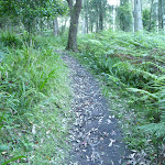


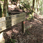

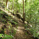
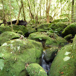

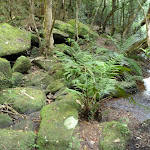
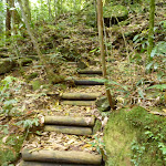
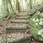

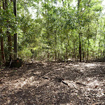
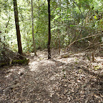
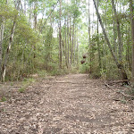
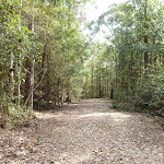
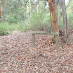

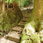
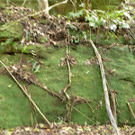


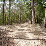

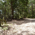


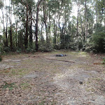

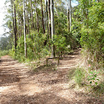
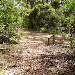
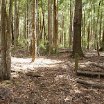

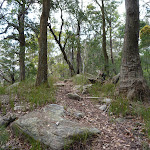
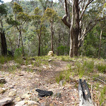
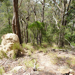
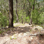
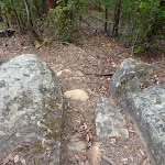

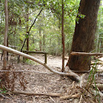
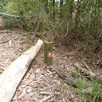


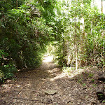
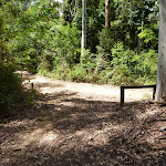
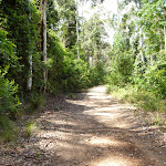


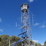

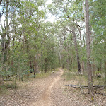
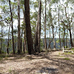
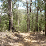
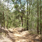

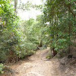
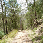
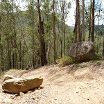


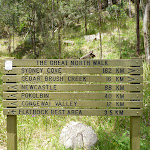


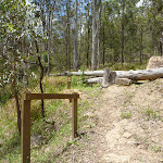

Basin Campsite
This large campsite sits by Wollombi Brook on the Great North Walk[1] and is accessible by car. The campsite provides a range of facilities such as a pit toilet[2], picnic tables and chairs[3], wood BBQs[4] and fireplaces[5]. Water is usually available from the water tank[6] or the nearby creek[7] – treat before use.
(0km) Basin Campsite → Int of Rock Lilly and Lyrebird trails
340 m
7 mins
41m
-4m
Moderate track
From the Basin campsite[8][9], this walk follows ‘The Great North walk’ sign, gently uphill [10][11], initially keeping the campsite on your right. The walk continues through tall open forest[12][13] for about 300m, until coming to a saddle[14], with a GNW arrow marker[15] (pointing ahead) and a ‘The Basin Camping Area’ sign[16] (Rock Lilly Trail, on the left).
(0.34km) Int of Rock Lilly AND Lyrebird trails → Int of GNW tracks AND Lyrebird Trail
1.9 km
47 mins
139m
-125m
Moderate track
Continue straight: From the intersection at the edge of the saddle[17][18][19], this walk follows the GNW arrow east and gently downhill. The track leads downhill to come close to Wollombi Brook (on your left), where the track gently undulates as it leads into the dense vine and mossy forest for about 1.2km. Then over the next 700m or so, the track leads past a few sandstone caves[20][21] and crosses a few small creeks to come to a signposted three-way intersection[22][23] with ‘The Great North Walk’ and the ‘Lyrebird Trail’ track, where a sign points back to ‘Basin Camping Area’[24].
(2.2km) Int of GNW tracks & Lyrebird Trail → Wollombi Brook Pool
280 m
7 mins
19m
-27m
Hard track
Continue straight: From the intersection[25][26], this walk follows the ‘Lyrebird Trail’ & ‘The Great North Walk’ sign [27], north along the track whilst keeping the valley to your left. The walk leads through the dense forest[28] for about 250m, until crossing a mossy creek with many small boulders[29]. This creek may become impassable after heavy or prolonged rain. On the other side of this side creek, the walk comes to the edge of the delightful Wollombi Brook Pool[30][31] (on the left, at the junction of this side creek and Wollombi Brook).
Wollombi Brook Pool
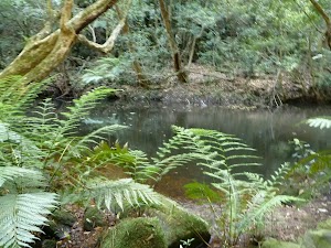
The Wollombi Brook pool is located where two creeks come together and is a deep pool surrounded by moist cool forest. On a hot day, this spot would make an ideal resting spot or place for a cooling swim.
(2.48km) Wollombi Brook Pool → End of Wild Boar Road
550 m
14 mins
52m
-5m
Hard track
Turn right: From Wollombi Brook Pool[32][33], this walk follows GNW arrow post north-east steeply uphill[34], initially keeping the main pool behind and to the left. The walk zigzags up through dense forest[35], up a series of timber[36] and rock steps[37] and past some large rock walls for about 500m, until coming to the the wide and flat area at the end of the dirt Wild Boar Road[38].
(3.03km) End of Wild Boar Road → Int of Kangaroo Point & Murrays Forest Road
5.3 km
2 hrs 12 mins
441m
-177m
Hard track
Continue straight: From the end of Wild Boar Road[39][40] (aka Piglet Point Road), this walk follows the dirt road fairly gently uphill[41][42] to the north. The roads leads distinctly uphill for about 500m, and then gently undulates along the ridge through forest[43] for about 2.5km. Here the walk comes to a clear and signposted four-way intersection[44][45] with ‘Walkers Ridge Road’ route and ‘The Great North Walk’ track.
Continue straight: From the intersection[46], this walk follows ‘The Great North Walk’ sign[47] north along the track that heads moderately steeply downhill. The walk continues through forest[48](with occasional timber[49] and rock steps[50]) for about 500m, to cross the usually small Wollombi Brook[51]. Then the walk climbs moderately steeply uphill[52] for about 400m, until coming to the end of the dirt Kangaroo Point Road[53][54].
Continue straight: From the end of Kangaroo Point Road[55], this walk follows the GNW arrow post north, gently uphill along Kangaroo Point Road[56]. The walk continues through forest (with the road gradually widening[57]) for about 1.3km, until coming to a signposted four-way intersection[58] with Murrays Forest Road[59] (and a wide trail[60] directly ahead).
(8.33km) Int of Kangaroo Point & Murrays Forest Road → Rest Area
50 m
1 mins
2m
0m
Hard track
Continue straight: From the four-way intersection[61], this walk follows the wide trail north and directly opposite Kangaroo Point Road[62][63]. After about 70m, this walk comes to a clearing used as an informal rest area[64][65]. At the end of this side trip, retrace your steps back to the main walk then Turn left .
Mt Warrawolong Campsite
This relatively small campsite is a flat open clearing a stones throw away from the dirt road with a small fire pit and enough room to comfortably pitch three tents. There is no water available at this campsite so you will need to make sure you have enough to last until you get to the next water source.
(8.33km) Int of Kangaroo Point & Murrays Forest Road → Int of Murrays Forest Road & GNW track
140 m
2 mins
2m
-1m
Moderate track
Turn right: From the intersection[66], this walk follows the dirt Murray Forest Road north-east, gently uphill[67] and directly away from the face of the ‘Kangaroo Pt’ sign[68]. After about 150m, this walk comes to a signposted three-way intersection[69] with the ‘Great North Walk’ trail (on your left).
(8.47km) Int of Murrays Forest Road and the Great North Walk → Int of Bar trail and Warrawolong Road
1.7 km
37 mins
41m
-147m
Hard track
Turn left : From the intersection, this walk follows the GNW arrow post[70] north along the dirt road for about 20m to another intersection with a ‘The Great North Walk’ sign[71]. Here the walk veers right (following the sign) up along the track until it flattens out and winds down to the top of a ridgeline. The track then follows this ridgeline through an open wooded forest[72] for about 300m, to find an unsignposted area that has been used as a campsite[73], at the end of a mostly flat section.
Continue straight: From the rest area[74], this walk follows the track down along the ridge line. The track winds steeply down into a saddle, where the track flattens out to lead through thicker green forest to the intersection with the narrow Bar Trail[75][76].
Veer right: From the intersection, this walk follows the GNW arrow post[77] north-east along the narrow, overgrown trail[78]. The trail begins to widen and after about 800m, this walk turns left to follow a ‘The Great North Walk’ sign[79] down for about 20m to an intersection[80] with the wide dirt Warrawolong Road.
(10.21km) Int of Bar trail and Warrawolong Road → Int of Turners and Warrawolong Roads
360 m
7 mins
8m
-12m
Moderate track
(10.57km) Int of Turners and Warrawolong Roads → Mt Warrawolong Fire Tower
2 km
56 mins
245m
-31m
Moderate track
Turn left: From the intersection, this walk heads north-west down along the dirt road[83], initially keeping the ‘Mt Warrawolong’ sign[84] on your left and keeping the valley on your right. The road leads gently downhill along the side of the hill for just over 300m to come to a Y-intersection[85] with the Mt Warrawolong trail (on your left).
Veer left: From the intersection, this walk heads uphill along the upper trail[86] past the ‘Authorised Vehicles Only’ sign[87]. After about 200m, the walk heads around a locked gate[88] then continues moderately steeply uphill, winding up the hill[89] for about 1.5km to come to a large flat clearing[90] and the tall fire tower[91] at the top of Mt Warrawolong[92]. At the end of this side trip, retrace your steps back to the main walk then Veer left.
Veer left: From the intersection, this walk heads uphill along the upper trail[86] past the ‘Authorised Vehicles Only’ sign[87]. After about 200m, the walk heads around a locked gate[88] then continues moderately steeply uphill, winding up the hill[89] for about 1.5km to come to a large flat clearing[90] and the tall fire tower[91] at the top of Mt Warrawolong[92]. At the end of this side trip, retrace your steps back to the main walk then Veer left.
Mt Warrawolong

At 642m above sea level, Mt Warrawolong is the highest point of the Great North Walk.
(10.57km) Int of Turners and Warrawolong Roads → Signposted Rest Area
2.3 km
53 mins
40m
-267m
Hard track
Turn right: From the intersection, this walk follows the ‘The Great North Walk’ sign[93], (away from face of the ‘Mt Warrawolong’ sign[94]) to head east along the dirt Turners Road. After about 150m, this walk turn left at another ‘The Great North Walk’ sign[95] to follow the trail as it gently undulates along the top of the ridge for just over 1km. Here the trail begins to wind downhill, becoming steeper as it goes, for about 1.1km to head around a rock road block[96] and find the signposted rest area, where a ‘Sydney Cove’ sign[97] points back up the trail.
Watagan Creek Campsite
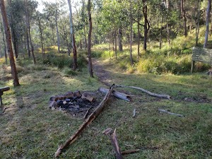
This is a Great North Walk signposted campsite, with plenty of room for a few tents but providing minimal facilities ie. no water, toilets or tables. There is, however, a bench and room for a fire.
(12.91km) Signposted Rest Area → Int of GNW track & Watagan Creek Road(southside)
100 m
3 mins
1m
-25m
Moderate track
Turn right: From the rest area[98], this walk follows ‘Newcastle’ sign[99] gently downhill[100] towards the valley, along the narrow track. The track leads downhill for almost 100m, coming to a T-intersection[101] with the dirt Watagan Creek Road[102], marked with a ‘Great North Walk’ sign[103] pointing back uphill.
Maps for the Basin campsite to Watagan Valley walk
You can download the PDF for this walk to print a map.
These maps below cover the walk and the wider area around the walk, they are worth carrying for safety reasons.
| Murrays Run | 1:25 000 Map Series | 91314N MURRAYS RUN | NSW-91314N |
| Morisset | 1:25 000 Map Series | 91311N MORISSET | NSW-91311N |
| Gosford | 1:100 000 Map Series | 9131 GOSFORD | 9131 |
Cross sectional view of the Basin campsite to Watagan Valley bushwalking track
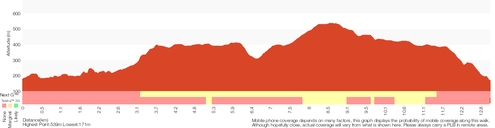
Analysis and summary of the altitude variation on the Basin campsite to Watagan Valley

Overview of this walks grade – based on the AS 2156.1 – 2001
Under this standard, a walk is graded based on the most difficult section of the walk.
| Length | 13 km | ||
| Time | 6 hrs | ||
| . | |||
| Grade 4/6 Hard track |
AS 2156.1 | Gradient | Very steep (4/6) |
| Quality of track | Formed track, with some branches and other obstacles (3/6) | ||
| Signs | Directional signs along the way (3/6) | ||
| Experience Required | Moderate level of bushwalking experience recommended (4/6) | ||
| Weather | Weather generally has little impact on safety (1/6) | ||
| Infrastructure | Limited facilities (such as cliffs not fenced, significant creeks not bridged) (4/6) |
Some more details of this walks Grading
Here is a bit more details explaining grading looking at sections of the walk
Gradient
8km of this walk has short steep hills and another 3.5km is very steep. The remaining (1.8km) has gentle hills with occasional steps.
Quality of track
Around 8km of this walk follows a formed track, with some branches and other obstacles, whilst the remaining 5km follows a clear and well formed track or trail.
Signs
Around 13km of this walk has directional signs at most intersection, whilst the remaining 280m is clearly signposted.
Experience Required
12km of this walk requires some bushwalking experience and another 930m requires no previous bushwalking experience. The remaining (280m) requires a leader a with moderate level of bushwalking experience.
weather
This whole walk, 13km is not usually affected by severe weather events (that would unexpectedly impact safety and navigation).
Infrastructure
11km of this walk has limited facilities (such as not all cliffs fenced) and another 1.4km has limited facilities (such as cliffs not fenced, significant creeks not bridged). The remaining (930m) is close to useful facilities (such as fenced cliffs and seats).
Similar walks
A list of walks that share part of the track with the Basin campsite to Watagan Valley walk.
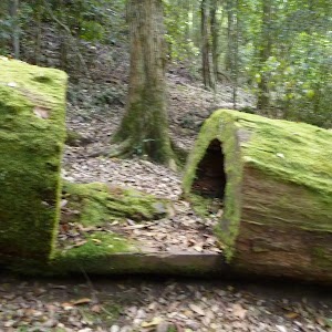
9.7 km One way
4 hrs 30 mins
Hard track

9.7 km One way
4 hrs
Hard track
13 km One way
6 hrs
Hard track
33.7 km One way
2 Days
Hard track
47.4 km One way
3 Days
Hard track
60.5 km One way
4 Days
Hard track
Other Nearby walks
A list of walks that start near the Basin campsite to Watagan Valley walk.
1.9 km Circuit
2 hrs 30 mins
Hard track
1.5 km Return
1 Hr
Moderate track
7.3 km Circuit
3 hrs
Hard track
1.7 km Circuit
45 mins
Moderate track
12.6 km One way
5 hrs 30 mins
Hard track
17.8 km One way
7 hrs
Hard track
4.1 km One way
2 hrs
Hard track
13.8 km One way
5 hrs
Hard track
17 km One way
6 hrs 30 mins
Hard track
29.7 km One way
2 Days
Hard track
17.2 km One way
7 hrs
Hard track
11 km One way
3 hrs 30 mins
Easy track
Plan your trip to and from the walk here
The Basin campsite to Watagan Valley walk starts at the Basin Campsite (gps: -33.104008, 151.23088)
Your main transport option to Basin Campsite is by;
![]() Car. There is free parking available.
Car. There is free parking available.
(get details)
The Basin campsite to Watagan Valley ends at the Int of GNW track & Watagan Creek Road(southside) (gps: -33.028602, 151.27391)
Your main transport option to Int of GNW track & Watagan Creek Road(southside) is by;
![]() Car. There is free parking available.
Car. There is free parking available.
(get details)
Short URL = http://wild.tl/bctwv
Gallery images
There are other downloads I am still working on.
You will probably need to login to access these — still all free.
* KML (google earth file)
* GPX (GPS file)
Special Maps/ brochures
* A3 topo maps
* PDF with Lands Topo map base
* PDF with arial image (and map overlay)
I wanted to get the main site live first, this extra stuff will come in time.
Happy walking
Matt 🙂
Comments