Seymour Pond

30 mins
890 m Return

45 m
Easy track
Katandra Rd Picnic Area
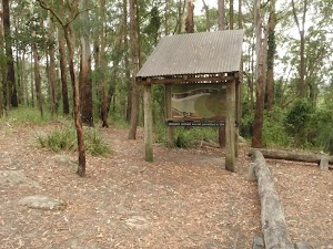
The Katandra Road Picnic Area is found at the end of a short driveway (signposted at the intersection of Katandra Rd and Croton Ave, Holgate). The picnic area is in front of the ranger’s residence and is open from 7am to 6pm daily. The picnic area provides some toilets, garbage bins, two picnic tables, parking and an information sign.
(0km) Katandra Rd picnic area → Int of Waterman walk and Katandra Rd track

140 m
3 mins
0m
-14m
Easy track
From the picnic area, this walk follows the ‘Seymour Pond’ and ‘Waterman Walk’ signs north-east along the clear track. The track soon heads down a series of steps and, shortly after turning right (at a locked gate), this walk comes to a three-way intersection marked with two blue/white arrows on a post.
(0.14km) Int of Waterman walk and Katandra Rd track → Seymour Pond Picnic area

300 m
8 mins
2m
-29m
Easy track
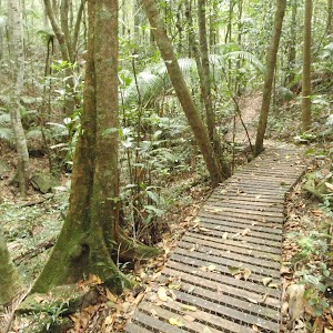
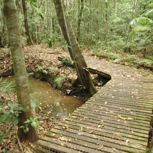
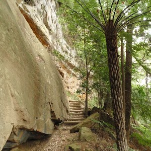
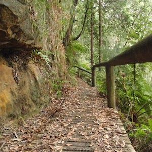
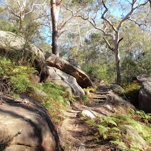
Turn left: From the intersection, this walk follows the upper arrow down the hill, keeping the fence and house to the right. The track heads down the hill then steps down into a palm-filled valley. Here, the walk climbs some steps and passes the ‘Commemorating 10 years of bushcaring in Katandra Reserve’ plaque[1], then bends right and around a sharp left-hand bend and past the number ‘5’ post (and old Wombat Hole). The track continues around the gully to cross a few small bridges and come to a picnic area and a ‘Seymour Pond’ sign.
Seymour Pond

Seymour Pond is medium-sized water body in Katandra Reserve. The pond is fed by a spring coming from the cliffs at the top of the reserve. The small creek was dammed in the early 1900’s to provide water for a farm on the south side (growing vegetables). The pond is home to water birds, large lizards and other wildlife. The council does not allow swimming in the pond[4], helping to maintain the ecosystem that now relies on this pond. There are a few spots beside the pond where you can enjoy the cool climate and the visiting birds.
Seymour Pond Picnic Area
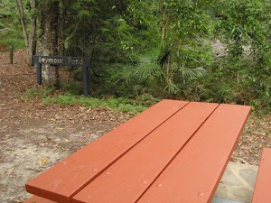
The Seymour Pond Picnic Area is found on the dam wall at the eastern end of Seymour Pond in Katandra Reserve. The picnic area provides a couple of picnic tables and a garbage bin. The picnic area is set in a lovely naturally shaded area in view of the Seymour Pond and beside Watermans and Toomeys walks.
(0.45km) Seymour Pond Picnic area → Strangler Fig Tube

130 m
2 mins
6m
-2m
Easy track
Veer right: From the picnic area, this walk heads across the dam wall, keeping the water on the left while passing the two picnic tables. The walk then crosses a timber bridge and comes to a signposted three-way intersection with ‘Toomey’ and ‘Waterman’ walks.
Continue straight: From the intersection, this walk follows the ‘Toomey Walk’ sign along the boardwalk, away from the pond. Soon the walk follows the track along the gully then follows the timber steps as they bend right and head up to the number ‘4’ post, next to the Strangler Fig tube. At the end of this side trip, retrace your steps back to the main walk then Turn around.
Continue straight: From the intersection, this walk follows the ‘Toomey Walk’ sign along the boardwalk, away from the pond. Soon the walk follows the track along the gully then follows the timber steps as they bend right and head up to the number ‘4’ post, next to the Strangler Fig tube. At the end of this side trip, retrace your steps back to the main walk then Turn around.
Strangler Fig Tube
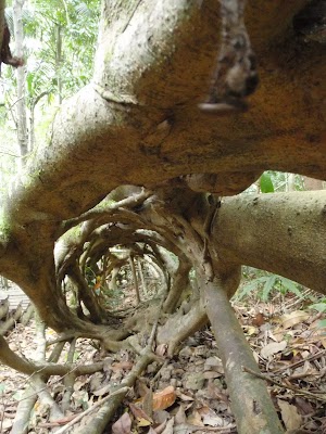
This Strangler Fig Tube is found beside Toomey Walk, just north of Seymour Pond. The scientific name of the tree is Ficus obliqua and it is listed on the Significant Tree Register. This Small-leaved Fig has grown around a large fallen log. The log has long-since rotted away, leaving a knotted tubular structure. Strangler Figs often grow from seeds dropped by birds. The seeds may fall on logs or rocks and the roots will make their way to the ground (to provided water, nutrients and a firm anchor), whilst the rest of the tree grows upwards for light. More info.
(0.45km) Seymour Pond Picnic area → Waterman View

110 m
2 mins
1m
-1m
Easy track
Turn sharp left: From the picnic tables, this walk heads past the ‘Seymour Pond’ sign (following the right-hand ‘Waterman walk’ arrow) and follows the track, keeping the pond close by on the right. The track soon leads to a viewing platform with long bench seats – Waterman view. At the end of this side trip, retrace your steps back to the main walk then Turn left.
Waterman View
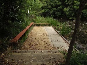
Waterman view (informally named) is a viewing point at the western end of Seymour Pond. The platform has a couple of long bench seats. A timber platform on the water’s edge means that visitors can get right up near the water. Signs here remind visitors that swimming is not allowed. This is a great spot to enjoy the birds and other life around the pond.
Maps for the Seymour Pond walk
You can download the PDF for this walk to print a map.These maps below cover the walk and the wider area around the walk, they are worth carrying for safety reasons.
| Gosford | 1:25 000 Map Series | 91312S GOSFORD | NSW-91312S |
| Gosford | 1:100 000 Map Series | 9131 GOSFORD | 9131 |
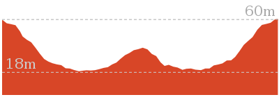
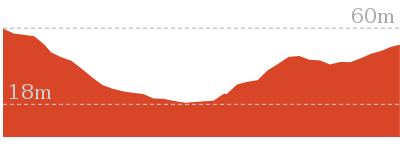
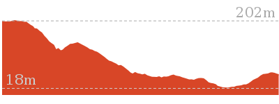
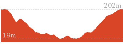
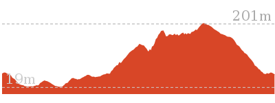
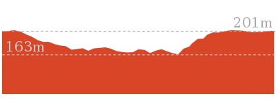
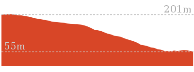
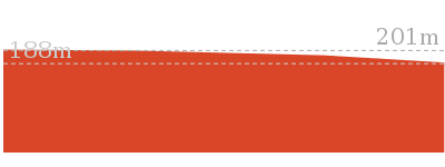
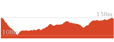
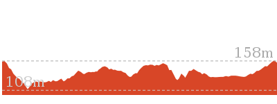
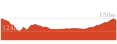
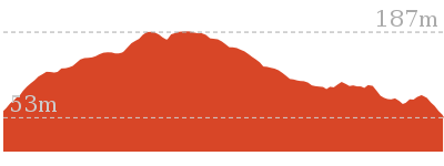
Cross sectional view of the Seymour Pond bushwalking track

Analysis and summary of the altitude variation on the Seymour Pond
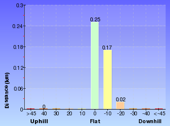
Overview of this walks grade – based on the AS 2156.1 – 2001
Under this standard, a walk is graded based on the most difficult section of the walk.
| Length | 890 m | ||
| Time | 30 mins | ||
| . | |||
| Grade 2/6 Easy track |
AS 2156.1 | Gradient | Gentle hills with occasional steps (2/6) |
| Quality of track | Clear and well formed track or trail (2/6) | ||
| Signs | Clearly signposted (1/6) | ||
| Experience Required | No experience required (1/6) | ||
| Weather | Weather generally has little impact on safety (1/6) | ||
| Infrastructure | Generally useful facilities (such as fenced cliffs and seats) (1/6) |
Some more details of this walks Grading
Here is a bit more details explaining grading looking at sections of the walk
Gradient
This whole walk, 450m has gentle hills with occasional steps.
Quality of track
This whole walk, 450m follows a clear and well formed track or trail.
Signs
This whole walk, 450m is clearly signposted.
Experience Required
This whole walk, 450m requires no previous bushwalking experience.
weather
This whole walk, 450m is not usually affected by severe weather events (that would unexpectedly impact safety and navigation).
Infrastructure
This whole walk, 450m is close to useful facilities (such as fenced cliffs and seats).
Similar walks
Other Nearby walks
Plan your trip to and from the walk here
The Seymour Pond walk starts and ends at the Katandra Rd picnic area (gps: -33.414582, 151.39599)Your transport options to Katandra Rd picnic area are by;
(get details)
Fire Danger
Each park may have its own fire ban, this rating is only valid for today and is based on information from the RFS Please check the RFS Website for more information.Weather Forest
This walk starts in the Hunter weather district always check the formal BOM forecast or pdf before starting your walk.Forecast snapshot
Park Information & Alerts
Short URL = http://wild.tl/sp
Gallery images
There are other downloads I am still working on.
You will probably need to login to access these — still all free.
* KML (google earth file)
* GPX (GPS file)
Special Maps/ brochures
* A3 topo maps
* PDF with Lands Topo map base
* PDF with arial image (and map overlay)
I wanted to get the main site live first, this extra stuff will come in time.
Happy walking
Matt 🙂












Comments