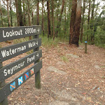
Watermans Walk


45 mins

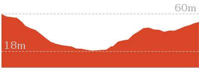
67 m
Easy track
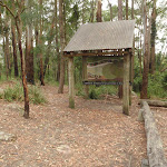


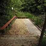


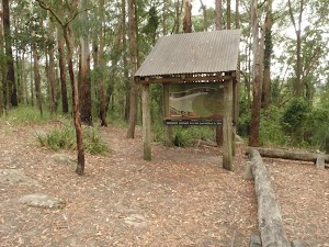
Katandra Rd Picnic Area
(0km) Katandra Rd picnic area → Int of Waterman walk and Katandra Rd track

140 m
3 mins
0m
-14m
Easy track
(0.14km) Int of Waterman walk and Katandra Rd track → Seymour Pond Picnic area
300 m
8 mins
2m
-29m
Easy track
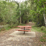
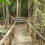
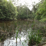
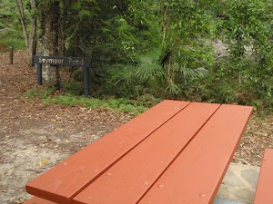
Seymour Pond

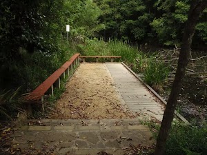
Seymour Pond Picnic Area
(0.45km) Seymour Pond Picnic area → Int of Waterman and Toomey walks
70 m
1 mins
1m
-1m
Easy track
(0.51km) Int of Waterman and Toomey walks → Strangler Fig Tube
60 m
1 mins
5m
-1m
Easy track
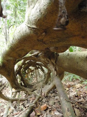
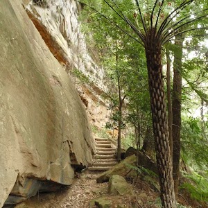
Strangler Fig Tube
(0.51km) Int of Waterman and Toomey walks → Waterman View
550 m
11 mins
20m
-20m
Easy track
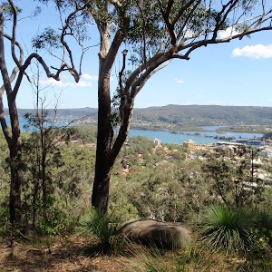
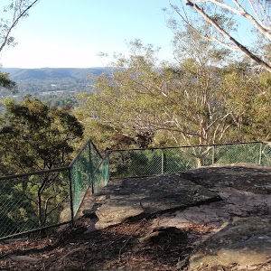
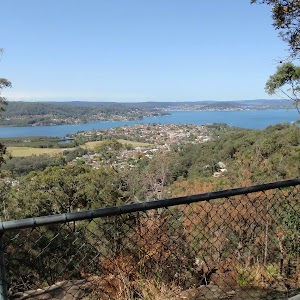
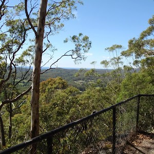
Waterman View
(1.07km) Waterman View → Katandra Rd picnic area
550 m
13 mins
44m
-3m
Easy track
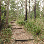
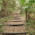
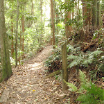
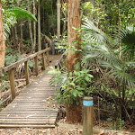
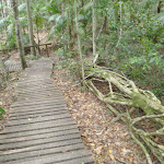
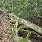
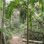
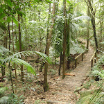
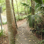
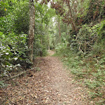
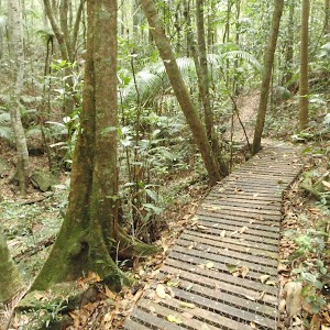
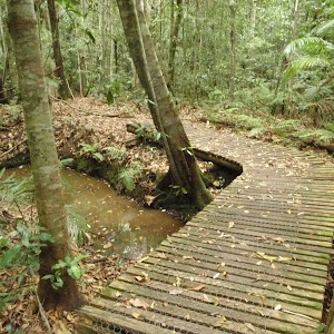
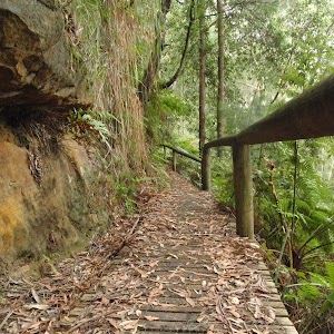
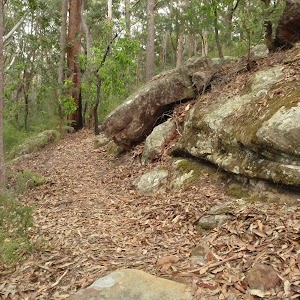
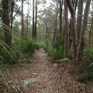
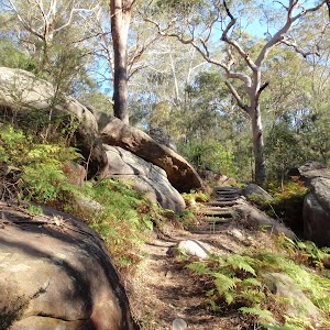
Veer right: From the picnic area, this walk heads away from the pond, following the left-hand ‘Waterman walk’ arrow (next to the locked gate) into the bush and across a couple of small bridges. The track passes post ‘5’ (an old wombat hole) then sharply bends right, soon passing the ‘Commemorating 10 years of bushcaring in Katandra Reserve’ plaque[7], where this walk then heads down some stairs. After walking through the palm filled valley for a short distance, the walk heads up the steps and, soon after passing the house and fence (on the left), comes to a three-way intersection marked with a post (with blue and white arrows).
Turn right: From the intersection, this walk follows the lower arrow up the steps and turns left in front of the locked gate. The walk follows these steps up the hill, then soon flattens out as the track comes to a picnic area and car park.
Maps for the Watermans Walk walk
You can download the PDF for this walk to print a map.These maps below cover the walk and the wider area around the walk, they are worth carrying for safety reasons.
| Gosford | 1:25 000 Map Series | 91312S GOSFORD | NSW-91312S |
| Gosford | 1:100 000 Map Series | 9131 GOSFORD | 9131 |
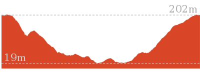
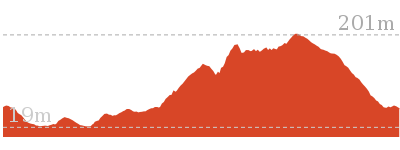
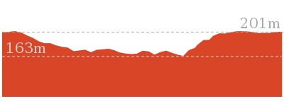
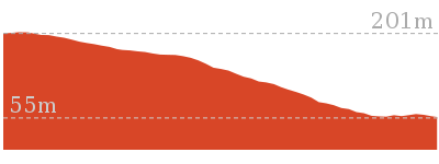
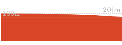
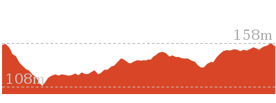
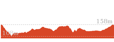
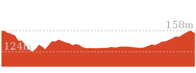
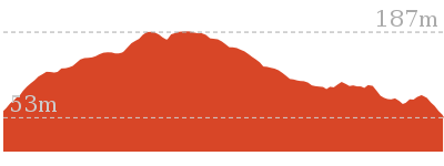
Cross sectional view of the Watermans Walk bushwalking track
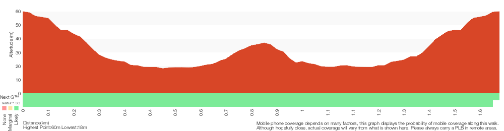
Analysis and summary of the altitude variation on the Watermans Walk
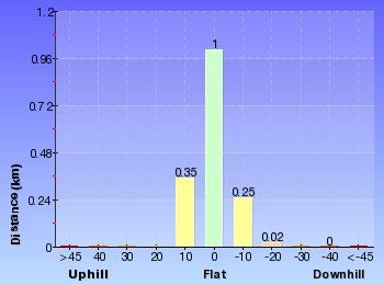
Overview of this walks grade – based on the AS 2156.1 – 2001
Under this standard, a walk is graded based on the most difficult section of the walk.
| Length | 1.6 km | ||
| Time | 45 mins | ||
| . | |||
| Grade 2/6 Easy track |
AS 2156.1 | Gradient | Gentle hills with occasional steps (2/6) |
| Quality of track | Clear and well formed track or trail (2/6) | ||
| Signs | Clearly signposted (1/6) | ||
| Experience Required | No experience required (1/6) | ||
| Weather | Weather generally has little impact on safety (1/6) | ||
| Infrastructure | Generally useful facilities (such as fenced cliffs and seats) (1/6) |
Some more details of this walks Grading
Here is a bit more details explaining grading looking at sections of the walk
Gradient
Around 1.4km of this walk has gentle hills with occasional steps, whilst the remaining 180m is flat with no steps.
Quality of track
This whole walk, 1.6km follows a clear and well formed track or trail.
Signs
This whole walk, 1.6km is clearly signposted.
Experience Required
This whole walk, 1.6km requires no previous bushwalking experience.
weather
This whole walk, 1.6km is not usually affected by severe weather events (that would unexpectedly impact safety and navigation).
Infrastructure
This whole walk, 1.6km is close to useful facilities (such as fenced cliffs and seats).
Similar walks
890 m Return
30 mins
Easy track


2 km Return
1 Hr
Moderate track
2.9 km One way
1 hr 30 mins
Moderate track
4.8 km Circuit
2 hrs 15 mins
Moderate track
5.3 km Circuit
2 hrs 45 mins
Moderate track
Other Nearby walks
8.5 km One way
3 hrs 45 mins
Hard track

1.2 km Circuit
45 mins
Moderate track
1.5 km One way
45 mins
Moderate track
4.1 km One way
2 hrs
Hard track


166 m Return
10 mins
Very easy
900 m Return
30 mins
Hard track

1.6 km Circuit
45 mins
Moderate track


2.1 km Circuit
1 Hr
Moderate track
3.3 km Circuit
1 hr 30 mins
Hard track
1.4 km Circuit
45 mins
Hard track
643 m Circuit
30 mins
Moderate track

2.9 km Circuit
1 hr 30 mins
Hard track
Plan your trip to and from the walk here
The Watermans Walk walk starts and ends at the Katandra Rd picnic area (gps: -33.414582, 151.39599)Your transport options to Katandra Rd picnic area are by;
(get details)


Short URL = http://wild.tl/2b
Gallery images
There are other downloads I am still working on.
You will probably need to login to access these — still all free.
* KML (google earth file)
* GPX (GPS file)
Special Maps/ brochures
* A3 topo maps
* PDF with Lands Topo map base
* PDF with arial image (and map overlay)
I wanted to get the main site live first, this extra stuff will come in time.
Happy walking
Matt 🙂
Comments