Summit walk – Charlotte Pass to Mount Kosciuszko – Summit Trail

6 hrs
18.5 km Return

611 m
Hard track
Covered in snow part of the year
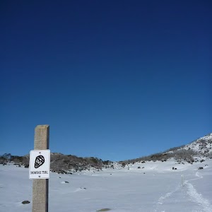
This walk leads through an extreme alpine environment and all walkers must be well prepared. During summer, be prepared for both very hot and cold weather, high winds, rain, snow, extreme UV levels and some sections of snow or ice on the ground. Before starting this walk, check advice with Snowy Region Visitor Information Centre (02) 6450 5600, the weather forecast and the snow conditions then change your plans as needed. These notes, grades and walking times have been written for use in the summer months only. Between May and the end of October, this walk is likely to be covered in snow/ice, visitors should carry and be prepared to use snowshoes or cross country skis. When there is a chance of significant snow on the ground, visitors will need particularly strong navigation and snowcraft skills – tracks and signage may not be visible. For most visitors, it is best to consider this walk closed during the colder months.
Between the long weekend in June and October, the road between Perisher Village and Charlotte Pass is closed by the RTA. It is possible to organise oversnow transport.
(0km) End of Kosciuszko Road → Snowy River bridge

4.5 km
1 hr 27 mins
164m
-73m
Hard track
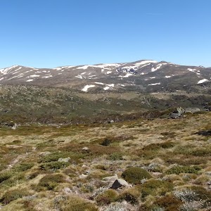
From the end of Kosciuszko Rd at Charlotte Pass[1] (just near the toilet block[2]), this walk heads along a wide management trail[3], following the large ‘Summit walk’ sign[4]. The walk initially dips down a bit[5] and heads through a grove of snow gums[6]. This walk soon leaves the snow gums and the landscape opens to a fantastic view of the Snowy River and the valley (on your right)[7]. After about 1km, the walk passes a yellow ‘MT K 8’ sign[8] on a snow pole. This walk continues along the management trail and gently undulates up along the side of the long ridge, passing several more ‘Mt K’ milestone signs counting down. After a while, the old road heads up and over a ridge[9], passing the ‘MT K 5’[10] and the original ‘K 3’ milestone (on your left) to find the un-signposted concrete bridge over Merritts Creek[11].
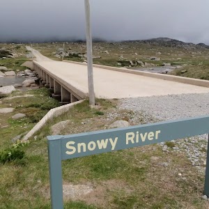
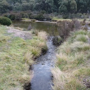
Continue straight: From the bridge, this walk follows the management trail west through the valley, where the trail soon bends right and passes a ‘Snowy River’ sign[12], coming to the bridge crossing the river[13].
Continue straight: From the bridge, this walk follows the management trail west through the valley, where the trail soon bends right and passes a ‘Snowy River’ sign[12], coming to the bridge crossing the river[13].
(4.48km) Snowy River bridge → Seamans Hut

1.5 km
27 mins
95m
0m
Hard track
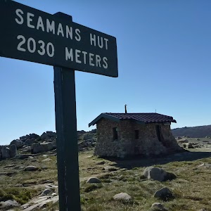
Continue straight: From the ‘Snowy River’ sign[14], this walk crosses the bridge and heads north-west up along the management trail[15]. The trail bends right and heads up towards Seamans Hut (visible in clear weather[16]). The walk winds up the long hill and bends left, near a flat clearing with some valley views (to your right[17]). Here, the old road bends left and heads up the hill, coming to the signposted ‘Seamans Hut’[18].
Seamans Hut
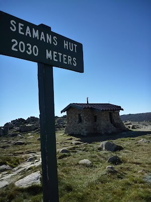
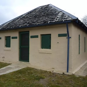
This hut was erected in 1929, after a young skier named Laurie Seaman perished in a blizzard when he was separated from his group. The hut was built using money donated by Seaman’s parents, for the use of those who might need emergency shelter in the mountains. It was renovated in 1938 due to fire. Seamans Hut is a 7m x3m granite stone building with a wood stove, although there is little wood in the area. More info.
(5.99km) Seamans Hut → Rawson Pass

1.6 km
31 mins
114m
-15m
Hard track
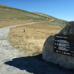
Continue straight: From ‘Seamans Hut’[20], this walk follows the management trail, heading west up the gentle hill, keeping the large valley to your right[21]. The trail winds steadily up along the side of the long hill and, about 150m past the road cutting, this trail leads to a stone path and Australia’s highest toilet block[22]. The walk then follows the stone path past the toilet and bike parking area[23] to come to a clearly signposted three-way intersection at ‘Rawson Pass’[24].
Rawson Pass

Rawson Pass is where the old Kosciuszko Road, from Charlotte Pass, meets the metal walkway from Thredbo. It is home to highest public toilet in Australia, this recently-added facility is perfectly positioned for those taking the walk up to the top of Kosciuszko. Rawson Pass is well signposted and 500m south east of Mt Kosciuszko (by straight line). There is also a place for to park mountain bikes for those cycling along the old road from Charlotte Pass.
(7.6km) Rawson Pass → Mt Kosciuszko

1.6 km
39 mins
127m
-23m
Hard track
Veer right: From the intersection at Rawson Pass, this walk follows the ‘Mt Kosciuszko’ sign[25] uphill along the stone pathway. The stone pathway soon becomes a gravel track and winds up and around the hill, keeping the peak of Mt Kosciuszko to your left. About 500m along the gravel track, this walk comes to a ‘Y’ intersection[26] (with the Kosciuszko summit track on your left), just past the ‘Alpine Walks’ sign and map[27].
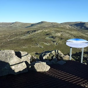
Veer left: From the intersection, this walk follows the ‘Mt Kosciuszko’ sign[28] uphill along the upper track. This track winds steadily up and around the peak of the mountain, passing a stone-paved[29] section of track, and also a metal grate[30] before climbing a few steps[31] to the cairn at the peak of Mt Kosciuszko[32].
Veer left: From the intersection, this walk follows the ‘Mt Kosciuszko’ sign[28] uphill along the upper track. This track winds steadily up and around the peak of the mountain, passing a stone-paved[29] section of track, and also a metal grate[30] before climbing a few steps[31] to the cairn at the peak of Mt Kosciuszko[32].
Mt Kosciuszko

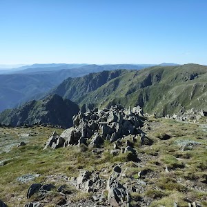
Mt Kosciuszko is the highest peak on the Australian continent, at 2228m above sea level. It was named by the Polish explorer Count Paul Edmund Strzelecki and named in honour of the Polish national hero General Tadeusz Kościuszko. Now a popular tourist attraction, thousands of people walk up to the summit each year. On a clear day, the 360-degree views from the summit across the roof of Australia are fantastic. There are higher mountains elsewhere on Australian territory. ‘The highest mountains in Australian Antarctic Territory are Mt McClintock (3490 meters) and Mt Menzies (3355 meters).’ .
Maps for the Summit walk – Charlotte Pass to Mount Kosciuszko – Summit Trail walk
You can download the PDF for this walk to print a map.These maps below cover the walk and the wider area around the walk, they are worth carrying for safety reasons.
| Perisher Valley | 1:25 000 Map Series | 85252S PERISHER VALLEY | NSW-85252S |
| Kosciuszko | 1:100 000 Map Series | 8525 KOSCIUSZKO | 8525 |
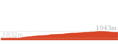
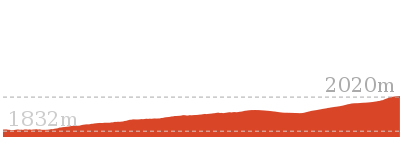
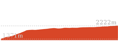
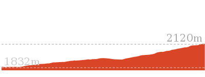
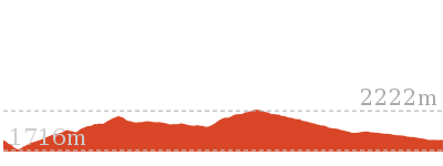
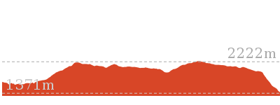
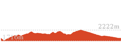
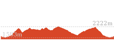
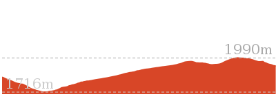
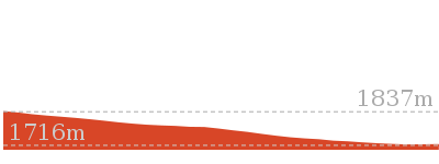
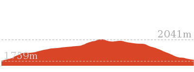
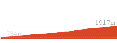
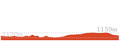
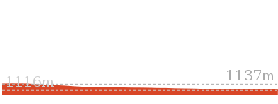
Cross sectional view of the Summit walk – Charlotte Pass to Mount Kosciuszko – Summit Trail bushwalking track

Analysis and summary of the altitude variation on the Summit walk – Charlotte Pass to Mount Kosciuszko – Summit Trail

Overview of this walks grade – based on the AS 2156.1 – 2001
Under this standard, a walk is graded based on the most difficult section of the walk.
| Length | 18.5 km | ||
| Time | 6 hrs | ||
| . | |||
| Grade 4/6 Hard track |
AS 2156.1 | Gradient | Short steep hills (3/6) |
| Quality of track | Clear and well formed track or trail (2/6) | ||
| Signs | Clearly signposted (1/6) | ||
| Experience Required | No experience required (1/6) | ||
| Weather | Forecast, unforecast storms and severe weather may impact on navigation and safety (4/6) | ||
| Infrastructure | Generally useful facilities (such as fenced cliffs and seats) (1/6) |
Some more details of this walks Grading
Here is a bit more details explaining grading looking at sections of the walk
Gradient
5km of this walk is flat with no steps and another 2.3km has gentle hills with occasional steps. The remaining (1.5km) has short steep hills.
Quality of track
This whole walk, 9km follows a clear and well formed track or trail.
Signs
This whole walk, 9km is clearly signposted.
Experience Required
This whole walk, 9km requires no previous bushwalking experience.
weather
This whole walk, 9km is affected by forecast, unforecast storms and severe weather events that may impact on navigation and safety.
Infrastructure
This whole walk, 9km is close to useful facilities (such as fenced cliffs and seats).
Similar walks
Other Nearby walks
Plan your trip to and from the walk here
The Summit walk – Charlotte Pass to Mount Kosciuszko – Summit Trail walk starts and ends at the End of Kosciuszko Road (gps: -36.431855, 148.32828)Your main transport option to End of Kosciuszko Road is by;
(get details)
Fire Danger
Each park may have its own fire ban, this rating is only valid for today and is based on information from the RFS Please check the RFS Website for more information.Weather Forest
This walk starts in the Snowy Mountains weather district always check the formal BOM forecast or pdf before starting your walk.Forecast snapshot
Park Information & Alerts
Short URL = http://wild.tl/1p
Gallery images
There are other downloads I am still working on.
You will probably need to login to access these — still all free.
* KML (google earth file)
* GPX (GPS file)
Special Maps/ brochures
* A3 topo maps
* PDF with Lands Topo map base
* PDF with arial image (and map overlay)
I wanted to get the main site live first, this extra stuff will come in time.
Happy walking
Matt 🙂












Comments