Main Range Track – Charlotte Pass to the Snowy River return

45 mins
1.6 km Return

123 m
Hard track
Covered in snow part of the year

This walk leads through an extreme alpine environment and all walkers must be well prepared. During summer, be prepared for both very hot and cold weather, high winds, rain, snow, extreme UV levels and some sections of snow or ice on the ground. Before starting this walk, check advice with Snowy Region Visitor Information Centre (02) 6450 5600, the weather forecast and the snow conditions then change your plans as needed. These notes, grades and walking times have been written for use in the summer months only. Between May and the end of October, this walk is likely to be covered in snow/ice, visitors should carry and be prepared to use snowshoes or cross country skis. When there is a chance of significant snow on the ground, visitors will need particularly strong navigation and snowcraft skills – tracks and signage may not be visible. For most visitors, it is best to consider this walk closed during the colder months.
Between the long weekend in June and October, the road between Perisher Village and Charlotte Pass is closed by the RTA. It is possible to organise oversnow transport.
(0km) End of Kosciuszko Road → Snowy River crossing

790 m
18 mins
1m
-122m
Hard track
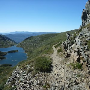
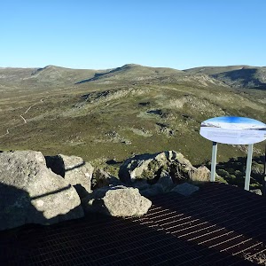
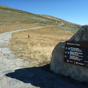
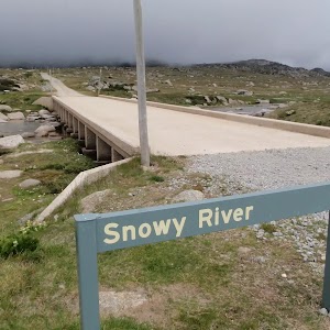
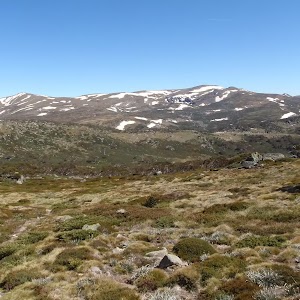
From Charlotte Pass[1] (at the turning circle at the end of Kosciuszko Rd), this walk follows the ‘Main Range Track’ – ‘Blue Lake Lookout’ sign[2] downhill along the wide paved path[3]. The walk winds down past the stone path[4] (on your right) and continues beside the ‘Glaciers shaped this ancient landscape’ information sign[5]. The path continues down through lightly scattered snow gums to the bottom of the valley, approximately 650m further. Just past the ‘From the mountains to the sea’ information sign[6], this walk crosses the Snowy River using the stepping stones[7] and comes to a strip of land between the two creeks[8]. (Crossing the river is dangerous and is not advisable when the water is flowing over the stepping stones[9]).
Snowy River crossing
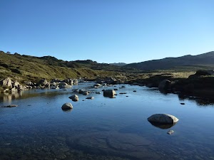
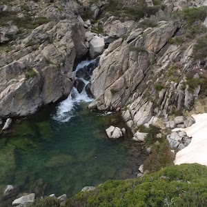
At the lowest point of the the Main Range circuit track is the confluence (meeting) of the Snowy River and Club Lake Creek. The walking track uses stones in the river to try to get across with dry feet. Since the track crosses just above the confluence there is an ‘island’[10] halfway across. These creeks may become impassable after rain and snow melt. This is lovely place to rest and enjoy the water and valley.
(0.79km) Snow river crossing → Foremans Hut ruins

490 m
9 mins
18m
0m
Experienced only
Continue straight: From the northern side of the Snowy river, this walk heads south west, following the very faint track[11], keeping the Snowy River to the left and Club Lake Creek to your right. The track continues through the valley for about 500m passing what appears to be an old fence line[12] and climbing a little to the old brick fireplace and chimney, which is all that remains Foremans hut[13]. At the end of this side trip, retrace your steps back to the main walk then Turn left.
Foremans Hut Ruins
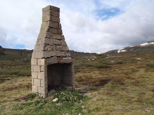
Foremans Hut was built in the 1920’s for a Dr Foreman of Wagga Wagga. Most of the hut was demolished in the 1940s, leaving the prominent chimney behind, which has in the past been used by a number of people as a navigation landmark, to save their lives in a blizzard.
This is also a nice place to camp for the night as there is a lot of open flat space. Water can be found at the Snowy River to the south or Club Lake Creek just to the north. More info.
Maps for the Main Range Track – Charlotte Pass to the Snowy River return walk
You can download the PDF for this walk to print a map.These maps below cover the walk and the wider area around the walk, they are worth carrying for safety reasons.
| Perisher Valley | 1:25 000 Map Series | 85252S PERISHER VALLEY | NSW-85252S |
| Kosciuszko | 1:100 000 Map Series | 8525 KOSCIUSZKO | 8525 |
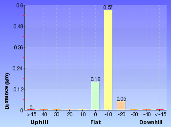
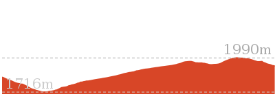
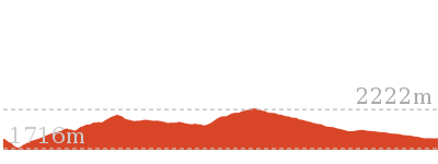
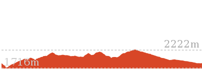
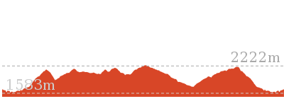
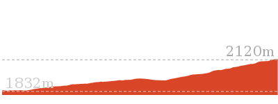
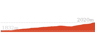
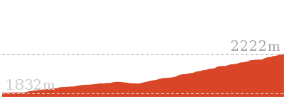
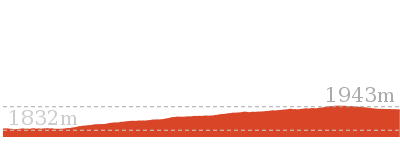
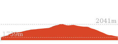
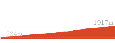
Cross sectional view of the Main Range Track – Charlotte Pass to the Snowy River return bushwalking track

Analysis and summary of the altitude variation on the Main Range Track – Charlotte Pass to the Snowy River return
Overview of this walks grade – based on the AS 2156.1 – 2001
Under this standard, a walk is graded based on the most difficult section of the walk.
| Length | 1.6 km | ||
| Time | 45 mins | ||
| . | |||
| Grade 4/6 Hard track |
AS 2156.1 | Gradient | Short steep hills (3/6) |
| Quality of track | Clear and well formed track or trail (2/6) | ||
| Signs | Clearly signposted (1/6) | ||
| Experience Required | Moderate level of bushwalking experience recommended (4/6) | ||
| Weather | Forecast, unforecast storms and severe weather may impact on navigation and safety (4/6) | ||
| Infrastructure | Limited facilities (such as cliffs not fenced, significant creeks not bridged) (4/6) |
Some more details of this walks Grading
Here is a bit more details explaining grading looking at sections of the walk
Gradient
This whole walk, 790m has short steep hills.
Quality of track
This whole walk, 790m follows a clear and well formed track or trail.
Signs
This whole walk, 790m is clearly signposted.
Experience Required
This whole walk, 790m requires a leader a with moderate level of bushwalking experience.
weather
This whole walk, 790m is affected by forecast, unforecast storms and severe weather events that may impact on navigation and safety.
Infrastructure
This whole walk, 790m has limited facilities (such as cliffs not fenced, significant creeks not bridged).
Similar walks
Other Nearby walks
Plan your trip to and from the walk here
The Main Range Track – Charlotte Pass to the Snowy River return walk starts and ends at the End of Kosciuszko Road (gps: -36.43167, 148.32865)Your main transport option to End of Kosciuszko Road is by;
(get details)
Fire Danger
Each park may have its own fire ban, this rating is only valid for today and is based on information from the RFS Please check the RFS Website for more information.Weather Forest
This walk starts in the Snowy Mountains weather district always check the formal BOM forecast or pdf before starting your walk.Forecast snapshot
Park Information & Alerts
Short URL = http://wild.tl/cpttsrr
Gallery images
There are other downloads I am still working on.
You will probably need to login to access these — still all free.
* KML (google earth file)
* GPX (GPS file)
Special Maps/ brochures
* A3 topo maps
* PDF with Lands Topo map base
* PDF with arial image (and map overlay)
I wanted to get the main site live first, this extra stuff will come in time.
Happy walking
Matt 🙂












Comments