Heathcote to Engadine via Audley


6 hrs 30 mins

635 m
Hard track


(0km) Heathcote Railway Station → Int of Wilson Parade and Karloo Track

200 m
3 mins
1m
-2m
Moderate track
(0.2km) Int of Karloo Track and Wilson Pde → Karloo Pools
2.6 km
1 hr 6 mins
87m
-222m
Moderate track
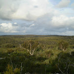
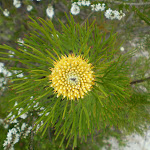
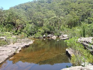
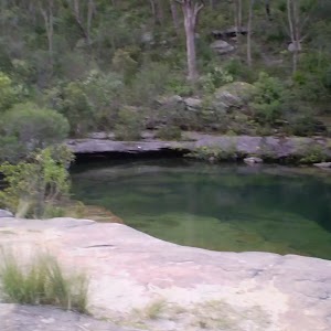
Veer left: From the intersection, this walk heads east. The track gradually rises onto the ridgeline and there are some reasonably good views over the surrounding valley. The track continues east in this manner then begins to gradually drop down off the ridge along the slightly rougher bush track until reaching Karloo Pools. This would be a good spot to take a break and get your toes wet.
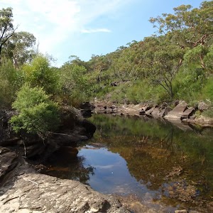
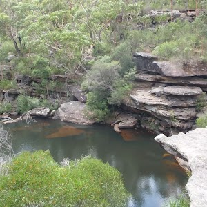
Ulloola Falls Campsite
(2.78km) Karloo Pools → Uloola Falls Camp
2.3 km
45 mins
125m
-47m
Moderate track
(5.04km) Uloola Falls Camp → Int of Uloola Track and Robertson Roundabout
4 km
1 hr 16 mins
105m
-107m
Moderate track
Continue straight: From the intersection, this walk follows the ‘Audley’ arrow along the bush track. The walk winds among the banksia and gum trees as it follows the defined rocky bush track along the ridge for a long while, before coming to the intersection, with multiple signposts including ‘Audley’ and ‘Robertsons Roundabout’.
(9.03km) Int of Uloola Track and Robertson Roundabout → Int of Engadine, Audley and Uloola Tracks
560 m
18 mins
1m
-92m
Moderate track
(9.59km) Int of Engadine, Audley and Uloola Tracks → Currawong Flats
140 m
4 mins
0m
-34m
Hard track
(9.59km) Int of Engadine, Audley and Uloola Tracks → Kangaroo Creek
1.2 km
27 mins
67m
-95m
Hard track
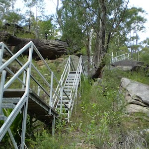
Veer right: From the intersection the track follows the Kangaroo Creek and Heathcote arrows along the bushtrack heading up the short rocky hill and along the side of the ridge, providing great views over the valley as it continues along for a while until coming to the top of a large metal staircase which it follows down to the bottom of the valley, coming to Kangaroo Creek.
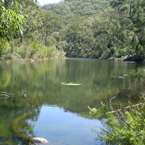
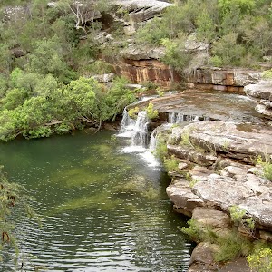
Kangaroo Creek Pools
(10.77km) Kangaroo Creek → Int of Engadine and Loop Track
1.7 km
47 mins
202m
-10m
Hard track
(12.5km) Loop Track Servicetrail (south-east) → Int of Engadine Track and Jacana Servicetrail
1.1 km
23 mins
26m
-42m
Moderate track
Continue straight: From the intersection, this walk follows the ‘Engadine’ arrow along the bush track through the thick gum tree forest. The walk passes a small bush track signposted as ‘closed for rehabilitation’ before crossing the small Forest Brook. The track then heads up the gentle rocky hill, flattening out to continue through the thick bush for a while before coming to the intersection with the management trail.
(13.62km) Int of Engadine Track and Jacana Servicetrail → Int of Engadine and Gnarra Rill Bike Track (south)
510 m
5 mins
12m
-7m
Moderate track
(14.13km) Int of Engadine and Gnarra Rill Bike Track (south) → Int of Engadine Track and The Ave Servicetrail
240 m
4 mins
1m
-4m
Moderate track
Continue straight: From the intersection, this walk follows the bush track heading north through the dense bushland. After a while, the track passes a sign permitting bicycles, and comes to the large signposted intersection with a management trail.
(14.37km) Int of Engadine Track and The Ave Servicetrail → Int of Audley and Engadine bushtracks
330 m
6 mins
1m
-15m
Moderate track
(14.7km) Int of Audley and Engadine bushtracks → Int of Engadine Bush and Servicetrail
80 m
1 mins
1m
0m
Moderate track
(14.77km) Int of Engadine Track and Bushtracks → Int of Engadine Railway Servicetrail and Engadine Track
30 m
0m
0m
Moderate track
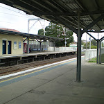
(14.8km) Int of Engadine Railway Servicetrail and Engadine Track → Engadine Railway Station
150 m
3 mins
6m
0m
Moderate track
Maps for the Heathcote to Engadine via Audley walk
You can download the PDF for this walk to print a map.These maps below cover the walk and the wider area around the walk, they are worth carrying for safety reasons.
| Port Hacking | 1:25 000 Map Series | 91294N PORT HACKING | NSW-91294N |
| Port Hacking | 1:100 000 Map Series | 9129 PORT HACKING | 9129 |
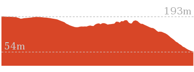
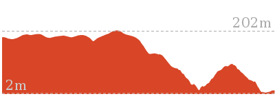
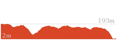
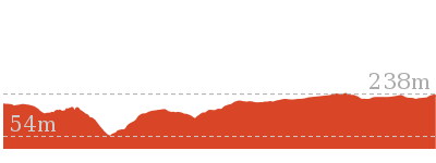
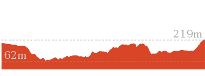
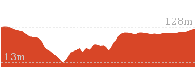
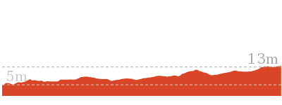
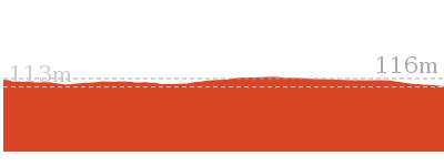
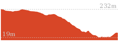
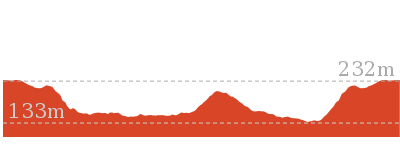
Cross sectional view of the Heathcote to Engadine via Audley bushwalking track
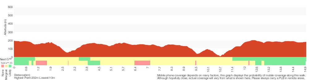
Analysis and summary of the altitude variation on the Heathcote to Engadine via Audley
Overview of this walks grade – based on the AS 2156.1 – 2001
Under this standard, a walk is graded based on the most difficult section of the walk.
| Length | 15 km | ||
| Time | 6 hrs 30 mins | ||
| . | |||
| Grade 4/6 Hard track |
AS 2156.1 | Gradient | Very steep (4/6) |
| Quality of track | Formed track, with some branches and other obstacles (3/6) | ||
| Signs | Directional signs along the way (3/6) | ||
| Experience Required | Some bushwalking experience recommended (3/6) | ||
| Weather | Weather generally has little impact on safety (1/6) | ||
| Infrastructure | Limited facilities, not all cliffs are fenced (3/6) |
Some more details of this walks Grading
Here is a bit more details explaining grading looking at sections of the walk
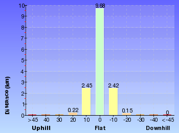
Gradient
8km of this walk has short steep hills and another 4.1km has gentle hills with occasional steps. Whilst another 2.6km is very steep and the remaining 670m is flat with no steps.
Quality of track
12km of this walk follows a formed track, with some branches and other obstacles and another 3km follows a clear and well formed track or trail. The remaining (460m) follows a smooth and hardened path.
Signs
Around 11km of this walk has directional signs at most intersection, whilst the remaining 3.9km is clearly signposted.
Experience Required
Around 8km of this walk requires no previous bushwalking experience, whilst the remaining 7km requires some bushwalking experience.
weather
This whole walk, 15km is not usually affected by severe weather events (that would unexpectedly impact safety and navigation).
Infrastructure
Around 14km of this walk has limited facilities (such as not all cliffs fenced), whilst the remaining 840m is close to useful facilities (such as fenced cliffs and seats).
Similar walks
2.3 km Circuit
1 hr 15 mins
Hard track

5.6 km Return
3 hrs
Moderate track
5.8 km One way
2 hrs 30 mins
Hard track
10 km One way
4 hrs 15 mins
Hard track
11.3 km One way
4 hrs 30 mins
Hard track
Other Nearby walks
10.1 km One way
5 hrs
Hard track
10.8 km One way
2 Days
Hard track

11 km Circuit
4 hrs
Hard track


858 m Return
20 mins
Easy track
5 km Return
1 hr 45 mins
Easy track

10.5 km Return
4 hrs
Moderate track

4.4 km One way
2 hrs
Hard track
2.2 km Return
45 mins
Easy track
918 m Return
20 mins
Very easy
9.8 km Return
4 hrs 30 mins
Hard track
6.4 km Circuit
2 hrs 30 mins
Moderate track

10.8 km One way
5 hrs
Hard track

Plan your trip to and from the walk here
The Heathcote to Engadine via Audley walk starts at the Heathcote Railway Station (gps: -34.088184, 151.0081)Your transport options to Heathcote Railway Station are by;
(get details)
The Heathcote to Engadine via Audley ends at the Engadine Railway Station (gps: -34.067891, 151.01472)
Your transport options to Engadine Railway Station are by;
(get details)


Short URL = http://wild.tl/hteva
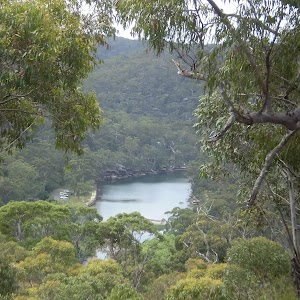
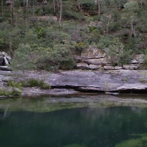
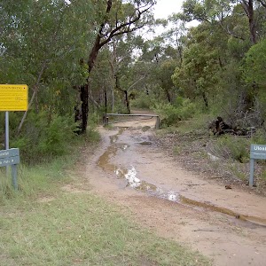
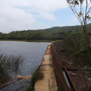
Gallery images
There are other downloads I am still working on.
You will probably need to login to access these — still all free.
* KML (google earth file)
* GPX (GPS file)
Special Maps/ brochures
* A3 topo maps
* PDF with Lands Topo map base
* PDF with arial image (and map overlay)
I wanted to get the main site live first, this extra stuff will come in time.
Happy walking
Matt 🙂
Comments