This walk offers a diverse range of vegetation and sights along its course. Passing Martins Falls and below Martins Lookout, the walk takes in some amazing views as it climbs up and down the ridge lines, above the many creeks and gullies. A walk to test your legs and your camera.* This walk passes through very remote areas and sections have no visible track. At least one person in your group should have training and experience in off track walking and navigation. Even with these notes and a GPS these extra skills and equipment are required.
Springwood to Blaxland Station
And Walk
Springwood to Blaxland Station

6 hrs

628 m
Experienced only
Springwood
(0km) Springwood Station → Int. Springwood Ave and Fairy Dell Reserve

270 m
5 mins
4m
-11m
Very easy
(0.27km) Int. Springwood Ave and Fairy Dell Reserve → Fairy Dell Reserve picnic area

150 m
3 mins
0m
-21m
Easy track
Fairy Dell Reserve picnic area
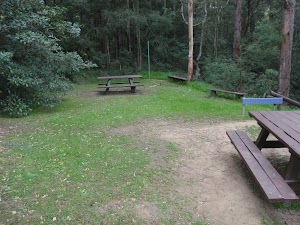
(0.41km) Fairy Dell Reserve picnic area → Int. Fairy Dell and Picnic Point Tracks

390 m
9 mins
5m
-44m
Hard track
(0.8km) Int. Fairy Dell and Picnic Point Tracks → Picnic Point

160 m
6 mins
33m
-2m
Hard track
Picnic Point

(0.8km) Int. Fairy Dell and Picnic Point Tracks → Int. Lawsons Lookout Trk and Fairy Dell Trk

140 m
3 mins
1m
-13m
Moderate track
(0.94km) Int. Lawsons Lookout Trk and Fairy Dell Trk → Lawsons Lookout

410 m
11 mins
39m
-11m
Hard track
Lawsons Lookout
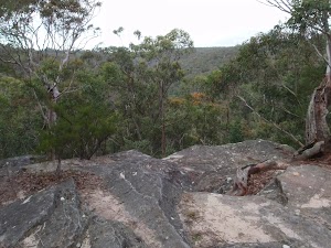
(0.94km) Int. Lawsons Lookout Trk and Fairy Dell Trk → Int. Magdala Ck and Magdala Falls trks

3.2 km
1 hr 7 mins
92m
-181m
Hard track
Turn right: From the intersection, the walk follows the arrows engraved in the rock, keeping the creek to the right. The walk winds down the hillside then crosses the creek, continuing to follow the creek (now on the left) to a ‘Magdala Falls’ sign.
Magdala Falls
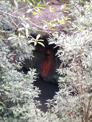
(4.18km) Int. Magdala Ck and Magdala Falls trks → Int. Martins Falls and Magdala Ck trks

300 m
7 mins
13m
-25m
Hard track
(4.47km) Int. Martins Falls and Magdala Ck trks → Behind Martins Falls

30 m
1 mins
1m
-2m
Hard track
Martins Falls

(4.47km) Int. Martins Falls and Magdala Ck trks → Perch Ponds camping area

380 m
10 mins
14m
-63m
Hard track
Perch Ponds Campsite
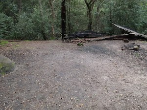
(4.86km) Perch Ponds camping area → Martins camping area

1.2 km
27 mins
51m
-67m
Hard track
Veer right: From the intersection, the walk follows direction of the ‘Long Track’ sign, down the hill. The track winds down near the creek and passes a sandy beach access before soon entering a second clearing.
Martins campsite
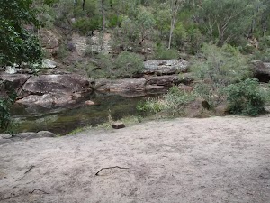
(6.03km) Martins camping area → Int. Martins Lookout and Bunyan Lookout Trk

230 m
6 mins
13m
-14m
Moderate track
(6.26km) Int. Martins Lookout and Bunyan Lookout Trk → Martins Lookout

530 m
26 mins
180m
-2m
Hard track
Martins Lookout
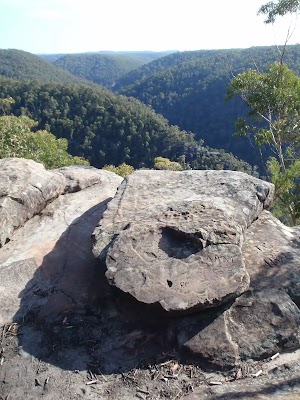
(6.26km) Int. Martins Lookout and Bunyan Lookout Trk → Bunyan Lookout

960 m
38 mins
222m
-25m
Experienced only
Bunyan Lookout
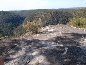
(7.22km) Bunyan Lookout → Int. Bunyan Lookout Trk and Lost Worlds Trk

570 m
10 mins
18m
-7m
Moderate track
(7.78km) Int. Bunyan Lookout Trk and Lost Worlds Trk → Lost Worlds Lookout

570 m
11 mins
20m
-13m
Moderate track
Lost Worlds Lookout
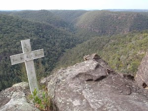
(7.78km) Int. Bunyan Lookout Trk and Lost Worlds Trk → Int. Bunyan Lookout Trk and St Helena Trk

590 m
10 mins
4m
-10m
Moderate track
(8.37km) Int. Bunyan Lookout Trk and St Helena Trk → St Helena Ridge Lookout

2.8 km
49 mins
9m
-122m
Hard track
St Helena Ridge Lookout
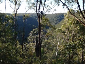
(11.18km) St Helena Ridge Lookout → Int. Waterfall and ridge trk

360 m
18 mins
4m
-122m
Experienced only
(11.53km) Int. Waterfall and ridge trk → St Helena waterfall

160 m
3 mins
4m
-6m
Experienced only
Continue straight: From the beach, the walk heads across the sand bar (covered in reeds) to come within ear-shot of the waterfall, located behind the inlet on the creek. The walk passes through the sandy, shallow section of the creek then walks up the bank and around to the waterfall. At the end of this side trip, retrace your steps back to the main walk then Continue straight.
St Helenas waterfall

(11.53km) Int. Waterfall and ridge trk → Blaxland Library Carpark

1.4 km
34 mins
150m
-28m
Experienced only
Turn left : From the large boulder, this walk heads up the hill and climbs the stone steps steeply, with a number of pink ribbons marking the initial track. The track continues steeply (eroded in places) up the hill and winds its way up to the un-signposted T-intersection.
Turn sharp right: From the intersection[13], this walk heads along the mostly flat track along the side of the hill, keeping the valley to your right. Soon the track leads to another intersection at the base of more stone steps, and a rock wall (on the left) that has ‘Florabella Pass’ engraved in it[14].
Continue straight: From the intersection, the walk heads around the boulder (which is on the left) and soon meets a set of stairs, to the left of a ‘Pippas Pass’ sign[15] in a tree.
Turn right: From the intersection[16], this walk follows the ‘Pippas Pass’ sign[17] (that is about 2m up a tree) gently downhill along the track, directly away from the rockface, keeping the main valley to your right. The track winds along the side of the hill for about 100m
to then climb up a set of sandstone steps just past a shallow sandstone overhang[18]. From here the track gently undulates along the side of the hill (with a steep valley to your right[19]) for about 300m to lead gently down and cross the usually small creek in the shaded valley[20]. Just after crossing this creek[21], the track bends left to head gently up through the valley along the base of a few natural sandstone walls[22] for about 200m, where the the track becomes rocky and starts to climb a bit more steeply. The track then leads up through a cleft in the rock[23] then about 60m later comes to a unsignposted three-way intersection (with the track on the left crossing the creek), marked with a smooth bark Angophera[24].
Turn left: From the intersection[25], this walk crosses the sandstone platform and creek[26]. Here the track winds gently uphill for about 40m to cross a smaller often dry creek [27] where the track continues uphill for another 30m to pass a grafittied sandstone overhang (on your left)[28]. The track continues gently uphill and bends right to cross a sandstone rock platform and small creek[29] to almost immediately come to a faint intersection with a track in the tall heath[30]. Here the walk turns left and heads uphill for for about 50m where the track then leads up some steps to come to the base of a sandstone cliff and smaller overhang[31]. Here the track bends left and and continues along the side of the hill for another 15m to pass a larger and more grafittied sandstone overhang[32]. From here the track continues to wind more steeply uphill for about 80m before turning left and following a wider track (away from the houses) and into the lower car park of Blaxland library just past the ‘Bushcare site’ information sign[33]. Here this walk turns right to head up to the library and main car park[34].
(12.93km) Blaxland Library Carpark → Blaxland shops

460 m
9 mins
28m
-9m
Very easy
Blaxland
(13.39km) Blaxland Shops → Blaxland Station

70 m
1 mins
0m
0m
Very easy
Maps for the Springwood to Blaxland Station walk
You can download the PDF for this walk to print a map.
These maps below cover the walk and the wider area around the walk, they are worth carrying for safety reasons.
| Springwood | 1:25 000 Map Series | 90304S SPRINGWOOD | NSW-90304S |
| Penrith | 1:25 000 Map Series | 90303N PENRITH | NSW-90303N |
| Penrith | 1:100 000 Map Series | 9030 PENRITH | 9030 |
Cross sectional view of the Springwood to Blaxland Station bushwalking track

Analysis and summary of the altitude variation on the Springwood to Blaxland Station
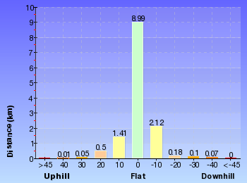
Overview of this walks grade – based on the AS 2156.1 – 2001
Under this standard, a walk is graded based on the most difficult section of the walk.
| Length | 13.5 km | ||
| Time | 6 hrs | ||
| . | |||
| Grade 5/6 Experienced only |
AS 2156.1 | Gradient | Very steep (4/6) |
| Quality of track | Rough unclear track (5/6) | ||
| Signs | No directional signs (5/6) | ||
| Experience Required | Moderate level of bushwalking experience recommended (4/6) | ||
| Weather | Storms may impact on navigation and safety (3/6) | ||
| Infrastructure | No facilities provided (5/6) |
Some more details of this walks Grading
Here is a bit more details explaining grading looking at sections of the walk
Gradient
5km of this walk is very steep and another 4.3km has gentle hills with occasional steps. Whilst another 3.3km has short steep hills and the remaining 800m is flat with no steps.
Quality of track
7km of this walk follows a rough track, where fallen trees and other obstacles are likely and another 3.9km follows a formed track, with some branches and other obstacles. Whilst another 1.4km follows a rough unclear track and a 940m section follows a smooth and hardened path. The remaining 55m follows a clear and well formed track or trail.
Signs
7km of this walk has minimal directional signs and another 4.6km has directional signs at most intersection. Whilst another 1.1km Has no directional signs and the remaining 940m is clearly signposted.
Experience Required
12km of this walk requires no previous bushwalking experience and another 1.3km requires some bushwalking experience. The remaining (110m) requires a leader a with moderate level of bushwalking experience.
weather
Around 12km of this walk is not usually affected by severe weather events (that would unexpectedly impact safety and navigation), whilst the remaining 1.3km is affected by storms that may impact your navigation and safety.
Infrastructure
8km of this walk has limited facilities (such as cliffs not fenced, significant creeks not bridged) and another 4.3km has limited facilities (such as not all cliffs fenced). Whilst another 1.3km is close to useful facilities (such as fenced cliffs and seats) and the remaining 100m has no facilities provided.
Similar walks
A list of walks that share part of the track with the Springwood to Blaxland Station walk.
Other Nearby walks
A list of walks that start near the Springwood to Blaxland Station walk.
Plan your trip to and from the walk here
The Springwood to Blaxland Station walk starts at the Springwood Station (gps: -33.699102, 150.5638)
Your transport options to Springwood Station are by;
![]() Train. (get details)
Train. (get details)
![]() Bus. (get details)
Bus. (get details)
![]() Car. There is free parking available.
Car. There is free parking available.
(get details)
![]() Train. (get details)
Train. (get details)
The Springwood to Blaxland Station ends at the Blaxland Station (gps: -33.743785, 150.60987)
Your transport options to Blaxland Station are by;
![]() Bus. (get details)
Bus. (get details)
![]() Car. There is free parking available.
Car. There is free parking available.
(get details)
Fire Danger
Each park may have its own fire ban, this rating is only valid for today and is based on information from the RFS Please check the RFS Website for more information.
Weather Forest
This walk starts in the Central Tablelands weather district always check the formal BOM forecast or pdf before starting your walk.
Forecast snapshot
Park Information & Alerts
Short URL = http://wild.tl/stbs
Gallery images
There are other downloads I am still working on.
You will probably need to login to access these — still all free.
* KML (google earth file)
* GPX (GPS file)
Special Maps/ brochures
* A3 topo maps
* PDF with Lands Topo map base
* PDF with arial image (and map overlay)
I wanted to get the main site live first, this extra stuff will come in time.
Happy walking
Matt 🙂
Martins Lookout Loop Walk
And Walk
Martins Lookout Loop Walk

6 hrs 30 mins

842 m
Hard track
Springwood
(0km) Springwood Station → No. 18 Sassafras Gully Rd

1.2 km
23 mins
35m
-38m
Very easy
(1.19km) No. 18 Sassafras Gully Rd → Int. Victory and Sassafras Gully Trks

1.4 km
33 mins
28m
-186m
Moderate track
Turn left: From the intersection, the walk heads down the hill, keeping the rock outcrop on the left. The walk passes a track on the left (which heads over the rock outcrop) and turns down the hill. As the walk winds down the hill, a few smaller tracks are passed before nearing a creek. The walk crosses the creek a few times as it heads down the gully to a larger creek junction. The walk crosses the junction, then follows the larger gully, soon coming to a ‘Sassafras Gully Rd’ sign (pointing back the way you came)[4].
(2.59km) Int. Victory and Sassafras Gully Trks → Perch Ponds camping area

3.1 km
1 hr 5 mins
80m
-147m
Hard track
Veer right: From the intersection, the walk follows the direction of the ‘Perch Ponds’ sign[8] across the hillside. The walk soon nears the creek on the left, then undulates above it for a short while. The track crosses a steeply banked creek junction, then continues following the main creek (which is on the left). The walk stays near this creek, coming into a campground clearing with large boulders.
Continue straight: From the campground clearing, the walk exits the clearing, keeping the main creek to the right, and immediately crosses a side creek. The walk keeps the main creek on the right as it slowly climbs the hillside. The track then heads downhill, passing under a few rock overhangs and soon entering the campground clearing of ‘Perch Ponds’.
Perch Ponds Campsite

(5.69km) Perch Ponds camping area → Martins camping area

1.2 km
27 mins
51m
-67m
Hard track
Veer right: From the intersection, the walk follows direction of the ‘Long Track’ sign, down the hill. The track winds down near the creek and passes a sandy beach access before soon entering a second clearing.
Martins campsite

(6.86km) Martins camping area → Int. Martins Lookout and Bunyan Lookout Trk

230 m
6 mins
13m
-14m
Moderate track
(7.09km) Int. Martins Lookout and Bunyan Lookout Trk → Bunyan Lookout

960 m
38 mins
222m
-25m
Experienced only
Bunyan Lookout

(7.09km) Int. Martins Lookout and Bunyan Lookout Trk → Martins Lookout

530 m
26 mins
180m
-2m
Hard track
Martins Lookout

(7.62km) Martins Lookout → Int. Martins Falls and Magdala Ck trks

1.7 km
1 Hr
160m
-273m
Hard track
Turn left: From the intersection, the walk heads towards the bottom of the rocky outcrop. The track heads across the hillside under the rocky outcrop and then turns left, descending the hill steeply. The walk winds down the hill for a short time to a signposted intersection.
Turn right: From the intersection, the walk follows the direction of the ‘Springwood Stn Via…’ sign across the hillside. The walk keeps the valley to the left as it winds down near the creek, on the left. The walk continues down across the creek to immediately lead up the hill into the clearing of Perch Ponds. The walk crosses the clearing to the signs at the other side.
Turn right: From Perch Ponds, the walk follows the ‘Magdala Gully-Fairy Dell’ sign[9], up the hill. The track winds up the hillside for a short time, keeping the creek on the right, then comes to a ‘Martins Falls’ sign[10].
(9.33km) Int. Martins Falls and Magdala Ck trks → Behind Martins Falls

30 m
1 mins
1m
-2m
Hard track
Martins Falls

(9.33km) Int. Martins Falls and Magdala Ck trks → Int. Lawsons Lookout Trk and Fairy Dell Trk

3.5 km
1 hr 14 mins
206m
-105m
Hard track
Continue straight: From the intersection, the walk keeps the valley on the right as it heads up the hill. The walk winds up the hill, crossing the creek after some time. The walk continues up the hill, now with the creek on the left, to an intersection, with arrows engraved in the rock.
Turn left : From the intersection engraved with arrows[11], the walk heads down across the creek. The track then keeps the Magdala Creek on the left before crossing for the first of many times. The walk continues up along Magdala Creek and crosses a rock shelf below some small falls, coming to a ‘Lawson’s Lookout’ sign[12].
(12.86km) Int. Lawsons Lookout Trk and Fairy Dell Trk → Lawsons Lookout

410 m
11 mins
39m
-11m
Hard track
Lawsons Lookout

(12.86km) Int. Lawsons Lookout Trk and Fairy Dell Trk → Int. Fairy Dell and Picnic Point Tracks

140 m
3 mins
13m
-1m
Moderate track
(13km) Int. Fairy Dell and Picnic Point Tracks → Picnic Point

160 m
6 mins
33m
-2m
Hard track
Picnic Point

(13km) Int. Fairy Dell and Picnic Point Tracks → Fairy Dell Reserve picnic area

390 m
9 mins
44m
-5m
Hard track
Fairy Dell Reserve picnic area

(13.39km) Fairy Dell Reserve picnic area → Int. Springwood Ave and Fairy Dell Reserve

150 m
3 mins
21m
0m
Easy track
(13.53km) Int. Springwood Ave and Fairy Dell Reserve → Springwood Station

270 m
5 mins
11m
-4m
Very easy
Maps for the Martins Lookout Loop Walk walk
You can download the PDF for this walk to print a map.
These maps below cover the walk and the wider area around the walk, they are worth carrying for safety reasons.
| Springwood | 1:25 000 Map Series | 90304S SPRINGWOOD | NSW-90304S |
| Penrith | 1:100 000 Map Series | 9030 PENRITH | 9030 |
Cross sectional view of the Martins Lookout Loop Walk bushwalking track

Analysis and summary of the altitude variation on the Martins Lookout Loop Walk
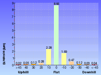
Overview of this walks grade – based on the AS 2156.1 – 2001
Under this standard, a walk is graded based on the most difficult section of the walk.
| Length | 13.8 km | ||
| Time | 6 hrs 30 mins | ||
| . | |||
| Grade 4/6 Hard track |
AS 2156.1 | Gradient | Very steep (4/6) |
| Quality of track | Rough track, where fallen trees and other obstacles are likely (4/6) | ||
| Signs | Minimal directional signs (4/6) | ||
| Experience Required | No experience required (1/6) | ||
| Weather | Weather generally has little impact on safety (1/6) | ||
| Infrastructure | Limited facilities (such as cliffs not fenced, significant creeks not bridged) (4/6) |
Some more details of this walks Grading
Here is a bit more details explaining grading looking at sections of the walk
Gradient
6km of this walk is very steep and another 6km has short steep hills. Whilst another 1.5km is flat with no steps and the remaining 150m has gentle hills with occasional steps.
Quality of track
7km of this walk follows a rough track, where fallen trees and other obstacles are likely and another 4.8km follows a formed track, with some branches and other obstacles. The remaining (1.6km) follows a smooth and hardened path.
Signs
7km of this walk has directional signs at most intersection and another 4.8km has minimal directional signs. The remaining (1.7km) is clearly signposted.
Experience Required
This whole walk, 14km requires no previous bushwalking experience.
weather
This whole walk, 14km is not usually affected by severe weather events (that would unexpectedly impact safety and navigation).
Infrastructure
6km of this walk has limited facilities (such as cliffs not fenced, significant creeks not bridged) and another 5km has limited facilities (such as not all cliffs fenced). The remaining (2.1km) is close to useful facilities (such as fenced cliffs and seats).
Similar walks
A list of walks that share part of the track with the Martins Lookout Loop Walk walk.
Other Nearby walks
A list of walks that start near the Martins Lookout Loop Walk walk.
Plan your trip to and from the walk here
The Martins Lookout Loop Walk walk starts and ends at the Springwood Station (gps: -33.699107, 150.5638)
Your transport options to Springwood Station are by;
![]() Train. (get details)
Train. (get details)
![]() Bus. (get details)
Bus. (get details)
![]() Car. There is free parking available.
Car. There is free parking available.
(get details)
Fire Danger
Each park may have its own fire ban, this rating is only valid for today and is based on information from the RFS Please check the RFS Website for more information.
Weather Forest
This walk starts in the Central Tablelands weather district always check the formal BOM forecast or pdf before starting your walk.
Forecast snapshot
Park Information & Alerts
Comments
Short URL = http://wild.tl/mllw
Gallery images
There are other downloads I am still working on.
You will probably need to login to access these — still all free.
* KML (google earth file)
* GPX (GPS file)
Special Maps/ brochures
* A3 topo maps
* PDF with Lands Topo map base
* PDF with arial image (and map overlay)
I wanted to get the main site live first, this extra stuff will come in time.
Happy walking
Matt 🙂
Faulconbridge to Blaxland
And Walk
Faulconbridge to Blaxland

2 Days

693 m
Experienced only
This two-day walk, or very solid one-day walk, takes you from station to station, through lush, scenic forest in the lower Blue Mountains. The walk follows the upper section of Glenbrook Creek most of the way to Blaxland, with a venture over the St Helena Ridge to add some views. An enjoyable two-day walk exploring the diverse range of gully and rocky ridge-top environments in the lower Blue Mountains.* This walk passes through very remote areas and sections have no visible track. At least one person in your group should have training and experience in off track walking and navigation. Even with these notes and a GPS these extra skills and equipment are required.
Faulconbridge
(0km) Faulconbridge Station → No. 10 Sir Henrys Pde

410 m
8 mins
10m
-16m
Moderate track
Victory Track

(0.41km) No. 10 Sir Henrys Pde → Int. Victory Trk and Clarinda Falls

1.3 km
38 mins
15m
-173m
Hard track
(1.74km) Int. Victory Trk and Clarinda Falls → Clarinda Falls

30 m
1 mins
1m
-4m
Moderate track
Clarinda Falls

(1.74km) Int. Victory Trk and Clarinda Falls → Victory Trk camping area

630 m
18 mins
23m
-72m
Hard track
Victory Track camping area
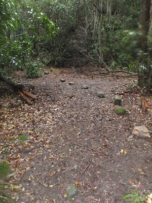
(2.37km) Victory Trk camping area → Victory Trk pool

880 m
24 mins
61m
-78m
Moderate track
Victory Track pool
(3.24km) Victory Trk pool → Perch Ponds camping area

3.4 km
1 hr 11 mins
85m
-165m
Hard track
Turn right: From the intersection, the walk heads down across the creek in the direction of the ‘To Wiggins Track’ sign[15]. The walk winds along the hillside, keeping the creek on the right, passing a blue track marker[16] which directs the walk to the other side of the creek. The walk now keeps the creek on the left as it winds up to a ‘Perch Ponds, Springwood Stn’ sign[17].
Veer right: From the intersection, the walk follows the direction of the ‘Perch Ponds’ sign[18] across the hillside. The walk soon nears the creek on the left, then undulates above it for a short while. The track crosses a steeply banked creek junction, then continues following the main creek (which is on the left). The walk stays near this creek, coming into a campground clearing with large boulders.
Continue straight: From the campground clearing, the walk exits the clearing, keeping the main creek to the right, and immediately crosses a side creek. The walk keeps the main creek on the right as it slowly climbs the hillside. The track then heads downhill, passing under a few rock overhangs and soon entering the campground clearing of ‘Perch Ponds’.
Perch Ponds Campsite

(6.62km) Perch Ponds camping area → Martins camping area

1.2 km
27 mins
51m
-67m
Hard track
Veer right: From the intersection, the walk follows direction of the ‘Long Track’ sign, down the hill. The track winds down near the creek and passes a sandy beach access before soon entering a second clearing.
Martins campsite

End of day 1
(7.79km) Martins camping area → Bunyan Lookout

1.2 km
44 mins
235m
-39m
Experienced only
Veer right: From the intersection, the walk follows the ‘Bunyan Lkt’ post down the stairs. The walk soon meets the creek and turns left, following the creek for a short distance before crossing at an opening in the shrubs around the creek. From here, the walk follows the cairns (rock stacks) across creek flats before climbing the hill to the base of a small cliff line. At one point beneath the cliff line, the walk ducks through a hole in the rock, then winds up through boulders, following more cairns. The walk continues up the hill, passing through a few more rocky outcrops to reach the informal, unfenced Bunyan Lookout, in a clearing near the cliff line.
Bunyan Lookout

(8.98km) Bunyan Lookout → Int. Bunyan Lookout Trk and Lost Worlds Trk

570 m
10 mins
18m
-7m
Moderate track
(9.55km) Int. Bunyan Lookout Trk and Lost Worlds Trk → Lost Worlds Lookout

570 m
11 mins
20m
-13m
Moderate track
Lost Worlds Lookout

(9.55km) Int. Bunyan Lookout Trk and Lost Worlds Trk → St Helena Ridge Lookout

3.4 km
59 mins
13m
-132m
Hard track
Veer left: From the intersection, this walk heads south east along track soon leading downhill. The walk meanders through the heath for quite some time. The walk nears a cliff line on the left, which it continues near for a short time before opening out onto a rocky outcrop with a view across to houses on the opposite hill (just before the steep downhill section).
St Helena Ridge Lookout

(12.94km) St Helena Ridge Lookout → Int. Waterfall and ridge trk

360 m
18 mins
4m
-122m
Experienced only
(13.3km) Int. Waterfall and ridge trk → St Helena waterfall

160 m
3 mins
4m
-6m
Experienced only
Continue straight: From the beach, the walk heads across the sand bar (covered in reeds) to come within ear-shot of the waterfall, located behind the inlet on the creek. The walk passes through the sandy, shallow section of the creek then walks up the bank and around to the waterfall. At the end of this side trip, retrace your steps back to the main walk then Continue straight.
St Helenas waterfall

(13.3km) Int. Waterfall and ridge trk → Blaxland Library Carpark

1.4 km
34 mins
150m
-28m
Experienced only
Turn left : From the large boulder, this walk heads up the hill and climbs the stone steps steeply, with a number of pink ribbons marking the initial track. The track continues steeply (eroded in places) up the hill and winds its way up to the un-signposted T-intersection.
Turn sharp right: From the intersection[19], this walk heads along the mostly flat track along the side of the hill, keeping the valley to your right. Soon the track leads to another intersection at the base of more stone steps, and a rock wall (on the left) that has ‘Florabella Pass’ engraved in it[20].
Continue straight: From the intersection, the walk heads around the boulder (which is on the left) and soon meets a set of stairs, to the left of a ‘Pippas Pass’ sign[21] in a tree.
Turn right: From the intersection[22], this walk follows the ‘Pippas Pass’ sign[23] (that is about 2m up a tree) gently downhill along the track, directly away from the rockface, keeping the main valley to your right. The track winds along the side of the hill for about 100m
to then climb up a set of sandstone steps just past a shallow sandstone overhang[24]. From here the track gently undulates along the side of the hill (with a steep valley to your right[25]) for about 300m to lead gently down and cross the usually small creek in the shaded valley[26]. Just after crossing this creek[27], the track bends left to head gently up through the valley along the base of a few natural sandstone walls[28] for about 200m, where the the track becomes rocky and starts to climb a bit more steeply. The track then leads up through a cleft in the rock[29] then about 60m later comes to a unsignposted three-way intersection (with the track on the left crossing the creek), marked with a smooth bark Angophera[30].
Turn left: From the intersection[31], this walk crosses the sandstone platform and creek[32]. Here the track winds gently uphill for about 40m to cross a smaller often dry creek [33] where the track continues uphill for another 30m to pass a grafittied sandstone overhang (on your left)[34]. The track continues gently uphill and bends right to cross a sandstone rock platform and small creek[35] to almost immediately come to a faint intersection with a track in the tall heath[36]. Here the walk turns left and heads uphill for for about 50m where the track then leads up some steps to come to the base of a sandstone cliff and smaller overhang[37]. Here the track bends left and and continues along the side of the hill for another 15m to pass a larger and more grafittied sandstone overhang[38]. From here the track continues to wind more steeply uphill for about 80m before turning left and following a wider track (away from the houses) and into the lower car park of Blaxland library just past the ‘Bushcare site’ information sign[39]. Here this walk turns right to head up to the library and main car park[40].
(14.69km) Blaxland Library Carpark → Blaxland shops

460 m
9 mins
28m
-9m
Very easy
Blaxland
(15.15km) Blaxland Shops → Blaxland Station

70 m
1 mins
0m
0m
Very easy
Maps for the Faulconbridge to Blaxland walk
You can download the PDF for this walk to print a map.
These maps below cover the walk and the wider area around the walk, they are worth carrying for safety reasons.
| Springwood | 1:25 000 Map Series | 90304S SPRINGWOOD | NSW-90304S |
| Penrith | 1:25 000 Map Series | 90303N PENRITH | NSW-90303N |
| Penrith | 1:100 000 Map Series | 9030 PENRITH | 9030 |
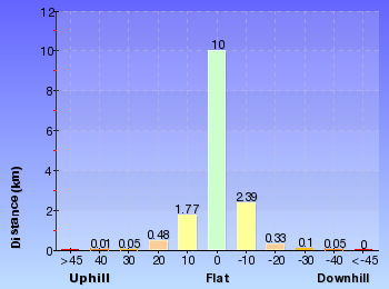
Cross sectional view of the Faulconbridge to Blaxland bushwalking track

Analysis and summary of the altitude variation on the Faulconbridge to Blaxland
Daily actual walking time estimates
| Day | Walking Time | Length |
|---|---|---|
| 1 | 3 hrs 7 mins | 7.8 km |
| 2 | 3 hrs 9 mins | 8.2 km |
Overview of this walks grade – based on the AS 2156.1 – 2001
Under this standard, a walk is graded based on the most difficult section of the walk.
| Length | 15.2 km | ||
| Time | 2 Days | ||
| . | |||
| Grade 5/6 Experienced only |
AS 2156.1 | Gradient | Very steep (4/6) |
| Quality of track | Rough unclear track (5/6) | ||
| Signs | No directional signs (5/6) | ||
| Experience Required | Moderate level of bushwalking experience recommended (4/6) | ||
| Weather | Storms may impact on navigation and safety (3/6) | ||
| Infrastructure | No facilities provided (5/6) |
Some more details of this walks Grading
Here is a bit more details explaining grading looking at sections of the walk
Gradient
6km of this walk has short steep hills and another 4.3km is very steep. Whilst another 4.1km has gentle hills with occasional steps and the remaining 530m is flat with no steps.
Quality of track
7km of this walk follows a rough track, where fallen trees and other obstacles are likely and another 6km follows a formed track, with some branches and other obstacles. Whilst another 1.4km follows a rough unclear track and a 940m section follows a smooth and hardened path. The remaining 55m follows a clear and well formed track or trail.
Signs
6km of this walk has directional signs at most intersection and another 6km has minimal directional signs. Whilst another 2.3km is clearly signposted and the remaining 1.1km Has no directional signs.
Experience Required
14km of this walk requires no previous bushwalking experience and another 1.3km requires some bushwalking experience. The remaining (110m) requires a leader a with moderate level of bushwalking experience.
weather
Around 14km of this walk is not usually affected by severe weather events (that would unexpectedly impact safety and navigation), whilst the remaining 1.3km is affected by storms that may impact your navigation and safety.
Infrastructure
8km of this walk has limited facilities (such as cliffs not fenced, significant creeks not bridged) and another 4.9km has limited facilities (such as not all cliffs fenced). Whilst another 2.3km is close to useful facilities (such as fenced cliffs and seats) and the remaining 100m has no facilities provided.
Similar walks
A list of walks that share part of the track with the Faulconbridge to Blaxland walk.
Other Nearby walks
A list of walks that start near the Faulconbridge to Blaxland walk.
Plan your trip to and from the walk here
The Faulconbridge to Blaxland walk starts at the Faulconbridge Station (gps: -33.69662, 150.53487)
Your transport options to Faulconbridge Station are by;
![]() Train. (get details)
Train. (get details)
![]() Bus. (get details)
Bus. (get details)
![]() Car. There is free parking available.
Car. There is free parking available.
(get details)
The Faulconbridge to Blaxland ends at the Blaxland Station (gps: -33.743785, 150.60987)
Your transport options to Blaxland Station are by;
![]() Train. (get details)
Train. (get details)
![]() Bus. (get details)
Bus. (get details)
![]() Car. There is free parking available.
Car. There is free parking available.
(get details)
Fire Danger
Each park may have its own fire ban, this rating is only valid for today and is based on information from the RFS Please check the RFS Website for more information.
Weather Forest
This walk starts in the Central Tablelands weather district always check the formal BOM forecast or pdf before starting your walk.
Forecast snapshot
Park Information & Alerts
Comments
Short URL = http://wild.tl/ftb
Gallery images
There are other downloads I am still working on.
You will probably need to login to access these — still all free.
* KML (google earth file)
* GPX (GPS file)
Special Maps/ brochures
* A3 topo maps
* PDF with Lands Topo map base
* PDF with arial image (and map overlay)
I wanted to get the main site live first, this extra stuff will come in time.
Happy walking
Matt 🙂
Woodford to Blaxland Station
And Walk
Woodford to Blaxland Station

7 hrs 15 mins

519 m
Experienced only
This walk takes a scenic route across the ridges and down to Glenbrook Creek before climbing to Blaxland. The walk is dotted with many views and usually much wildlife along the way. If there has been substantial rain, the side trip to St Helena waterfall is worth checking out.* This walk passes through very remote areas and sections have no visible track. At least one person in your group should have training and experience in off track walking and navigation. Even with these notes and a GPS these extra skills and equipment are required.
Woodford
(0km) Woodford Station → Int. Oaks Firetrail and Old Bathurst Rd

730 m
15 mins
22m
-39m
Easy track
(0.73km) Int. Oaks Firetrail and Old Bathurst Rd → Int. Oaks Firetrail and cliff lookout Trk

3.5 km
1 hr 10 mins
87m
-175m
Moderate track
(4.21km) Int. Oaks Firetrail and cliff lookout Trk → Cliff lookout

100 m
3 mins
5m
-18m
Hard track
Cliff Lookout
(4.21km) Int. Oaks Firetrail and cliff lookout Trk → Int. St Helena Ridge Trail and Bunyah Lookout Trk

6.9 km
2 hrs 21 mins
187m
-363m
Hard track
Turn left : From the intersection, the walk heads east, down the rocky management trail. The trail winds down the hill, passing over sandy and rocky areas. The trail then flattens out, undulating and winding for quite some time, with the track widening and narrowing greatly in many areas. After some time, the walk enters a large clearing, with a rocky outcrop to the right.
(11.1km) Int. St Helena Ridge Trail and Bunyan Lookout Trk → St Helena Ridge Lookout

4.9 km
1 hr 26 mins
41m
-174m
Hard track
Continue straight: From the intersection, the walk heads north-east along the sandy track. The walk meanders through low, green heath for quite some time, winding through a section of pines before returning to heath as the track arrives at the cairn, on the right, which marks the intersection.
Turn sharp right: From the intersection, this walk heads south east along track soon leading downhill. The walk meanders through the heath for quite some time. The walk nears a cliff line on the left, which it continues near for a short time before opening out onto a rocky outcrop with a view across to houses on the opposite hill (just before the steep downhill section).
St Helena Ridge Lookout

(16.03km) St Helena Ridge Lookout → Int. Waterfall and ridge trk

360 m
18 mins
4m
-122m
Experienced only
(16.38km) Int. Waterfall and ridge trk → St Helena waterfall

160 m
3 mins
4m
-6m
Experienced only
Continue straight: From the beach, the walk heads across the sand bar (covered in reeds) to come within ear-shot of the waterfall, located behind the inlet on the creek. The walk passes through the sandy, shallow section of the creek then walks up the bank and around to the waterfall. At the end of this side trip, retrace your steps back to the main walk then Continue straight.
St Helenas waterfall

(16.38km) Int. Waterfall and ridge trk → Blaxland Library Carpark

1.4 km
34 mins
150m
-28m
Experienced only
Turn left : From the large boulder, this walk heads up the hill and climbs the stone steps steeply, with a number of pink ribbons marking the initial track. The track continues steeply (eroded in places) up the hill and winds its way up to the un-signposted T-intersection.
Turn sharp right: From the intersection[2], this walk heads along the mostly flat track along the side of the hill, keeping the valley to your right. Soon the track leads to another intersection at the base of more stone steps, and a rock wall (on the left) that has ‘Florabella Pass’ engraved in it[3].
Continue straight: From the intersection, the walk heads around the boulder (which is on the left) and soon meets a set of stairs, to the left of a ‘Pippas Pass’ sign[4] in a tree.
Turn right: From the intersection[5], this walk follows the ‘Pippas Pass’ sign[6] (that is about 2m up a tree) gently downhill along the track, directly away from the rockface, keeping the main valley to your right. The track winds along the side of the hill for about 100m
to then climb up a set of sandstone steps just past a shallow sandstone overhang[7]. From here the track gently undulates along the side of the hill (with a steep valley to your right[8]) for about 300m to lead gently down and cross the usually small creek in the shaded valley[9]. Just after crossing this creek[10], the track bends left to head gently up through the valley along the base of a few natural sandstone walls[11] for about 200m, where the the track becomes rocky and starts to climb a bit more steeply. The track then leads up through a cleft in the rock[12] then about 60m later comes to a unsignposted three-way intersection (with the track on the left crossing the creek), marked with a smooth bark Angophera[13].
Turn left: From the intersection[14], this walk crosses the sandstone platform and creek[15]. Here the track winds gently uphill for about 40m to cross a smaller often dry creek [16] where the track continues uphill for another 30m to pass a grafittied sandstone overhang (on your left)[17]. The track continues gently uphill and bends right to cross a sandstone rock platform and small creek[18] to almost immediately come to a faint intersection with a track in the tall heath[19]. Here the walk turns left and heads uphill for for about 50m where the track then leads up some steps to come to the base of a sandstone cliff and smaller overhang[20]. Here the track bends left and and continues along the side of the hill for another 15m to pass a larger and more grafittied sandstone overhang[21]. From here the track continues to wind more steeply uphill for about 80m before turning left and following a wider track (away from the houses) and into the lower car park of Blaxland library just past the ‘Bushcare site’ information sign[22]. Here this walk turns right to head up to the library and main car park[23].
(17.78km) Blaxland Library Carpark → Blaxland shops

460 m
9 mins
28m
-9m
Very easy
Blaxland
(18.24km) Blaxland Shops → Blaxland Station

70 m
1 mins
0m
0m
Very easy
Maps for the Woodford to Blaxland Station walk
You can download the PDF for this walk to print a map.
These maps below cover the walk and the wider area around the walk, they are worth carrying for safety reasons.
| Springwood | 1:25 000 Map Series | 90304S SPRINGWOOD | NSW-90304S |
| Penrith | 1:25 000 Map Series | 90303N PENRITH | NSW-90303N |
| Jamison | 1:25 000 Map Series | 89302N JAMISON | NSW-89302N |
| Katoomba | 1:25 000 Map Series | 89301S KATOOMBA | NSW-89301S |
| Penrith | 1:100 000 Map Series | 9030 PENRITH | 9030 |
| Katoomba | 1:100 000 Map Series | 8930 KATOOMBA | 8930 |
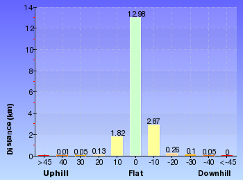
Cross sectional view of the Woodford to Blaxland Station bushwalking track

Analysis and summary of the altitude variation on the Woodford to Blaxland Station
Overview of this walks grade – based on the AS 2156.1 – 2001
Under this standard, a walk is graded based on the most difficult section of the walk.
| Length | 18.3 km | ||
| Time | 7 hrs 15 mins | ||
| . | |||
| Grade 5/6 Experienced only |
AS 2156.1 | Gradient | Very steep (4/6) |
| Quality of track | Rough unclear track (5/6) | ||
| Signs | No directional signs (5/6) | ||
| Experience Required | Moderate level of bushwalking experience recommended (4/6) | ||
| Weather | Storms may impact on navigation and safety (3/6) | ||
| Infrastructure | No facilities provided (5/6) |
Some more details of this walks Grading
Here is a bit more details explaining grading looking at sections of the walk
Gradient
11km of this walk has short steep hills and another 4.7km has gentle hills with occasional steps. Whilst another 1.6km is flat with no steps and the remaining 470m is very steep.
Quality of track
11km of this walk follows a rough track, where fallen trees and other obstacles are likely and another 6km follows a formed track, with some branches and other obstacles. Whilst another 1.3km follows a smooth and hardened path and a 450m section follows a rough unclear track. The remaining 55m follows a clear and well formed track or trail.
Signs
11km of this walk has minimal directional signs and another 6km has directional signs at most intersection. Whilst another 1.3km is clearly signposted and the remaining 100m Has no directional signs.
Experience Required
17km of this walk requires no previous bushwalking experience and another 1.3km requires some bushwalking experience. The remaining (110m) requires a leader a with moderate level of bushwalking experience.
weather
Around 17km of this walk is not usually affected by severe weather events (that would unexpectedly impact safety and navigation), whilst the remaining 1.3km is affected by storms that may impact your navigation and safety.
Infrastructure
11km of this walk has limited facilities (such as cliffs not fenced, significant creeks not bridged) and another 6km has limited facilities (such as not all cliffs fenced). Whilst another 1.3km is close to useful facilities (such as fenced cliffs and seats) and the remaining 100m has no facilities provided.
Similar walks
A list of walks that share part of the track with the Woodford to Blaxland Station walk.
Other Nearby walks
A list of walks that start near the Woodford to Blaxland Station walk.
Plan your trip to and from the walk here
The Woodford to Blaxland Station walk starts at the Woodford Station (gps: -33.735763, 150.48228)
Your transport options to Woodford Station are by;
![]() Train. (get details)
Train. (get details)
![]() Bus. (get details)
Bus. (get details)
![]() Car. There is free parking available.
Car. There is free parking available.
(get details)
![]() Train. (get details)
Train. (get details)
The Woodford to Blaxland Station ends at the Blaxland Station (gps: -33.743785, 150.60987)
Your transport options to Blaxland Station are by;
![]() Bus. (get details)
Bus. (get details)
![]() Car. There is free parking available.
Car. There is free parking available.
(get details)
Fire Danger
Each park may have its own fire ban, this rating is only valid for today and is based on information from the RFS Please check the RFS Website for more information.
Weather Forest
This walk starts in the Central Tablelands weather district always check the formal BOM forecast or pdf before starting your walk.
Forecast snapshot
Park Information & Alerts
Comments
Short URL = http://wild.tl/wtbs
Gallery images
There are other downloads I am still working on.
You will probably need to login to access these — still all free.
* KML (google earth file)
* GPX (GPS file)
Special Maps/ brochures
* A3 topo maps
* PDF with Lands Topo map base
* PDF with arial image (and map overlay)
I wanted to get the main site live first, this extra stuff will come in time.
Happy walking
Matt 🙂
Woodford to Faulconbridge
And Walk
Woodford to Faulconbridge

2 Days

955 m
Experienced only
This walk starts out as mainly service trail to then drop into the Glenbrook Ck Valley for an overnight stay at Martins camping area. The next day the walk follows the winding bush track up the valley to Faulconbridge. In doing so the walk passes Clarinda Falls and some large pools which compliment the wonderful Glenbrook Creek.* This walk passes through very remote areas and sections have no visible track. At least one person in your group should have training and experience in off track walking and navigation. Even with these notes and a GPS these extra skills and equipment are required.
Woodford
(0km) Woodford Station → Int. Oaks Firetrail and Old Bathurst Rd

730 m
15 mins
22m
-39m
Easy track
(0.73km) Int. Oaks Firetrail and Old Bathurst Rd → Int. Oaks Firetrail and cliff lookout Trk

3.5 km
1 hr 10 mins
87m
-175m
Moderate track
(4.21km) Int. Oaks Firetrail and cliff lookout Trk → Cliff lookout

100 m
3 mins
5m
-18m
Hard track
Cliff Lookout

(4.21km) Int. Oaks Firetrail and cliff lookout Trk → Int. St Helena Ridge Trail and Bunyah Lookout Trk

6.9 km
2 hrs 21 mins
187m
-363m
Hard track
Turn left : From the intersection, the walk heads east, down the rocky management trail. The trail winds down the hill, passing over sandy and rocky areas. The trail then flattens out, undulating and winding for quite some time, with the track widening and narrowing greatly in many areas. After some time, the walk enters a large clearing, with a rocky outcrop to the right.
(11.1km) Int. St Helena Ridge Trail and Bunyan Lookout Trk → Int. Bunyan Lookout Trk and Lost Worlds Trk

2.7 km
47 mins
42m
-56m
Hard track
Continue straight: From the intersection, the walk heads north-east along the sandy track. The walk meanders through low, green heath for quite some time, winding through a section of pines before returning to heath as the track arrives at the cairn, on the right, which marks the intersection.
Continue straight: From the intersection, the walk heads north, winding through the scrub. The walk meanders for a short time, passing through a few sandy sections before coming to a red painted stump in a clearer section of track.
(13.81km) Int. Bunyan Lookout Trk and Lost Worlds Trk → Lost Worlds Lookout

570 m
11 mins
20m
-13m
Moderate track
Lost Worlds Lookout

(13.81km) Int. Bunyan Lookout Trk and Lost Worlds Trk → Bunyan Lookout

570 m
10 mins
7m
-18m
Moderate track
Bunyan Lookout

(14.38km) Bunyan Lookout → Int. Martins Lookout and Bunyan Lookout Trk

960 m
38 mins
25m
-222m
Experienced only
(15.33km) Int. Martins Lookout and Bunyan Lookout Trk → Martins Lookout

530 m
26 mins
180m
-2m
Hard track
Martins Lookout

(15.33km) Int. Martins Lookout and Bunyan Lookout Trk → Martins camping area

230 m
6 mins
14m
-13m
Moderate track
Martins campsite

End of day 1
(15.56km) Martins camping area → Perch Ponds camping area

1.2 km
27 mins
67m
-51m
Hard track
Veer left: From the intersection, the walk follows the direction of the ‘Springwood Stn Via…’ sign across the hillside. The walk keeps the valley to the left as it winds down near the creek, on the left. The walk continues down across the creek to immediately lead up the hill into the clearing of Perch Ponds. The walk crosses the clearing to the signs at the other side.
Perch Ponds Campsite

(16.73km) Perch Ponds camping area → Victory Trk pool

3.4 km
1 hr 11 mins
165m
-85m
Hard track
Continue straight: From the campground clearing, the walk exits the clearing, keeping the creek on the right. The track follows the creek, undulating and meandering for some time, and passing through a steeply banked creek junction. The walk tends left and slightly uphill to a ‘Perch Ponds’ sign[2] (pointing back the way you came).
Veer left: From the intersection, the track heads across the hillside in the opposite direction to the ‘Perch Ponds’ sign[3] . The track winds for some time, crossing a creek and passing a blue track marker[4] on the other side. The track follows the creek, now on the left, up to a ‘To Wiggins Track’ sign[5] (pointing back the way you came).
Turn left: From the intersection, the walk follows the ‘Faulconbridge Station’ sign[6] across a gully. The track winds and undulates above the creek (keeping the creek to the left) and soon drops down and crosses the creek. The walk continues, now with the creek on the right, to an intersection with a faint track (which leads to a pool in the creek).
Victory Track pool

(20.11km) Victory Trk pool → Victory Trk camping area

880 m
24 mins
78m
-61m
Moderate track
Victory Track camping area

(20.99km) Victory Trk camping area → Int. Victory Trk and Clarinda Falls

630 m
18 mins
72m
-23m
Hard track
(21.62km) Int. Victory Trk and Clarinda Falls → Clarinda Falls

30 m
1 mins
1m
-4m
Moderate track
Clarinda Falls

(21.62km) Int. Victory Trk and Clarinda Falls → No. 10 Sir Henrys Pde

1.3 km
38 mins
173m
-15m
Hard track
Victory Track

(22.94km) No. 10 Sir Henrys Pde → Faulconbridge Station

410 m
8 mins
16m
-10m
Moderate track
Faulconbridge
Maps for the Woodford to Faulconbridge walk
You can download the PDF for this walk to print a map.
These maps below cover the walk and the wider area around the walk, they are worth carrying for safety reasons.
| Springwood | 1:25 000 Map Series | 90304S SPRINGWOOD | NSW-90304S |
| Penrith | 1:25 000 Map Series | 90303N PENRITH | NSW-90303N |
| Jamison | 1:25 000 Map Series | 89302N JAMISON | NSW-89302N |
| Katoomba | 1:25 000 Map Series | 89301S KATOOMBA | NSW-89301S |
| Penrith | 1:100 000 Map Series | 9030 PENRITH | 9030 |
| Katoomba | 1:100 000 Map Series | 8930 KATOOMBA | 8930 |
Cross sectional view of the Woodford to Faulconbridge bushwalking track

Analysis and summary of the altitude variation on the Woodford to Faulconbridge
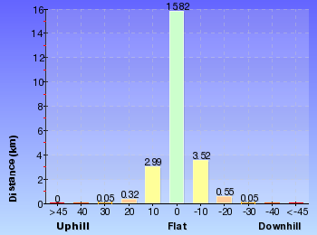
Daily actual walking time estimates
| Day | Walking Time | Length |
|---|---|---|
| 1 | 6 hrs 7 mins | 16.8 km |
| 2 | 3 hrs 7 mins | 7.8 km |
Overview of this walks grade – based on the AS 2156.1 – 2001
Under this standard, a walk is graded based on the most difficult section of the walk.
| Length | 23.4 km | ||
| Time | 2 Days | ||
| . | |||
| Grade 5/6 Experienced only |
AS 2156.1 | Gradient | Very steep (4/6) |
| Quality of track | Rough unclear track (5/6) | ||
| Signs | No directional signs (5/6) | ||
| Experience Required | No experience required (1/6) | ||
| Weather | Weather generally has little impact on safety (1/6) | ||
| Infrastructure | Limited facilities (such as cliffs not fenced, significant creeks not bridged) (4/6) |
Some more details of this walks Grading
Here is a bit more details explaining grading looking at sections of the walk
Gradient
16km of this walk has short steep hills and another 3.8km is very steep. Whilst another 2.9km has gentle hills with occasional steps and the remaining 1.1km is flat with no steps.
Quality of track
11km of this walk follows a rough track, where fallen trees and other obstacles are likely and another 10km follows a formed track, with some branches and other obstacles. Whilst another 1.1km follows a smooth and hardened path and the remaining 960m follows a rough unclear track.
Signs
10km of this walk has directional signs at most intersection and another 10km has minimal directional signs. Whilst another 2.5km is clearly signposted and the remaining 960m Has no directional signs.
Experience Required
This whole walk, 23km requires no previous bushwalking experience.
weather
This whole walk, 23km is not usually affected by severe weather events (that would unexpectedly impact safety and navigation).
Infrastructure
12km of this walk has limited facilities (such as cliffs not fenced, significant creeks not bridged) and another 9km has limited facilities (such as not all cliffs fenced). The remaining (2.5km) is close to useful facilities (such as fenced cliffs and seats).
Similar walks
A list of walks that share part of the track with the Woodford to Faulconbridge walk.
Other Nearby walks
A list of walks that start near the Woodford to Faulconbridge walk.
Plan your trip to and from the walk here
The Woodford to Faulconbridge walk starts at the Woodford Station (gps: -33.735763, 150.48228)
Your transport options to Woodford Station are by;
![]() Train. (get details)
Train. (get details)
![]() Bus. (get details)
Bus. (get details)
![]() Car. There is free parking available.
Car. There is free parking available.
(get details)
![]() Train. (get details)
Train. (get details)
The Woodford to Faulconbridge ends at the Faulconbridge Station (gps: -33.69662, 150.53487)
Your transport options to Faulconbridge Station are by;
![]() Bus. (get details)
Bus. (get details)
![]() Car. There is free parking available.
Car. There is free parking available.
(get details)
Fire Danger
Each park may have its own fire ban, this rating is only valid for today and is based on information from the RFS Please check the RFS Website for more information.
Weather Forest
This walk starts in the Central Tablelands weather district always check the formal BOM forecast or pdf before starting your walk.
Forecast snapshot
Park Information & Alerts
Comments
Short URL = http://wild.tl/wtf
Gallery images
There are other downloads I am still working on.
You will probably need to login to access these — still all free.
* KML (google earth file)
* GPX (GPS file)
Special Maps/ brochures
* A3 topo maps
* PDF with Lands Topo map base
* PDF with arial image (and map overlay)
I wanted to get the main site live first, this extra stuff will come in time.
Happy walking
Matt 🙂
Woodford to Glenbrook
And Walk
Woodford to Glenbrook

3 Days

731 m
Hard track
Woodford
(0km) Woodford Station → Int. Oaks Firetrail and Old Bathurst Rd

730 m
15 mins
22m
-39m
Easy track
(0.73km) Int. Oaks Firetrail and Old Bathurst Rd → Int. Oaks Firetrail and cliff lookout Trk

3.5 km
1 hr 10 mins
87m
-175m
Moderate track
(4.21km) Int. Oaks Firetrail and cliff lookout Trk → Cliff lookout

100 m
3 mins
5m
-18m
Hard track
Cliff Lookout

(4.21km) Int. Oaks Firetrail and cliff lookout Trk → Int. Wheel Gully Trail and Oaks Firetrail

7.9 km
2 hrs 45 mins
318m
-316m
Hard track
Continue straight: From the intersection, the walk heads south up the hill, passing a blue marker sign soon after leaving the intersection. The track then continues up onto the ridge top, then follows the high ground for some time. The track along the ridgeline is surrounded by rocky surfaces and lower vegetation which lends views of the surrounding valleys. The track begins to descend after winding over and around the ridgeline for some time. As the track descends, it passes a rock shelf to the right of the track, which has good views over the valley. The track continues down the hill into a saddle with an intersection with a gate, to the left.
Continue straight: From the intersection in the saddle the track heads up the hill for a short time. The track climbs up onto a plateau where the track is bordered by rocky surfaces and low scrub across the ridge line. This plateau is then left as the track descends slightly as the track winds along the hillside for some time to wind right, coming quickly to the intersection.
(12.09km) Int. Wheel Gully Trail and Oaks Firetrail → Int. in Wheel Gully loop

100 m
2 mins
0m
-16m
Moderate track
Wheel Gully
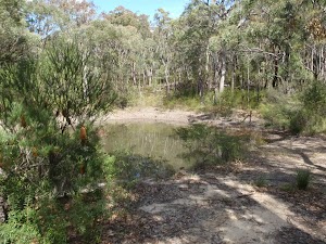
End of day 1
(12.19km) Int. in Wheel Gully loop → Int. Wheel Gully Trail and Oaks Firetrail

100 m
2 mins
16m
0m
Moderate track
(12.29km) Int. Wheel Gully Trail and Oaks Firetrail → The Oaks Picnic Area

6 km
1 hr 59 mins
26m
-270m
Moderate track
Continue straight: From the intersection, the walk heads down a slight slope. The trail drops down some steeper sections as the trail generally descends at a gentle gradient, winding slightly as it leads down to a gate and interpretative sign before an intersection.
Continue straight: From the intersection, the walk heads east, directly away from the gate and sign to the bend in the management trail.
Continue straight: From the intersection, the walk heads away from both the ’40’ sign and the gate, heading east down the management trail. The walk soon comes to the intersection, signposted ‘Red Hands Cave’.
Veer right: From the intersection, the walk heads in an easterly direction along the management trail, tending left around to the Oaks Picnic Area on the left and the car park on the right.
The Oaks Picnic Area
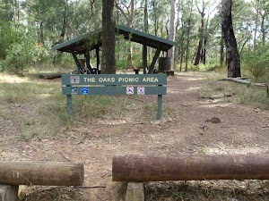
(18.32km) The Oaks Picnic Area → Int. Oaks Picnic Area Trk and Oaks single Trk

70 m
1 mins
2m
0m
Moderate track
(18.39km) Int. Oaks Picnic Area Trk and Oaks single Trk → 5km to Glenbrook Sign

2.3 km
38 mins
5m
-72m
Moderate track
(20.65km) 5km to Glenbrook Sign → The Ironbark Picnic Area

2.7 km
46 mins
8m
-52m
Moderate track
Turn right: From the intersection, the walk follows the narrower track east towards the road. The track opens up at the car park, and the walk crosses the road to the Ironbark picnic area.
Ironbark Picnic Area
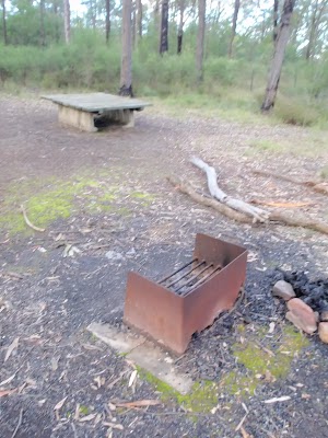
(23.38km) The Ironbark Picnic Area → Top of Darug campsite car park

1.6 km
30 mins
8m
-98m
Moderate track
Veer left: From the dirt road just below the signposted ‘Nioka’ campsite, this walk follows the main road, initially keeping the campsite to the left. The walk heads across a small, bridged creek crossing and up to the intersection. At the intersection, there are some information signs about the area (on the right).
Continue straight: From the signposts, the walk follows the ‘Daruk’[2] arrow along the flat dirt road, keeping the hill up to the left. After passing the garbage bins, the trail crosses a small creek and comes to an intersection with a bush track on the left, just before the signposted ‘Darug’ campsite.
Euroka Campground – Darug
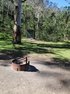
End of day 2
(24.93km) Top of Darug campsite car park → Int. Euroka Trk and The Oaks Fire Trail

2.3 km
51 mins
111m
-103m
Hard track
Continue straight: From the intersection, the walk heads north, following neither of the arrows on the sign. The track soon comes to Mount Portal Trail, just next to the intersection with Euroka Road.
Veer right: From the intersection, the walk follows the ‘The Causeway’ sign, along the bush track. The track tends right into the low grassy bush. As the track continues down the hill, the grass gives way to wattle bush covering the gully. The track leads down many stairs then crosses a creek or two before winding along the hillside. The track then continues down into the gully to pass a fading track, on the left, then winds through to a hairpin corner on the road, marked by a ‘Euroka Track’ sign (pointing back the way you came).
(27.24km) Int. Euroka Trk and The Oaks Fire Trail → Eastern side of Causeway

230 m
5 mins
0m
-28m
Moderate track
Veer right: From the southern side of the causeway, the walk heads across the causeway to the road, next to the fenced, paved area. The causeway may be impassable after rain.
Glenbrook causeway
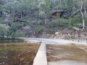
(27.48km) Eastern side of Causeway → Jelly Bean Pool

320 m
6 mins
5m
-6m
Hard track
Jellybean Pool
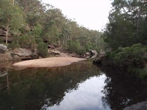
(27.79km) Jelly Bean Pool → Glenbrook Information Centre car park

500 m
13 mins
88m
-3m
Moderate track
Continue straight: From the bins, the walk heads up to the top of the car park to the sealed road. The walk soon turns right, up the stairs and into the bush. The walk heads up many stairs, crossing the road twice along the way. The track winds around a rocky outcrop and enters a small grassed area with bench seats. The walk continues past these seats to the bottom of the car park, at the front of the Glenbrook Information Centre.
NPWS Glenbrook Information Centre
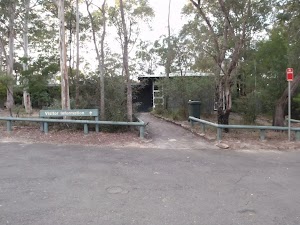
(28.29km) Glenbrook Information Centre car park → Glenbrook Station

1.3 km
23 mins
35m
-13m
Moderate track
Glenbrook
Maps for the Woodford to Glenbrook walk
You can download the PDF for this walk to print a map.
These maps below cover the walk and the wider area around the walk, they are worth carrying for safety reasons.
| Springwood | 1:25 000 Map Series | 90304S SPRINGWOOD | NSW-90304S |
| Penrith | 1:25 000 Map Series | 90303N PENRITH | NSW-90303N |
| Jamison | 1:25 000 Map Series | 89302N JAMISON | NSW-89302N |
| Katoomba | 1:25 000 Map Series | 89301S KATOOMBA | NSW-89301S |
| Penrith | 1:100 000 Map Series | 9030 PENRITH | 9030 |
| Katoomba | 1:100 000 Map Series | 8930 KATOOMBA | 8930 |
Cross sectional view of the Woodford to Glenbrook bushwalking track

Analysis and summary of the altitude variation on the Woodford to Glenbrook
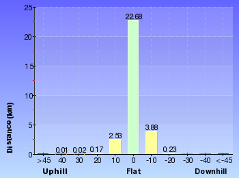
Daily actual walking time estimates
| Day | Walking Time | Length |
|---|---|---|
| 1 | 4 hrs 15 mins | 12.3 km |
| 2 | 3 hrs 56 mins | 12.7 km |
| 3 | 1 hr 38 mins | 4.6 km |
Overview of this walks grade – based on the AS 2156.1 – 2001
Under this standard, a walk is graded based on the most difficult section of the walk.
| Length | 29.6 km | ||
| Time | 3 Days | ||
| . | |||
| Grade 4/6 Hard track |
AS 2156.1 | Gradient | Very steep (4/6) |
| Quality of track | Rough track, where fallen trees and other obstacles are likely (4/6) | ||
| Signs | Minimal directional signs (4/6) | ||
| Experience Required | Moderate level of bushwalking experience recommended (4/6) | ||
| Weather | Storms may impact on navigation and safety (3/6) | ||
| Infrastructure | Limited facilities, not all cliffs are fenced (3/6) |
Some more details of this walks Grading
Here is a bit more details explaining grading looking at sections of the walk
Gradient
14km of this walk has short steep hills and another 6km is very steep. Whilst another 6km has gentle hills with occasional steps and the remaining 3km is flat with no steps.
Quality of track
16km of this walk follows a formed track, with some branches and other obstacles and another 11km follows a clear and well formed track or trail. Whilst another 2.5km follows a smooth and hardened path and the remaining 320m follows a rough track, where fallen trees and other obstacles are likely.
Signs
21km of this walk has directional signs at most intersection and another 4.5km is clearly signposted. The remaining (4.3km) has minimal directional signs.
Experience Required
27km of this walk requires no previous bushwalking experience and another 1.9km requires some bushwalking experience. The remaining (320m) requires a leader a with moderate level of bushwalking experience.
weather
Around 29km of this walk is not usually affected by severe weather events (that would unexpectedly impact safety and navigation), whilst the remaining 330m is affected by storms that may impact your navigation and safety.
Infrastructure
Around 25km of this walk has limited facilities (such as not all cliffs fenced), whilst the remaining 4.1km is close to useful facilities (such as fenced cliffs and seats).
Similar walks
A list of walks that share part of the track with the Woodford to Glenbrook walk.
Other Nearby walks
A list of walks that start near the Woodford to Glenbrook walk.
Plan your trip to and from the walk here
The Woodford to Glenbrook walk starts at the Woodford Station (gps: -33.735763, 150.48228)
Your transport options to Woodford Station are by;
![]() Train. (get details)
Train. (get details)
![]() Bus. (get details)
Bus. (get details)
![]() Car. There is free parking available.
Car. There is free parking available.
(get details)
The Woodford to Glenbrook ends at the Glenbrook Station (gps: -33.768939, 150.62134)
Your transport options to Glenbrook Station are by;
![]() Train. (get details)
Train. (get details)
![]() Bus. (get details)
Bus. (get details)
![]() Car. There is free parking available.
Car. There is free parking available.
(get details)
Fire Danger
Each park may have its own fire ban, this rating is only valid for today and is based on information from the RFS Please check the RFS Website for more information.
Weather Forest
This walk starts in the Central Tablelands weather district always check the formal BOM forecast or pdf before starting your walk.
Forecast snapshot
Park Information & Alerts
Comments
Short URL = http://wild.tl/wtg
Gallery images
There are other downloads I am still working on.
You will probably need to login to access these — still all free.
* KML (google earth file)
* GPX (GPS file)
Special Maps/ brochures
* A3 topo maps
* PDF with Lands Topo map base
* PDF with arial image (and map overlay)
I wanted to get the main site live first, this extra stuff will come in time.
Happy walking
Matt 🙂
Raymond Rd to Lawsons Lookout
And Walk
Raymond Rd to Lawsons Lookout

15 mins

20 m
Moderate track
(0km) End of Raymond Rd → Lawsons Lookout

100 m
3 mins
3m
-17m
Moderate track
Lawsons Lookout

Maps for the Raymond Rd to Lawsons Lookout walk
You can download the PDF for this walk to print a map.
These maps below cover the walk and the wider area around the walk, they are worth carrying for safety reasons.
| Springwood | 1:25 000 Map Series | 90304S SPRINGWOOD | NSW-90304S |
| Penrith | 1:100 000 Map Series | 9030 PENRITH | 9030 |
Cross sectional view of the Raymond Rd to Lawsons Lookout bushwalking track

Analysis and summary of the altitude variation on the Raymond Rd to Lawsons Lookout
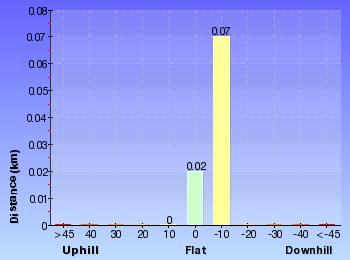
Overview of this walks grade – based on the AS 2156.1 – 2001
Under this standard, a walk is graded based on the most difficult section of the walk.
| Length | 202 m | ||
| Time | 15 mins | ||
| . | |||
| Grade 3/6 Moderate track |
AS 2156.1 | Gradient | Short steep hills (3/6) |
| Quality of track | Formed track, with some branches and other obstacles (3/6) | ||
| Signs | Directional signs along the way (3/6) | ||
| Experience Required | No experience required (1/6) | ||
| Weather | Weather generally has little impact on safety (1/6) | ||
| Infrastructure | Generally useful facilities (such as fenced cliffs and seats) (1/6) |
Some more details of this walks Grading
Here is a bit more details explaining grading looking at sections of the walk
Gradient
This whole walk, 100m has short steep hills.
Quality of track
This whole walk, 100m follows a formed track, with some branches and other obstacles.
Signs
This whole walk, 100m has directional signs at most intersection.
Experience Required
This whole walk, 100m requires no previous bushwalking experience.
weather
This whole walk, 100m is not usually affected by severe weather events (that would unexpectedly impact safety and navigation).
Infrastructure
This whole walk, 100m is close to useful facilities (such as fenced cliffs and seats).
Similar walks
A list of walks that share part of the track with the Raymond Rd to Lawsons Lookout walk.
Other Nearby walks
A list of walks that start near the Raymond Rd to Lawsons Lookout walk.
Plan your trip to and from the walk here
The Raymond Rd to Lawsons Lookout walk starts and ends at the End of Raymond Rd (gps: -33.706077, 150.56627)
Your transport options to End of Raymond Rd are by;
![]() Train. (get details)
Train. (get details)
![]() Bus. (get details)
Bus. (get details)
![]() Car. There is free parking available.
Car. There is free parking available.
(get details)
Fire Danger
Each park may have its own fire ban, this rating is only valid for today and is based on information from the RFS Please check the RFS Website for more information.
Weather Forest
This walk starts in the Central Tablelands weather district always check the formal BOM forecast or pdf before starting your walk.
Forecast snapshot
Park Information & Alerts
Comments
Short URL = http://wild.tl/llfrr
Gallery images
There are other downloads I am still working on.
You will probably need to login to access these — still all free.
* KML (google earth file)
* GPX (GPS file)
Special Maps/ brochures
* A3 topo maps
* PDF with Lands Topo map base
* PDF with arial image (and map overlay)
I wanted to get the main site live first, this extra stuff will come in time.
Happy walking
Matt 🙂
Lawson Lookout from Fairy Dell Reserve

1 hr 30 mins

149 m
Hard track
Springwood
(0km) Springwood Station → Int. Springwood Ave and Fairy Dell Reserve

270 m
5 mins
4m
-11m
Very easy
(0.27km) Int. Springwood Ave and Fairy Dell Reserve → Fairy Dell Reserve picnic area

150 m
3 mins
0m
-21m
Easy track
Fairy Dell Reserve picnic area

(0.41km) Fairy Dell Reserve picnic area → Int. Fairy Dell and Picnic Point Tracks

390 m
9 mins
5m
-44m
Hard track
(0.8km) Int. Fairy Dell and Picnic Point Tracks → Picnic Point

160 m
6 mins
33m
-2m
Hard track
Picnic Point

(0.8km) Int. Fairy Dell and Picnic Point Tracks → Int. Lawsons Lookout Trk and Fairy Dell Trk

140 m
3 mins
1m
-13m
Moderate track
(0.94km) Int. Lawsons Lookout Trk and Fairy Dell Trk → Lawsons Lookout

410 m
11 mins
39m
-11m
Hard track
Lawsons Lookout

(1.35km) Lawsons Lookout → End of Raymond Rd

100 m
3 mins
17m
-3m
Moderate track
Maps for the Lawson Lookout from Fairy Dell Reserve walk
You can download the PDF for this walk to print a map.
These maps below cover the walk and the wider area around the walk, they are worth carrying for safety reasons.
| Springwood | 1:25 000 Map Series | 90304S SPRINGWOOD | NSW-90304S |
| Penrith | 1:100 000 Map Series | 9030 PENRITH | 9030 |
Cross sectional view of the Lawson Lookout from Fairy Dell Reserve bushwalking track

Analysis and summary of the altitude variation on the Lawson Lookout from Fairy Dell Reserve
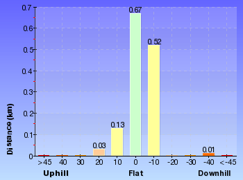
Overview of this walks grade – based on the AS 2156.1 – 2001
Under this standard, a walk is graded based on the most difficult section of the walk.
| Length | 2.7 km | ||
| Time | 1 hr 30 mins | ||
| . | |||
| Grade 4/6 Hard track |
AS 2156.1 | Gradient | Very steep (4/6) |
| Quality of track | Formed track, with some branches and other obstacles (3/6) | ||
| Signs | Directional signs along the way (3/6) | ||
| Experience Required | No experience required (1/6) | ||
| Weather | Weather generally has little impact on safety (1/6) | ||
| Infrastructure | Limited facilities (such as cliffs not fenced, significant creeks not bridged) (4/6) |
Some more details of this walks Grading
Here is a bit more details explaining grading looking at sections of the walk
Gradient
800m of this walk is very steep and another 270m is flat with no steps. Whilst another 150m has gentle hills with occasional steps and the remaining 140m has short steep hills.
Quality of track
Around 930m of this walk follows a formed track, with some branches and other obstacles, whilst the remaining 410m follows a smooth and hardened path.
Signs
Around 930m of this walk has directional signs at most intersection, whilst the remaining 410m is clearly signposted.
Experience Required
This whole walk, 1.3km requires no previous bushwalking experience.
weather
This whole walk, 1.3km is not usually affected by severe weather events (that would unexpectedly impact safety and navigation).
Infrastructure
800m of this walk is close to useful facilities (such as fenced cliffs and seats) and another 410m has limited facilities (such as cliffs not fenced, significant creeks not bridged). The remaining (140m) has limited facilities (such as not all cliffs fenced).
Similar walks
A list of walks that share part of the track with the Lawson Lookout from Fairy Dell Reserve walk.
Other Nearby walks
A list of walks that start near the Lawson Lookout from Fairy Dell Reserve walk.
Plan your trip to and from the walk here
The Lawson Lookout from Fairy Dell Reserve walk starts and ends at the Springwood Station (gps: -33.699102, 150.5638)
Your transport options to Springwood Station are by;
![]() Train. (get details)
Train. (get details)
![]() Bus. (get details)
Bus. (get details)
![]() Car. There is free parking available.
Car. There is free parking available.
(get details)
Fire Danger
Each park may have its own fire ban, this rating is only valid for today and is based on information from the RFS Please check the RFS Website for more information.
Weather Forest
This walk starts in the Central Tablelands weather district always check the formal BOM forecast or pdf before starting your walk.
Forecast snapshot
Park Information & Alerts
Comments
Short URL = http://wild.tl/fdtll
Gallery images
There are other downloads I am still working on.
You will probably need to login to access these — still all free.
* KML (google earth file)
* GPX (GPS file)
Special Maps/ brochures
* A3 topo maps
* PDF with Lands Topo map base
* PDF with arial image (and map overlay)
I wanted to get the main site live first, this extra stuff will come in time.
Happy walking
Matt 🙂
Clarinda Falls from Faulconbridge
And Walk
Clarinda Falls from Faulconbridge

2 hrs

219 m
Hard track
Faulconbridge
(0km) Faulconbridge Station → No. 10 Sir Henrys Pde

410 m
8 mins
10m
-16m
Moderate track
Victory Track

(0.41km) No. 10 Sir Henrys Pde → Clarinda Falls

1.3 km
39 mins
16m
-177m
Hard track
Turn left: From the intersection, the track follows the ‘Clarinda Falls’ sign[11] towards the log fallen on the rock. The track tends left around the hillside, coming to Clarinda Falls.
Clarinda Falls

Maps for the Clarinda Falls from Faulconbridge walk
You can download the PDF for this walk to print a map.
These maps below cover the walk and the wider area around the walk, they are worth carrying for safety reasons.
| Springwood | 1:25 000 Map Series | 90304S SPRINGWOOD | NSW-90304S |
| Penrith | 1:100 000 Map Series | 9030 PENRITH | 9030 |
Cross sectional view of the Clarinda Falls from Faulconbridge bushwalking track

Analysis and summary of the altitude variation on the Clarinda Falls from Faulconbridge
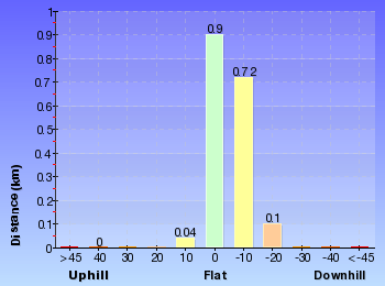
Overview of this walks grade – based on the AS 2156.1 – 2001
Under this standard, a walk is graded based on the most difficult section of the walk.
| Length | 3.5 km | ||
| Time | 2 hrs | ||
| . | |||
| Grade 4/6 Hard track |
AS 2156.1 | Gradient | Very steep (4/6) |
| Quality of track | Formed track, with some branches and other obstacles (3/6) | ||
| Signs | Directional signs along the way (3/6) | ||
| Experience Required | No experience required (1/6) | ||
| Weather | Weather generally has little impact on safety (1/6) | ||
| Infrastructure | Limited facilities, not all cliffs are fenced (3/6) |
Some more details of this walks Grading
Here is a bit more details explaining grading looking at sections of the walk
Gradient
Around 1.3km of this walk is very steep, whilst the remaining 440m has short steep hills.
Quality of track
Around 1.3km of this walk follows a formed track, with some branches and other obstacles, whilst the remaining 410m follows a smooth and hardened path.
Signs
Around 1.7km of this walk is clearly signposted, whilst the remaining 25m has directional signs at most intersection.
Experience Required
This whole walk, 1.8km requires no previous bushwalking experience.
weather
This whole walk, 1.8km is not usually affected by severe weather events (that would unexpectedly impact safety and navigation).
Infrastructure
Around 1.7km of this walk is close to useful facilities (such as fenced cliffs and seats), whilst the remaining 25m has limited facilities (such as not all cliffs fenced).
Similar walks
A list of walks that share part of the track with the Clarinda Falls from Faulconbridge walk.
Other Nearby walks
A list of walks that start near the Clarinda Falls from Faulconbridge walk.
Plan your trip to and from the walk here
The Clarinda Falls from Faulconbridge walk starts and ends at the Faulconbridge Station (gps: -33.69662, 150.53487)
Your transport options to Faulconbridge Station are by;
![]() Train. (get details)
Train. (get details)
![]() Bus. (get details)
Bus. (get details)
![]() Car. There is free parking available.
Car. There is free parking available.
(get details)
Fire Danger
Each park may have its own fire ban, this rating is only valid for today and is based on information from the RFS Please check the RFS Website for more information.
Weather Forest
This walk starts in the Central Tablelands weather district always check the formal BOM forecast or pdf before starting your walk.
Forecast snapshot
Park Information & Alerts
Comments
Short URL = http://wild.tl/ftcf
Gallery images
There are other downloads I am still working on.
You will probably need to login to access these — still all free.
* KML (google earth file)
* GPX (GPS file)
Special Maps/ brochures
* A3 topo maps
* PDF with Lands Topo map base
* PDF with arial image (and map overlay)
I wanted to get the main site live first, this extra stuff will come in time.
Happy walking
Matt 🙂
Faulconbridge to Springwood via Sassafras Gully

3 hrs

338 m
Hard track
Faulconbridge
(0km) Faulconbridge Station → No. 10 Sir Henrys Pde

410 m
8 mins
10m
-16m
Moderate track
Victory Track

(0.41km) No. 10 Sir Henrys Pde → Int. Victory Trk and Clarinda Falls

1.3 km
38 mins
15m
-173m
Hard track
(1.74km) Int. Victory Trk and Clarinda Falls → Clarinda Falls

30 m
1 mins
1m
-4m
Moderate track
Clarinda Falls

(1.74km) Int. Victory Trk and Clarinda Falls → Victory Trk camping area

630 m
18 mins
23m
-72m
Hard track
Victory Track camping area

(2.37km) Victory Trk camping area → Victory Trk pool

880 m
24 mins
61m
-78m
Moderate track
Victory Track pool

(3.24km) Victory Trk pool → No. 18 Sassafras Gully Rd

1.7 km
39 mins
191m
-46m
Hard track
Turn left: From the intersection, the walk follows the ‘Sassafras Gully Rd’ sign[15] up the stairs. The walk crosses a large creek junction and continues up the gully, passing under numerous rock overhangs. Moving away from the creek and its rocky outcrops, the walk steeply climbs the hillside. The walk comes below a rocky outcrop, which it follows around to the right, keeping the outcrop on the right (ignoring the track which leads up the outcrop). The walk comes to an unsignposted intersection with another track.
Turn right: From the intersection, the walk heads up the hill, keeping the rock outcrop to the right. The track tends left towards a house fenceline (house No. 18), which it follows to the end of Sassafras Gully Rd.
(4.92km) No. 18 Sassafras Gully Rd → Springwood Station

1.2 km
23 mins
38m
-35m
Very easy
Springwood
Maps for the Faulconbridge to Springwood via Sassafras Gully walk
You can download the PDF for this walk to print a map.
These maps below cover the walk and the wider area around the walk, they are worth carrying for safety reasons.
| Springwood | 1:25 000 Map Series | 90304S SPRINGWOOD | NSW-90304S |
| Penrith | 1:100 000 Map Series | 9030 PENRITH | 9030 |
Cross sectional view of the Faulconbridge to Springwood via Sassafras Gully bushwalking track

Analysis and summary of the altitude variation on the Faulconbridge to Springwood via Sassafras Gully
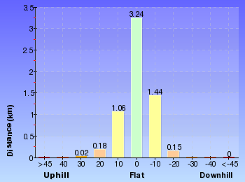
Overview of this walks grade – based on the AS 2156.1 – 2001
Under this standard, a walk is graded based on the most difficult section of the walk.
| Length | 6.1 km | ||
| Time | 3 hrs | ||
| . | |||
| Grade 4/6 Hard track |
AS 2156.1 | Gradient | Very steep (4/6) |
| Quality of track | Rough track, where fallen trees and other obstacles are likely (4/6) | ||
| Signs | Directional signs along the way (3/6) | ||
| Experience Required | No experience required (1/6) | ||
| Weather | Weather generally has little impact on safety (1/6) | ||
| Infrastructure | Limited facilities (such as cliffs not fenced, significant creeks not bridged) (4/6) |
Some more details of this walks Grading
Here is a bit more details explaining grading looking at sections of the walk
Gradient
3.6km of this walk has short steep hills and another 1.3km is very steep. The remaining (1.2km) is flat with no steps.
Quality of track
3.6km of this walk follows a formed track, with some branches and other obstacles and another 1.6km follows a smooth and hardened path. The remaining (900m) follows a rough track, where fallen trees and other obstacles are likely.
Signs
Around 3.1km of this walk has directional signs at most intersection, whilst the remaining 3km is clearly signposted.
Experience Required
This whole walk, 6km requires no previous bushwalking experience.
weather
This whole walk, 6km is not usually affected by severe weather events (that would unexpectedly impact safety and navigation).
Infrastructure
3km of this walk is close to useful facilities (such as fenced cliffs and seats) and another 2.2km has limited facilities (such as not all cliffs fenced). The remaining (900m) has limited facilities (such as cliffs not fenced, significant creeks not bridged).
Similar walks
A list of walks that share part of the track with the Faulconbridge to Springwood via Sassafras Gully walk.
Other Nearby walks
A list of walks that start near the Faulconbridge to Springwood via Sassafras Gully walk.
Plan your trip to and from the walk here
The Faulconbridge to Springwood via Sassafras Gully walk starts at the Faulconbridge Station (gps: -33.69662, 150.53487)
Your transport options to Faulconbridge Station are by;
![]() Train. (get details)
Train. (get details)
![]() Bus. (get details)
Bus. (get details)
![]() Car. There is free parking available.
Car. There is free parking available.
(get details)
![]() Train. (get details)
Train. (get details)
The Faulconbridge to Springwood via Sassafras Gully ends at the Springwood Station (gps: -33.699107, 150.5638)
Your transport options to Springwood Station are by;
![]() Bus. (get details)
Bus. (get details)
![]() Car. There is free parking available.
Car. There is free parking available.
(get details)
Fire Danger
Each park may have its own fire ban, this rating is only valid for today and is based on information from the RFS Please check the RFS Website for more information.
Weather Forest
This walk starts in the Central Tablelands weather district always check the formal BOM forecast or pdf before starting your walk.
Forecast snapshot
Park Information & Alerts
Comments
Short URL = http://wild.tl/ftsvsg
Gallery images
There are other downloads I am still working on.
You will probably need to login to access these — still all free.
* KML (google earth file)
* GPX (GPS file)
Special Maps/ brochures
* A3 topo maps
* PDF with Lands Topo map base
* PDF with arial image (and map overlay)
I wanted to get the main site live first, this extra stuff will come in time.
Happy walking
Matt 🙂


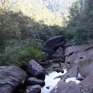
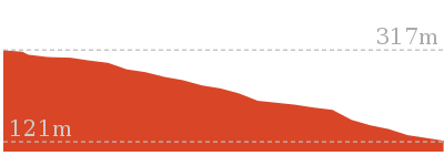
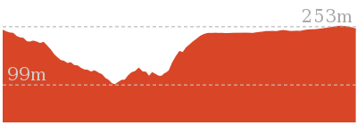
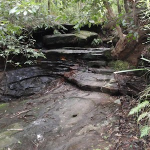
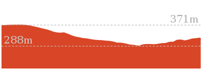
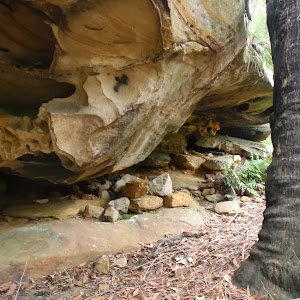

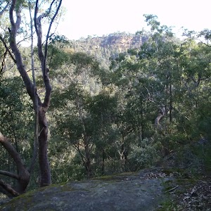
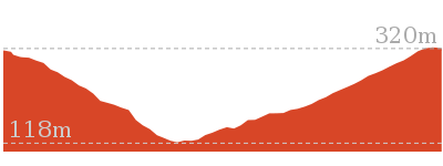
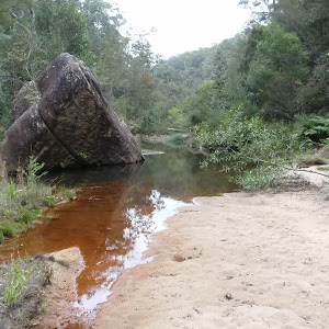

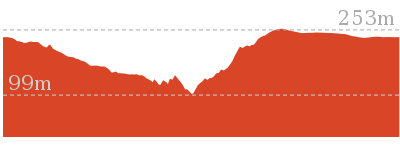
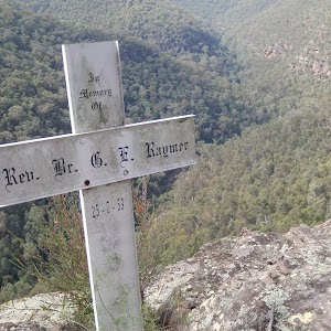
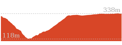

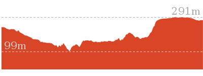
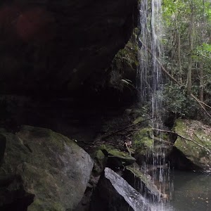
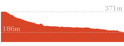
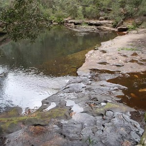

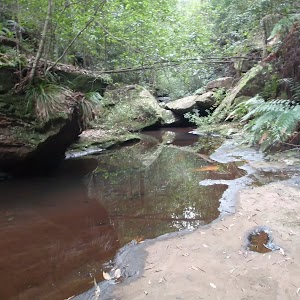
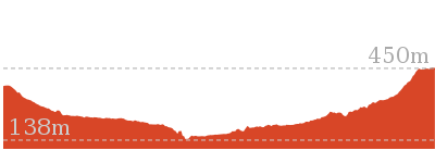
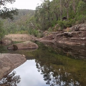
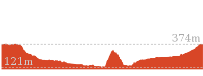
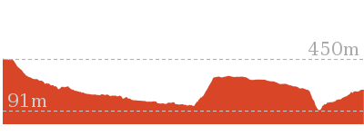
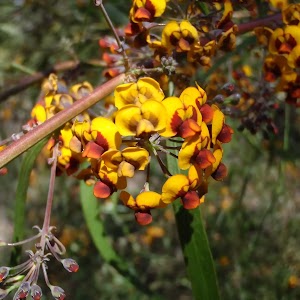
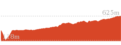
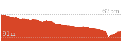
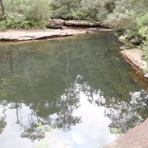

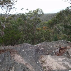
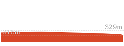
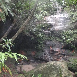
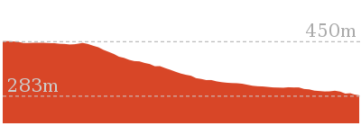
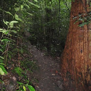
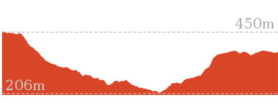
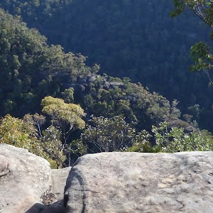
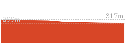
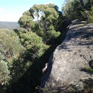
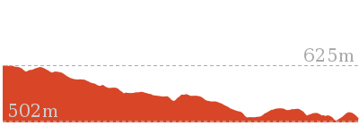
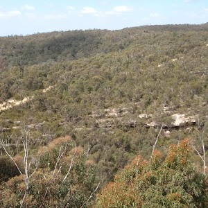

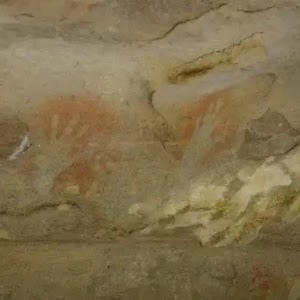
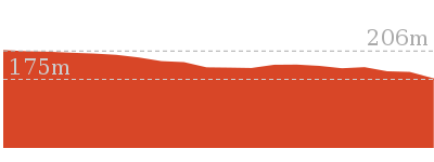
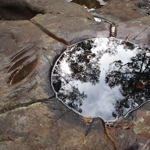
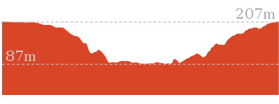
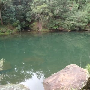
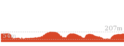
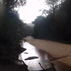
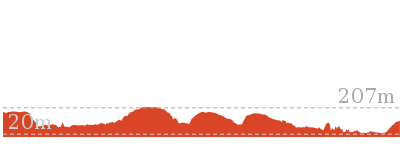
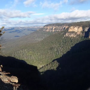

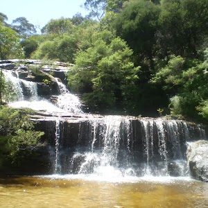
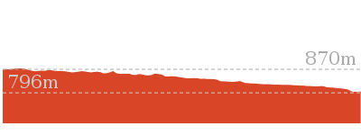


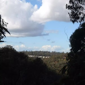
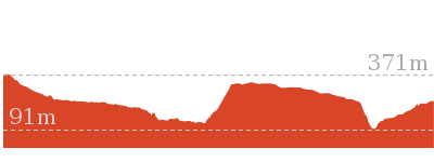
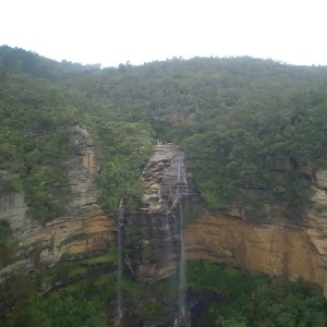
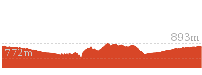
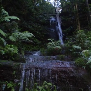

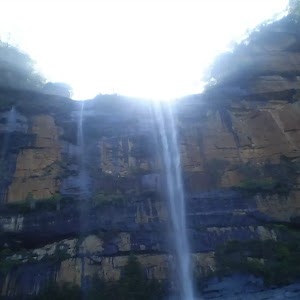

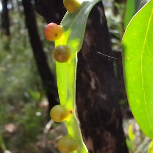
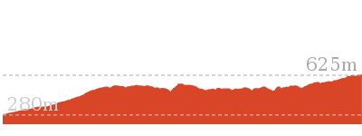
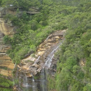
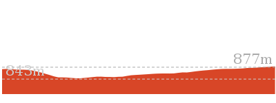
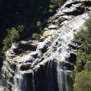
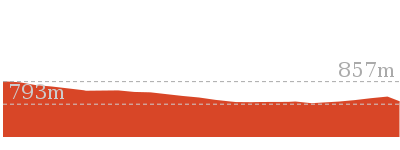
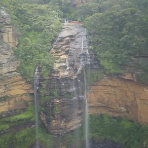
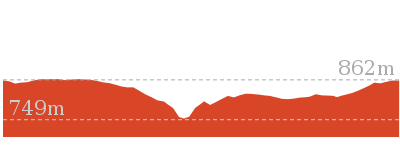
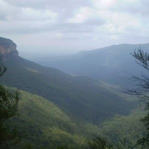

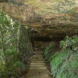
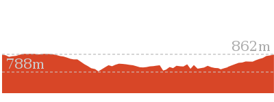
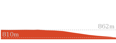
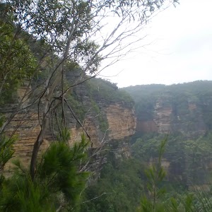


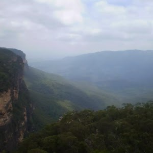
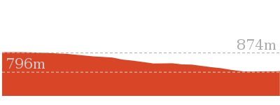
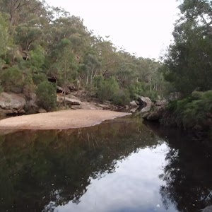
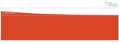
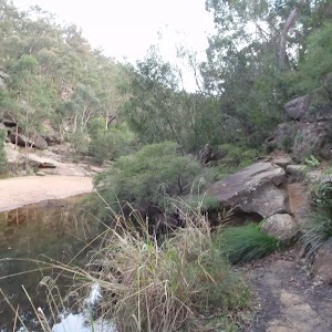
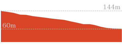
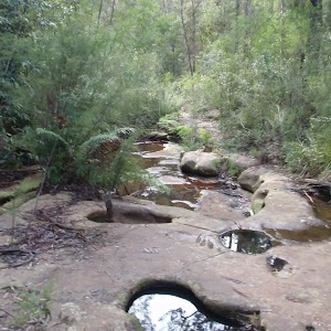
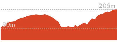
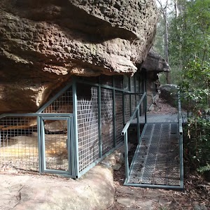
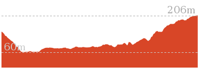
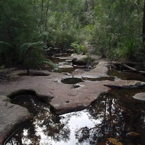
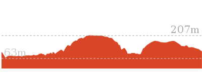
Comments