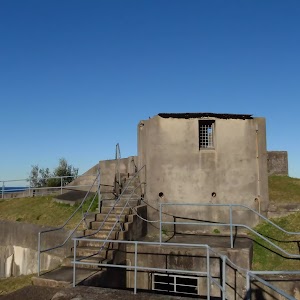
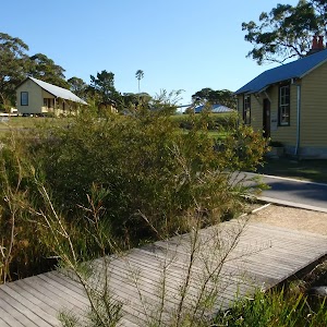
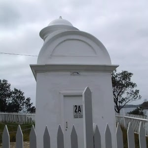
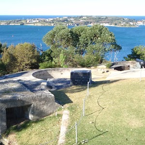
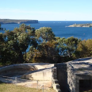
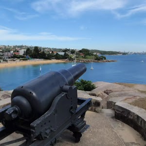
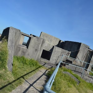
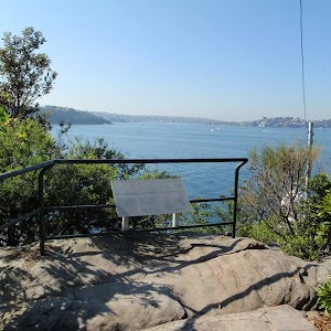
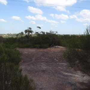
This walk guides you through the historic and well maintained outer Middle Head fortification battery. Take a step back in time, by walking along Old Fort Road past the old barracks and through the banksia forest to the open clearing and array of gun emplacements. At the fortification, you can explore the tunnels, underground rooms and circular gun emplacements, enjoy the views of the sea cliffs and harbour views.
Middle Head Battery walk
And Walk
Middle Head Battery walk

30 mins

10 m
Easy track
(0km) Cobblers Beach Trail trackhead → Int. Old Fort and Govenors Rds

70 m
1 mins
0m
-3m
Very easy
Mosman[2]), this walk heads to the very end of Middle Head Rd towards the sandstone wall[3]. After 50m the walk heads over the bridged ‘Middle Head Moat’[4][5], then around the boom gate to come to a signposted intersection with ‘Old Fort Rd’ and ‘Govenors Rd’[6]. (There is a public toilet
in the sandstone building the right)
(0.07km) Int. Old Fort and Govenors Rds → Old Fort Road gun brackets

220 m
4 mins
2m
-4m
Easy track
and ‘Barracks No.1’[8] to the left. After about 130m the old road heads over a rise and then leads down between the metal bollards[9] to come to an intersection in a large clearing beside a row large gun timber brackets (bases)[10], marked with a ‘Middle Head’ sign[11]
(0.29km) Old Fort Road gun brackets → Middle Head Fort

50 m
1 mins
1m
0m
Easy track
Outer Middle Head Battery
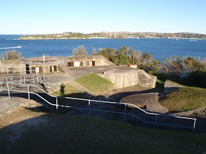
(0.33km) Outer Forts → Western Fort

110 m
4 mins
5m
-31m
Hard track
[22] for another 15m to come beside the unfenced western forts[23] and tall cliff[24]. Keep two full body lengths back from cliffs and significant drops to reduce the risk of falling. At the end of this side trip, retrace your steps back to the main walk then Turn sharp right.
Maps for the Middle Head Battery walk walk
You can download the PDF for this walk to print a map.
These maps below cover the walk and the wider area around the walk, they are worth carrying for safety reasons.
| Sydney Heads | 1:25 000 Map Series | 91302N SYDNEY HEADS | NSW-91302N |
| Sydney | 1:100 000 Map Series | 9130 SYDNEY | 9130 |
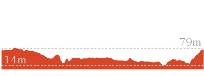
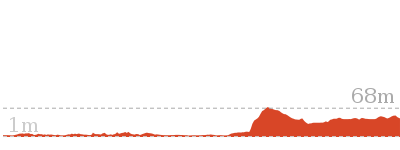
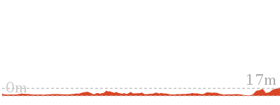
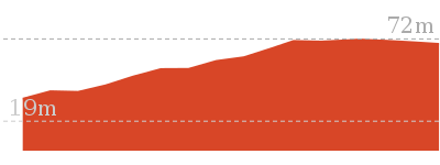
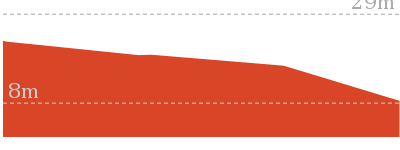
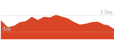
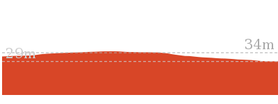
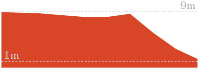
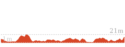
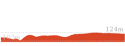
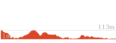
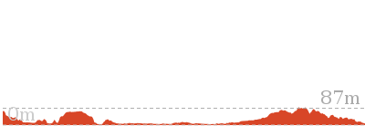
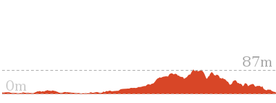
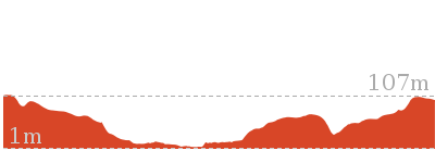
Cross sectional view of the Middle Head Battery walk bushwalking track

Analysis and summary of the altitude variation on the Middle Head Battery walk
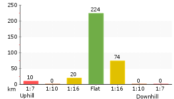
Accessibility summary information for the Middle Head Battery walk
Toilets: There are 0 designated accessible toilets on this walk.
Seats: There are 0 places to sit on this walk.
Hazards: There are 1 specific noteable accessability related hazards on this walk.
Trip Hazard Ground is rough and slopes moderately steeply down to unfenced drop into gun emplcement and cliff edge. Significant unfenced fall risk. Found about 330m into the walk.
Accessibility Details
Overview of this walks grade – based on the AS 2156.1 – 2001
Under this standard, a walk is graded based on the most difficult section of the walk.
| Length | 664 m | ||
| Time | 30 mins | ||
| . | |||
| Grade 2/6 Easy track |
AS 2156.1 | Gradient | Gentle hills with occasional steps (2/6) |
| Quality of track | Clear and well formed track or trail (2/6) | ||
| Signs | Clearly signposted (1/6) | ||
| Experience Required | No experience required (1/6) | ||
| Weather | Weather generally has little impact on safety (1/6) | ||
| Infrastructure | Generally useful facilities (such as fenced cliffs and seats) (1/6) |
Some more details of this walks Grading
Here is a bit more details explaining grading looking at sections of the walk
Gradient
Around 270m of this walk has gentle hills with occasional steps, whilst the remaining 65m is flat with no steps.
Quality of track
Around 270m of this walk follows a clear and well formed track or trail, whilst the remaining 65m follows a smooth and hardened path.
Signs
This whole walk, 330m is clearly signposted.
Experience Required
This whole walk, 330m requires no previous bushwalking experience.
weather
This whole walk, 330m is not usually affected by severe weather events (that would unexpectedly impact safety and navigation).
Infrastructure
This whole walk, 330m is close to useful facilities (such as fenced cliffs and seats).
Similar walks
A list of walks that share part of the track with the Middle Head Battery walk walk.
Other Nearby walks
A list of walks that start near the Middle Head Battery walk walk.
Plan your trip to and from the walk here
The Middle Head Battery walk walk starts and ends at the Cobblers Beach Trail trackhead (gps: -33.826961, 151.2643)
Your transport options to Cobblers Beach Trail trackhead are by;
![]() Bus. (get details)
Bus. (get details)
![]() Car. Parking fees apply in the area.
Car. Parking fees apply in the area.
(get details)
Fire Danger
Each park may have its own fire ban, this rating is only valid for today and is based on information from the RFS Please check the RFS Website for more information.
Weather Forest
This walk starts in the Metropolitan weather district always check the formal BOM forecast or pdf before starting your walk.
Forecast snapshot
Park Information & Alerts
Short URL = http://wild.tl/mhbw
Gallery images
There are other downloads I am still working on.
You will probably need to login to access these — still all free.
* KML (google earth file)
* GPX (GPS file)
Special Maps/ brochures
* A3 topo maps
* PDF with Lands Topo map base
* PDF with arial image (and map overlay)
I wanted to get the main site live first, this extra stuff will come in time.
Happy walking
Matt 🙂
Cobblers Beach
And Walk
Cobblers Beach

30 mins

58 m
Hard track
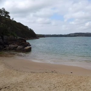
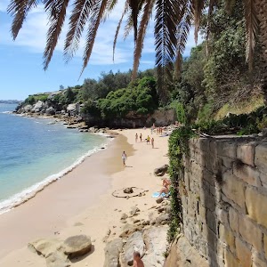
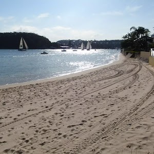
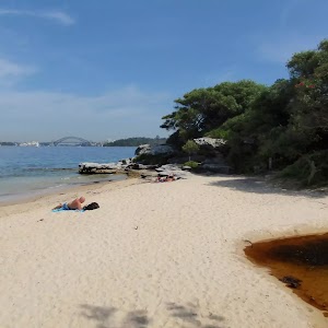
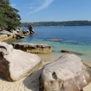
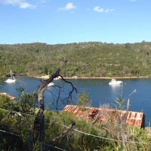
This walk guides you down a short but fairly steep trail to the beautiful Cobblers Beach. The beach is a small pretty and clothing optional beach on the northern edge of Middle Head in Sydney Harbour NP. There is a grassy area above the beach if you want to picnic and the water is generally protected from the swell and the rocks on the shoreline are interesting to explore.
(0km) Cobblers Beach Trail trackhead → Cobblers Beach Trail sign

50 m
1 mins
0m
-2m
Easy track
(0.05km) Cobblers Beach Trail sign → Cobblers Beach

420 m
10 mins
8m
-48m
Hard track
Continue straight: From the intersection, the walk follows the wide management trail downhill. The trail starts to bend left and heads noteably more steeply downhill
[8] in places over the next 220m where the trail mostly flattens out[9] and bends sharply right. After this bend, the trail continues to lead more gently downhill for another 50m to come to an open grassy area signposted as ‘Cobblers Beach’[10]. Access to the sand is down a few uneven stone steps
.
Cobblers Beach

Maps for the Cobblers Beach walk
You can download the PDF for this walk to print a map.
These maps below cover the walk and the wider area around the walk, they are worth carrying for safety reasons.
| Sydney Heads | 1:25 000 Map Series | 91302N SYDNEY HEADS | NSW-91302N |
| Sydney | 1:100 000 Map Series | 9130 SYDNEY | 9130 |
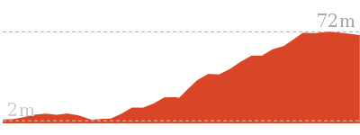
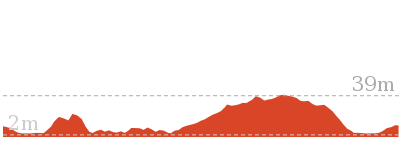
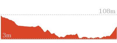
Cross sectional view of the Cobblers Beach bushwalking track

Analysis and summary of the altitude variation on the Cobblers Beach
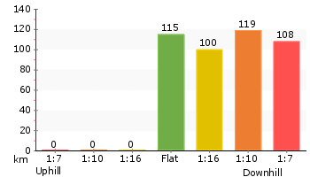
Accessibility summary information for the Cobblers Beach
Toilets: There are 0 designated accessible toilets on this walk.
Seats: There are 0 places to sit on this walk.
Hazards: There are 1 specific noteable accessability related hazards on this walk.
Trip Hazard A series of 4 cut sandstone steps (ranging up to 34cm high) and debris to access sandy beach area. Found about 440m into the walk.
Accessibility Details
Overview of this walks grade – based on the AS 2156.1 – 2001
Under this standard, a walk is graded based on the most difficult section of the walk.
| Length | 930 m | ||
| Time | 30 mins | ||
| . | |||
| Grade 4/6 Hard track |
AS 2156.1 | Gradient | Very steep (4/6) |
| Quality of track | Formed track, with some branches and other obstacles (3/6) | ||
| Signs | Directional signs along the way (3/6) | ||
| Experience Required | No experience required (1/6) | ||
| Weather | Weather generally has little impact on safety (1/6) | ||
| Infrastructure | Limited facilities, not all cliffs are fenced (3/6) |
Some more details of this walks Grading
Here is a bit more details explaining grading looking at sections of the walk
Gradient
Around 290m of this walk is very steep, whilst the remaining 180m has gentle hills with occasional steps.
Quality of track
Around 420m of this walk follows a formed track, with some branches and other obstacles, whilst the remaining 50m follows a clear and well formed track or trail.
Signs
Around 420m of this walk has directional signs at most intersection, whilst the remaining 50m is clearly signposted.
Experience Required
This whole walk, 470m requires no previous bushwalking experience.
weather
This whole walk, 470m is not usually affected by severe weather events (that would unexpectedly impact safety and navigation).
Infrastructure
Around 290m of this walk has limited facilities (such as not all cliffs fenced), whilst the remaining 180m is close to useful facilities (such as fenced cliffs and seats).
Similar walks
A list of walks that share part of the track with the Cobblers Beach walk.
Other Nearby walks
A list of walks that start near the Cobblers Beach walk.
Plan your trip to and from the walk here
The Cobblers Beach walk starts and ends at the Cobblers Beach Trail trackhead (gps: -33.826982, 151.26425)
Your transport options to Cobblers Beach Trail trackhead are by;
![]() Bus. (get details)
Bus. (get details)
![]() Car. Parking fees apply in the area.
Car. Parking fees apply in the area.
(get details)
Fire Danger
Each park may have its own fire ban, this rating is only valid for today and is based on information from the RFS Please check the RFS Website for more information.
Weather Forest
This walk starts in the Metropolitan weather district always check the formal BOM forecast or pdf before starting your walk.
Forecast snapshot
Park Information & Alerts
Comments
Short URL = http://wild.tl/cb
Gallery images
There are other downloads I am still working on.
You will probably need to login to access these — still all free.
* KML (google earth file)
* GPX (GPS file)
Special Maps/ brochures
* A3 topo maps
* PDF with Lands Topo map base
* PDF with arial image (and map overlay)
I wanted to get the main site live first, this extra stuff will come in time.
Happy walking
Matt 🙂
Inner Middle Head Battery walk
And Walk
Inner Middle Head Battery walk

30 mins

26 m
Moderate track
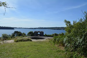
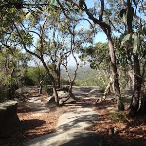
On this walk you will explore the historic northern or ‘inner’ Middle Head fortification battery. You can explore the trenches, tunnels and rooms of the fortifications on the less busy gun emplacements on Middle Head. The vegetation, water, cliff and harbour views are also spectacular and well worth spending a bit of time to carefully explore and soak up the sites.
(0km) Cobblers Beach Trail trackhead → Int. Old Fort and Govenors Rds

70 m
1 mins
0m
-3m
Very easy
Mosman[2]), this walk heads to the very end of Middle Head Rd towards the sandstone wall[3]. After 50m the walk heads over the bridged ‘Middle Head Moat’[4][5], then around the boom gate to come to a signposted intersection with ‘Old Fort Rd’ and ‘Govenors Rd’[6]. (There is a public toilet
in the sandstone building the right)
(0.07km) Int. Old Fort and Govenors Rds → Int. Govenors Rd and Inner Forts Trk

140 m
2 mins
0m
-4m
Easy track
(0.2km) Int. Govenors Rd and Inner Forts Trk → Inner Forts intersection

110 m
2 mins
1m
0m
Moderate track
(0.31km) Inner Forts intersection → Disappearing Gun Pit North

70 m
2 mins
0m
-18m
Moderate track
[14][15] beside the ocean cliffs[16]. Take extra care as the ground slopes towards the gun pit and cliff edges – stay 2 body lengths back from any significant drop.
Inner Middle Head Battery
Maps for the Inner Middle Head Battery walk walk
You can download the PDF for this walk to print a map.
These maps below cover the walk and the wider area around the walk, they are worth carrying for safety reasons.
| Sydney Heads | 1:25 000 Map Series | 91302N SYDNEY HEADS | NSW-91302N |
| Sydney | 1:100 000 Map Series | 9130 SYDNEY | 9130 |
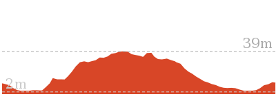
Cross sectional view of the Inner Middle Head Battery walk bushwalking track

Analysis and summary of the altitude variation on the Inner Middle Head Battery walk
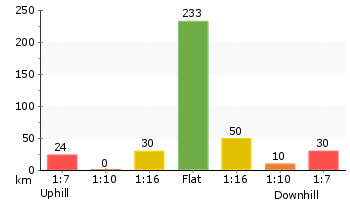
Accessibility summary information for the Inner Middle Head Battery walk
Toilets: There are 0 designated accessible toilets on this walk.
Seats: There are 0 places to sit on this walk.
Hazards: There are 1 specific noteable accessability related hazards on this walk.
Trip Hazard Ground is rough and slopes moderately steeply down to unfenced drop into gun emplcement. Significant unfenced fall risk. Found about 370m into the walk.
Accessibility Details
Overview of this walks grade – based on the AS 2156.1 – 2001
Under this standard, a walk is graded based on the most difficult section of the walk.
| Length | 762 m | ||
| Time | 30 mins | ||
| . | |||
| Grade 3/6 Moderate track |
AS 2156.1 | Gradient | Short steep hills (3/6) |
| Quality of track | Formed track, with some branches and other obstacles (3/6) | ||
| Signs | Directional signs along the way (3/6) | ||
| Experience Required | No experience required (1/6) | ||
| Weather | Weather generally has little impact on safety (1/6) | ||
| Infrastructure | Limited facilities, not all cliffs are fenced (3/6) |
Some more details of this walks Grading
Here is a bit more details explaining grading looking at sections of the walk
Gradient
200m of this walk is flat with no steps and another 110m has gentle hills with occasional steps. The remaining (70m) has short steep hills.
Quality of track
210m of this walk follows a clear and well formed track or trail and another 110m follows a formed track, with some branches and other obstacles. The remaining (65m) follows a smooth and hardened path.
Signs
Around 270m of this walk is clearly signposted, whilst the remaining 110m has directional signs at most intersection.
Experience Required
This whole walk, 380m requires no previous bushwalking experience.
weather
This whole walk, 380m is not usually affected by severe weather events (that would unexpectedly impact safety and navigation).
Infrastructure
Around 200m of this walk is close to useful facilities (such as fenced cliffs and seats), whilst the remaining 180m has limited facilities (such as not all cliffs fenced).
Similar walks
A list of walks that share part of the track with the Inner Middle Head Battery walk walk.
Other Nearby walks
A list of walks that start near the Inner Middle Head Battery walk walk.
Plan your trip to and from the walk here
The Inner Middle Head Battery walk walk starts and ends at the Cobblers Beach Trail trackhead (gps: -33.826961, 151.2643)
Your transport options to Cobblers Beach Trail trackhead are by;
![]() Bus. (get details)
Bus. (get details)
![]() Car. Parking fees apply in the area.
Car. Parking fees apply in the area.
(get details)
Fire Danger
Each park may have its own fire ban, this rating is only valid for today and is based on information from the RFS Please check the RFS Website for more information.
Weather Forest
This walk starts in the Metropolitan weather district always check the formal BOM forecast or pdf before starting your walk.
Forecast snapshot
Park Information & Alerts
Comments
Short URL = http://wild.tl/imhbw
Gallery images
There are other downloads I am still working on.
You will probably need to login to access these — still all free.
* KML (google earth file)
* GPX (GPS file)
Special Maps/ brochures
* A3 topo maps
* PDF with Lands Topo map base
* PDF with arial image (and map overlay)
I wanted to get the main site live first, this extra stuff will come in time.
Happy walking
Matt 🙂
Arabanoo Lookout
And Walk
Arabanoo Lookout

15 mins

5 m
Very easy
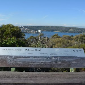
This short and easy walk leads from Tania Park to wonderful views of Arabanoo Lookout. The views over North Head and the water are wonderful. There is a concrete path leading the whole way and two seats at the top waiting for you to soak up the views. Tania Park can get busy on weekends with sport and walkers. A lovely walk if you are in the area. There are toilets, picnic area and playground at the far end of the Oval.
Tania Park

(0km) Dobroyd Scenic Drive → Arabanoo Lookout

70 m
1 mins
0m
-5m
Very easy
.
Arabanoo Lookout

at the lookout.
This lookout is named after Arabanoo, an Aboriginal man kidnapped in December 1788, by British marines on Governor Phillips orders. The Governor believed that this was justified as he wished to facilitate communication between the British and the Aborigines. Arabanoo lived in the company of the Europeans until the 18th May 1789 where he died due to smallpox infection.
Maps for the Arabanoo Lookout walk
You can download the PDF for this walk to print a map.
These maps below cover the walk and the wider area around the walk, they are worth carrying for safety reasons.
| Sydney Heads | 1:25 000 Map Series | 91302N SYDNEY HEADS | NSW-91302N |
| Sydney | 1:100 000 Map Series | 9130 SYDNEY | 9130 |
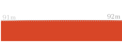
Cross sectional view of the Arabanoo Lookout bushwalking track

Analysis and summary of the altitude variation on the Arabanoo Lookout
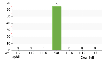
Accessibility summary information for the Arabanoo Lookout
Toilets: There are 0 designated accessible toilets on this walk.
Seats: There are 2 places to sit on this walk.
They are 70m apart.
Hazards: There are 0 specific noteable accessability related hazards on this walk.
Accessibility Details
Overview of this walks grade – based on the AS 2156.1 – 2001
Under this standard, a walk is graded based on the most difficult section of the walk.
| Length | 142 m | ||
| Time | 15 mins | ||
| . | |||
| Grade 1/6 Very easy |
AS 2156.1 | Gradient | Flat, no steps (1/6) |
| Quality of track | Smooth and hardened path (1/6) | ||
| Signs | Clearly signposted (1/6) | ||
| Experience Required | No experience required (1/6) | ||
| Weather | Weather generally has little impact on safety (1/6) | ||
| Infrastructure | Generally useful facilities (such as fenced cliffs and seats) (1/6) |
Some more details of this walks Grading
Here is a bit more details explaining grading looking at sections of the walk
Gradient
This whole walk, 70m is flat with no steps.
Quality of track
This whole walk, 70m follows a smooth and hardened path.
Signs
This whole walk, 70m is clearly signposted.
Experience Required
This whole walk, 70m requires no previous bushwalking experience.
weather
This whole walk, 70m is not usually affected by severe weather events (that would unexpectedly impact safety and navigation).
Infrastructure
This whole walk, 70m is close to useful facilities (such as fenced cliffs and seats).
Similar walks
A list of walks that share part of the track with the Arabanoo Lookout walk.
Other Nearby walks
A list of walks that start near the Arabanoo Lookout walk.
Plan your trip to and from the walk here
The Arabanoo Lookout walk starts and ends at the Dobroyd Scenic Drive (gps: -33.808363, 151.2688)
Your main transport option to Dobroyd Scenic Drive is by;
![]() Car. There is free parking available.
Car. There is free parking available.
(get details)
Fire Danger
Each park may have its own fire ban, this rating is only valid for today and is based on information from the RFS Please check the RFS Website for more information.
Weather Forest
This walk starts in the Metropolitan weather district always check the formal BOM forecast or pdf before starting your walk.
Forecast snapshot
Park Information & Alerts
Comments
Short URL = http://wild.tl/al
Gallery images
There are other downloads I am still working on.
You will probably need to login to access these — still all free.
* KML (google earth file)
* GPX (GPS file)
Special Maps/ brochures
* A3 topo maps
* PDF with Lands Topo map base
* PDF with arial image (and map overlay)
I wanted to get the main site live first, this extra stuff will come in time.
Happy walking
Matt 🙂
Georges Heights Lookout
And Walk
Georges Heights Lookout

7 mins

2 m
Very easy
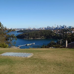
The Georges Heights Lookout has a brilliant view, which is well worth the short stroll from the road. The track is wheelchair-accessible and leads past some interesting signs about the area. The grass surrounding the lookout is also a nice place to lay the picnic rug for lunch. Georges Heights is the site of a series of gun emplacements, and provides great views over the harbour.
(0km) Int. Chowder Bay Trk and Georges Heights Rd → Georges Head Lookout

70 m
1 mins
0m
-2m
Very easy
Georges Heights

Maps for the Georges Heights Lookout walk
You can download the PDF for this walk to print a map.
These maps below cover the walk and the wider area around the walk, they are worth carrying for safety reasons.
| Sydney Heads | 1:25 000 Map Series | 91302N SYDNEY HEADS | NSW-91302N |
| Sydney | 1:100 000 Map Series | 9130 SYDNEY | 9130 |
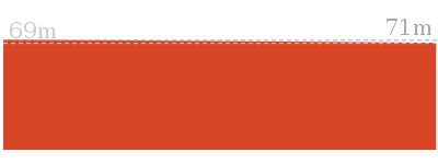
Cross sectional view of the Georges Heights Lookout bushwalking track

Analysis and summary of the altitude variation on the Georges Heights Lookout
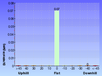
Overview of this walks grade – based on the AS 2156.1 – 2001
Under this standard, a walk is graded based on the most difficult section of the walk.
| Length | 144 m | ||
| Time | 7 mins | ||
| . | |||
| Grade 1/6 Very easy |
AS 2156.1 | Gradient | Flat, no steps (1/6) |
| Quality of track | Smooth and hardened path (1/6) | ||
| Signs | Clearly signposted (1/6) | ||
| Experience Required | No experience required (1/6) | ||
| Weather | Weather generally has little impact on safety (1/6) | ||
| Infrastructure | Generally useful facilities (such as fenced cliffs and seats) (1/6) |
Some more details of this walks Grading
Here is a bit more details explaining grading looking at sections of the walk
Gradient
This whole walk, 70m is flat with no steps.
Quality of track
This whole walk, 70m follows a smooth and hardened path.
Signs
This whole walk, 70m is clearly signposted.
Experience Required
This whole walk, 70m requires no previous bushwalking experience.
weather
This whole walk, 70m is not usually affected by severe weather events (that would unexpectedly impact safety and navigation).
Infrastructure
This whole walk, 70m is close to useful facilities (such as fenced cliffs and seats).
Similar walks
A list of walks that share part of the track with the Georges Heights Lookout walk.
Other Nearby walks
A list of walks that start near the Georges Heights Lookout walk.
Plan your trip to and from the walk here
The Georges Heights Lookout walk starts and ends at the Int. Chowder Bay Trk and Georges Heights Rd (gps: -33.836478, 151.25821)
Your transport options to Int. Chowder Bay Trk and Georges Heights Rd are by;
![]() Bus. (get details)
Bus. (get details)
![]() Car. There is free parking available.
Car. There is free parking available.
(get details)
Fire Danger
Each park may have its own fire ban, this rating is only valid for today and is based on information from the RFS Please check the RFS Website for more information.
Weather Forest
This walk starts in the Metropolitan weather district always check the formal BOM forecast or pdf before starting your walk.
Forecast snapshot
Park Information & Alerts
Comments
Short URL = http://wild.tl/ghl
Gallery images
There are other downloads I am still working on.
You will probably need to login to access these — still all free.
* KML (google earth file)
* GPX (GPS file)
Special Maps/ brochures
* A3 topo maps
* PDF with Lands Topo map base
* PDF with arial image (and map overlay)
I wanted to get the main site live first, this extra stuff will come in time.
Happy walking
Matt 🙂
Bradleys Head to Chowder Bay walk
And Walk
Bradleys Head to Chowder Bay walk

1 hr 30 mins

161 m
Moderate track
This walk explores a great section of Sydney Harbour. Starting with some historic points at Bradleys Head, you can enjoy views of Sydney’s Opera House and Harbour Bridge. The views will continue to delight as you explore bushland and the bays along the way. The pleasant walk ends at Clifton Gardens, where you will find a kiosk and equipment for the kids to play.
HMAS Sydney Memorial Mast
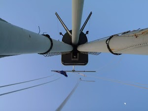
More info.
(0km) HMAS Sydney Mast, Bradleys Head → Int. Borogegal Walking Trail and Taylors Bay Lookout track

790 m
17 mins
42m
-29m
Easy track
(0.79km) Int. Borogegal Walking Trail and Taylors Bay Lookout track → Taylors Bay Lookout

50 m
1 mins
0m
-6m
Moderate track
(0.79km) Int. Borogegal Walking Trail and Taylors Bay Lookout track → Chowder Head track intersection

1.2 km
31 mins
88m
-81m
Moderate track
Continue straight: From the intersection, the walk heads along the line of the houses, on the left, for approximately 140m. The track passes a Japanese Submarine information sign on the right as it continues along sections of boardwalk track, to the intersection next to the last house. The walk heads up the stairs below the last house to be met by a large sandstone staircase on the left and a track to the front.
Continue straight: From the intersection, this walk heads away from the house and clearing along the fairly flat track keeping the water glimpses to your right. The path soon leads to a clear three-way intersection with a ‘Ashton Park’ sign pointing back along the track.
(2.03km) Chowder Head track intersection → Chowder Head

90 m
2 mins
0m
-10m
Moderate track
Chowder Head
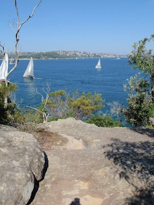
(2.03km) Chowder Head track intersection → Morella St lookout

280 m
6 mins
15m
-16m
Moderate track
Veer left: From the intersection, this walk follows the main track keeping the water glimpses to your right (and the Morella Rd track to your left). The track gently works is way around the hill to come to a sign point back to ‘Ashton Park’ and a large clearing with good views behind some houses.
(2.31km) Morella St lookout → Bottom of Sarahs walk steps

80 m
3 mins
0m
-17m
Easy track
(2.38km) Bottom of Sarahs walk steps → Clifton Gardens baths

250 m
5 mins
3m
-16m
Moderate track
Turn right: From the intersection, this walk heads down onto the beach, towards the wharf in the middle of the beach. The walk passes an Illawarra Flame tree, as it heads approximately 100m along the beach to the start of the wharf.
Clifton Gardens Reserve

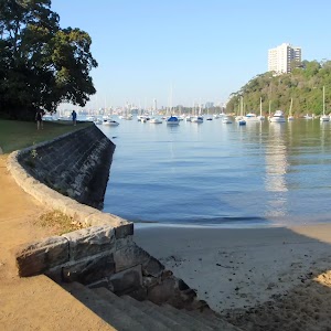
Today, Clifton Gardens is touted as ‘remnant bushland’, offering birdwatching, a netted swimming enclosure, change rooms, a fenced playground[20], and of course, spectacular views over Chowder Bay. A short bush track leads through to Rawson Oval.
(2.63km) Clifton Gardens Baths → Chowder Bay Lower Gate

210 m
5 mins
13m
-10m
Moderate track
Bacino Kiosk

Maps for the Bradleys Head to Chowder Bay walk walk
You can download the PDF for this walk to print a map.
These maps below cover the walk and the wider area around the walk, they are worth carrying for safety reasons.
| Parramatta River | 1:25 000 Map Series | 91303N PARRAMATTA RIVER | NSW-91303N |
| Sydney Heads | 1:25 000 Map Series | 91302N SYDNEY HEADS | NSW-91302N |
| Sydney | 1:100 000 Map Series | 9130 SYDNEY | 9130 |
Cross sectional view of the Bradleys Head to Chowder Bay walk bushwalking track

Analysis and summary of the altitude variation on the Bradleys Head to Chowder Bay walk
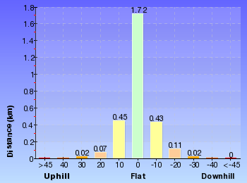
Overview of this walks grade – based on the AS 2156.1 – 2001
Under this standard, a walk is graded based on the most difficult section of the walk.
| Length | 2.8 km | ||
| Time | 1 hr 30 mins | ||
| . | |||
| Grade 3/6 Moderate track |
AS 2156.1 | Gradient | Short steep hills (3/6) |
| Quality of track | Formed track, with some branches and other obstacles (3/6) | ||
| Signs | Directional signs along the way (3/6) | ||
| Experience Required | No experience required (1/6) | ||
| Weather | Weather generally has little impact on safety (1/6) | ||
| Infrastructure | Limited facilities, not all cliffs are fenced (3/6) |
Some more details of this walks Grading
Here is a bit more details explaining grading looking at sections of the walk
Gradient
1.2km of this walk has short steep hills and another 840m has gentle hills with occasional steps. The remaining (790m) is flat with no steps.
Quality of track
1.6km of this walk follows a formed track, with some branches and other obstacles and another 790m follows a smooth and hardened path. The remaining (440m) follows a clear and well formed track or trail.
Signs
Around 2.6km of this walk is clearly signposted, whilst the remaining 210m has directional signs at most intersection.
Experience Required
This whole walk, 2.8km requires no previous bushwalking experience.
weather
This whole walk, 2.8km is not usually affected by severe weather events (that would unexpectedly impact safety and navigation).
Infrastructure
Around 2km of this walk is close to useful facilities (such as fenced cliffs and seats), whilst the remaining 850m has limited facilities (such as not all cliffs fenced).
Similar walks
A list of walks that share part of the track with the Bradleys Head to Chowder Bay walk walk.
Other Nearby walks
A list of walks that start near the Bradleys Head to Chowder Bay walk walk.
Plan your trip to and from the walk here
The Bradleys Head to Chowder Bay walk walk starts at the HMAS Sydney Mast, Bradleys Head (gps: -33.853055, 151.24629)
Your transport options to HMAS Sydney Mast, Bradleys Head are by;
![]() Bus. (get details)
Bus. (get details)
![]() Car. A park entry fee is required for driving into the park.
Car. A park entry fee is required for driving into the park.
(get details)
The Bradleys Head to Chowder Bay walk ends at the Chowder Bay Lower Gate (gps: -33.838667, 151.25467)
Your transport options to Chowder Bay Lower Gate are by;
![]() Bus. (get details)
Bus. (get details)
![]() Car. Parking fees apply in the area.
Car. Parking fees apply in the area.
(get details)
Fire Danger
Each park may have its own fire ban, this rating is only valid for today and is based on information from the RFS Please check the RFS Website for more information.
Weather Forest
This walk starts in the Metropolitan weather district always check the formal BOM forecast or pdf before starting your walk.
Forecast snapshot
Park Information & Alerts
Comments
Short URL = http://wild.tl/9j
Gallery images
There are other downloads I am still working on.
You will probably need to login to access these — still all free.
* KML (google earth file)
* GPX (GPS file)
Special Maps/ brochures
* A3 topo maps
* PDF with Lands Topo map base
* PDF with arial image (and map overlay)
I wanted to get the main site live first, this extra stuff will come in time.
Happy walking
Matt 🙂
Seaforth Oval to Davidson Park
And Walk
Seaforth Oval to Davidson Park

4 hrs 30 mins

491 m
Hard track
Seaforth Oval
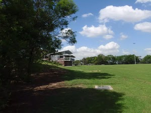
(0km) Seaforth Oval → Bantry Bay Picnic Area

890 m
25 mins
9m
-111m
Hard track
Veer left: From the intersection, this walk follows the ‘Timbergetters Track’ sign[2] down the wooden steps and through the bush, winding steadily down a long hill as it drops down several more sets of steps, following the bush track to the signposted intersection with the Old Bullock Track[3] (closed for maintenance at time of writing).
Continue straight: From the intersection (with the signposted ‘Old Bullock Track’[4] on the right), this walk heads west down the three wooden steps and along the track, winding through the dense scrub for a while. The walk crosses a small creek at some stepping stones and passes an old telegraph pole with no power lines attached. The track continues in this manner for a little while longer before it comes to the top of a short set of rock steps, where it starts to wind down into the valley using several scattered sets of wooden steps and one long set of rock steps, until coming down to the large picnic area at the bottom.
Bantry Bay Picnic Area
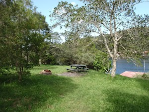
(0.89km) Bantry Bay Picnic Area → The Bluff Lookout

1.8 km
48 mins
166m
-77m
Hard track
Bluff Lookout
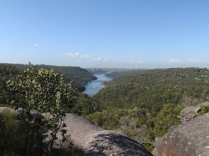
(2.72km) The Bluff Lookout → Int of Bluff and Natural Bridge Tracks

210 m
4 mins
11m
0m
Moderate track
Continue straight: From the intersection, the track follows the service trail (with the bush track on the right), heading north-west through the bush for a little while before coming to the signposted intersection with the Natural Bridge Track.
(2.92km) Int of Bluff and Natural Bridge Tracks → Natural Bridge

500 m
15 mins
1m
-71m
Hard track
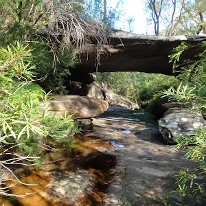
Veer left: From the intersection, this walk follows the track marker along the bush track, heading west through the bush for a short distance to a large rock outcrop. From here, the walk continues along the defined bush track, winding down the long and sometimes steep rocky hill, into the valley. The vegetation gradually gets thicker, until this walk comes down to a wide rock arch crossing a creek – the Natural Bridge.
Natural Bridge
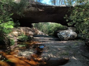
(3.43km) Natural Bridge → Int of Natural Bridge and Currie Road Tracks

250 m
6 mins
39m
0m
Moderate track
(3.68km) Int of Natural Bridge and Currie Road Tracks → Int of Bates Creek and Currie Rd tracks

180 m
3 mins
5m
-1m
Easy track
(3.86km) Int of Bates Creek and Currie Rd tracks → Back of Magazine Buildings

1.9 km
40 mins
50m
-114m
Moderate track
Continue straight: From the intersection, this walk follows the ‘Magazine Track’ sign along the wide, flat trail which winds around behind some houses (on the right). The track continues along a narrower, rocky bush track which steadily winds down a long hill to the bottom of the valley, where it flattens out just above the water. From here, the walk continues along the bush track, winding up and down along the side of the hill until it follows a track marker up to the magazine buildings’ fence line. The track runs parallel to this fence as it heads along to an open, square concrete tank just off to the left of the track, from which the roofs of the magazine buildings and Middle Harbour Creek are both visible.
Bantry Bay Explosives Magazine complex
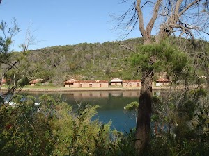
(5.74km) Back of Magazine Buildings → Int of Magazine and Flat Rock Beach Tracks

1.1 km
23 mins
44m
-53m
Moderate track
(6.79km) Int of Magazine and Flat Rock Beach Tracks → Flat Rock Beach

30 m
1 mins
0m
-6m
Moderate track
Flat Rock Beach
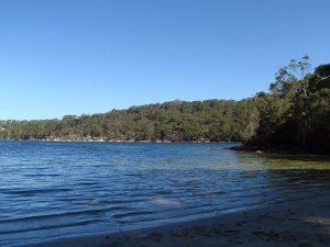
(6.79km) Int of Magazine and Flat Rock Beach Tracks → Int of Davidson Park driveway and Flat Rock Track

2.4 km
1 Hr
154m
-157m
Moderate track
Turn left: From the intersection, this walk follows the ‘Flat Rock Track’ sign along the bush track heading down the side of the hill, with the ground sloping up to the right. The walk winds down the rocky track for a little while, before flattening out as it passes by a small pipeline and then continues along the side of the hill. The track meanders through the bush for a while before coming to the four-way intersection with a bush track (which heads up the rocky hill to the right, and down to a private property at the bottom of the hill on the left).
Continue straight: From the intersection, this walk follows the bush track along the side of the hill, with the ground sloping up to the right. The track meanders through the dense bushland, occasionally catching a nice view over Middle Harbour Creek down to the left, and continues to the intersection of a rough service trail on the right, which heads uphill.
Continue straight: From the intersection, this walk follows the bush track along the side of the hill, with the ground sloping up to the right as it heads through the bush. The walk stays above Middle Harbour Creek for a while before it drops down a steep set of wooden steps to the intersection with the Davidson Park driveway, at a wooden picnic seat.
(9.21km) Int of Davidson Park driveway and Flat Rock Track → Int of Davidson Park driveway and Rotary Rotunda path

770 m
13 mins
12m
-11m
Very easy
Turn left: From the intersection, this walk follows the Davidson Park driveway, crossing under Roseville Bridge with Middle Harbour Creek on the left. The walk passes a small car park and bends to the right, winding around the large picnic areas (on the left), passing a building with some toilets (also on the left), and continuing along for a little while before coming to the signposted intersection of the Rotary Rotunda footpath.
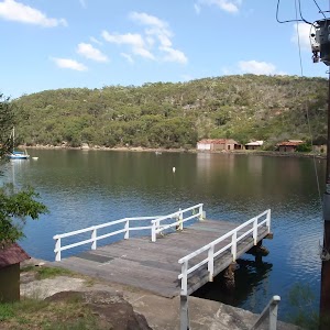
Davidson picnic area

Maps for the Seaforth Oval to Davidson Park walk
You can download the PDF for this walk to print a map.
These maps below cover the walk and the wider area around the walk, they are worth carrying for safety reasons.
| Parramatta River | 1:25 000 Map Series | 91303N PARRAMATTA RIVER | NSW-91303N |
| Sydney | 1:100 000 Map Series | 9130 SYDNEY | 9130 |
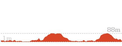
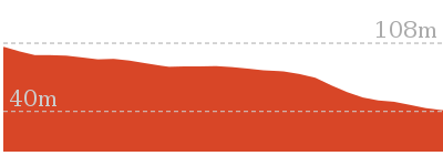
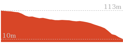
Cross sectional view of the Seaforth Oval to Davidson Park bushwalking track

Analysis and summary of the altitude variation on the Seaforth Oval to Davidson Park

Overview of this walks grade – based on the AS 2156.1 – 2001
Under this standard, a walk is graded based on the most difficult section of the walk.
| Length | 10 km | ||
| Time | 4 hrs 30 mins | ||
| . | |||
| Grade 4/6 Hard track |
AS 2156.1 | Gradient | Very steep (4/6) |
| Quality of track | Formed track, with some branches and other obstacles (3/6) | ||
| Signs | Directional signs along the way (3/6) | ||
| Experience Required | Some bushwalking experience recommended (3/6) | ||
| Weather | Weather generally has little impact on safety (1/6) | ||
| Infrastructure | Limited facilities, not all cliffs are fenced (3/6) |
Some more details of this walks Grading
Here is a bit more details explaining grading looking at sections of the walk
Gradient
5km of this walk has short steep hills and another 2.8km is very steep. Whilst another 1.2km is flat with no steps and the remaining 770m has gentle hills with occasional steps.
Quality of track
9km of this walk follows a formed track, with some branches and other obstacles and another 770m follows a smooth and hardened path. The remaining (610m) follows a clear and well formed track or trail.
Signs
Around 6km of this walk is clearly signposted, whilst the remaining 4.2km has directional signs at most intersection.
Experience Required
Around 7km of this walk requires some bushwalking experience, whilst the remaining 2.6km requires no previous bushwalking experience.
weather
This whole walk, 10km is not usually affected by severe weather events (that would unexpectedly impact safety and navigation).
Infrastructure
Around 7km of this walk has limited facilities (such as not all cliffs fenced), whilst the remaining 3km is close to useful facilities (such as fenced cliffs and seats).
Similar walks
A list of walks that share part of the track with the Seaforth Oval to Davidson Park walk.
Other Nearby walks
A list of walks that start near the Seaforth Oval to Davidson Park walk.
Plan your trip to and from the walk here
The Seaforth Oval to Davidson Park walk starts at the Seaforth Oval (gps: -33.781957, 151.23724)
Your transport options to Seaforth Oval are by;
![]() Bus. (get details)
Bus. (get details)
![]() Car. There is free parking available.
Car. There is free parking available.
(get details)
The Seaforth Oval to Davidson Park ends at the Int of Davidson Park driveway and Rotary Rotunda path (gps: -33.7682, 151.20325)
Your transport options to Int of Davidson Park driveway and Rotary Rotunda path are by;
![]() Bus. (get details)
Bus. (get details)
![]() Car. There is free parking available.
Car. There is free parking available.
(get details)
Fire Danger
Each park may have its own fire ban, this rating is only valid for today and is based on information from the RFS Please check the RFS Website for more information.
Weather Forest
This walk starts in the Metropolitan weather district always check the formal BOM forecast or pdf before starting your walk.
Forecast snapshot
Park Information & Alerts
Comments
Short URL = http://wild.tl/sotdp
Gallery images
There are other downloads I am still working on.
You will probably need to login to access these — still all free.
* KML (google earth file)
* GPX (GPS file)
Special Maps/ brochures
* A3 topo maps
* PDF with Lands Topo map base
* PDF with arial image (and map overlay)
I wanted to get the main site live first, this extra stuff will come in time.
Happy walking
Matt 🙂
Castle Rock Beach
And Walk
Castle Rock Beach

30 mins

20 m
Moderate track
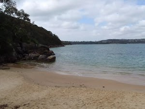
(0km) End of Ogilvry Rd → Castle Rock Beach

100 m
3 mins
0m
-20m
Moderate track
Continue straight: From the intersection, this walk follows the ‘Manly Scenic Walk’ arrow down the concrete steps towards the water, to the signposted intersection of the ‘Manly to Spit’ and ‘Castle Rock’ beach tracks.
Veer right: From the intersection, this walk leads down the concrete steps to Castle Rock Beach.
Castle Rock Beach
Maps for the Castle Rock Beach walk
You can download the PDF for this walk to print a map.
These maps below cover the walk and the wider area around the walk, they are worth carrying for safety reasons.
| Sydney Heads | 1:25 000 Map Series | 91302N SYDNEY HEADS | NSW-91302N |
| Sydney | 1:100 000 Map Series | 9130 SYDNEY | 9130 |
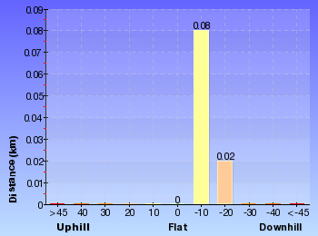
Cross sectional view of the Castle Rock Beach bushwalking track

Analysis and summary of the altitude variation on the Castle Rock Beach
Overview of this walks grade – based on the AS 2156.1 – 2001
Under this standard, a walk is graded based on the most difficult section of the walk.
| Length | 200 m | ||
| Time | 30 mins | ||
| . | |||
| Grade 3/6 Moderate track |
AS 2156.1 | Gradient | Short steep hills (3/6) |
| Quality of track | Clear and well formed track or trail (2/6) | ||
| Signs | Directional signs along the way (3/6) | ||
| Experience Required | Some bushwalking experience recommended (3/6) | ||
| Weather | Weather generally has little impact on safety (1/6) | ||
| Infrastructure | Generally useful facilities (such as fenced cliffs and seats) (1/6) |
Some more details of this walks Grading
Here is a bit more details explaining grading looking at sections of the walk
Gradient
This whole walk, 100m has short steep hills.
Quality of track
This whole walk, 100m follows a clear and well formed track or trail.
Signs
Around 75m of this walk is clearly signposted, whilst the remaining 25m has directional signs at most intersection.
Experience Required
Around 75m of this walk requires some bushwalking experience, whilst the remaining 25m requires no previous bushwalking experience.
weather
This whole walk, 100m is not usually affected by severe weather events (that would unexpectedly impact safety and navigation).
Infrastructure
This whole walk, 100m is close to useful facilities (such as fenced cliffs and seats).
Similar walks
A list of walks that share part of the track with the Castle Rock Beach walk.
Other Nearby walks
A list of walks that start near the Castle Rock Beach walk.
Plan your trip to and from the walk here
The Castle Rock Beach walk starts and ends at the End of Ogilvry Rd (gps: -33.811, 151.25954)
Your transport options to End of Ogilvry Rd are by;
![]() Bus. (get details)
Bus. (get details)
![]() Car. There is free parking available.
Car. There is free parking available.
(get details)
Fire Danger
Each park may have its own fire ban, this rating is only valid for today and is based on information from the RFS Please check the RFS Website for more information.
Weather Forest
This walk starts in the Metropolitan weather district always check the formal BOM forecast or pdf before starting your walk.
Forecast snapshot
Park Information & Alerts
Comments
Short URL = http://wild.tl/crb
Gallery images
There are other downloads I am still working on.
You will probably need to login to access these — still all free.
* KML (google earth file)
* GPX (GPS file)
Special Maps/ brochures
* A3 topo maps
* PDF with Lands Topo map base
* PDF with arial image (and map overlay)
I wanted to get the main site live first, this extra stuff will come in time.
Happy walking
Matt 🙂
Taronga Zoo, Bradleys Head to Athol Hall

1 hr 30 mins

138 m
Moderate track
The walk around Bradleys Head is a great way to see Sydney Harbour and some interesting cultural heritage. The walk passes stunning views at Bradleys Head, to the mast of HMAS Sydney, before coming back to the old Athol Hall for afternoon tea. The entrance to Taronga Zoo is passed twice so be prepared for the kids wanting to visit!
(0km) Taronga Zoo Wharf → Taronga Zoo Entrance

220 m
4 mins
11m
-5m
Very easy
Taronga Zoo
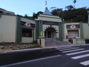
(0.22km) Taronga Zoo Entrance → Int. Borogegal Walking Trail and Athol Hall Trk

410 m
9 mins
24m
-15m
Moderate track
Veer right: From the intersection, the walk heads down the stairs then continues along the hill for a short time. The walk descends more stairs to a signposted intersection.
(0.63km) Int. Borogegal Walking Trail and Athol Hall Trk → HMAS Sydney Mast, Bradleys Head

670 m
16 mins
31m
-40m
Easy track
Continue straight: From the intersection, this walk heads towards the car park, keeping the harbour to the right. The walk leads approximately 10m to the intersection with a track (leading down to Bradleys Head Amphitheatre).
Veer left: From the intersection, this walk heads along the footpath next to the car park for a short distance, until it comes to be above the flag pole, HMAS Sydney Mast.
HMAS Sydney Memorial Mast

More info.
(1.3km) HMAS Sydney Mast, Bradleys Head → Int. Borogegal Walking Trail and Taylors Bay Lookout track

790 m
17 mins
42m
-29m
Easy track
(2.09km) Int. Borogegal Walking Trail and Taylors Bay Lookout track → Taylors Bay Lookout

50 m
1 mins
0m
-6m
Moderate track
(2.09km) Int. Borogegal Walking Trail and Taylors Bay Lookout track → Athol Hall car park

110 m
2 mins
10m
0m
Moderate track
(2.2km) Athol Hall car park → Athol Hall

100 m
2 mins
0m
-5m
Easy track
Athol Hall

(2.3km) Athol Hall → Int. Borogegal Walking Trail and Athol Hall Trk

70 m
2 mins
0m
-9m
Moderate track
(2.37km) Int. Borogegal Walking Trail and Athol Hall Trk → Taronga Zoo Wharf

630 m
13 mins
20m
-35m
Moderate track
Veer left: From the intersection, the walk heads along the hill and soon crosses a wooden bridge before heading down some stone steps. The track leads around the hillside to an intersection next to a wire fence, where the walk continues along the fairly flat path to find a set of bench seats and a harbour lookout. From here, the walk continues past the view and up the ramp to come to an intersection with a road opposite the Taronga Zoo Entrance.
Turn left: From the pedestrian crossing, the walk heads down the hill towards the Sydney Harbour Bridge, along the footpath to the wharf entrance on the left.
Maps for the Taronga Zoo, Bradleys Head to Athol Hall walk
You can download the PDF for this walk to print a map.
These maps below cover the walk and the wider area around the walk, they are worth carrying for safety reasons.
| Parramatta River | 1:25 000 Map Series | 91303N PARRAMATTA RIVER | NSW-91303N |
| Sydney | 1:100 000 Map Series | 9130 SYDNEY | 9130 |
Cross sectional view of the Taronga Zoo, Bradleys Head to Athol Hall bushwalking track

Analysis and summary of the altitude variation on the Taronga Zoo, Bradleys Head to Athol Hall

Overview of this walks grade – based on the AS 2156.1 – 2001
Under this standard, a walk is graded based on the most difficult section of the walk.
| Length | 3 km | ||
| Time | 1 hr 30 mins | ||
| . | |||
| Grade 3/6 Moderate track |
AS 2156.1 | Gradient | Short steep hills (3/6) |
| Quality of track | Formed track, with some branches and other obstacles (3/6) | ||
| Signs | Directional signs along the way (3/6) | ||
| Experience Required | No experience required (1/6) | ||
| Weather | Weather generally has little impact on safety (1/6) | ||
| Infrastructure | Limited facilities, not all cliffs are fenced (3/6) |
Some more details of this walks Grading
Here is a bit more details explaining grading looking at sections of the walk
Gradient
1.4km of this walk is flat with no steps and another 1.4km has gentle hills with occasional steps. The remaining (250m) has short steep hills.
Quality of track
2.1km of this walk follows a smooth and hardened path and another 860m follows a formed track, with some branches and other obstacles. The remaining (70m) follows a clear and well formed track or trail.
Signs
Around 2km of this walk is clearly signposted, whilst the remaining 1km has directional signs at most intersection.
Experience Required
This whole walk, 3km requires no previous bushwalking experience.
weather
This whole walk, 3km is not usually affected by severe weather events (that would unexpectedly impact safety and navigation).
Infrastructure
Around 2.9km of this walk is close to useful facilities (such as fenced cliffs and seats), whilst the remaining 110m has limited facilities (such as not all cliffs fenced).
Similar walks
A list of walks that share part of the track with the Taronga Zoo, Bradleys Head to Athol Hall walk.
Other Nearby walks
A list of walks that start near the Taronga Zoo, Bradleys Head to Athol Hall walk.
Plan your trip to and from the walk here
The Taronga Zoo, Bradleys Head to Athol Hall walk starts and ends at the Taronga Zoo Wharf (gps: -33.845752, 151.23978)
Your transport options to Taronga Zoo Wharf are by;
![]() Ferry. (get details)
Ferry. (get details)
![]() Bus. (get details)
Bus. (get details)
![]() Car. There is free parking available.
Car. There is free parking available.
(get details)
Fire Danger
Each park may have its own fire ban, this rating is only valid for today and is based on information from the RFS Please check the RFS Website for more information.
Weather Forest
This walk starts in the Metropolitan weather district always check the formal BOM forecast or pdf before starting your walk.
Forecast snapshot
Park Information & Alerts
Comments
Short URL = http://wild.tl/tzbhtah
Gallery images
There are other downloads I am still working on.
You will probably need to login to access these — still all free.
* KML (google earth file)
* GPX (GPS file)
Special Maps/ brochures
* A3 topo maps
* PDF with Lands Topo map base
* PDF with arial image (and map overlay)
I wanted to get the main site live first, this extra stuff will come in time.
Happy walking
Matt 🙂
Taronga Zoo to Spit Bridge
And Walk
Taronga Zoo to Spit Bridge

5 hrs

410 m
Hard track
This is a scenic and culturally rich walk with views over Sydney Harbour and many interesting heritage buildings along the way. The start at the zoo allows for a possible visit. The walk then passes the Bacino Bar on the way through the military heritage buildings. This is an excellent walk to do on a hot summer’s day, with access to beautiful beaches along the whole walk.
(0km) Taronga Zoo Wharf → Taronga Zoo Entrance

220 m
4 mins
11m
-5m
Very easy
Taronga Zoo

(0.22km) Taronga Zoo Entrance → Int. Borogegal Walking Trail and Athol Hall Trk

410 m
9 mins
24m
-15m
Moderate track
Veer right: From the intersection, the walk heads down the stairs then continues along the hill for a short time. The walk descends more stairs to a signposted intersection.
Athol Hall

(0.63km) Int. Borogegal Walking Trail and Athol Hall Trk → Int. Borogegal Walking Trail and Taylors Bay Lookout track

280 m
6 mins
14m
-10m
Moderate track
Turn left: From the entrance to Athol Hall, this walk heads up the hill, with the views of Sydney Harbour on the left. The walk continues up the road, where it crosses to the parking toll booth.
Continue straight: From the corner of Bradley Head Rd and the car park, this walk heads down the hill just behind the parking pay booth. The track meanders down the hill to a signposted intersection. Now Turn left to rejoin the main walk .
(0.63km) Int. Borogegal Walking Trail and Athol Hall Trk → HMAS Sydney Mast, Bradleys Head

670 m
16 mins
31m
-40m
Easy track
Continue straight: From the intersection, this walk heads towards the car park, keeping the harbour to the right. The walk leads approximately 10m to the intersection with a track (leading down to Bradleys Head Amphitheatre).
Veer left: From the intersection, this walk heads along the footpath next to the car park for a short distance, until it comes to be above the flag pole, HMAS Sydney Mast.
HMAS Sydney Memorial Mast

More info.
(1.3km) HMAS Sydney Mast, Bradleys Head → Int. Borogegal Walking Trail and Taylors Bay Lookout track

790 m
17 mins
42m
-29m
Easy track
(2.09km) Int. Borogegal Walking Trail and Taylors Bay Lookout track → Taylors Bay Lookout

50 m
1 mins
0m
-6m
Moderate track
(2.09km) Int. Borogegal Walking Trail and Taylors Bay Lookout track → Bottom of the Iluka and Morella access track

1.1 km
27 mins
67m
-77m
Moderate track
Continue straight: From the intersection, the walk heads along the line of the houses, on the left, for approximately 140m. The track passes a Japanese Submarine information sign on the right as it continues along sections of boardwalk track, to the intersection next to the last house. The walk heads up the stairs below the last house to be met by a large sandstone staircase on the left and a track to the front.
(3.18km) Bottom of the Iluka and Morella access track → Chowder Head track intersection

150 m
4 mins
21m
-4m
Moderate track
(3.33km) Chowder Head track intersection → Chowder Head

90 m
2 mins
0m
-10m
Moderate track
Chowder Head

(3.33km) Chowder Head track intersection → Morella St lookout

280 m
6 mins
15m
-16m
Moderate track
Veer left: From the intersection, this walk follows the main track keeping the water glimpses to your right (and the Morella Rd track to your left). The track gently works is way around the hill to come to a sign point back to ‘Ashton Park’ and a large clearing with good views behind some houses.
(3.61km) Morella St lookout → Bottom of Sarahs walk steps

80 m
3 mins
0m
-17m
Easy track
(3.68km) Bottom of Sarahs walk steps → Clifton Gardens baths

250 m
5 mins
3m
-16m
Moderate track
Turn right: From the intersection, this walk heads down onto the beach, towards the wharf in the middle of the beach. The walk passes an Illawarra Flame tree, as it heads approximately 100m along the beach to the start of the wharf.
Clifton Gardens Reserve

Today, Clifton Gardens is touted as ‘remnant bushland’, offering birdwatching, a netted swimming enclosure, change rooms, a fenced playground[20], and of course, spectacular views over Chowder Bay. A short bush track leads through to Rawson Oval.
(3.94km) Clifton Gardens Baths → Chowder Bay Lower Gate

210 m
5 mins
13m
-10m
Moderate track
Bacino Kiosk

(4.14km) Chowder Bay Lower Gate → Roundabout at end of Chowder Bay Road

230 m
4 mins
19m
-5m
Moderate track
Turn left: From the wharf, this walk heads directly away from that wharf, heading up the stairs. At the top of the stairs, this walk follows the footpath right, around a flag pole and house on the left. The walk continues past a round-about, to the start of a car park, opposite Bacino Bar.
Chowder Bay
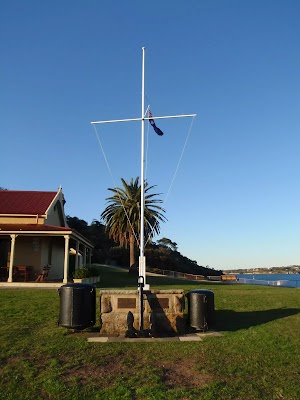
(4.37km) Roundabout at end of Chowder Bay Road → Int. Bacino Bar back deck and Chowder Bay Trk

20 m
1 mins
6m
0m
Moderate track
(4.39km) Int. Bacino Bar back deck and Chowder Bay Trk → Bacino Bar

30 m
1 mins
0m
-3m
Moderate track
Bacino Cafe
(4.39km) Int. Bacino Bar back deck and Chowder Bay Trk → Georges Head Lookout

400 m
9 mins
49m
-5m
Moderate track
Turn right: From the intersection, this walk heads across the road to head up the bush track on the hill for approximately 50m, to the signposted intersection behind ‘Georges Head Lookout’.
Turn right: From the intersection, this walk follows the sign to Georges Head Lookout, down the hill to the circular paved lookout above the fortifications.
Georges Heights

(4.79km) Georges Head Lookout → Int. WW1 Hospital and Chowder Bay Trk

450 m
8 mins
15m
-11m
Easy track
Turn right: From the intersection, this walk follows the signs to ‘Balmoral Beach’ up the hill for a short while. The track opens out to a clearing on the left which has some old structures in it. This is the World War 1 hospital.
WW1 Hospital
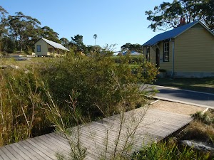
(5.25km) Int. WW1 Hospital and Chowder Bay Trk → Rocky Point Bridge

1.7 km
35 mins
14m
-87m
Hard track
Continue straight: From the intersection, this walk follows the sign to ‘Balmoral Beach’ downhill away from the road. The walk heads down many flights of stairs and turns right, through a fence. The track then turns left to continue down more stairs, which lead the walk across a bridge and next to an oval with a signposted intersection.
Turn right: From the intersection, this walk heads toward the sea, keeping the oval to your left. The walk passes ‘1st Balmoral Sea Scouts’ on the right before coming to the car park.
Continue straight: From Balmoral Park car park, this walk heads onto the beach and follows along it, past the pipe and wharf, then continues up the beach to then head up the stairs onto the bridge, connecting the small rocky island to the promenade above the beach.
Balmoral Beach

(6.94km) Rocky Point Bridge → Rocky Point

110 m
2 mins
0m
-1m
Moderate track
(6.94km) Rocky Point Bridge → Int. Wyargine Reserve Trk and Balmoral Beach

480 m
8 mins
8m
-3m
Moderate track
(7.42km) Int. Wyargine Reserve Trk and Balmoral Beach → Chinamans Beach Reserve South

850 m
18 mins
42m
-43m
Moderate track
Continue straight: From the intersection, this walk heads up the road following ‘Stanton Rd’ then ‘Burran Ave’ signs, to veer left onto Hopetoun Ave. The walk soon passes Kirk Oswald Ave (off to the left). After a while the road again splits into two levels, opposite the intersection of Armitage Rd.
Turn right: From the intersection, this walk heads down the hill, following the sign ‘Armitage Lane’ along the road, and around to the left into Rosherville Rd. The walk continues along the footpath, passing a large boulder and a bench on the right before winding down behind the playground in Rosherville Reserve. The track passes the playground, taking the closest access track to the southern end of Chinamans Beach. Now Turn sharp left to rejoin the main walk .
(7.42km) Int. Wyargine Reserve Trk and Balmoral Beach → Middle of Chinamans Beach

1 km
19 mins
25m
-30m
Hard track
Turn right: From the end of the beach, this walk heads along the sand, keeping the water to the right, until near the middle of Chinamans Beach. A wood-railed track heads off to the toilet block on the left, marking the intersection.
Chinamans Beach and Reserve
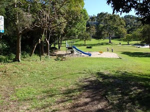
(8.42km) Middle of Chinamans Beach → Int. Grecia Lane Trk and Chinamans Beach Reserve North

70 m
1 mins
3m
0m
Moderate track
(8.49km) Int. Grecia Lane Trk and Chinamans Beach Reserve North → Int. Middle Harbour Yacht Club car park and Spit Rd

1.1 km
25 mins
55m
-56m
Moderate track
(8.49km) Int. Grecia Lane Trk and Chinamans Beach Reserve North → Middle Harbour Yacht Club entrance

860 m
16 mins
18m
-19m
Hard track
Spit Syphon
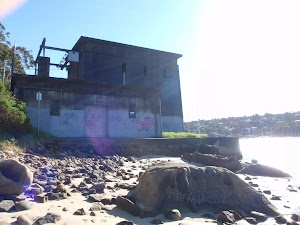
(9.35km) Middle Harbour Yacht Club entrance → Spit Bridge South

360 m
6 mins
2m
-5m
Easy track
Turn right: From the intersection, this walk heads along Spit Rd towards the bridge, keeping the shops on your right. The walk heads along the road to where it splits, to go over the bridge, opposite ‘Sydney Harbour Kayaks’.
Sydney Harbour Kayaks
(9.7km) Spit Bridge South → Int. Spit Rd and Ellery’s Punt Reserve Road

350 m
6 mins
11m
-2m
Easy track
Spit Bridge
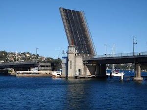
(10.05km) Int. Spit Rd and Ellery’s Punt Reserve Road → Int. Ellery’s Punt Reserve Rd and Manly Scenic Walkway

100 m
2 mins
2m
-7m
Easy track
Veer right: From the intersection, this walk heads down the hill towards the water. The walk soon comes to Ellery’s Punt Reserve car park on the right. This walk continues past this, down the footpath to the signposted intersection.
Ellery’s Punt Reserve
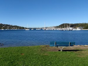
(10.16km) Int. Ellery’s Punt Reserve Rd and Manly Scenic Walkway → Int. Battle Boulevard and Manly Rd

230 m
5 mins
11m
0m
Moderate track
Continue straight: From the end of the cul-de-sac, this walk follows Battle Bvd up the road to the car park just near the intersection with Manly Road.
Maps for the Taronga Zoo to Spit Bridge walk
You can download the PDF for this walk to print a map.
These maps below cover the walk and the wider area around the walk, they are worth carrying for safety reasons.
| Parramatta River | 1:25 000 Map Series | 91303N PARRAMATTA RIVER | NSW-91303N |
| Sydney Heads | 1:25 000 Map Series | 91302N SYDNEY HEADS | NSW-91302N |
| Sydney | 1:100 000 Map Series | 9130 SYDNEY | 9130 |
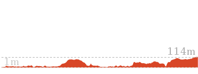
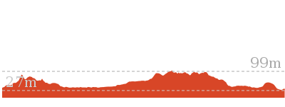
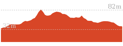
Cross sectional view of the Taronga Zoo to Spit Bridge bushwalking track

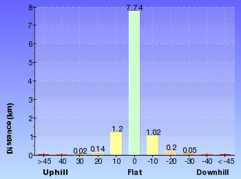
Analysis and summary of the altitude variation on the Taronga Zoo to Spit Bridge
Overview of this walks grade – based on the AS 2156.1 – 2001
Under this standard, a walk is graded based on the most difficult section of the walk.
| Length | 10.4 km | ||
| Time | 5 hrs | ||
| . | |||
| Grade 4/6 Hard track |
AS 2156.1 | Gradient | Very steep (4/6) |
| Quality of track | Rough track, where fallen trees and other obstacles are likely (4/6) | ||
| Signs | Minimal directional signs (4/6) | ||
| Experience Required | Moderate level of bushwalking experience recommended (4/6) | ||
| Weather | Storms may impact on navigation and safety (3/6) | ||
| Infrastructure | Limited facilities, not all cliffs are fenced (3/6) |
Some more details of this walks Grading
Here is a bit more details explaining grading looking at sections of the walk
Gradient
3.3km of this walk is flat with no steps and another 3.2km has gentle hills with occasional steps. Whilst another 2.1km is very steep and the remaining 1.9km has short steep hills.
Quality of track
4.1km of this walk follows a smooth and hardened path and another 3.1km follows a formed track, with some branches and other obstacles. Whilst another 1.7km follows a rough track, where fallen trees and other obstacles are likely and the remaining 1.5km follows a clear and well formed track or trail.
Signs
7km of this walk is clearly signposted and another 1.7km has directional signs at most intersection. The remaining (1.7km) has minimal directional signs.
Experience Required
Around 9km of this walk requires no previous bushwalking experience, whilst the remaining 1.7km requires a leader a with moderate level of bushwalking experience.
weather
Around 9km of this walk is not usually affected by severe weather events (that would unexpectedly impact safety and navigation), whilst the remaining 1.7km is affected by storms that may impact your navigation and safety.
Infrastructure
Around 8km of this walk is close to useful facilities (such as fenced cliffs and seats), whilst the remaining 2.6km has limited facilities (such as not all cliffs fenced).
Similar walks
A list of walks that share part of the track with the Taronga Zoo to Spit Bridge walk.
Other Nearby walks
A list of walks that start near the Taronga Zoo to Spit Bridge walk.
Plan your trip to and from the walk here
The Taronga Zoo to Spit Bridge walk starts at the Taronga Zoo Wharf (gps: -33.845752, 151.23978)
Your transport options to Taronga Zoo Wharf are by;
![]() Ferry. (get details)
Ferry. (get details)
![]() Bus. (get details)
Bus. (get details)
![]() Car. There is free parking available.
Car. There is free parking available.
(get details)
The Taronga Zoo to Spit Bridge ends at the Int. Battle Boulevard and Manly Rd (gps: -33.800405, 151.24678)
Your transport options to Int. Battle Boulevard and Manly Rd are by;
![]() Bus. (get details)
Bus. (get details)
![]() Car. There is free parking available.
Car. There is free parking available.
(get details)
Fire Danger
Each park may have its own fire ban, this rating is only valid for today and is based on information from the RFS Please check the RFS Website for more information.
Weather Forest
This walk starts in the Metropolitan weather district always check the formal BOM forecast or pdf before starting your walk.
Forecast snapshot
Park Information & Alerts
Comments
Short URL = http://wild.tl/tztsb
Gallery images
There are other downloads I am still working on.
You will probably need to login to access these — still all free.
* KML (google earth file)
* GPX (GPS file)
Special Maps/ brochures
* A3 topo maps
* PDF with Lands Topo map base
* PDF with arial image (and map overlay)
I wanted to get the main site live first, this extra stuff will come in time.
Happy walking
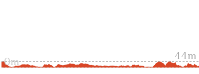
Matt 🙂


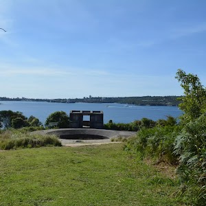
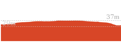













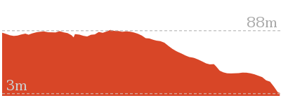
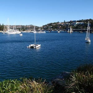
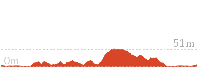
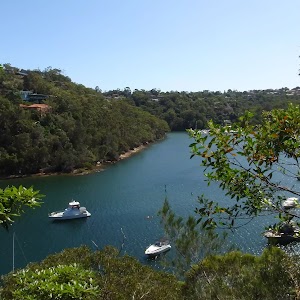

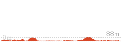
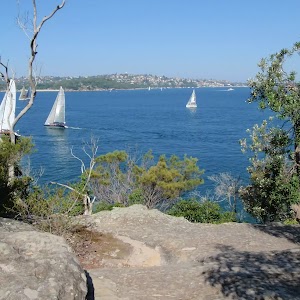

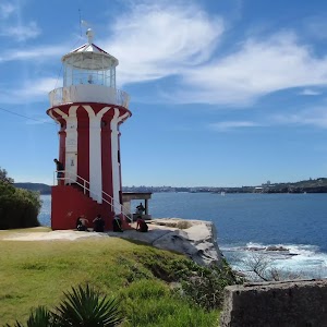
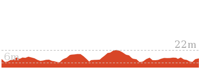













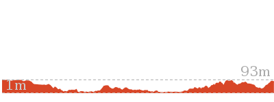






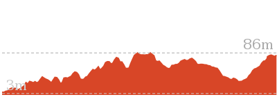

Comments