Kangarutha Track to Hobart Beach


4 hrs 30 mins

476 m
Hard track


(0km) Kianinny Boat Ramp → Kianinny Park

60 m
1 mins
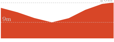
3m
0m
Easy track
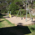
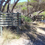
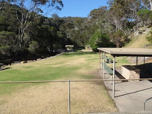
Kianinny Bay picnic area
(0.06km) Kianinny Park → Kianinny Bay Lookout
150 m
5 mins
27m
-5m
Hard track
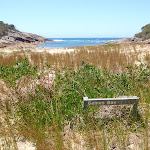
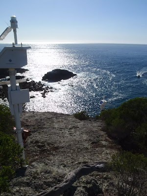
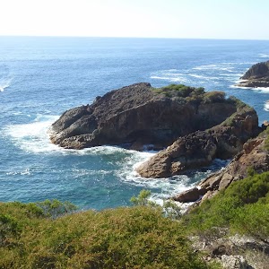
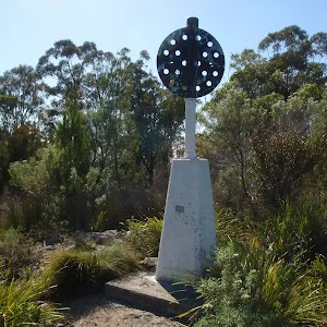
Kianinny Bay Lookout
(0.21km) Kianinny Bay Lookout → Boulder Bay
1.5 km
35 mins
72m
-93m
Hard track
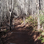
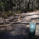
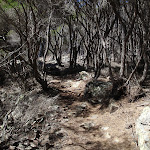
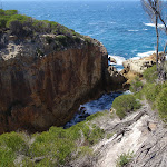
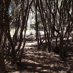
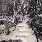
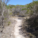
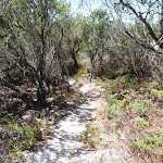
Veer right: From the intersection, this walk heads up the hill away from the ocean. The track winds along an area of low heath to soon turn left into taller heath. The track winds and undulates through the cleared passage in the heathland, passing through a few gullies. The walk crosses a large creek with stairs leading down and away from a rock platform. The track then continues up and around the hillside through an area of more open vegetation. This walk then leads down the hill to an arrow post, marking the track on the right.
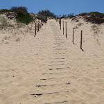
Continue straight: From the intersection, this walk heads down the hill along the track, soon coming into view of the beach. The walk winds down the stairs onto a rock which leads onto the beach. This walk continues to the middle of the beach.
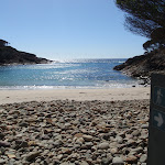
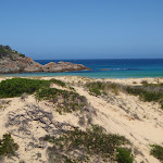
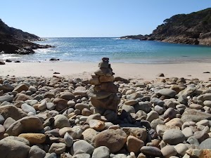
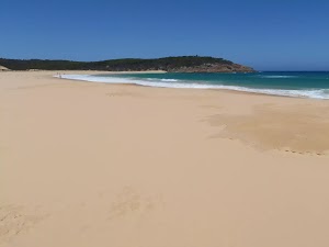
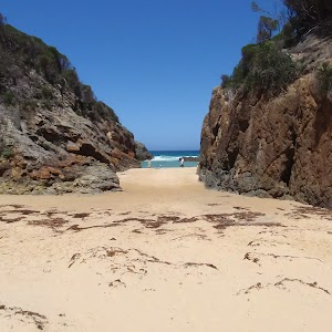
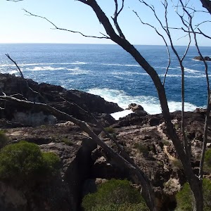
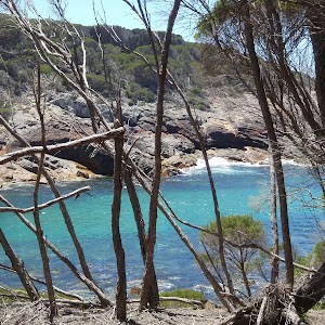
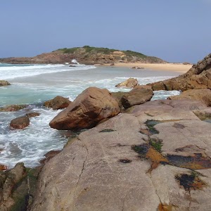
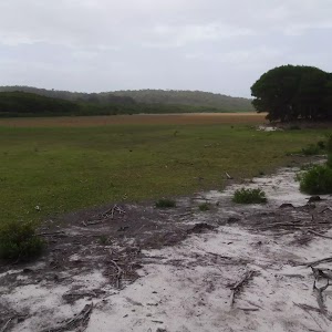
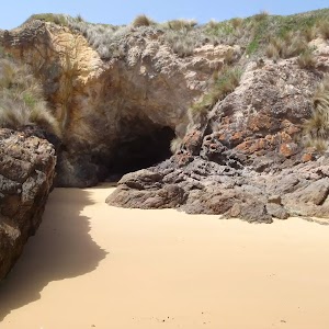
Boulder Bay
(1.73km) Boulder Bay → Int Kangarutha Trk Nth and White Rock Rd
2.8 km
1 hr 9 mins
186m
-152m
Hard track
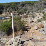
Continue straight: From the intersection, the walk follows the arrow down the steps, towards the ocean. The track opens out onto the coast and arrives at a white post on the rock platform beside the bay.
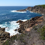
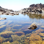
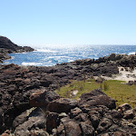
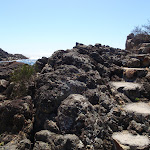
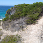
Turn right: From the first white post, the walk heads towards the next visible white post, keeping the ocean on the left. The track meanders along the rocky platform then tends away from the bay, turning right, up the hill. As it climbs up the hill, the walk passes an ant mound, to the left, and soon heads over a very rocky area, following the most worn and compacted route through the rocks. The track continues, with the ocean on the left, and follows a track marker down the hill, arriving at the middle of a rocky bay.
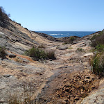
Continue straight: From the middle of the rocky bay, the walk follows rock-cut steps up onto the rocky headland, keeping the water on the left. The track then winds its way over the rocks, passing a lookout on the left, and dropping into a U-shaped rock valley (which points out to sea).
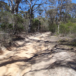
Continue straight: From the U-shaped rock valley, the walk climbs the hill, keeping the ocean on the left. The track continues for some time passing many great views of the coast. After passing through more areas of open and closed heath, the track bends right and goes up some stairs to an intersection with a service trail.
(4.57km) Int. Kangarutha Trk Nth and White Rock Rd → White Rock Nth route
230 m
5 mins
1m
-34m
Hard track
Continue straight: On the side of the car park where the road leads up the hill, this walk follows track around the cliff tops, keeping the small bay below on the left. The track heads around the small hill (above on the right), leading to a point on the white rock which overlooks the sea and surrounding coast. At the end of this side trip, retrace your steps back to the main walk then Continue straight.
White Rock

(4.57km) Int. Kangarutha Trk Nth and White Rock Rd → Int. White Rock Rd and Kangarutha Trk Sth
40 m
1 mins
3m
0m
Moderate track
(4.6km) Int. White Rock Rd and Kangarutha Trk Sth → Games Bay
1.6 km
36 mins
69m
-109m
Hard track
Turn right: From the bay, this walk heads up the hill, keeping the ocean on the left of the track. The walk winds up the steps to then meander along the hillside, coming to a track marker at an intersection.
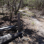
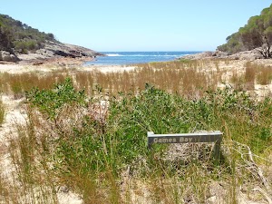
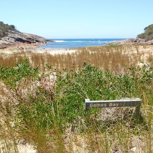
Veer left: From the intersection, this walk heads down the stairs following the track marker arrow. The track very quickly winds down into the sandy creek bed behind Games Bay. A signpost marking ‘Games Bay’ is hidden in the low bush at the back of the beach area.
Games Bay
(6.21km) Games Bay → Int. Wallagoot Gap and Kangarutha Trks
2.4 km
49 mins
86m
-82m
Hard track
(8.61km) Int. Wallagoot Gap and Kangarutha Trks → Wallagoot Gap
110 m
2 mins
0m
-8m
Easy track
Wallagoot Gap

(8.61km) Int. Wallagoot Gap and Kangarutha Trks → Wallagoot Beach North
280 m
6 mins
12m
-11m
Moderate track
(8.89km) Wallagoot Beach North → Wallagoot Beach
1.5 km
25 mins
9m
-17m
Moderate track
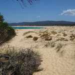
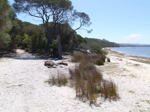
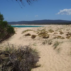
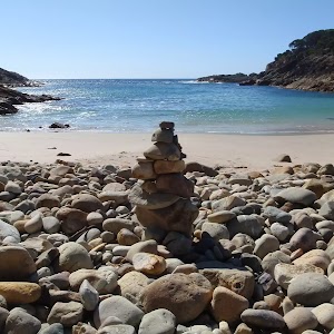
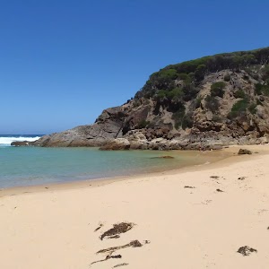
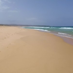
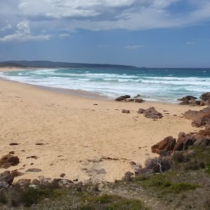
Wallagoot Beach
(10.42km) Wallagoot Beach → Ocean beaches carpark Trk
300 m
5 mins
7m
-2m
Moderate track
(10.72km) Ocean beaches carpark Trk → Wallagoot Lake Shore (Hobart Beach)
430 m
6 mins
1m
-2m
Moderate track
Turn right: From the intersection, this walk follows the arrow on the sign to ‘Wallagoot Lake’[4], away from the car park and picnic table. The track tends right, down the hill, for approximately 50m to an intersection on the shore of Wallagoot Lake.
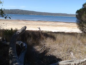
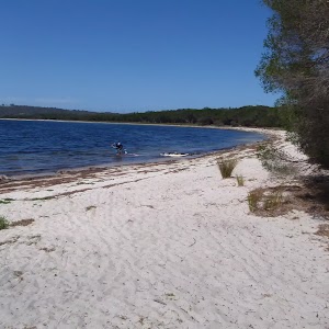
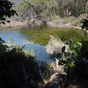
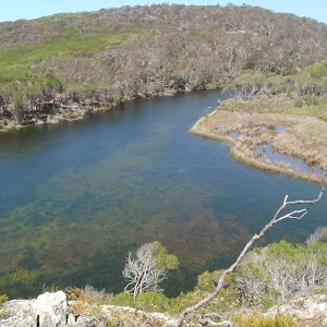
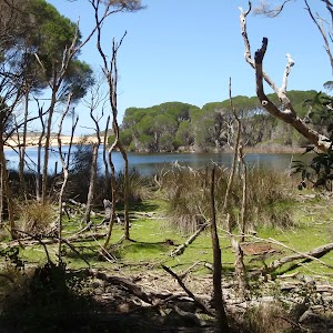
Wallagoot Lake (Lagoon)
Hobart Beach
(11.15km) Wallagoot Lake Shore (Hobart Beach) → Hobart Beach large shelter
330 m
5 mins
1m
0m
Easy track
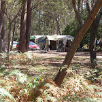
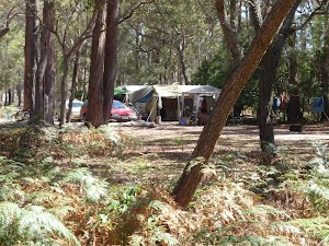
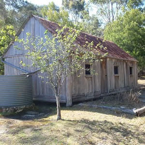
Hobart Beach campground
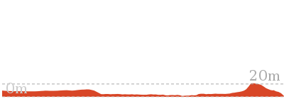
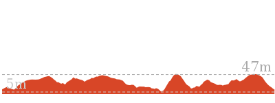
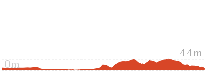
Maps for the Kangarutha Track to Hobart Beach walk
You can download the PDF for this walk to print a map.These maps below cover the walk and the wider area around the walk, they are worth carrying for safety reasons.
| Wolumla | 1:25 000 Map Series | 88242N WOLUMLA | NSW-88242N |
| Bega | 1:25 000 Map Series | 88241S BEGA | NSW-88241S |
| Bega | 1:100 000 Map Series | 8824 BEGA | 8824 |
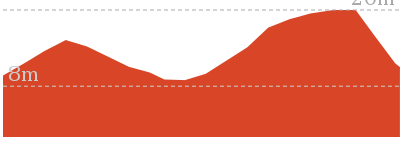
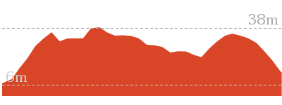
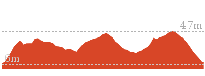
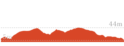
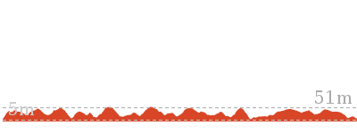
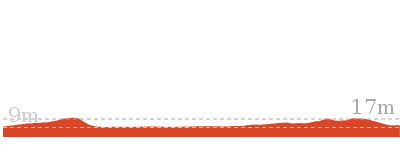
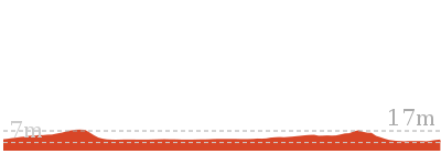
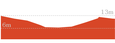
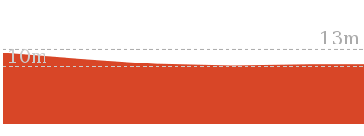
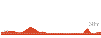
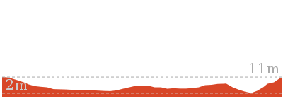
Cross sectional view of the Kangarutha Track to Hobart Beach bushwalking track
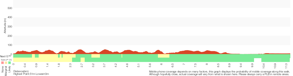
Analysis and summary of the altitude variation on the Kangarutha Track to Hobart Beach
Overview of this walks grade – based on the AS 2156.1 – 2001
Under this standard, a walk is graded based on the most difficult section of the walk.
| Length | 11.5 km | ||
| Time | 4 hrs 30 mins | ||
| . | |||
| Grade 4/6 Hard track |
AS 2156.1 | Gradient | Very steep (4/6) |
| Quality of track | Rough track, where fallen trees and other obstacles are likely (4/6) | ||
| Signs | Minimal directional signs (4/6) | ||
| Experience Required | No experience required (1/6) | ||
| Weather | Weather generally has little impact on safety (1/6) | ||
| Infrastructure | Limited facilities (such as cliffs not fenced, significant creeks not bridged) (4/6) |
Some more details of this walks Grading
Here is a bit more details explaining grading looking at sections of the walk
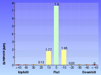
Gradient
4.6km of this walk has short steep hills and another 4.6km is very steep. Whilst another 2km is flat with no steps and the remaining 390m has gentle hills with occasional steps.
Quality of track
6km of this walk follows a rough track, where fallen trees and other obstacles are likely and another 4.7km follows a formed track, with some branches and other obstacles. The remaining (540m) follows a clear and well formed track or trail.
Signs
8km of this walk has minimal directional signs and another 2.9km has directional signs at most intersection. The remaining (540m) is clearly signposted.
Experience Required
This whole walk, 11km requires no previous bushwalking experience.
weather
This whole walk, 11km is not usually affected by severe weather events (that would unexpectedly impact safety and navigation).
Infrastructure
8km of this walk has limited facilities (such as cliffs not fenced, significant creeks not bridged) and another 2.4km has limited facilities (such as not all cliffs fenced). The remaining (690m) is close to useful facilities (such as fenced cliffs and seats).
Similar walks

194 m Circuit
10 mins
Hard track
416 m Return
15 mins
Hard track

648 m Return
15 mins
Easy track

1 km Return
30 mins
Moderate track
1.2 km Circuit
45 mins
Moderate track

1.8 km Return
1 Hr
Hard track
3.5 km Return
2 hrs
Hard track
5.2 km Return
2 hrs
Hard track
6 km Return
1 hr 45 mins
Moderate track
7.6 km Circuit
2 hrs 15 mins
Hard track

8.8 km One way
4 hrs
Hard track
9 km Return
3 hrs 30 mins
Hard track
10.5 km Return
3 hrs 30 mins
Hard track
10.6 km Circuit
3 hrs 45 mins
Hard track

Other Nearby walks
3.6 km Return
1 hr 15 mins
Easy track

5 km Return
1 hr 30 mins
Moderate track
8 km Circuit
3 hrs 30 mins
Experienced only

5 km Return
1 hr 45 mins
Experienced only
464 m Return
10 mins
Moderate track

482 m Return
12 mins
Hard track
5.2 km Circuit
2 hrs
Hard track

286 m Return
5 mins
Moderate track
2.1 km Return
45 mins
Hard track

1.8 km One way
45 mins
Moderate track

3.5 km One way
1 hr 15 mins
Hard track
2.3 km Return
45 mins
Hard track
Plan your trip to and from the walk here
The Kangarutha Track to Hobart Beach walk starts at the Kianinny Boat Ramp (gps: -36.736751, 149.9819)Your main transport option to Kianinny Boat Ramp is by;
(get details)
The Kangarutha Track to Hobart Beach ends at the Hobart Beach large shelter (gps: -36.797, 149.93998)
Your main transport option to Hobart Beach large shelter is by;
(get details)


Short URL = http://wild.tl/ktthb
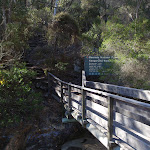
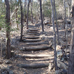
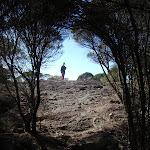
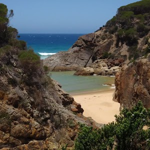
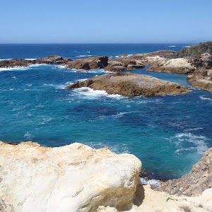
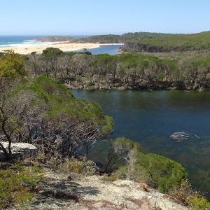
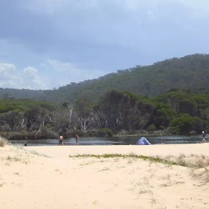
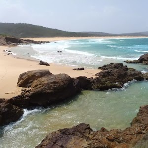
Gallery images
There are other downloads I am still working on.
You will probably need to login to access these — still all free.
* KML (google earth file)
* GPX (GPS file)
Special Maps/ brochures
* A3 topo maps
* PDF with Lands Topo map base
* PDF with arial image (and map overlay)
I wanted to get the main site live first, this extra stuff will come in time.
Happy walking
Matt 🙂
Comments