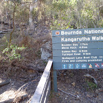
Kianiny Bay to Boulder Bay


2 hrs

200 m
Hard track
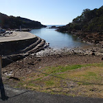


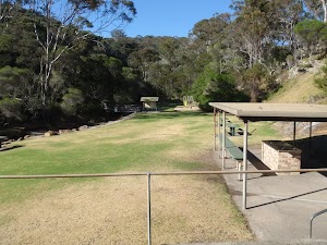
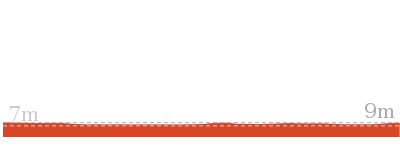
(0km) Kianinny Boat Ramp → Kianinny Park

60 m
1 mins
3m
0m
Easy track
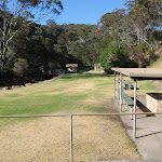
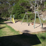
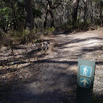
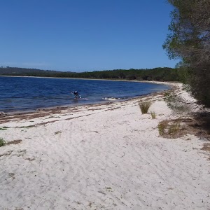
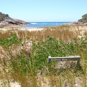
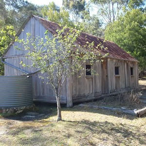
Kianinny Bay picnic area
(0.06km) Kianinny Park → Kianinny Bay Lookout
150 m
5 mins
27m
-5m
Hard track
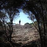
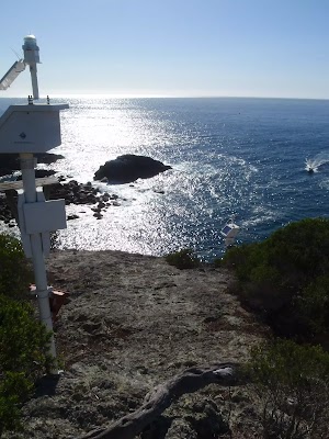
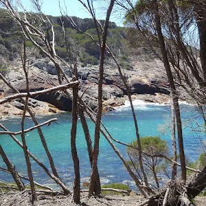
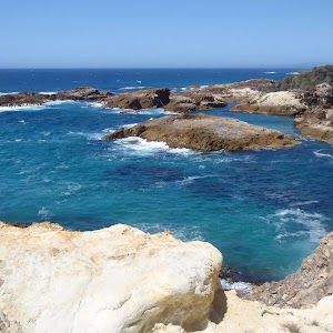
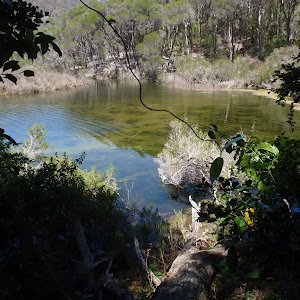
Kianinny Bay Lookout
(0.21km) Kianinny Bay Lookout → Int. Kangarutha and Wild Horse Bay Lookout Trks
550 m
13 mins
31m
-26m
Hard track
(0.76km) Int. Kangarutha and Wild Horse Bay Lookout Trks → Wild Horse Bay Lookout
160 m
3 mins
0m
-22m
Hard track
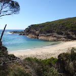
White Horse Bay Lookout
(0.76km) Int. Kangarutha and Wild Horse Bay Lookout Trks → Boulder Bay
970 m
22 mins
41m
-67m
Hard track
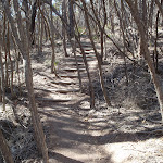
Continue straight: From the intersection, this walk heads down the hill along the track, soon coming into view of the beach. The walk winds down the stairs onto a rock which leads onto the beach. This walk continues to the middle of the beach.
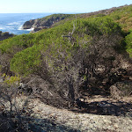
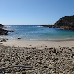
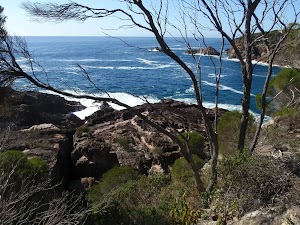
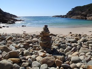
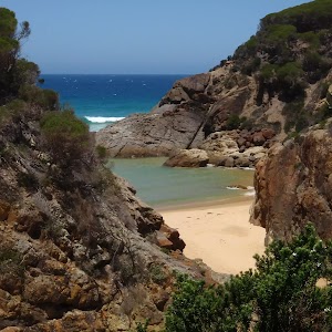
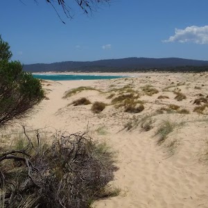
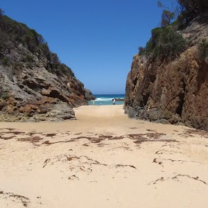
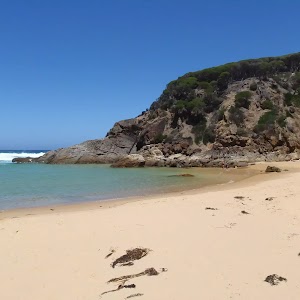
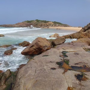
Boulder Bay
Maps for the Kianiny Bay to Boulder Bay walk
You can download the PDF for this walk to print a map.These maps below cover the walk and the wider area around the walk, they are worth carrying for safety reasons.
| Bega | 1:25 000 Map Series | 88241S BEGA | NSW-88241S |
| Bega | 1:100 000 Map Series | 8824 BEGA | 8824 |
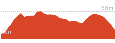
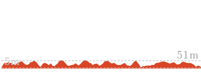
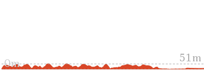
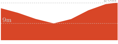
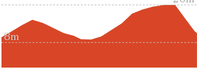
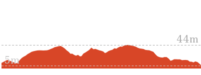
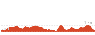
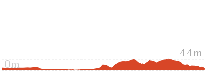
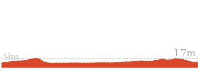
Cross sectional view of the Kianiny Bay to Boulder Bay bushwalking track
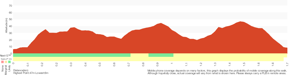
Analysis and summary of the altitude variation on the Kianiny Bay to Boulder Bay
Overview of this walks grade – based on the AS 2156.1 – 2001
Under this standard, a walk is graded based on the most difficult section of the walk.
| Length | 3.5 km | ||
| Time | 2 hrs | ||
| . | |||
| Grade 4/6 Hard track |
AS 2156.1 | Gradient | Very steep (4/6) |
| Quality of track | Rough track, where fallen trees and other obstacles are likely (4/6) | ||
| Signs | Minimal directional signs (4/6) | ||
| Experience Required | No experience required (1/6) | ||
| Weather | Weather generally has little impact on safety (1/6) | ||
| Infrastructure | Limited facilities (such as cliffs not fenced, significant creeks not bridged) (4/6) |
Some more details of this walks Grading
Here is a bit more details explaining grading looking at sections of the walk
Gradient
Around 1.7km of this walk is very steep, whilst the remaining 55m has gentle hills with occasional steps.
Quality of track
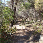
1.5km of this walk follows a formed track, with some branches and other obstacles and another 170m follows a rough track, where fallen trees and other obstacles are likely. The remaining (55m) follows a clear and well formed track or trail.
Signs
1.4km of this walk has minimal directional signs and another 320m has directional signs at most intersection. The remaining (55m) is clearly signposted.
Experience Required
This whole walk, 1.7km requires no previous bushwalking experience.
weather
This whole walk, 1.7km is not usually affected by severe weather events (that would unexpectedly impact safety and navigation).
Infrastructure
Around 1.5km of this walk has limited facilities (such as cliffs not fenced, significant creeks not bridged), whilst the remaining 210m is close to useful facilities (such as fenced cliffs and seats).
Similar walks
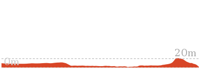
416 m Return
15 mins
Hard track

1.8 km Return
1 Hr
Hard track
8.8 km One way
4 hrs
Hard track
11.5 km One way
4 hrs 30 mins
Hard track
Other Nearby walks

194 m Circuit
10 mins
Hard track
1 km Return
30 mins
Moderate track
5.2 km Return
2 hrs
Hard track
648 m Return
15 mins
Easy track

9 km Return
3 hrs 30 mins
Hard track
1.2 km Circuit
45 mins
Moderate track

10.5 km Return
3 hrs 30 mins
Hard track
6 km Return
1 hr 45 mins
Moderate track
3.6 km Return
1 hr 15 mins
Easy track
10.6 km Circuit
3 hrs 45 mins
Hard track


5 km Return
1 hr 30 mins
Moderate track
7.6 km Circuit
2 hrs 15 mins
Hard track

Plan your trip to and from the walk here
The Kianiny Bay to Boulder Bay walk starts and ends at the Kianinny Boat Ramp (gps: -36.736751, 149.9819)Your main transport option to Kianinny Boat Ramp is by;
(get details)


Short URL = http://wild.tl/kbtbb
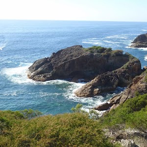
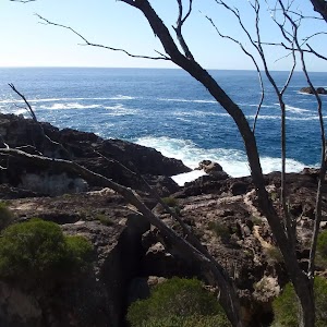
Gallery images
There are other downloads I am still working on.
You will probably need to login to access these — still all free.
* KML (google earth file)
* GPX (GPS file)
Special Maps/ brochures
* A3 topo maps
* PDF with Lands Topo map base
* PDF with arial image (and map overlay)
I wanted to get the main site live first, this extra stuff will come in time.
Happy walking
Matt 🙂
Comments