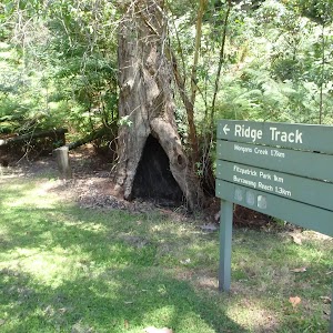
Morgans Creek to Padstow


2 hrs 45 mins

144 m
Moderate track
Closed:
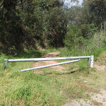


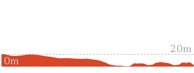
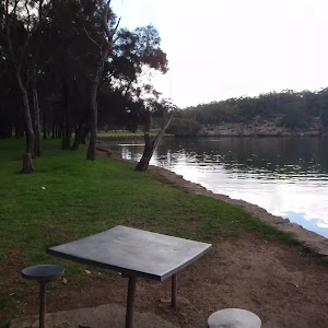
Morgans Creek
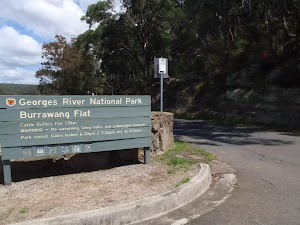
(0km) Int of Morgans Creek and the Ridge Track → Boomerang Reserve

570 m
10 mins
9m
-11m
Moderate track
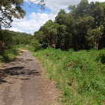
Turn right: From the intersection, the walk follows Henry Lawson drive, keeping Georges River to the right. The road bends to the right and soon reaches Boomerang Reserve, on the left.
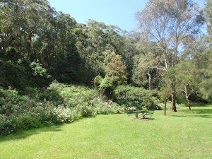
Boomerang Reserve
(0.57km) Boomerang Reserve → Int of the Henry Lawson drive and Georges River National Park service trail
570 m
10 mins
10m
-7m
Easy track
(1.14km) Int of the Henry Lawson drive and Georges River National Park service trail → End of Gorges river service trail
530 m
10 mins
11m
-9m
Moderate track
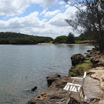
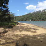
(1.67km) End of Gorges river service trail → West end of Mickeys Point Beach
230 m
4 mins
4m
-6m
Moderate track
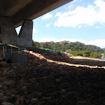
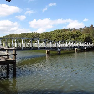
(1.9km) West end of Mickeys Point Beach → Base of Alfords Point Bridge
600 m
10 mins
5m
-9m
Moderate track
(2.51km) Base of Alfords Point Bridge → Int of One Tree Point service trail
320 m
6 mins
9m
-2m
Moderate track
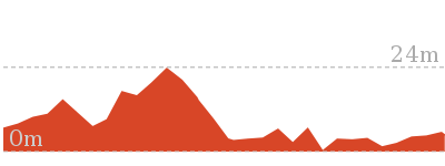
(2.83km) Int of One Tree Point service trail → Int of One Tree Point bushtrack and Playford road
500 m
12 mins
38m
-2m
Moderate track
Continue straight: From the intersection, the walk follows the bush track beside the powerlines up the small hill to the metal gate at the bend in Playford Rd.
(3.33km) Int of One Tree Point bushtrack and Playford road → Int of Villiers and Dilke road
510 m
8 mins
5m
-4m
Very easy
Convenience Store
(3.84km) Int of Villiers and Dilke road → End of Riverview road
920 m
15 mins
0m
-34m
Very easy
(4.76km) End of Riverview road → Western end of Salt Pan creek Bridge
190 m
3 mins
0m
-10m
Easy track
Turn right: From the intersection, the walk follows the footpath on Henry Lawson drive down the hill, (keeping the road on the left) towards the bridge. Just before the bridge, the walk comes to the top of a wooden staircase, to the right.
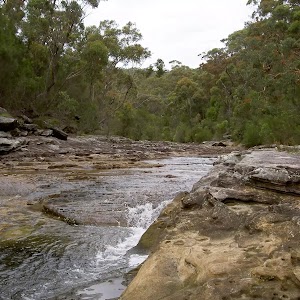
(4.95km) Western end of Salt Pan Creek Bridge → Salt Pan Creek picnic area
550 m
10 mins
8m
-7m
Moderate track
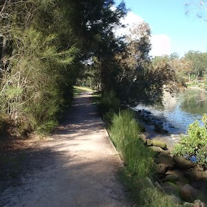
Turn right: From the intersection, this walk follows the footpath north (keeping the river on the right) onto a bush track and then up some wooden steps. The track continues along for a while until it drops down some more steps to the Salt Pan creek picnic area.
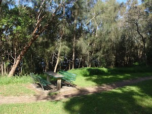
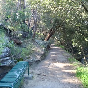
Salt Pan Creek picnic area
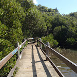
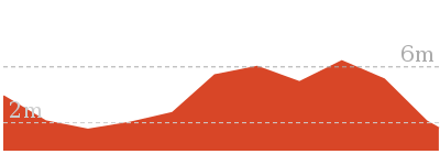
(5.49km) Salt Pan Creek picnic area → Picnic area at base of Pipe Bridge
390 m
7 mins
5m
-6m
Moderate track
Continue straight: From the bottom of the steps, this walk follows the boardwalk as it winds alongside the river (keeping the river on the right), through mangroves for a short while. Soon the boardwalk becomes a bush track and continues to the picnic area under the large pipe bridge.
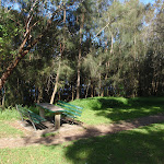
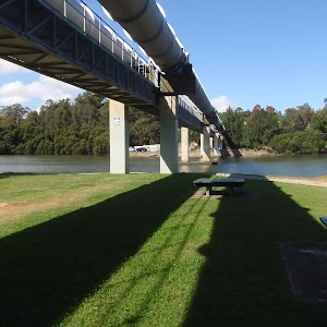
Pipe bridge picnic area
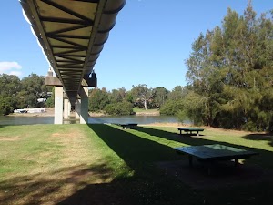
(5.88km) Picnic area at base of Pipe Bridge → Davies Reserve
280 m
6 mins
10m
-6m
Very easy
Davies Reserve
(6.17km) Davies Reserve → End of Bridge Street
700 m
13 mins
14m
-12m
Very easy
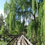
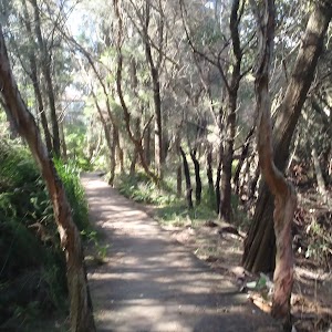
Continue straight: From the intersection, the walk continues along the short board walk (keeping the power lines above to the right). Soon the boardwalk joins onto a hardened footpath, which continues along through the grass clearing, running parallel to Salt Pan Creek. The track passes behind a number of houses, and then passes a couple of transmission towers as the footpath tends left to the end of Meager Avenue.
Veer right: ###This section of the track is closed for End of 2010 to sometime in 2011. Please walk along Meager Ave to Davies Rd as an alternate route### From the end of Meager Ave, the walk follows the footpath lined with wooden posts (with the white house at no.2 initially on the left) into the bush and down the gentle hill. After a short distance, the footpath joins a board walk and continues through some mangroves and out to the creek edge. The boardwalk then turns left, crossing under the railway bridge to the intersection with the Salt Pan Creek footbridge on the right.
Turn left: From the intersection, this walk follows the boardwalk around the creek’s edge (keeping the train line on the left) and through some mangroves for a short distance, until coming to a concrete footpath. This path continues past a transmission tower to the end of Bridge Street.
(6.87km) End of Bridge Street → Padstow Railway Station
1.1 km
19 mins
16m
-4m
Very easy
Continue straight: From the intersection, this walk heads south (away from the trail line) along Davies Road, along the footpath. After a short while, the walk turns right into Ryan Rd, crossing at the traffic lights. This walk follows the footpath through the suburbs to cross, straight ahead at the roundabout, onto Howard Road. The road then passes a few shops and comes to the Padstow railway station on the right.
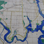
Maps for the Morgans Creek to Padstow walk
You can download the PDF for this walk to print a map.These maps below cover the walk and the wider area around the walk, they are worth carrying for safety reasons.
| Botany Bay | 1:25 000 Map Series | 91303S BOTANY BAY | NSW-91303S |
| Sydney | 1:100 000 Map Series | 9130 SYDNEY | 9130 |
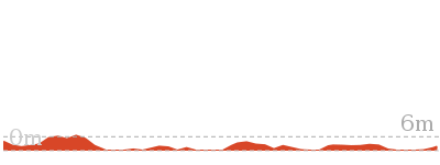
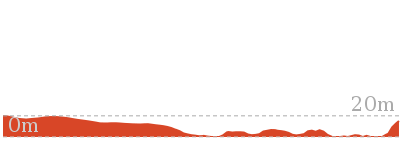
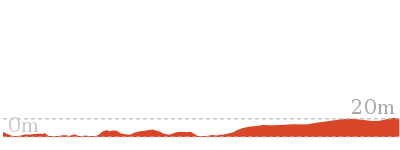
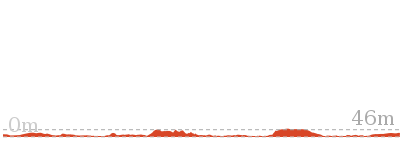
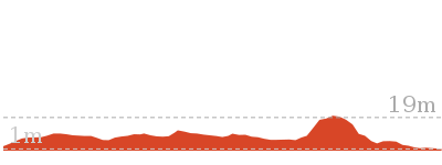
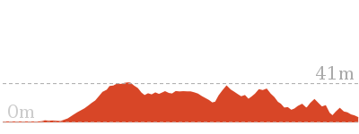
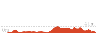
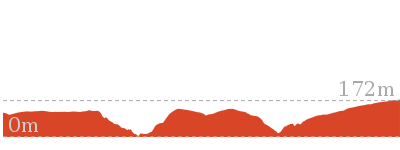
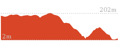
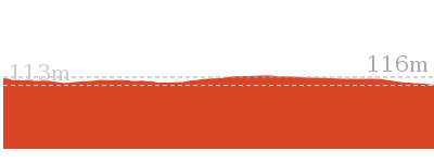
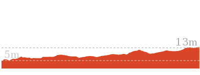
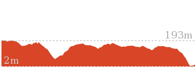
Cross sectional view of the Morgans Creek to Padstow bushwalking track
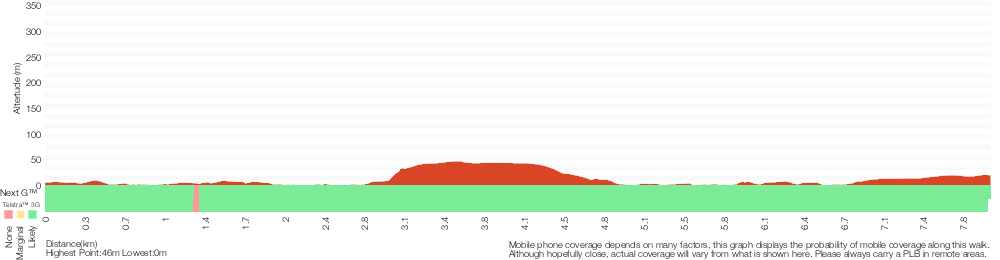
Analysis and summary of the altitude variation on the Morgans Creek to Padstow

Overview of this walks grade – based on the AS 2156.1 – 2001
Under this standard, a walk is graded based on the most difficult section of the walk.
| Length | 8 km | ||
| Time | 2 hrs 45 mins | ||
| . | |||
| Grade 3/6 Moderate track |
AS 2156.1 | Gradient | Short steep hills (3/6) |
| Quality of track | Formed track, with some branches and other obstacles (3/6) | ||
| Signs | Directional signs along the way (3/6) | ||
| Experience Required | Some bushwalking experience recommended (3/6) | ||
| Weather | Weather generally has little impact on safety (1/6) | ||
| Infrastructure | Limited facilities, not all cliffs are fenced (3/6) |
Some more details of this walks Grading
Here is a bit more details explaining grading looking at sections of the walk
Gradient
4.5km of this walk is flat with no steps and another 3.1km has gentle hills with occasional steps. The remaining (450m) has short steep hills.
Quality of track
4.1km of this walk follows a smooth and hardened path and another 2.2km follows a formed track, with some branches and other obstacles. The remaining (1.8km) follows a clear and well formed track or trail.
Signs
Around 5km of this walk is clearly signposted, whilst the remaining 3km has directional signs at most intersection.
Experience Required
Around 6km of this walk requires no previous bushwalking experience, whilst the remaining 2.2km requires some bushwalking experience.
weather
This whole walk, 8km is not usually affected by severe weather events (that would unexpectedly impact safety and navigation).
Infrastructure
Around 7km of this walk is close to useful facilities (such as fenced cliffs and seats), whilst the remaining 730m has limited facilities (such as not all cliffs fenced).
Similar walks
566 m Return
15 mins
Very easy
1 km Return
20 mins
Very easy

1.2 km One way
30 mins
Moderate track
2.6 km One way
1 Hr
Moderate track
2.8 km One way
1 Hr
Moderate track
4.3 km Return
1 hr 30 mins
Very easy

15.8 km One way
5 hrs 30 mins
Moderate track
Other Nearby walks
2.9 km Circuit
1 hr 15 mins
Hard track


769 m Circuit
30 mins
Moderate track
1.8 km Circuit
45 mins
Moderate track
2.5 km One way
1 hr 15 mins
Moderate track
4 km One way
1 hr 45 mins
Moderate track
1.3 km One way
30 mins
Very easy

11 km One way
4 hrs
Hard track
5.8 km One way
2 hrs 30 mins
Hard track
918 m Return
20 mins
Very easy
2.2 km Return
45 mins
Easy track
10 km One way
4 hrs 15 mins
Hard track

15 km One way
6 hrs 30 mins
Hard track
Plan your trip to and from the walk here
The Morgans Creek to Padstow walk starts at the Int of Morgans Creek and the Ridge Track (gps: -33.975847, 151.0187)Your transport options to Int of Morgans Creek and the Ridge Track are by;
(get details)
The Morgans Creek to Padstow ends at the Padstow Railway Station (gps: -33.951899, 151.03197)
Your transport options to Padstow Railway Station are by;
(get details)


Short URL = http://wild.tl/mctp
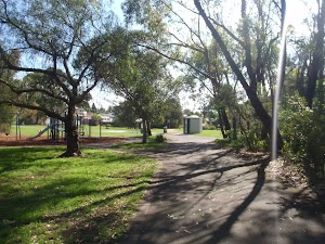
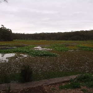
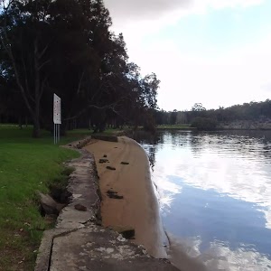
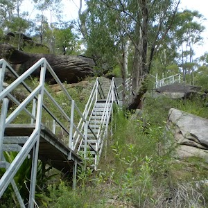
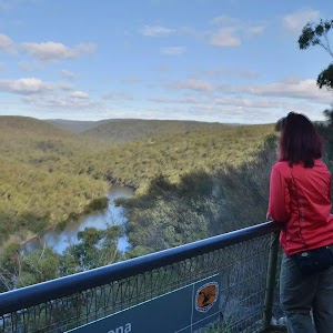
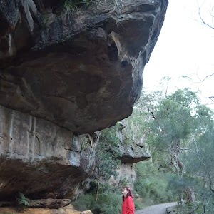
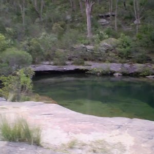
Gallery images
There are other downloads I am still working on.
You will probably need to login to access these — still all free.
* KML (google earth file)
* GPX (GPS file)
Special Maps/ brochures
* A3 topo maps
* PDF with Lands Topo map base
* PDF with arial image (and map overlay)
I wanted to get the main site live first, this extra stuff will come in time.
Happy walking
Matt 🙂
Comments