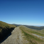
Guthega to Charlotte Pass


6 hrs 30 mins

908 m
Experienced only


Covered in snow part of the year
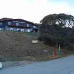
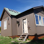
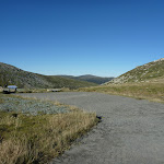
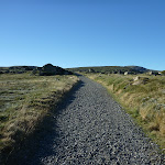
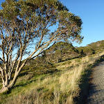
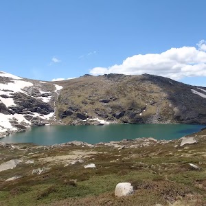
Guthega
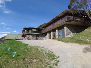
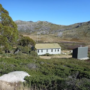
Guthega Alpine Inn
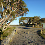
(0km) Car park below Guthega Alpine Inn → Int. of Guthega road servicetrail and Flying fox track

480 m
10 mins
6m
-34m
Moderate track
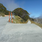
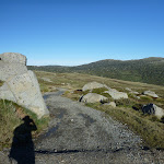
Turn sharp left: From the intersection, the walk follows the concrete road down the hill towards the dam. After about 100m, the track veers right at another intersection, following the lower track. The concrete track turns to the right, but this walk continues straight, onto the wide dirt management trail (between the small boulders). Soon the trail bends right and comes to an intersection with a bush track.
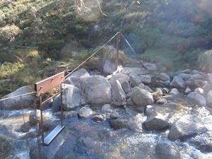
(0.48km) Int. of Guthega road servicetrail and Flying fox track → Flying Fox
330 m
9 mins
15m
-44m
Moderate track
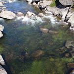
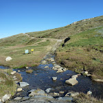
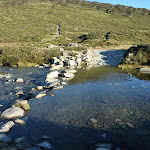
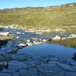
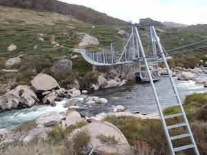
Veer left: From the intersection, the walk initially steps over a small, eroded gap in the track[1] and then heads upstream alongside Blue Cow Creek, keeping the creek to your right. Before long, the track comes closer to the creek, and reaches a rocky crossing with a bridge[2] and a flying fox[3] over the creek.
Flying Fox
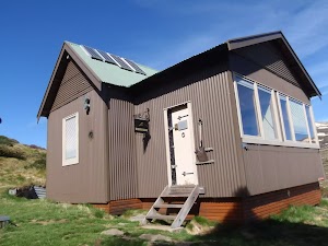
(0.81km) Blue Cow Creek crossing → Illawong Lodge
2.2 km
50 mins
129m
-87m
Moderate track
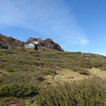
Illawong Lodge
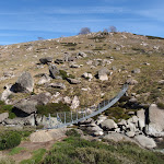
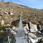
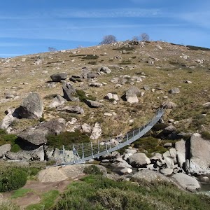
(3.03km) Illawong Lodge → Suspension bridge
160 m
4 mins
0m
-28m
Moderate track
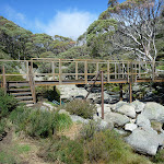
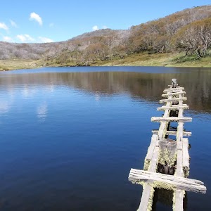
Suspension Bridge
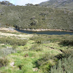
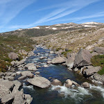
(3.19km) Suspension bridge → Pounds Creek flats
2.6 km
1 hr 13 mins
342m
0m
Experienced only
Pounds Creek Flats
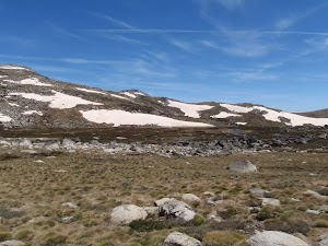
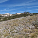
(5.78km) Pounds Creek flats → Twynam saddle
1.1 km
29 mins
131m
0m
Experienced only
(6.85km) Twynam saddle → Mt Twynam
580 m
13 mins
97m
0m
Experienced only
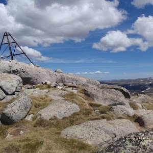
Mt Twynam
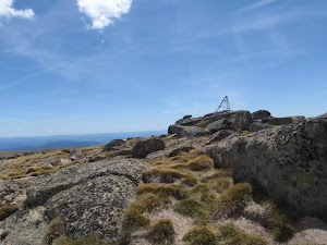
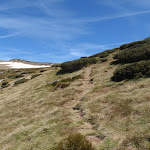
(7.42km) Mt Twynam → Int of Main Range and Mt Twynam tracks
2.9 km
1 hr 1 mins
26m
-166m
Experienced only
Continue straight: From near the top of the hill, the walk follows the old 4WD trail south-west, down along the ridge line. At the end of the ridge, the trail winds down the steep, grassy hill into the saddle and around behind a signpost to the intersection with the Main Range track.
(10.32km) Int of Main Range and Mt Twynam tracks → Carruthers Peak
860 m
18 mins
99m
-2m
Hard track
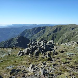
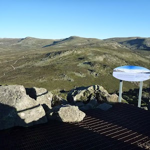
Carruthers Peak
(10.32km) Int of Main Range and Mt Twynam tracks → Int of Main Range and Blue Lake Lookout tracks
880 m
17 mins
7m
-60m
Hard track
(11.2km) Int of Main Range and Blue Lake Lookout tracks → Blue Lake lookout
640 m
14 mins
8m
-72m
Hard track
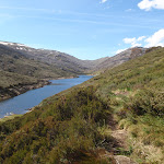
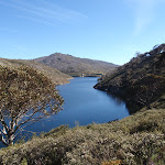
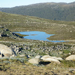
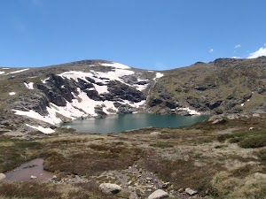
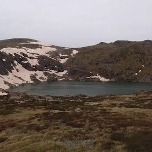
Blue Lake
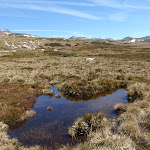
(11.2km) Int of Main Range and Blue Lake Lookout tracks → Snowy River crossing
3.2 km
1 hr 7 mins
33m
-306m
Hard track
Snowy River crossing
(14.44km) Snowy River crossing → End of Kosciuszko Road
790 m
18 mins
122m
-1m
Hard track
Maps for the Guthega to Charlotte Pass walk
You can download the PDF for this walk to print a map.These maps below cover the walk and the wider area around the walk, they are worth carrying for safety reasons.
| Perisher Valley | 1:25 000 Map Series | 85252S PERISHER VALLEY | NSW-85252S |
| Kosciuszko | 1:100 000 Map Series | 8525 KOSCIUSZKO | 8525 |
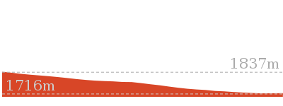
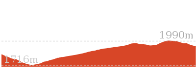
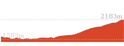
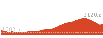
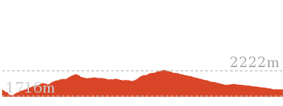
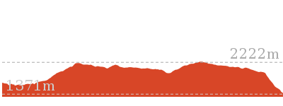
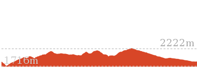
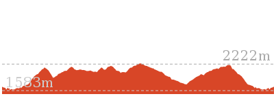
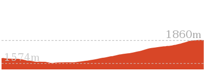
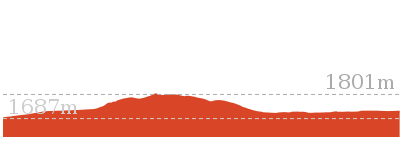
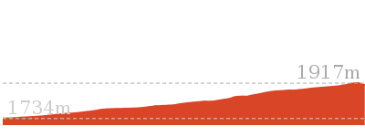
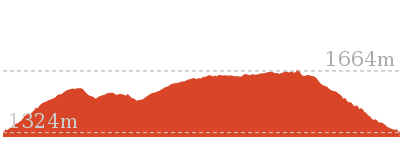
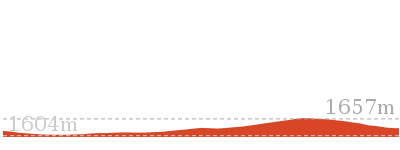
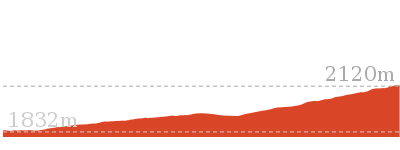
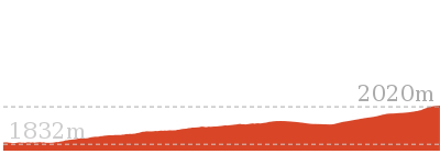
Cross sectional view of the Guthega to Charlotte Pass bushwalking track
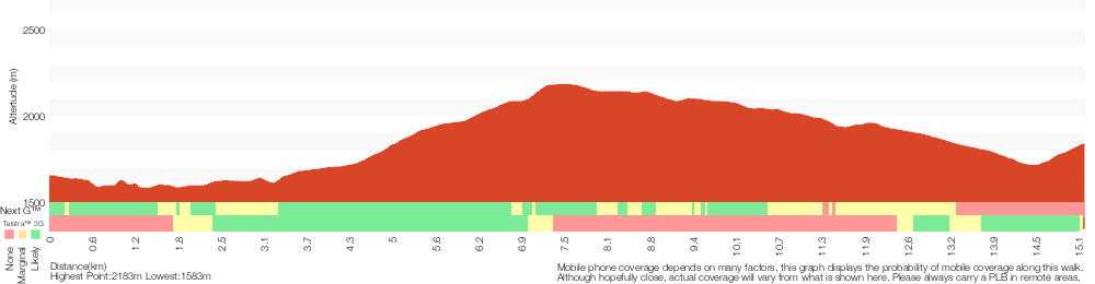
Analysis and summary of the altitude variation on the Guthega to Charlotte Pass
Overview of this walks grade – based on the AS 2156.1 – 2001
Under this standard, a walk is graded based on the most difficult section of the walk.
| Length | 15.2 km | ||
| Time | 6 hrs 30 mins | ||
| . | |||
| Grade 5/6 Experienced only |
AS 2156.1 | Gradient | Short steep hills (3/6) |
| Quality of track | Rough unclear track (5/6) | ||
| Signs | No directional signs (5/6) | ||
| Experience Required | High level of bushwalking experience recommended (5/6) | ||
| Weather | Forecast, unforecast storms and severe weather likely to have an impact on your navigation and safety (5/6) | ||
| Infrastructure | No facilities provided (5/6) |
Some more details of this walks Grading
Here is a bit more details explaining grading looking at sections of the walk
Gradient
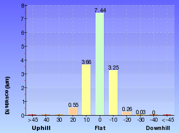
13km of this walk has short steep hills and another 2.2km has gentle hills with occasional steps. The remaining (240m) is flat with no steps.
Quality of track
5km of this walk follows a formed track, with some branches and other obstacles and another 4.9km follows a clear and well formed track or trail. Whilst another 3km follows a rough unclear track and a 1.5km section follows a rough track, where fallen trees and other obstacles are likely. The remaining 480m follows a smooth and hardened path.
Signs
5km of this walk is clearly signposted and another 3.7km has directional signs at most intersection. Whilst another 3.2km has minimal directional signs and the remaining 3km Has no directional signs.
Experience Required
7km of this walk requires a leader with a high level of bushwalking experience and another 4km requires a leader a with moderate level of bushwalking experience. Whilst another 3.6km requires some bushwalking experience and the remaining 480m requires no previous bushwalking experience.
weather
8km of this walk is affected by forecast, unforecast storms and severe weather events that may impact on navigation and safety and another 4km forecast, unforecast storms and severe weather likely to have an impact on your navigation and safety. Whilst another 2.8km is affected by storms that may impact your navigation and safety and the remaining 400m is not usually affected by severe weather events (that would unexpectedly impact safety and navigation).
Infrastructure
6km of this walk has limited facilities (such as not all cliffs fenced) and another 4.3km has limited facilities (such as cliffs not fenced, significant creeks not bridged). Whilst another 3.7km is close to useful facilities (such as fenced cliffs and seats) and the remaining 1.1km has no facilities provided.
Similar walks
1.6 km Return
45 mins
Hard track

6.4 km Return
2 hrs 45 mins
Moderate track
6.4 km Return
2 hrs 30 mins
Moderate track

9.3 km Return
4 hrs
Hard track
14.8 km Return
6 hrs 45 mins
Experienced only
17.4 km Return
8 hrs
Experienced only
21.9 km Circuit
9 hrs
Hard track
25.8 km One way
2 Days
Experienced only
27.7 km Circuit
2 Days
Experienced only
45 km Circuit
4 Days
Experienced only
Other Nearby walks
3.3 km Return
1 hr 30 mins
Hard track

6 km Return
3 hrs
Very experienced only
5.2 km One way
2 hrs 45 mins
Hard track
3 km Circuit
1 hr 30 mins
Moderate track

7.3 km Circuit
3 hrs
Hard track


5.6 km Return
2 hrs 30 mins
Hard track
14.1 km Circuit
5 hrs 30 mins
Hard track
22.4 km Return
9 hrs
Hard track

2.5 km Return
1 Hr
Moderate track
374 m Return
15 mins
Moderate track
15.2 km Return
5 hrs 30 mins
Hard track
12 km Return
4 hrs 30 mins
Hard track
Plan your trip to and from the walk here
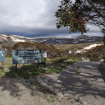
The Guthega to Charlotte Pass walk starts at the Car park below Guthega Alpine Inn (gps: -36.382035, 148.37259)Your main transport option to Car park below Guthega Alpine Inn is by;
(get details)
The Guthega to Charlotte Pass ends at the End of Kosciuszko Road (gps: -36.43167, 148.32865)
Your main transport option to End of Kosciuszko Road is by;
(get details)


Short URL = http://wild.tl/gtcp
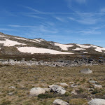
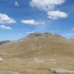
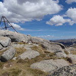
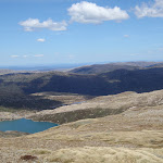
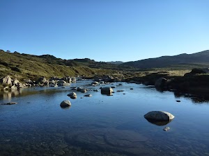
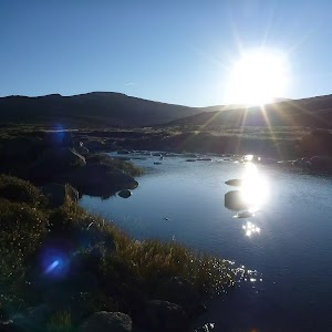
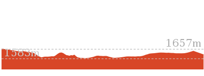
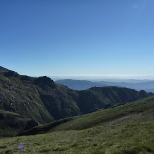
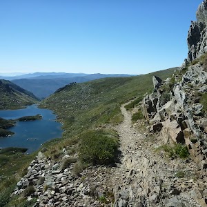
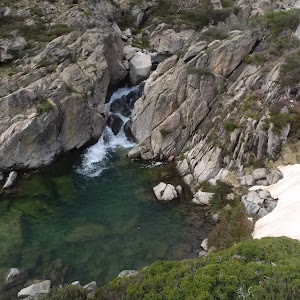
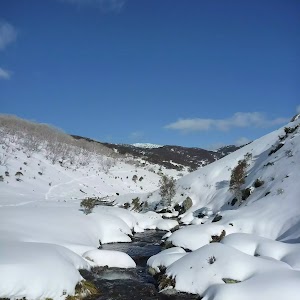
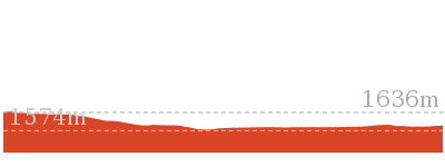
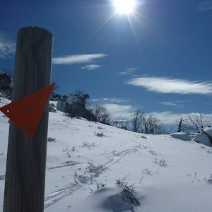
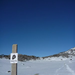
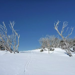
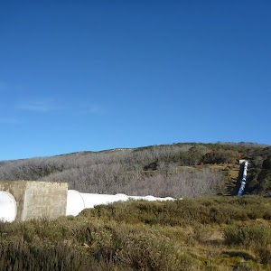
Gallery images
There are other downloads I am still working on.
You will probably need to login to access these — still all free.
* KML (google earth file)
* GPX (GPS file)
Special Maps/ brochures
* A3 topo maps
* PDF with Lands Topo map base
* PDF with arial image (and map overlay)
I wanted to get the main site live first, this extra stuff will come in time.
Happy walking
Matt 🙂
Comments